
Hallo zusammen,
Wie kann es sein, dass die von Russland völkerrechtswidrig annektierte ukrainische Halbinsel Krim auf Openstreetmap als Russland bezeichnet wird? Damit wird der russische Landraub von OSM gestützt. Ich finde das skandalös.
 OpenStreetMap
Hallo zusammen,
Wie kann es sein, dass die von Russland völkerrechtswidrig annektierte ukrainische Halbinsel Krim auf Openstreetmap als Russland bezeichnet wird? Damit wird der russische Landraub von OSM gestützt. Ich finde das skandalös.
Some street name are not confirmed. Still figure out.
A while back I posted here about SafeStreets, a free walkability and pedestrian-safety scorer that runs on OSM for any address, with Nimman Road in Chiang Mai as the example. Since then the product has moved on in two ways that I thought I can share: the scoring model and how it reads OSM changed. My focus has shifted to the US, so most of what follows is about that, with a short note on the international path at the end.
What changed in the product
The first entry described an earlier model built around a Network Design component (35 percent) and an Accessibility component (25 percent), with greenery and destination access making up the rest. The composite is now four components on a 0 to 10 scale:
Daily Reach:40 percent. Proximity-weighted access to 7 service categories.
Street Safety: 30 percent. Now its own first-class component, a weighted-OR of a crossings grid against pedestrian separation, plus a speed-exposure proxy.
Transit Reach:15 percent. GTFS via Transitland, OSM stops as fallback.
Walking Comfort:15 percent. Sentinel-2 canopy, terrain, air quality (the one non-OSM component).
There is also a new 6-tier label on top of the number, from Pedestrian-first down to Hostile, so the score reads in plain language rather than just a figure.
How it reads OSM now
The bigger change is mechanical. In the first entry every score hit live Overpass inside an 800m and 1,200m query, which was slow and broke whenever Overpass rate-limited me. US scoring is now Overpass-free. I precompute the street and safety metrics from a planet extract onto an H3 resolution-9 grid (roughly 26 million hexes covering the US, about 0.1 km2 each), paired with a local OSM POI layer of around 2 million amenities. A US score is now a hex lookup plus a POI merge, no live API call.
The OSM tags doing the work, by component:
Navážu na předchozí blog o rozšíření reality statických map. Držím se OpenStreetMap. tato otevřená a transparentní datová struktura unese i další vrstvu interpretace.
OSM se dnes tváří jako nesmírně podrobná mapa světa, jenže při hlubším pohledu to není mapa v původním smyslu. Je to prostorová databáze, která eviduje, že někde existuje lavička, zřícenina, pumpa nebo studánka, včetně polohy, tvaru a části významu. Jenže lidská zkušenost se neskládá z jednotlivých objektů, ale ze situací. Neprostupná cesta, zavřená hospoda, návrat za tmy, potřeba odpočinku nebo ztráta signálu. To vše vytváří v hlavě jinou realitu, než zachycují samotná geoprostorová data.
Do databáze lze přidávat další vrstvy: počasí, otevírací doby, sezónnost, uzavírky, ceny, kulturní program. Klíčové je, co se stane, když se tyto vrstvy protnou v konkrétním čase a místě. Suchá fakta se promění v obraz prostředí, ve kterém právě teď vzniká lidské rozhodnutí. Role mapy se tím posouvá: místo otázky kde co je, nastupuje otázka co to znamená pro mě, teď a tady.
Velké jazykové modely umožňují tyto vrstvy spojovat do sémantických souvislostí. Z prostorových dat, času a kontextu vzniká interpretace reality. Nejen mapa, ale pole významů, které reaguje na pohyb, čas i záměr. Tradiční GIS zůstává kostrou, popisuje prostor. Nad ním vyrůstá vrstva, která ukazuje, co dává smysl, co nese riziko, co přináší komfort nebo vyžaduje rozhodnutí.
Dopady se netýkají jen technologií. Dotýkají se cestovního ruchu, místní ekonomiky i každodenního života. Uživatel nedostává jen body zájmu. Dostává kontext odpovídající jeho aktuální situaci. Z mapového základu se stává kontextová informační struktura spojující prostor, čas a význam. A z čtení krajiny se stává podklad pro jeho rozhodnutí.
I’m deeply impressed by Openstreetmap. And by some very active contributors near Leuven. But, do we really need trams in our lovely tiny city?
Hello OpenStreetMappers!
I am particularly proud to share with you today the complete results and highlights of the very first edition of the CityMapper Externship, held from April 10 to May 10, 2026, in Yaoundé, Cameroon.
Within the framework of the UN MAPPERS chapters initiative pilot project, I had the honor, as Ambassador, to lead this training, empowerment, and open data utilization initiative by young Africans to solve our challenges and improve the global map. This intensive immersion program was designed to train a new generation of urban mappers while producing open, sustainable, and high-quality geospatial data for our cities.
🛠️ One Month of Immersion: From Virtual Sprints to the Field Over four weeks, around thirty young people from French-speaking Africa (15 in-person in Yaoundé and 20 participating online from Togo, Senegal, and France) followed a progressive and intense path:
Initial Training: Mastering core open mapping tools (JOSM, HOT Tasking Manager, Mapillary, EveryDoor).
Remote Sprints: Mapping buildings and road networks across 8 HOT Tasking Manager projects linked to humanitarian missions.
Field Collection: Mapping the University of Yaoundé I campus and the city streets using EveryDoor and Mapillary.
If I’ve spare time to do this, I’ll do the update
I joined this site due to cycling. My tracking app (Strava) uses Open Street Maps. One of my cycling goals was to ride every street in my city, which is difficult enough without mapping errors. I kept seeing “roads” on this map that are in reality private driveways, “public” roads that are actually private, and some roads that exist in reality but aren’t on the map yet. (And in one case, a road on the map that has never existed in reality.)
I haven’t yet figured out how to accurately add missing roads, but I’m trying to make the map better by correcting these other features.
Lần này tôi sẽ quay trở lại và làm vài trò vè sửa đổi nhắng nhít và ko thường xuyên cho lắm. (Chẳng ai quan tâm đâu 🐒). This time I’ll be back with some silly, occasional edits. (Nobody cares anyway 🐒)
So this weekend (20/06 - 21/06) I went full mapper-mode around Chitlapakkam and Tambaram. Grabbed my phone, walked around the neighbourhood, spent hours on my laptop for mapping and ended up with 18 changesets and ~96 edits over two days. Honestly, some of this should’ve been there years ago.
Starting with the obvious ones. The T13 Police Station and the Tambaram MLA Office, two places people actually need to find were nowhere on OSM. Not a node, not a building outline, nothing. Fixed that.
Also noticed the Sembakkam Zone 3 MCC was still tagged as whatever it used to be. It’s a municipal transit yard now. Updated accordingly.
The Shell petrol complex nearby was not mapped and a bit of a mess. I added the following:
Also quietly deleted a defunct petrol bunk that closed down a while back. It was still sitting on the map doing nothing. Gone now.
The EV charger is probably the most useful addition here OsmAnd, Organic Maps and other navigation apps pull charging locations from OSM.
Two temples in Chitlapakkam that have been around forever, but not on OSM. At all. They are now. Also added some metadata to a spiritual centre that was on the map but barely tagged (This was one of my first edits in OSM, when I started it 3 months back !!)
Oh, and the outdoor kids’ play area inside Chitlapakkam Park? Mapped. Families use it every single day and it wasn’t showing up anywhere.
Walked around the Chitlapakkam surroundings and found a bunch of medical shops, a pharmacy counter, and a few bank branches that were missing. These are the places people search for when they actually need them. Added them all from the ground survey.
Sto mappando la città in cui abito, Piombino. Nella scorsa settimana ho aggiunto quasi 7000 punti tra marciapiedi, strisce pedonali, panchine, cestini, pali della pubblica illuminazione, etc.
Perché lo faccio? Beh, innanzitutto perché Google, con le sue politiche sull’accesso ai dati che sono stati volutamente aggiunti dagli utenti e non da Google stessa, può andare a fare in culo. In secondo luogo, anche se Piombino è una città relativamente piccola, voglio che abbia le mappe più dettagliate e accessibili possibile. Infine, dato che utilizzo OSM nei miei progetti, volevo restituire qualcosa alla comunità, spargendo anche la voce che esiste e che è importante aggiungere la propria attività non solo su Google Maps, ma soprattutto su OSM.
In questa prima fase sto aggiungendo punti a destra e a sinistra e credo di aver già fatto un buon lavoro. Le fasi successive, però, sono ancora più importanti: l’aggiunta dei metadati agli elementi mappati e la ricostruzione degli edifici da zero (questi ultimi sono stati mappati 14 anni fa).
E niente, mandate a fare in culo Google, monopolista di dati che non sono suoi. Contribuite ai progetti open source, che permettono alle persone di costruire nuovi progetti basandosi su di essi.
Classifica: https://osmstats.neis-one.org/?item=countries&country=Italy
Validating the work of others is important. I was creative in doing just that.

completed survey of all speed limits in an area south of Palatine Road, east of Wilke, west of Arlington Heights Road and north of Euclid/Northwest Highway. Updated street data on the map.
愛知県尾張旭市内のバス停・バス路線のマッピングを進めています。 コミュニティバス「あさぴー号」の停留所について不明点が残っているため、1週間以内に現地調査に行きたいです。 また、瀬戸市内の商店街にある店舗についても、営業時間などの情報を調べてマッピングを進めていきたいと思います。
bonjour, comment metre à jour le parcours eurovelo 6 qui n’es pas à jour ? ( peut-etre d’autres aussi, mais c’est celui que je fait en ce moment ) importer les traces GPX du site Eurovelo ne marche pas ( pb de dates dans fichiers) .
merci de vos commentaires
최근에 현체로 경주월드 다녀왔거든요? 가기 한 이틀 전에 osm 드가서 경주월드 편집하는데 타카티스크?? (2022년에 운행 중단) 서라벌관람차?? (2022년 8월에 철거) 처음 들어본 게 많아서 당황했습니다. (심지어 타카티스크가 아니라 타가디스코임) 어쨌든 중요한 지물들을 편집했습니다. (미로탐험 없애고, 타임라이더 만들고 등등) 근데 잼민이인 저 혼자 하긴 너무 힘든거 같아서 제발 도와주시면 좋겠습니다 ㅠㅠ
(아니 줄바꿈 왜 안돼;;)
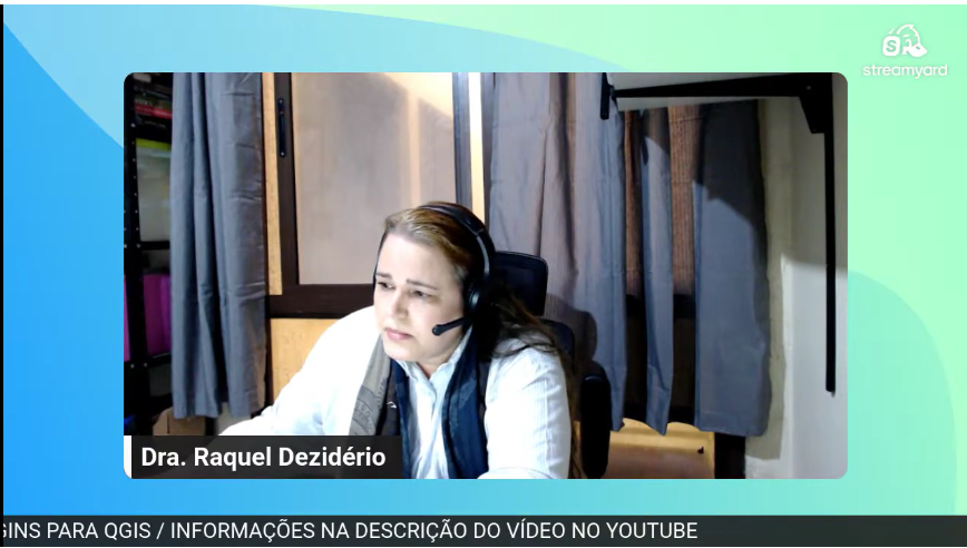 Dr. Raquel Dezidério Souto leading Session 3 of the Ciclo de Oficinas OSM 2026. The files used in Workshop 3 can be found in the video description. Link
Dra. Raquel Dezidério Souto conduzindo a sessão 3 do Ciclo de Oficinas OSM 2026. Os arquivos utilizados na oficina 3 podem ser encontrados na descrição do vídeo. Link
This is a very simple idea: given a set of GPX traces for a hike you are planning to take, generate a file containing all the waypoints of interest within the area covered by the GPX traces. I create a buffer around the GPX traces and extract the area from OSM. I define a set of tags of interest. I use Ollama with Mistral Nemo to make sure that POIs make sense to visit while walking on foot, as places are sometimes mislabeled in OSM. Before saving the waypoints to a GPX file, I use Ollama again to generate waypoint descriptions and set labels for each waypoint. Feel free to try it out! The code is on GitHub.
Mapping Sitka is pretty much my identity. I was upset when someone reverted my work because honestly I’ve been working every waking hour for a few months now. It was good though because I needed to step back and not take it too seriously. I’ve had some manic episodes late in life and they unlocked some anger I’m not familiar with. It was actually impressive how mad I got. Anyway, what are these diaries for if not a super personal post? Stay mappy people


