
Les bâtiments et leurs architectes de nouveaux pays ajoutés sur [www.mapaedifi.eu] : Bulgarie, Croatie, Danemark, Finlande, Hongrie, Islande, Lettonie et Lituanie.
Informations extraites d’OSM et enrichies avec Wikidata et Panoramax.
 OpenStreetMap
Les bâtiments et leurs architectes de nouveaux pays ajoutés sur [www.mapaedifi.eu] : Bulgarie, Croatie, Danemark, Finlande, Hongrie, Islande, Lettonie et Lituanie.
Informations extraites d’OSM et enrichies avec Wikidata et Panoramax.
Como é de costume, mais uma publicação no diário comemorando +10K de edições

I’ve been working recently on a personal project to investigate how much of the Overpass query language could be implemented using a different back end database, namely the QLever database.
Overpass is the most widely used public interface for querying OSM data. It is relatively easy to use and understand and its outputs in GeoJSON or OSM XML are readily integrated into OSM or other geospatial tool chains for visualization or other processing.
But Overpass is somewhat of a victim of its success. Demand for the public Overpass service has recently outpaced server capacity. My earlier work on a container image for Overpass was intended to help scale capacity by making it easier for data consumers to run their own local Overpass servers.
This project looks in a different direction. What if the Overpass QL with its ease of use and its integration into other tools were available on top of a different data source?
QLever is a SPARQL database developed by the Chair for Algorithms and Data Structures at the University of Freiburg. SPARQL is an RDF query language where the data are represented as “triples” of a subject, predicate, and object.
QLever represents geospatial data as WKT and can perform geospatial operations on WKT. The osm2rdf conversion generates WKT data for every OSM element. So, the data in QLever stores the complete geometry from OSM.
But the key to QLever’s performance with OSM data is that in the conversion from OSM PBF to TTL (Terse RDF Triple Language), osm2rdf generates triples for every element to describe their spatial relations with other elements. That is, osm2rdf pre-computes the spatial relations sfIntersects, sfContains, sfCovers, sfTouches, sfCrosses, sfOverlaps, and sfEquals between all OSM elements.
Znáte to velmi dobře. Zastavíte se na kole na rozcestí někde u Lipna, na okraji národního parku na Šumavě, nebo u vstupu do historického centra Českého Krumlova. Před vámi stojí klasický mapový stojan. Velká tištěná mapa, kolem ní pár fotek a na okraji nechybí to, co definuje naši současnou snahu o propojení světů: QR kódy.
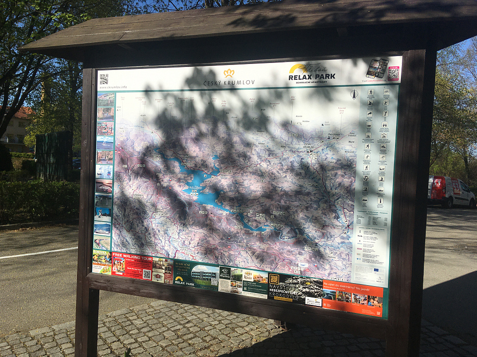
Naskenujete čtvereček a telefon vás odkáže na lokální nabídku zážitků, otevírací dobu půjčovny lodí nebo menu nedaleké restaurace. Je to praktické a funkční. Fyzický prostor mapy se tu potkává s digitálním obsahem. Ale ruku na srdce, je to teprve začátek. QR kód je sice skvělý vynález, ale z principu je příliš pasivní, statický a jednoduchý na to, aby dokázal přenést skutečnou dynamiku a komplexitu světa až k vám. A vy ten místní svět přece chcete vidět, zažít právě teď.
This is a personal note so I remember the settings to use depending on my method of transportation:
Remember to point one camera to the right, the other to the left. Maximizes aerodynamics and captures better quality images of signs.
ISO above 200 causes picture clarity problems. Remaining under 200 ensures that daylight photos are clearer and signs can be read better. Leaving the Color Profile Flat preserves maximum detail in shadows. None of the images might be appealing to the eye, but they will be very good for mapping purposes
Hi folks! I’m up for election to HOT’s voting membership this year (thank you, Pete!). As a part of that process, I’m posting my answers to their prompting questions here on my OSM diary.
I know that I already owe this community a summary of my previous research within the OpenStreetMap ecosystem – and what’s changed since then. By way of explanation and apology: I wanted to flag that I will be giving a talk at this year’s State of the Map in Paris with an update on my previous work. You can see the talk I gave in 2022 here. I also gave a talk at the HOT Summit in 2021.
I also want to flag that no LLMs were used in the writing of these answers: while I do use them sometimes for more functional, repetitive, or iterative work, I did not use them below. Writing is often a form of thinking for me, and for these answers, I wanted to prioritize that process.
In the last 6 or so years, HOT has both professionally and personally changed how I think about technology, community, and crises. It’s also meant different things at different times for me – which I wrote a bit more about in the question below.
In short: I’ve come to see HOT (and humanitarian mapping more broadly) as a kind of canary in the coal mine for the broader technology ecosystem at large. The questions I found here, at HOT and across OSM are ones that I have later found in the broader ecosystems they feed into (and even the world at large): questions about navigating permacrises, about AI, about shifts in funding landscapes, about ethical dilemmas for data pipelines, about cross-cultural community-building, and many, many others.
I have perhaps an unusual path to being involved with HOT: I was an anthropologist and ethnographer of the ecosystem of humanitarian mapping that HOT feeds into before becoming involved as a mapper and facilitator in the past few years.
El proyecto de importación de desfibriladores (DEA) en Málaga ya está publicado y abierto a la participación de mapeadores locales. La coordinación se llevará a cabo desde el grupo local OSM Málaga, un grupo pequeño y cercano de mapeadores que conocemos bien la zona.

Esta importación llevaba tiempo pendiente dentro del plan de importación de datos abiertos del Ayuntamiento. He trabajado en adaptar el formato original y preparar los datos para su incorporación a OpenStreetMap. La revisión de la calidad de las ubicaciones se realizará durante la fase colaborativa, aprovechando el conocimiento local y la verificación sobre el terreno.
En importaciones anteriores basadas en datos abiertos municipales, el resultado final en OSM ha terminado siendo más completo y preciso que el conjunto de datos original, gracias al trabajo conjunto de la comunidad. La intención es que esta importación siga el mismo camino: no solo añadir datos, sino mejorarlos.
Adding Wikidata tags to all OSM features listed in Wikidata
Ayubowan from Sri Lanka,
My name is Hasna from Sri Lanka, and I bring over 3.8 years of experience in OpenStreetMap (OSM) and humanitarian geospatial work. I began as a self-learner with limited engagement, but my journey has evolved into sustained, impact-driven contribution at both national and global levels.
In 2022, I joined UNOPS Sri Lanka, where I worked within capacity-building initiatives for civil society organizations. In this role, I actively promoted OpenStreetMap, open-source GIS, and humanitarian mapping through HOT. Through the UNOPS Vriddhi Project, I directly trained over 100 civil society partners, strengthening local mapping capacity and enabling wider adoption of geospatial tools in development work. This experience grounded my understanding of how open mapping translates into real-world community impact.
A defining milestone in my journey was attending State of the Map 2025 in Manila. This experience significantly reshaped my perspective on the global humanitarian mapping ecosystem. It allowed me to connect with experienced mappers, mentors, and contributors, and establish a strong professional network. Since then, my engagement with HOT has become more structured, consistent, and purpose-driven.
Currently, I serve as the Country Lead for Sri Lanka under WOM Asia Navigators, where I support community engagement and capacity development in open mapping. Over the past seven months, I have completed more than 190 HOT tasks across disaster preparedness, disaster response, and recovery operations, demonstrating sustained technical contribution in humanitarian contexts.
What does HOT mean to you? HOT represents a global humanitarian ecosystem that transforms geospatial data into life-saving action. To me, it is not just a platform, but a collaborative force of mappers, organizations, and communities working to ensure that vulnerable populations are visible, supported, and included in disaster preparedness and response systems.
Good day!
I’m Erika from the Philippines, an open mapping advocate and member of UPRI YouthMappers. I actively contribute to OpenStreetMap and humanitarian mapping initiatives that support disaster resilience, risk reduction, and community-based geospatial data.
My journey with HOT began as a volunteer mapper through YouthMappers, participating in mapathons that create critical data for disaster-prone and vulnerable communities. Over time, I became a student leader in UPRI YouthMappers and later served as an Open Mapping Guru, helping train new mappers and support community programs within the HOT ecosystem. I also expanded my involvement in the broader open mapping community through local and international events such as Pista ng Mapa (Festival of Maps) and State of the Map. These experiences strengthened my appreciation for the power of collaboration, community building, and open geospatial data in addressing real-world challenges.
building=canteen denomination=akṣara-puruṣottama_darśana/viśiṣṭādvaita
Radio and communication towers made of wood are rare. Lists of such objects can be found on https://en.wikipedia.org/wiki/Cell_site#Wooden_structures , https://en.wikipedia.org/wiki/List_of_tallest_wooden_buildings_and_structures and https://en.wikipedia.org/wiki/Lattice_tower#Wooden_lattice_towers .
A possible further object may exist north of Kóspallag, Hungary at 47.8786466 N 18.9422987 E. However there are no pictures of this tower available. In the openstreetmap entries this object is classified as a hybrid structure of steel and wood, but Google Streetview shows it as a steel object, however it is barely visible there.
So someone should determine the exact type of this structure. It would be also a great idea, if someone could take a picture of this tower and upload it to Wikipedia, so everyone can see its type.
Further it would be great if Hungarian mappers can find out further wooden cellphone transmitters (past and present) in Hungary and add them to the list on https://en.wikipedia.org/wiki/Cell_site#Wooden_structures
I don’t normally think about the Sun’s direction when I go out running. When it gets exceptionally hot in summer, I start to notice it and wonder if I can tune my early morning run routes to experience slightly less heat. In principle, that should be possible. The position of the Sun can be worked out with a Python script. Combined with the angle of the Sun in the sky and your heading, it will tell you if you are running straight into the Sun or if the Sun is behind you. My personal preference is running towards the sunrise. After sunrise, you can call OSRM to optimize around solar load, defined as a function of Sun azimuth, your heading, and Sun altitude. This is probably over-engineering for route planning, though. The solar load has no simple formula, and the effect of clouds or humidity is hard to account for. Just a basic knowledge of civil dawn, sunrise time, and sunrise direction is probably enough for everyday running. But back to route generation — if you can find a metric to optimize for, you can generate new routes you have not run before. It is hard to define route novelty, but something like sun direction is easier to work with. The end goal would be to create routes that are different from what you can discover by simply using your street sense.
Seit den ersten Schritten meiner OSM‑Reise liebte ich die Idee von Spielplatzkarten. Dafür gibt es mehrere Gründe, auf die ich hier nicht ausführlich eingehen möchte: offene Daten, Karten, FOSS – und natürlich die Kinder und ihre Freude (und … alle Eltern da draußen werden es sicherlich zu schätzen wissen, wenn ihre Kinder auf einem Spielplatz mit vielen anderen Kindern spielen 😉).
Es gab bereits einige Spielplatzkarten. Manche basierten auf OpenStreetMap‑Daten, andere nicht oder nutzten eine Mischung. Einige wirkten wie aus den 90ern, andere moderner. Oft mussten Nutzer:innen ein Konto beim Anbieter erstellen — oder, noch schlimmer, bei Google 🙈. Zudem wurden in diesen Fällen Fotos, Kommentare oder Bewertungen in deren Systemen gespeichert, und OSM diente lediglich als Kartenschicht, um Spielplätze anzuzeigen.
From the very beginning of my OSM journey, I loved the idea of playground maps. There are several reasons for this, but I won’t go into detail here. For example: open data, maps, FOSS, and, of course, the children and their joy (and… all the parents out there will surely appreciate it when their children play at a playground - ideally with plenty of other kids 😉).
There were already some playground maps available. Some were based on OpenStreetMap data, others were not, or used a mix of both. Some looked like they were designed in the 90s, while others did not. In many cases, users were required to create an account with the maintainer’s service—or, even worse, with Google 🙈. Additionally, in these cases, photos, comments, reviews, and so on were stored in their systems, and OSM was only used as a map layer to display playgrounds in general.
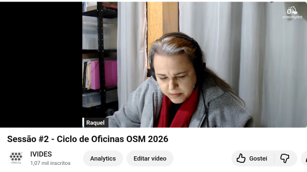 Session 2 of the 2026 OpenStreetMap Workshop - Link
Merhaba,
OpenStreetMap’i Türkçe olarak kullanan topluluk üyelerinden bir ricam var.
Sitede, düzenleyicilerde veya OpenStreetMap ekosistemindeki diğer araçlarda karşılaştığınız Türkçe çeviri sorunlarını bu günlük girdisinin altında paylaşabilir misiniz?
Mümkünse aşağıdaki bilgileri de ekleyin:
Amaç, gönüllü olarak OpenStreetMap’in Türkçe kullanıcı deneyimini iyileştirmek ve tespit edilen sorunların düzeltilmesine katkı sağlamak.
Şimdiden geri bildirim veren herkese teşekkür ederim.
Sessão 2 do Ciclo de Oficinas OSM 2026 - Link
We more experienced mappers realize fast that OSM Carto is just meant to show off the capabilities of the database. So many takes I have seen “I did it becuase if I did it another way (which would be the conceptual better way, also documented on the wiki) it wouldn´t show up on https://www.openstreetmap.org…”
I am launching
As an open source project to first generate golf-centric PMtiles to help the mapping and application who wants to display world wide coursemaps. Then move on to at least daily updates to help mappers.
Help wanted if you want to try it out!


