 OpenStreetMap
Posted by PRISCOVIA12 on 5 October 2024 in English.
Users' Diaries
Recent diary entries


KAMPANAT THUMWONG
 This Conference was a Good opportunity for me and all the team from Rwanda as well as Africa in General because it was the first time of Africa to host the state of the Map.
apart from traveling from Kigali to Nairobi for 26hours in the bus ,I enjoyed every details in the conference and Nairobi.
This Conference was a Good opportunity for me and all the team from Rwanda as well as Africa in General because it was the first time of Africa to host the state of the Map.
apart from traveling from Kigali to Nairobi for 26hours in the bus ,I enjoyed every details in the conference and Nairobi.
Hallo, ich bin bei openstreetmap registriert. Wenn ich mich bei osmhydrant anmelden will kommt direkt wenn ich auf Login drücke eine Fehlermeldung. Fehler 500 Datei nicht gefunden.

Attending State of the Map 2024 in Nairobi, Kenya, was an unforgettable experience that deepened my understanding of mapping and the OpenStreetMap community. It was truly inspiring to be part of such a vibrant and passionate group of mappers and contributors from 54 countries. The sessions on community capacity building, disaster recovery and response, and conservation have reinvigorated my commitment to OpenStreetMap. I’m grateful to the community for supporting our initiatives on Pudussery Panchayat Mapping and the creation of a spatial flood asset database. Special thanks to OSMF for the State of the Map 2024 Travel Grant. I’m excited to continue contributing and collaborating with this amazing community. Here’s to more mapping adventures ahead!
Posted by wawa33 on 4 October 2024 in German (Deutsch).

Seit etwa 2 Tagen kann man besagte Satellitenaufnahmen und Katastereintragungen aus dem Bayern Atlas nicht mehr anzeigen lassen. Ist das ein Versehen?
はじめに
日記機能を使い始めてまもなく3か月、数回書いてみて、使い方がかなり分かってきた。
山歩きでは、しばしば、等高線がほしくなる。 これまではOSM地図を国土地理院地図に切り替えていた。 一度表示した国土地理院のタイル地図画像ファイルはSDカードに保存しているが、 全zoomが保存されているわけではなく、山歩きではスマホの電波も届かないことが多く、 実時間でのダウンロードができず、使い勝手が悪い。
国土地理院の標高タイルについても、事情は同じであるが、 5mメッシュDEMの zoom 15 にあたるため、必要範囲を予めダウンロードしておくこと は容易である。
そこで dem5a を使って、OSM地図に等高線を付け加えることを考えた。
QGISなどを使って、オフラインで等高線を求める記事[3]は他にもあるが、 自分が欲しいのは、自作OSM地図アプリに組み込むプログラムである。 これに関するものは少なかった。
最初に試した簡易プログラム[5]
    void getContour(Bitmap bmp) {
        for (int j = 0; j < 255; j++) {
            for (int i = 0; i < 255; i++) {
                float c = ele[j][i];        // check pixel
                float r = ele[j][i+1];      // right pixel
                float d = ele[j+1][i];      // down
                float g = ele[j+1][i+1];    // diagonal
                int ic = (int)(c/20);
                int ir = (int)(r/20);
                int id = (int)(d/20);
                int ig = (int)(g/20);
                boolean flag = (ic != ir) || (ic != id) || (ic != ig);
                bmp.setPixel(j, i, flag ? 0xffff0000 : 0x00000000);
            }
        }
    }
東京の高尾山の山頂を含む zoom 15 のタイルの等高線を描いた結果を下に示す。 その下に、国土地理院の標準地図タイルを載せた。
プログラムは非常に簡単であるが、ギザギザが目立つ。線の太さは1画素であり、 これより細く見える線は簡単に描けない。
4画素の比較で塗りつぶしは常に右上にしているのがギザギザの原因であろう。 4画素中、等高線が一番近くを通る画素を塗りつぶすように変えれば、ギザギザは いくらか目立たなくなるかもしれない。
Posted by Jiri Podhorecky on 4 October 2024 in Czech (Česky).
Last updated on 5 October 2024.

Když jsem psal deníkový záznam o Pozorování přírody ve městě, zmínil jsem na závěr i web iNaturalist.
Pozorování přírody se dá dělat různými způsoby, s různou odborností a intenzitou zaujetí. Pokud si k tomu chcete dělat počítačové záznamy a archiv fotek, v Čechách máte možnost například s databází BioLib, své pozorování volně žijících ptáků můžete zaznamenat do Faunistické databáze Avif České společnosti ornitologické, zkoumat rostliny na Pl@ntNet nebo se skamarádíte s webem iNaturalist.
A k němu tedy krátce napíšu.
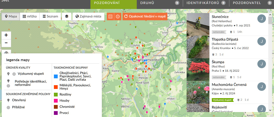
iNaturalist je jedním z globálních projektů, které by bez OpenStreetMap nebyly příliš užitečné.
Každý záznam, fotografie, nebo zvuk z vašeho pozorování přírody se totiž lokalizuje na mapě, kde byl zachycen. Pokud zaznamenáte zvíře nebo rostlinu s přesným taxonem a výskytem, záznam se dále může stát vědecky využitelným pro budoucí výzkumy. Ty se dějí ideálně s geografickými referencemi, tedy s přesnými lokalizacemi na mapách.

Salut la communauté d’OpenSreetMap !
Je suis désormais un fier nouveau participant à cet énorme projet de partage de savoir qui m’a d’abord aidé et même ravi en tant qu’utilisateur. Ravi de recevoir gratuitement et sans contrepartie ces données cartographiques minutieusement accumulées, et rigoureusement organisées, jusqu’à devenir une référence fiable. Un exemple illustratif de ce qu’on appelle dans le monde du Libre, le DataLove.
Fier, donc, mais non moins attentif à la rigueur du projet : je ne voudrais pas détruire dans mes modifications, des données fiables, ou ajouter des données erronées. J’ai par exemple entrepris de nommer des chemins par leur nom locaux, avant de m’apercevoir que le type d’information “Nom local” existait en plus du “Nom” tout court. J’ai donc entrepris une recherche sur le forum pour vérifier la bonne pratique dans ce cas de figure, et j’ai rectifié mon erreur. C’est peut-être du chipotage à vos yeux, d’autant que “Nom local” n’existe seulement que si l’on a déjà ajouté “Nom”, mais, comme dit l’expression : les petits ruisseaux font les grandes rivières. C’est de cette rigueur des bonnes pratiques qu’un tel projet tire sa fiabilité.
Cependant, c’est des erreurs que vient ma participation à ce projet : en bon français, c’est en râlant sur des erreurs que j’ai fini par publier ma première note. Puis, constatant qu’on m’avait mal compris, j’ai pris la peine de me former via des tutos sur YouTube, pour effectuer les modifications moi-même. Et c’est en découvrant la facilité avec laquelle on peut contribuer que j’ai pris un certain goût à la contribution.
Donc dans un sens, ces erreurs sont un mal pour un bien. Alors merci ! Merci aux contributeurs, merci pour votre générosité que je compte bien imiter. Au plaisir, cher lecteur de vous re-croiser.

On December 5th, 2017, I joined Humanitarian OpenStreetMap Team with the goal of making a tangible impact. Over the years, my curiosity on the HOT Tasking Manager grew, and I found myself increasingly drawn to OpenStreetMap (OSM). At first, I was overwhelmed with how to become more active and create more impact, but I soon discovered that my love for and working on the computer was my gateway. Contributing to OSM quickly became an addiction, a way to relax, a therapeutic outlet when I was feeling tired or frustrated.
Posted by UNGSC-DTLM-Ale_Zena on 3 October 2024 in English.
osm.org/relation/15736220 What to do against these deletion? I know, you’d said “oh, just revert the changes”. Teoretically you’d be right …. teoretically
Dealing with these long relation it’s not easy, unless you keep monitored and act in the first hours or in a few days
I’ll try to fix it

2-oct-2024 Track recording (pakai street complete - android app) jalan perumahan VBT baru yaitu Block F2(?), langsung edit osm lewat vespucci (android)
Belum selesai, besok lanjut lagi
Posted by Provinsi Papua Pengunungan on 2 October 2024 in Indonesian (Bahasa Indonesia).

Provinsi, Papua, Pengunungan
Posted by Janaína Brígida on 1 October 2024 in Brazilian Portuguese (Português do Brasil).

Mapeamento de ruas, passeios não formalizados. Árvores frutíferas.

Something local for my first entry
شارع عين الهاشمي شريوف
شريوف
Zannat Street

area fix