
97394 addresses completed.
Users' Diaries
Recent diary entries
Salut,sunt Darius si sunt un nou editor aici daca fac ceva gresit va rog sa imi scrieti pe chat. Multumesc!
As I’m interested in pedestrian infrastructure, I asked myself what percentage of all sidewalks in Germany has already been mapped.
It is difficult to answer this question because I do not know the total number of sidewalks in Germany. However, it is possible to change the question slightly to make it easier to answer: How many streets in Germany contain information about the presence of sidewalks?
This is easier to answer, because we can assume that all streets of Germany have already been mapped. Therefore, to answer the question, we just have to count the streets that contain the desired information.
Sidewalk tags
Currently, four tags are in use for mapping sidewalks: sidewalk, sidewalk:left, sidewalk:right and sidewalk:both. The tag sidewalk was introduced around 2010 and is still widespread, accounting for around 80% of all sidewalk tags:

Artificial Intelligence OpenAI Maps4 and finance. Things are progressing beautifully.

I am telling it what to do in English, and it’s writing the tags for me and making the edit. I will review everything it does and not do anything with it that I wouldn’t do by hand (but more tediously).
On September 20th, 2025, the Oyomappers Team had an amazing time participating in a map and clean-up event sponsored by the Humanitarian Open Street Map Team (Hot). We used Chatmap to help us with the exercise, and it was truly impactful!
During the cleanup at Ajegunle Market in Oyo, Oyo State, Nigeria, the atmosphere was filled with joy. The community was so grateful, and we felt their warmth as they expressed their appreciation and prayed for us. It was a wonderful experience to be part of something so positive!
Preto da xeral, cara a Santiago:
1: 42.83260561456377, -8.490026482670231
2: 42.833944, -8.4885
3: 42.83227214824429, -8.484829702587875
4 — meténdose no monte: 42.83589523767619, -8.478794732324063
5 — xunto ó polígono: 42.832087250867744, -8.47701374553567
Cara ó Claudio:
6: 42.82891202269784, -8.44964144451512
Cara Quian:
7 — zona de casas e cans: 42.82549704792105, -8.466056563567795
8 — desvío pequecho na costa grande: 42.824348189151635, -8.460949637702718
9 — está nun lugar un pouco incómodo, ó lado do centro de Quian: 42.82171989767033, -8.4618508598875
10 — finca ó lado do centro: 42.82248321535699, -8.464114526157271
11 — paso dos eucaliptos: 42.82184580637066, -8.464704612129077
12 — pódese entrar? 42.820665401972235, -8.46381411875115
13 — á beira do río pasado o túnel. As castañas son pequenas: 42.82365571596714, -8.468277314517298
14 — cara ó monte. As castañas son xigantescas: 42.82161496766397, -8.471076563043434
15 — unha recta solitaria: 42.824161, -8.471682

This afternoon, while pondering and daydreaming about seriously quitting OSM for real, I ventured into the land of Wikimapia.
Then I stumbled upon a conversation between high-ranking admins over there.
“Why did you delete a number of TNB sub-stations from the map? Don’t you think those tags were useful, to some people at least? I think the user(s) who initially created those tags put a lot of effort in detailing the model nos., etc. for some of the sub-stations. Thanks.”
“The TNB sub stations is not a place. It just an OBJECT just like small bridges, security guard post, small jetty etc. Different with a PLACE such as Pulau Pinang Bridge or any big bridges, police station or a port such as Port Kelang. As you can see there are few users that like to tag a small roadside stall and a small public toilet. That also is in the list for deletion. You must know to differentiate what can be tag and what can’t.”
“I was under the impression that anything permanent of some importance (except personal houses) could be tagged. If that’s the case, people shouldn’t be tagging ATM machines, telco towers, transmission towers, etc. To be honest, I disagree with you on this point as TNB substations are permanent and important to some people as I mentioned before.”
“You may disagree with me but TNB sub stations is not an important objects for WM users. It just like tagging a bus stops and taxi stands if you know what I mean”
Well, maybe I should stay in OpenStreetMap.
Jokes aside, I’m quite surprised that Wikimapia is still active today. I still see several Wikimapia mappers still doing dedicated micromapping in their respective neighborhoods.

One of the trickiest challenges in OSM is when a river (or any linear water feature) doubles as a regional or administrative boundary.
Rivers shift course over time; floods, erosion, and meanders, while boundaries often remain legally fixed. The result? Misalignments, overlapping lines, or confusing gaps on our maps.
For many contributors, editing such overlaps is daunting. Boundaries are sensitive, technically complex, and mistakes can cause big issues. Yet, leaving them mismatched affects disaster planning, legal clarity, and overall map quality.
My Question to Experienced Mappers 🙏
How do you decide whether to follow the legal boundary or the current river course?
Rivers don’t wait. Boundaries don’t move. But as mappers, we can bridge the gap. I’d love to hear your experiences and solutions!
Qwajo OSM
While working on an OSM-related statistics project that I need to present in the next few months, I stumbled across some ‘conversations of the past,’ scattered in changeset comments and block reports.
Some of those conversations triggered a strong emotional response in me—so much that I had to pause for a quick breather. I think I’ve just been exposed to a serious infohazard.
Then I remembered “that page” on Wikimedia Meta-Wiki.
Wikistress is stress caused by activity on a wiki like Wikipedia such as conflict, vandals, trolls, edit wars, and incivility.
I’ve suffered this kind of stress several times on Wikipedia, and now—since OSM is by nature quite similar to Wikipedia—I’ve relapsed again.
By the way, on that page, there are several tips for dealing with personal wikistress. I think we can adapt those tips to the OpenStreetMap context.
“Edit a less controversial page.”
Instead of big, difficult tasks such as place and highway classifications, adding things like toilets, cafés, restaurants, and pet shops might be less controversial (and more wholesome to do).
“Stop looking at your watchlist. It does contain pages that you are emotionally involved with. Of course, not having any pages in your watchlist is a good start :)”
Stay away from the OpenStreetMap Carto basemap (or any OSM-derived map tiles) for awhile?
“Take a long vacation. Treat yourself to relaxation, favorite TV shows (unless they cause you wikistress), spend time with friends, family, and pets, and maybe try something new.”
“If you are just reverting and deleting and not enjoying yourself then STOP. Someone else will have to deal with it. Do something else. “
“Remind yourself why it’s best to avoid fights and ignore trolls “
“Unsubscribe from the mailing lists and escape the pointless repetitive arguments, the endless recriminations and the general desire to create more heat than light.”
Posted by umbraosmbr on 20 September 2025 in Portuguese (Português).
🗺️ Mapeia Crato – 2ª Edição
As inscrições já estão abertas! 🎉
https://doity.com.br/mapeiacrato2edicao
📌 Participe dessa jornada de mapeamento colaborativo no OpenStreetMap e ajude a transformar o território do Cariri através do mapa livre e aberto.
✅ Capacitação aberta para iniciantes e experientes ✅ Suporte para quem nunca usou o Editor JOSM ✅ Certificado de Participação para todos os inscritos ✅ Apoio: Movimento Software Livre (MSL) e HOTOSM
👉 Garanta já sua inscrição e venha mapear com a gente!
Posted by Raquel Dezidério Souto on 19 September 2025 in Portuguese (Português).
Last updated on 9 October 2025.
– only in Portuguese
IVIDES DATA oferece um conjunto de três oficinas de mapeamento no OpenStreetMap
As oficinas visam a capacitação em mapeamento de feições no OpenStreetMap, utilizando os dois editores mais populares.
A primeira oficina foi realizada virtualmente em 18 de setembro de 2025 e os próximos encontros estão programados para 02 e 15 de OUTUBRO de 2025, sempre de 19h às 21h UTC-3.
Confira a programação:
- Mapeamento de caminhos no OpenStreetMap com editor iD - 18-09-2025
- Mapeamento de áreas no OpenStreetMap com editor JOSM - 02-10-2025
- Validação com o editor JOSM - 15-10-2025
Esta ação não tem formulário de inscrição, as sessões são abertas e transmitidas AO VIVO.
Acompanhe as sessões que estão sendo transmitidas AO VIVO E ABERTAS AO PÚBLICO pelo canal IVIDES no YouTube.
Os(as) participantes enviam os seus resultados por e-mail e realizando corretamente as tarefas, receberão um certificado de treinamento de 4h de carga horária.
Aproveite esta oportunidade de aprender profundamente sobre o mapeamento no OpenStreetMap. O conteúdo abrange questões muito além do que está nos manuais já publicados.
Posted by Gregory Peony on 19 September 2025 in English.
Dear diary,
Yesterday, I was in a meeting of the HOT QCQA WG, when Patrik_B asked a question at the very end of the meeting. How can you download select data within a given complex geometry via overpass; the geometry in the JOSM layer isn’t visible when downloading?
The Objective
Download all desired data via overpass within this boundary.
 Fig.1. Area of Interest.
Download Along to Highlight the Boundary of the AOI on the Slippy Map
Ralph was first to answer the question. His solution was to download data from OSM using the download along plug-in. The area of downloaded data would then be visible on the slippy map and this could be referenced when drawing a bounding box to download the data. Very clever.
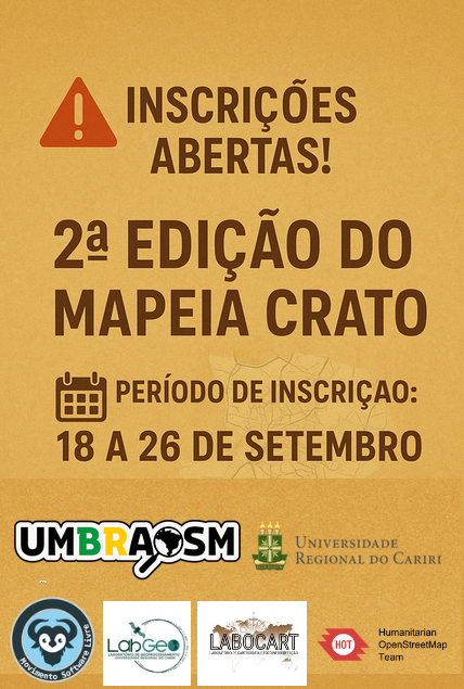
Posted by umbraosmbr on 18 September 2025 in Portuguese (Português).
🚨 Inscrições Abertas! 🚨
👉 Vem aí a 2ª Edição do Mapeia Crato – CE 2025.

A 1ª edição foi um sucesso 🎉 Contamos com a participação de 15 alunos, 2 professores coordenadores, além de membros da comunidade OpenStreetMap Brasil e da UMBraOSM.
Agora é a sua vez de fazer parte dessa iniciativa! Participe da 2ª edição e ajude a mapear o Crato de forma colaborativa.
📅 Período de inscrição: de 18 a 26 de setembro 🔗 Inscreva-se agora: doity.com.br/mapeiacrato2edicao
Posted by Arun Kumar Saini on 18 September 2025 in English.
Someone ask me for “What experience do you have building websites with Open Street Maps using controls limit then monitor and report on tile usage?”
According to the official statistics page, today OpenStreetMap has hit the milestone of 10 million registered users! This is not the first time though; in fact it already happened earlier this year and in 2023 (during which year the amount even exceeded 11 million!); lately, the number of registered users graph shows a saw-tooth pattern, probably, in my opinion, due to the SPAM accounts being continuously banned by the admins.
By the way, if you happen to have an account on OSM wiki, please check the translation of Template:Contributors/count in your language as it may need to be updated. That template is pretty simple but it’s used by a couple of “main” wiki pages.
However, the number seems pretty high, but it may be worth noting that only about 23% (~2.25 million) of the total number of registered users has made at least one modification in the OSM database. Considering that the database has received 17 billion¹ edits, that means that every contributor has made an average of 7,400 changes from their entire lifespan as a user (you can see how many contributions you made on your HDYC page).
One last question that’s been bothering me: how many users would be registered on OSM if no one had been deleted or banned? Well, according to the API, at the time of writing, the last valid user id is 23,302,305 so the answer is more than double the number of currently registered users.
Imagine what could be achieved with twice as many contributors!
¹ number calculated using the file changesets.osm dated 2025-04-07 (license ODbL 1.0); the values shown here are unverified and may be incorrect.
Happy mapping to all 10 million users!
ที่อยู่

I joined OSM from the https://deflock.me/ community, and have since added 21 ALPRs. I’ve also contributed a few new developments to the map, and looking to add more.
GIS has been a huge interest of mine, and I’ve been maintaining my own private ATAK repository for a while. I’m excited to find a place to share this knowledge now. When I was younger, I would systematically walk areas of Baltimore, MD looking to uncover interesting POI. I wish I had OSM back then to store my findings.
Posted by Hadiat Tarmawan on 17 September 2025 in Indonesian (Bahasa Indonesia).
Puri Nirwana 1 Blok X No. 17 Kel. Pabuaran Rt. 014/16 Kab. Bogor
Posted by Jiri Podhorecky on 16 September 2025 in Czech (Česky).
Last updated on 31 October 2025.

Když mapuji venkov, nejde mi jen o kreslení čar a bodů na monitoru. Skutečné poznání míst přichází teprve venku, na čerstvém vzduchu. Na jihu Čech – mezi Blanským lesem a Šumavou, nebo v Pomalší – jsem si ověřil, že je pořád co objevovat.
Co se dá zjistit vlastníma očima
Častokrát mi stačí obyčejná vycházka nebo okružní jízda na kole. Všimnu si třeba lesní cesty, která není vyznačená, nebo kapličky zarostlé v křoví. Občas si fotím rychlé momentky – ne kvůli kráse snímku, ale jako připomínku co nezapomenout. Doma pak na mapě projdu trasu a doplním drobnosti, které jsem viděl.
Nikdy se nevracím naprázdno. Nejčastěji mne překvapí charakter místa, který prostě vzdáleně z mapy nepřečtu. Například když je celá obec na šikmém svahu a tedy i náves je mírně z kopce. Je to důležité? Nevím, někdy ne, ale někdy možná ano. Tyto postřehy mi propojují mapu s trvalou pamětí místa.
Názvy, které nikde nenajdu
Některé místní názvy nejsou oficiální, ale vžily se, takže lidé vědí, o čem je řeč. V Českém Krumlově je například kus chodníku, spojující sídliště Vyšný a vlakové nádraží. Lidé co tu žijí delší dobu, stezce říkají Močka. Myslím že přijde čas ji tak označit. Tyto znalosti se předávají běžným vyprávěním. Chce to čas a trpělivost – někdy při posezení u piva, jindy jen tak mezi řečí. Odměnou jsou ale postřehy, které žádný úřad nezaznamenal.
Když promluví sousedi
Jiným způsobem se dají zapojit i celé komunity. Sdílel jsem třeba fotku ukazatele u Svatého Jana nad Malší – jen obyčejný snímek, který by sám o sobě mapě nepomohl. Ale v internetové skupině se hned rozproudily reakce: že ukazatel byl původně jiný, pak byl upravený a přepsaný do dnešní podoby. Najednou se vidělo, že má pro lidi nějakou historii, vývoj, a pro mne prvek na mapě získal svůj kontext. Někdy se díky tomu řeč stočí k dalším nezmapovaným tématům. A já si je ověřím na další cestě.