
We can improve user experience by providing verified, detailed and relevant information to OpenStreetMap. Let’s make OpenStreetMap a little bit better every day!
Users' Diaries
Recent diary entries
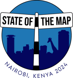
Now that I’ve taken a day off after the 14-hour bus trip from Nairobi to Dar es Salaam, I can finally sit and share my thoughts on State of the Map – the first time the global conference was held in Africa!!
Before starting my academic career last year, most of my 8+ years of work experience has been in the OSM and open mapping ecosystem. Check out my diary on OSM’s 19th birthday, where I shared more about my journey in this amazing community. To quote myself from that diary (I’m becoming a real academic now, haha): “OSM is a project that needs communicators, developers, managers, strategists, etc., working together to unlock its true value within the community.”
I was thrilled to see this in action in Nairobi! I met so many people working on diverse projects ranging from environment, health, climate, disaster, urban planning, etc. Most importantly, meeting people like myself (non-tech folks) focused on community organizing, communications, project management, etc, all under the OSM umbrella. This is why gatherings like these are crucial – they remind us that OSM is not just a map.
The conference experience was mixed for me because I was part of the organizing committee this time, so I got to see both sides (organizing and attending). If I had to choose, I’d probably prefer attending. But hey, if we all choose that, there would be nothing to attend, right!?
There were so many great talks! My favourite was probably On the Ground. The duo presentation was both fun and thought-provoking, making me think about how I’ve been mapping and what I could improve. Another highlight was the lightning talks - seeing young students and recent graduates so excited to share their OSM work and dreams was inspiring. It shows how OSM is shaping the next generation—boosting their confidence, networks, and more!
wie heeft iets die ik kan toevoegen, of wie heeft mij een vraag. laat me weten
groeten van Fernando Van Der Burg
Street Max Speed

This is a bit of an experiment on how to use this Diary
9 September 2024
- I just moved to Brooks, Alberta from Calgary,
- After glancing at the ResultMaps page it seems like I might be the only active contributor in the area of Brooks/Newell County so that’s partly scary and partly exciting, as there’s still a lot of work to be done.
- My first order of business will probably be figuring out why half the roads in town use an abbreviated “W” or “E” suffix as opposed to using the full word spelled out. I’ll have to work on standardizing that, although I’ll have to do some sleuthing to figure out the correct format for those.
- I’m sure there will also be a lot of work to be done in terms of speed limits, sidewalks, stop signs, and other features that could be useful for navigation software.
- Perhaps I’ll come back and do some editing in Calgary from time to time as well, particularly in the Taza Park area which continues to make steady construction progress.
- I’m a busy man but love contributing to osm and hope to make some progress over the next couple of years. Thanks for reading my first diary entry~~!
I have no idea what stop is. Precisely saying, I have no idea what Site.key.table.entry.stop is.
Oh yes, it should be a variable of this site: I found it TranslateWikiNet as an untranslated-to-Japanese variable, Osm:Site.key.table.entry.stop/ja. And it should be a certain map feature (to which site.key.table.entry.* is dedicated to). But I have not been able to figure what it is: I spent half a year already to pick it up on this website, vainly browsing here and there.
Any other language translations? Oh yes, I’ve noticed it since my first day of search. They’re Stop, Halte, 停车站 and so on. It lulls me to put it into 停留所 (ja: bus stop), but Google Image Search kept me from this temptation: it shows me some train station images too, which shouldn’t be called so in my language. Et voila, here we have Site.key.table.entry.bus stop already! So Site.key.table.entry.stop is likely for something else.
I find myself in a deadlock. Your suggestion will be appreciated. At best the pointer on this site, or on wiki, or screenshot. But for any input I’ll be grateful.
| Started using Open | Street Map and have enrolled for Transportation, Agriculture, Disaster Prevention and Disaster Recovery |
Posted by dcapillae on 9 September 2024 in Spanish (Español).
Last updated on 7 April 2025.

 Entrada y libro de Marjorie Grice-Hutchinson sobre la historia del Cementerio Inglés de Málaga. Fuente: trabajo propio.
El Cementerio Inglés de Málaga celebrará un día de puertas abiertas el próximo 27 de septiembre con motivo del Día Mundial del Turismo. La entrada será gratuita entre las 9 y las 14 horas. Será una buena oportunidad para visitarlo y colaborar en la mejora del mapeado de tumbas y arquitectura funeraria de Málaga.
Aunque la mayoría de tumbas significativas del Cementerio Inglés ya están en el mapa, algunas necesitan ser ubicadas con precisión, añadirles las inscripciones de las lápidas o documentarlas fotográficamente subiendo una imagen de la tumba a Wikimedia Commons: la categoría contenedora es Anglican Cemetery, Málaga.
Posted by Raquel Dezidério Souto on 8 September 2024 in Brazilian Portuguese (Português do Brasil).
Last updated on 29 May 2026.
O IVIDES.org participou da edição do evento global do OpenStreetMap, que foi realizado em Nairobi (Kenya)
As pesquisas que estão em andamento foram apresentadas no evento que reuniu os mapeadores do OSM em terras africanas
Tivemos grande satisfação em participar do SotM 2024, que foi realizado na cidade de Nairobi (Kenya), e mostrar parte das pesquisas que estão em andamento. Dois pôsteres foram apresentados e mais uma sessão auto-organizada (self-organized session), com os resultados parciais de três projetos, especificamente:
- Plataforma colaborativa de mapeamento das zonas costeira e marinha;
- HUB YouthMappers Rio de Janeiro (Brasil) - orientação e suporte técnico;
- Plataforma colaborativa de infraestrutura para redução de riscos de desastres na cidade de Maricá (Rio de Janeiro).
🦒 Apresentação oral
Mapping the Infrastructure for Disaster Risk Reduction with OpenStreetMap, uMap and WordPress
| PDF da apresentação | Link para o projeto |
Journal Entry No.1
1.) Learned how to use OpenStreetMap interface, studied tutorials and watched videos to learn how to utilize the software.
2.) Similarities to Angle Ranking, Clinical Notes, Detail Oriented observed in utilizing this software effectively and efficiently.
Time Spent today: 2 Hours
~ End of Note ~
Posted by a2021 on 7 September 2024 in Japanese (日本語).
Last updated on 28 April 2025.
2025年4月28日 日本全体
建物 24935321 / 全地物 42683658 = 58.4%
2025年3月6日 日本全体
建物 24505846 / 全地物 42050435 = 58.3%
2025年2月2日 日本全体
建物 24211623 / 全地物 41646203 = 58.1%
2025年1月19日 日本全体
建物 24106328 / 全地物 41482342 = 58.1%
2024年11月30日 日本全体
建物 23819544 / 全地物 41026345 = 58.1%
2024年11月28日
関東
建物 5081819 / 全地物 9092712 = 55.9%
建物 5096929 / 全地物 9116307 = 55.9%[12/07]
2024年11月13日
日本全体
・japan.osm の全40,746,043レコード中、建物レコードは 23,696,293 (58.2%)であった。 ・2か月半前ではjapan.osm の全39,982,313レコード中、建物レコードは 23.230,411 であったので、全体では1.9%、建物は2.0%の増加となる。
建物 23696293 / 全地物 40746043 = 58.2%
procRelation high 160991relations
Relation 出力レコード数=123635 最大Outer数=2211
関東
・kanto.osmでは全 9,030,910レコード中、建物レコードは 5,054,325(56%)であった。 2か月半前では、全8,871,868レコード中、建物レコードは 4,966,970(56%)であったので、 全体では1.79%、建物は1.76%の増加となる。
建物 5054325 / 全地物 9030910 = 56.0%
procRelation high 47016relations
Relation 出力レコード数=27980 最大Outer数=173
2024年9月25日
関西
昨晩までのOSMデータ kansai.osm について
レコード数=6410779, 建物数=3960770(62%), 最大レコード長=77900, 平均レコード長=123.3, 平均タグ長=11.6B, 最大タグ長=650B
という結果を得た。 1か月弱で、総レコード数は 48,467(+0.76%)、建物レコード数は 37,939(+0.97%)増えた。 自分の寄与度が大きいが、その数値は求めていない。 人口1万数千人の田舎町をマッピングしたが、田舎では建物数は人口よりも大きい。 農地、住宅内道路なども多く追加した。
2024年8月29日
日本全体
・2024.8.29 時点では、japan.osm の全39,982,313レコード中、建物レコードは 23.230,411 (58%)であった。
関西
・kansai.osmでは全6,362,312レコード中、建物レコードは 3,922,831(62%)であった。
関東
・kanto.osmでは全8,871,868レコード中、建物レコードは 4,966,970(56%)であった。
・関東地方の建物マッピングが若干遅れているというわけではなく、 首都圏はマンションの比率が高いことが影響しているのであろう。 また、農村では住居以外の建物が多く、人口の割には建物の数が多いことも関係しているであろう。
・全レコード数は自作OSM地図でレンダリング対象とするものに限定した値である。
Première entrée du “journal” ?
Posted by darkonus on 7 September 2024 in Ukrainian (Українська).
Цей важливий етап став можливим завдяки нашій команді перекладачів: мені, darkonus, а також andygol і Gontsa. Два роки тому ми мріяли, щоб новини світу OpenStreetMap були доступні українською мовою, і тепер можемо бачити, як ця мрія реалізувалася.
Ми вважаємо, що наш внесок допомагає зблизити українську та світову спільноти, роблячи інформацію про OpenStreetMap доступнішою для українських користувачів.
Крім того, якщо у вас є цікаві новини чи події з OpenStreetMap, ви також можете їх додати до тижневика! Більше інформації про те як це зробити та просту інструкцію можна знайти тут.
Хоча випуски регулярно виходять, нам завжди буде корисна підтримка від зацікавлених читачів, які могли б допомогти з перекладом та редагуванням. Це дозволило б покращити якість тексту. Якщо ви хочете долучитися до нашої команди та допомогти, ми будемо раді вашій участі.
🎉
سوق تجاري

도로 상에 존재하는 터널이나 교량에 대하여, 해당 구간에 속한 도로의 name 태그를 수정하여 터널이름, 다리이름을 입력하는 경우가 빈번히 보입니다.
하지만 이는 원칙적으로 잘못된 방식이며, 공식적으로 권장되는 매핑 방식은 name 태그 대신 tunnel:name 내지는 bridge:name 태그를 사용하여 구조물 명칭을 표현하는 것입니다. 추가적으로 교량의 경우 구조물을 따라 area를 그리고, 거기에 man_made=bridge 태그를 붙여 나타냅니다. 그리고 해당 area의 name 태그에 교량 명칭을 입력합니다.
이런 매핑 방식을 사용하면 해당 도로 전체를 편집할 때에도 Overpass API 등으로 간편하게 작업할 수 있습니다.
Posted by Jiri Podhorecky on 6 September 2024 in Czech (Česky).
Last updated on 8 September 2024.

Teď nenapíšu nic objevného, protože to mnozí dávno znají.
Zajímavost a užitečnost map je založená na množství a kvalitě souvisejících informací , které jsou k základní mapě připojeny.
Každý mapový portál se snaží související údaje připojovat, u OSM je fajn, že to jde nejjednodušeji s Wikipedií, s Wikidaty.
Jednou z nejpraktičtějších stránek zobrazujících wikipedické informace na mapě OSM je Geopedia.de
Stránky jsou použitelné ve všech jazycích. Odkazy na Wikipedii se zobrazí v jazyce prostředí, v jazyce země kde je lokalita a v angličtině ke stejnému heslu na Wikipedii.
Strana je dobře čitelná i na mobilu, takže se dá použít jako rychlý turistický průvodce po zajímavostech a památkách.
Co pro vylepšení můžete udělat?
Přidávejte k bodům, objektům i polygonům wikipedická hesla, která na wikipedii existují ať se dostanou do Geopedia.de . Na wikipedii jsou popsány nejen konkrétní historické budovy, ale také přírodní památky, chráněná území, přírodní parky a katastrální území.
Bugünde sağlıklı olmak için çaba sarf ediyorum
Posted by Oluwanifemi Daramola on 5 September 2024 in English.

The end of a thing they say is better than the beginning, but my experience with HOTOSM was nothing short of good from the start to the end. On the 27th of May, I met with some of the amazing people I would be working with; Kshitij and Shola, my mentors, my co-intern, Azhar, Sam and Eden, her mentors. From the very first moment, I felt welcomed and although there was still that little feeling of doubt you get on your first day at anything, I was sure I would have a great time. Next, I met Petya, the most amazing and supportive coordinator.
It was my first time connecting and working with people from other parts of the world and it was a wonderful experience. Something interesting that hit me from the start was that almost everyone I spoke with was chatty. That was quite a new zone for me. I was used to just giving brief answers to describe myself or my day. But I saw that sharing made it an even friendlier environment. Petya once said, that “sharing is caring”, and I have truly learned that. Shared experiences help people bond and relate to you better. Speaking well instead of vaguely is something I have now adopted and getting better at.
Every Wednesday was a time to look forward to, as that was when I had weekly progress reviews with my mentors. I learned new things in interesting ways, laughed with them, and got to know about them. My mentors were so open to sharing and imparting their knowledge, it was a community that was truly invested in my growth in their ways. The time zone difference was interesting, my wonderful mentor, Kshitij who is almost 6 hours ahead of my time still always gave his Wednesday evenings to fix my task blockers and help me grow in my career. Although I could tell he enjoyed working, I knew that was a sacrifice he made every Wednesday and I am very grateful for that. Shola and I are in the same time zone but with different commitments, she still always showed up and reached out to ensure I was doing okay.
Je vous aime
I’m running linux as my desktop OS and couldn’t find a tool I was happy with for viewing the GPS coordinates stored in a photograph’s metadata (exif). I whipped up this quick-and-dirty shell script to do it for me.
~/.local/bin/photolocation :
xdg-open $(seq 1 4 | while read i; do exif "$1" -m --ifd=GPS -t=0x000$i; done | tr '\n' ' ' | awk '{printf ("%s%.6f %s%.6f\n",$1,$2+$3/60+$4/3600,$5,$6+$7/60+$8/3600)}' |sed 's/[NE]//;s/[SW]/-/;' | awk '{printf "https://www.openstreetmap.org/?mlat=" $1 "&mlon=" $2 "#map=18/" $1 "/" $2 "\n"}')
I also made a .desktop entry so I can run it from the file manager or from my image viewer by choosing “open with…”
.local/share/applications/photolocation.desktop :
[Desktop Entry]
Name=View location in OpenStreetMap
TryExec=photolocation
Exec=photolocation %f
Terminal=false
Type=Application
MimeType=image/jpeg;image/jpg;
Keywords=Picture;Photo;Photograph;Map;OpenStreetMap;