 OpenStreetMap

Peraturan aman central menyukarkan saya untuk buat mapping di dalam.
Users' Diaries
Recent diary entries

En aout dernier, j’avais été surpris de la facilité avec laquelle j’étais devenu le contributeur n°1 en Grèce, via l’application StreetComplete.
Je viens d’accomplir la même chose, mais en contribuant sur la France.
Comment mi suis-je pris :
- J’ai pris un endroit loin de chez moi, où je n’avais pas encore travaillé
- J’ai sept jours durant fait une sortie à vélo d’une heure avec StreetComplete et vesspucci
- j’ai tagué, j’ai ajouté et tagué
C’est aussi simple que cela et ne prend pas beaucoup de temps. Je ne reproduirai sans doute pas la chose, car près de chez moi, ça commence à faire un sacré trajet afin que je rentre dans des zones en besoin de tags.
Posted by Marcelo Soares Souza on 18 April 2024 in English.

We created a F-Droid repository for all Agroecology Map applications.
F-Droid is an open source app store and software repository for Android.
Agroecology Map is a Free Software, based on OpenStreetMap, citizen science platform that aims to assist in mapping and exchanging experiences in Agroecology.
- How to add the Agroecology Map F-Droid repository?
- Settings
- Repositories
- Add (+) Repository (https://fdroid.agroecologymap.org/repo/)
- Scan QR Code or Enter repository URL manually
Step-by-step https://youtube.com/shorts/4Cw3jPzmS2I?si=zYxrgR1fHMfHEDq7

私たちが使っているGoogle mapなどにはかず多くのレイヤーを用いて作られていると学びました。自分でマッピングすることが、日本地図を測量して初めて作った伊能忠敬のようでワクワクしています。ちなみに彼の記念館や屋敷、昔の街並みは千葉県の香取市にあり、「佐原の町並み」として観光地になっています。

Pipelines are notoriously tough to map. They lie mostly underground, often with little to no visible trace on aerial imagery. What may look like a pipeline route on the ground may actually be a tangled bundle of pipelines, and even if we can figure out an individual pipeline’s true route, imagery tells us nothing about its name, who operates it, or what substance it carries.
Fortunately, the Pipeline and Hazardous Materials Safety Administration (PHMSA), an agency of the U.S. Department of Transportation, publishes authoritative, open data on pipeline routes. The NPMS Public Viewer, however, presents this data as raster images and limits how far you can zoom in. Despite this, we can use it quite effectively to identify pipelines and trace their precise routes.
Workflow
Requirements: JOSM, with Expert Mode enabled (this can be found at the bottom of the View menu).
Choose a county
Posted by SeverinGeo on 17 April 2024 in English.
Last updated on 15 May 2025.

English below / Português abaixo
Dans mon précédent post, mon propos visait à promouvoir la cartographie de terrain comme première activité concrète de cartographie OSM proposée à des débutants, plutôt que l’hégémonique cartographie des bâtiments, mais pas du tout à dénigrer la cartographie des bâtiments en tant que telle : alors que certaines personnes dans la communauté voient essentiellement OSM comme une base de données de navigation et jugent les bâtiments comme un objet secondaire voire assez inutile, pour ma part, je reconnais tout à fait leur importance pour divers aspects, comme par exemple, participer à représenter (notamment avec les barrières et les arbres) ce qu’on appelle en géographie le tissu urbain, ou servir comme approximation de l’effectif d’une population. J’ai d’ailleurs enseigné pendant quelques années InaSAFE pour QGIS, qui utilise notamment les bâtiments OSM comme données de vulnérabilités, ou coordonné la cartographie de tous les bâtiments dans les préfectures et sous-préfectures de la RCA pendant la crise de 2012 -2014.
Pour autant, je ne fais pas des bâtiments l’alpha et l’oméga de la carto OSM, et en fait, surtout pas l’alpha. En effet, ce n’est pas le premier objet que je ferais cartographier sur imagerie par des débutants :

| It’s summer in the Philippines, and even at 08h, the sun’s already ablaze, and a friend with an umbrella is always welcome sight. |
Our Tuesday morning in Tagbilaran started with a field mapping exercise with volunteers from the University of Bohol YouthMappers Club, gathering by the bandstand in Plaza Rizal for last minute rejoinders.
خربا حوران درعا السويداء
Posted by booktiger on 16 April 2024 in Chinese (China) (中文(中国大陆)).
.jpg)
独家披露!危害国家安全的“神秘设备”,非法采集我国地理信息数据
CCTV今日说法 2024-04-15 13:25 北京
https://mp.weixin.qq.com/s/vszn3qfZJvICrPE0AUiJZg
《中华人民共和国国家安全法》将每年4月15日定为全民国家安全教育日。确立全民国家安全教育日,是为了动员全社会参与到维护国家安全的各项工作中来。只有人人参与,人人负责,国家安全才能真正获得巨大的人民性基础,才能有坚实的制度保障。
随着科技的发展,某国外企业以一种更为新型、隐蔽的方式,诱导我国公民非法采集国家地理信息数据。第九个全民国家安全教育日到来之际,《今日说法》栏目推出特别策划《神秘设备》,独家披露这一案件。
可疑的“行车记录仪”
2022年,福建福州的施某在浏览网页时看到了一款“行车记录仪”,公司官网宣称,只要使用这款设备就能获得虚拟币奖励,让施某很是心动,他立即在官网下单了5台“行车记录仪”,每台售价为450多美金。
2023年初,收到设备后,施某把5台“行车记录仪”全都装在了自己的车上,想要获取多倍收益。使用这款“行车记录仪”后,施某发现,该公司的地图App会时常发布一些任务,要求用户开车去不同的地方“点亮”地图。如果用户去了,系统就会发放虚拟币作为奖励。

施某按照App的指示操作了一段时间后,赚了几千个虚拟币,按照汇率共获得了3000多元人民币。但施某觉得不值当,就没有再继续使用这款“行车记录仪”,后来他也没管这件事。直到国家安全机关工作人员找上门后,施某才意识到了事情的严重性。
国家安全机关工作人员发现,这款设备并不具备普通行车记录仪的功能。该设备以4K高清画质捕捉地面画面,同时具备自动识别功能,能对地面周围信息进行捕捉、分析,并且采集的画面只能保存8小时,24小时后自动消失,而这些消失的画面数据则被专用App发送到境外服务器。
Posted by Jiri Podhorecky on 16 April 2024 in Czech (Česky).
Last updated on 15 June 2024.

Rozhodl jsem se lépe zmapovat golfová hřiště. Mám za sebou několik prozkoumaných hřišť, nedaleko Sokolova, Karlových Varů, Českého Krumlova, Karlštejna, Milovic… a postupně si vyberu i další nezmapované lokality.
Studium těchto lokalit mne přivedlo na méně zjevné skutečnosti, ať už se týkají krajiny, golfové hry, nebo dalších souvislostí s obojím. Dobře zmapované golfové hřiště může být rychlou pomůckou jak pro zájemce o hru, tak i lepším orientačním bodem pro uživatele OSM v jiných situacích.
A v neposlední řadě tu je i menší riziko, že zde mapovací práci v OSM nezlikviduje nějaký rutinní editor, který plošně reimportuje mapová data pozemků LPIS, aniž by detailně řešil, co se v konkrétním místě skutečně nachází. Golfová hřiště jsou většinou soukromé pozemky, které nezajímají ani editory vlastních komerčních aplikací zabývající se dopravní navigací, nebo cyklotrasami.
Můj text je o mapování. O golfu jako takovém skoro vůbec, ale o jeho vlivu na životní prostředí především.
Golf je prý pro všechny
Je to vlastně největší sportovní hřiště, které využívá pro hru specifické krajinné prvky. Golfová krajina a její uspořádání je především romantická a idealizující forma přírody, zbavená všech, pro hru nadbytečných detailů. Do krajiny naopak přidává nové prvky, které jsou součástí hry.
Golf je původem ze Skotska či prostě z Britských ostrovů, jako oddechová hra pro skupinu lidí, zpravidla z vyšší společenské třídy. To taky naznačuje, proč je golfová krajina právě taková, jaká je. Postupem času až do současnosti se forma a pravidla golfu ustálila a - kromě těch obykle známých skutečností - se definitivně ustálila i schematická a naivní představa o krásné krajině, v které se golf hraje. Ze zkresleného zájmu o krásu krajiny se vlastně nepochopením přírody stala její hrozba. A to stojí zato prozkoumat.
Skotská golfová hřiště požírá eroze. Kluby zoufale shánějí finance na opravy iDnes, 31. března 2024

Welcome to my fifth OpenStreetMap NextGen development diary.
This week has been mostly focused on GPS Traces 🛰.
🔖 You can read my other development diaries here:
osm.org/user/NorthCrab/diary/
🐙 This project is open-source and publicly available:
https://github.com/Zaczero/openstreetmap-ng
GPS Traces Demo
It’s best to experience the refreshed traces in a video form, so I prepared a short demo (no audio):
⏯️ https://files.monicz.dev/osm/traces-demo.mp4
For comparison, here’s how the same trace looks on the current website:
osm.org/user/bielebog/traces/11326871
You will quickly notice the super-fast upload speed and the new trace animations. If there’s something wrong with the file you attached, you will receive instant feedback on the upload page. One new feature is possibility to edit trace name. Previously, this feature has been hidden behind API 0.6.
One more planned feature is rendering the map behind the trace animation. Now that the system works on individual coordinates, it will be fairly easy to implement. Traces without a human-understandable point of reference are not as useful as they could be.
Unified Traces URLs
Let’s start with discussing the current URL routes.
- If you want to access a way, you visit
/way/<ID> - If you want to access a note, you visit
/note/<ID> - If you want to access a trace, you visit
/user/<USER>/traces/<ID>
Which is not consistent. OpenStreetMap-NG unifies this experience by introducing a new URL route: /trace/<ID>. All existing URLs remain backwards compatible and are automatically redirected.
Short-Term Development Plan
There’s just a few things left before reaching the core feature parity with the existing website. Those are the things I want to finish before inviting new contributors ツ.
- Elements sidebar (50% work in progress)
- User Diaries
- User Profiles
- Applications (OAuth) settings
Contributor Benefits

✔ Mini curso para a Defesa Civil (Brasil)
✔ Oficina sobre mapeamento de pontos de interesse (POI) com OpenStreetMap
✔ Special interview about Brazilian NSDI on the first anniversary of YouthMappers UFRJ
✔ Entrevista especial sobre a INDE no aniversário de 1 ano do YouthMappers UFRJ
✔ YouthMappers UFRJ receives the Women’s Participation Award!
✔ YouthMappers UFRJ recebe o Women’s Participation Award!
✔ Our participation in the Open Data Day YouthMappers at UFBA 2024
✔ Nossa participação no Open Data Day 2024 do YouthMappers at UFBA
✔ Web map do mapeamento colaborativo para redução de riscos e desastes (RRD)
✔ Web map of colaborative mapping for the Disaster Risk Reduction (DRR)
✔ Mapear POI no OpenStreetMap e exibir dinamicamente com uMap
✔ Mapping POI in OpenStreetMap and displaying dynamically with uMap
✔ V Olimpíada Brasileira de Cartografia incluiu o OpenStreetMap como parte de sua etapa prática
✔ V Brazilian Cartographic Olympiad included OpenStreetMap as part of its practical stage
✔ Geocodificação com OpenStreetMap
✔ Mapeamento humanitário e OpenStreetMap
✔ Nossa participação no State of the Map Brasil 2023
✔ Atualização dos dados populacionais dos municípios brasileiros no OpenStreetMap
Posted by Raquel Dezidério Souto on 15 April 2024 in Brazilian Portuguese (Português do Brasil).
Last updated on 30 April 2024.
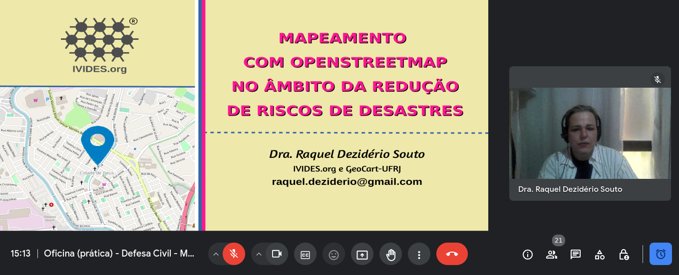
IVIDES.org® realizou mini curso sobre mapeamento com OpenStreetMap voltado à redução de riscos de desastres
No dia 11 de abril de 2024, o Instituto Virtual para o Desenvolvimento Sustentável - IVIDES.org, na pessoa de sua presidenta, Dra. Raquel Dezidério Souto, promoveu um mini curso sobre mapeamento colaborativo com OpenStreetMap e voltado à redução de riscos de desastres (RRD). O treinamento foi oferecido aos(às) servidores(as) de defesas civis de diversos estados do Brasil, como parte de um curso sobre logística para desastres.
Como parte dos documentos, foi incluída uma lista preliminar de feições relacionadas à RRD e as etiquetas correspondentes. Todos os arquivos da apresentação podem ser encontrados neste LINK.
کافی نت ایفل

Having both GoPro Hero11 and Max360, I was curious whether there would be any use from running both cameras at the same time. While Max 360 captures all around, would Hero 11 possibly have better resolution, which could be useful for streetview platforms like Mapillary and Panoramax, thus also providing additional detail for OSM mapping?
Here’s the same object - a surveillance camera - from both action cameras. Hero11 is even a little bit further away.
Max360:
My first diary entry in thirteen years, and so much has changed on OSM. The editing tools have come on so much, and there is now an incredible level of detail, even in the rural town I’m living in now. I think I need to go back to the documentation to refresh my memory and look at adding all the things missing in my neighbourhood.

Why is there no Arabic language on maps?لماذا لاتوجد اللغة العربية في الخرائط

It is for doing mapping so I can get better, so thank you guys! Google Maps is my main option but I am in Rank 149 of OpenStreetMap! Thank you for @DavidDean as he said he was in the top 50 in 2008! I specifically like you guys! Kind Regards, Brilloant

2024年4月3號花蓮外海發生規範 7.2 強烈地動,造成嚴重 ê 道路中斷 kah 人命傷亡。OpenStreetMap Taiwan 社群開設下跤三个專案,向望各界鍵盤圖客支援繪製花蓮 ê 建築、土地利用 kah 落勾 ê 道路 kah 溪流:
- 中橫公路東段:https://tasks.hotosm.org/projects/16508
- 蘇花公路:https://tasks.hotosm.org/projects/16507/
- 花東縱谷北段新城、秀林、花蓮、吉安、壽豐:https://tasks.hotosm.org/projects/16505
這馬佇咧參詳地動了後 ê 衛星影像捐贈 ē-tàng iōng tī 繪製新 ê 地貌,並且 tī 主要災後復原了後,期待直接 tī 在庄 ê 實體活動,幫助在庄 ê 人。
On April 3, 2024, an earthquake happened outside the coast of Hualien, which caused serious roadblocks and human casualties. OpenStreetMap Taiwan has opened 3 projects for mapping affected areas, requesting worldwide mappers to map buildings, landuses, missing roads or waterways in Hualien.
- Central Cross-island Highway eastern section: https://tasks.hotosm.org/projects/16508
- Suhua Highway: https://tasks.hotosm.org/projects/16507/
- Hua-Dong Valley northern part, Sincheng, Siulin, Hualien, Ji’an, Shoufong: https://tasks.hotosm.org/projects/16505
We are talking if there is a possibility to donate the newest satellite image after the earthquake to map the after-earthquake situations. And the possibility of hosting mapping events on-site after the affected area returns to normal, helping locals by mapping the newest map data.