
Работа дня
ДВФУ.Моделирование учебного процесса Минпромторг.ЦУПП.СТЗ.Моделирование процессов Empiry.Карты РЦМ.Empiry.Патенты Алеф-Куб.Интеграция Генезис знаний.Сотрудничество
 OpenStreetMap
Работа дня
ДВФУ.Моделирование учебного процесса Минпромторг.ЦУПП.СТЗ.Моделирование процессов Empiry.Карты РЦМ.Empiry.Патенты Алеф-Куб.Интеграция Генезис знаний.Сотрудничество
不知道怎么测量两点距离,有没有教一下的 I don’t know how to measure the distance between two points. Have you taught me anything
I wrote a long-ish post on my personal blog about how I used osm2pgsql to set up and maintain the database that powers Resto-Bot, the silly bot that toots out an OSM restaurant feature that has not been updated in more than 5 years.
You can’t use the cistern because it is locked by key. You don’t reach the water .
A week ago, my colleague Can (who works at HOT and is part of Yer Çizenler) got a message from Dr Çevik, a Turkish surgeon treating people injured by the earthquake in Turkey.
It said: On the first day I went to Rehaniya, when Google Maps was not working, Organic Maps guided us. The importance of such tools is enormous. Good luck to you, Can. 🔥 organic maps 🔥
Can asked him to explain and he did… You can find the video here and the transcript below.
 The OpenStreetMap community in Tanzania hosts an annual conference called State of the Map Tanzania that brings together mappers, software developers, and other contributors to talk about and share information about OpenStreetMap. Presentations, workshops, and discussions on a variety of mapping-related topics, such as mapping methods, data gathering, data analysis, and software development, are frequently included in the conference. Participants can network with other OpenStreetMap contributors and get knowledge on the most recent advancements in the industry.
This is a cross-post from my blog
I posted a couple of days ago about my first captures with the GoPro MAX camera I have on loan and uploading to Mapillary. This all went pretty smooth, so I wanted to capture while biking. I bike around town a fair amount and you can cover more ground in the same amount of time compared to walking, so I was eager to try it.
Years ago, I captured Mapillary imagery with my regular GoPro HERO 3+ camera mounted on my bike:
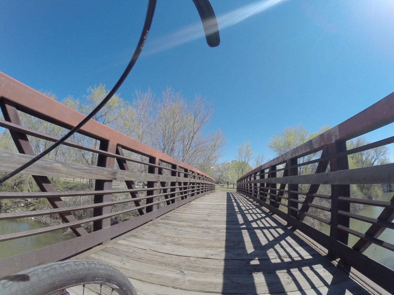
I remember from back then (2014) that the uploading process was not super straightforward, but Mapillary was only 1 year old then, so that was to be expected.
I still have some of the accessories from my HERO 3+, like a helmet attachment and a quick-release adapter. The accessory interface on the cameras hasn’t changed, so those things work even with the most recent GoPro cameras. Here’s the helmet attachment with quick-release shoe:
English version below.
tl;dr: Probier doch mal die Overpassabfrage für Straßen mit veralteten Parkraumdaten in deiner Gegend aus oder für Straßen gänzlich ohne Parkrauminformationen, um zu sehen, ob es Handlungsbedarf gibt :)
Try the overpass queries for streets with deprecated parking data in your area or for streets without any parking information at all to see if there is a need for action :)
Das Tagging von Parkplätzen entlang von Straßen hat vor kurzem ein großes Update erfahren: Das vorherige parking:lane-Schema wurde mit bestehenden OSM-Konventionen harmonisiert und durch ein einfacher und flexibler anwendbares Street-Parking-Taggingschema abgelöst. Existierende Daten nach dem alten Schema müssen nun also geprüft und in die neue Form überführt werden.
Für das Verständnis des neuen Parkraumschemas hilft dieser Schnelleinstieg. Aber auch, wer sich nicht tiefer mit diesem komplexen Schema beschäftigen möchte, kann dabei helfen, die Daten zu vervollständigen und zu aktualisieren. Dafür gibt es helfende Werkzeuge, in deren Benutzung ich hier einführen möchte.
Alle Tags an Straßen, die mit parking:lane oder parking:condition anfangen, gehören zum alten Schema und sollten aktualisiert werden. Diese Overpass-Abfrage listet dir alle Straßen, die das alte Schema verwenden (oben links auf den grünen Knopf Ausführen klicken). Bleibt die Abfrage leer, sind entweder noch keine Parkraumdaten erfasst (siehe unten) oder sie sind bereits auf dem aktuellen Stand.
Die Tags des neuen Schemas beginnen nur noch mit parking:left|right|both, also ohne die Bestandteile lane und condition. Aktuelle Parkraumdaten lassen sich mit dieser Abfrage finden.
Introducing me, Dimas, the head of the UGM SpaceTime community. We are one of the teams that passed the funding from the 2022 Booster Grant program held by the Open Mapping Hub Asia-Pacific and the Indonesian OpenStreetMap Association (POI).
In this funding, we updated OSM data related to the Trans Jogja and Teman Bus routes and the location of bus stops in Yogyakarta City and its surroundings. In addition, the output of our activities is WebGIS which displays existing routes and stops.
It was found that the data in OSM related to routes was found to be inconsistent with the routes we had validated through field surveys. In addition, many routes were cut off in several segments and errors in tagging data. So we intend to update the data based on current conditions in the field.
We will completely change the Trans Jogja and Teman Bus routes in “Relations” in OSM. So maybe there will be many changes regarding routes and stops in Yogyakarta after I upload this diary.
Note de l’éditrice: Écrit à l’origine par Heather Lesson, Dinar Adiatma, et Can Ünen. Ceci est une traduction.
Disposer des données cartographiques les plus récentes et les plus précises est crucial pour les interventions d’urgence. La communauté OpenStreetMap et ses partenaires ont créé ceci pour soutenir les humanitaires. Les données OSM sont partagées sur la platforme Humanitarian Data Exchange et sont utilisées pour développer des produits de gestion de l’information pour les décideurs répondant aux urgences.
Cette courte note a pour but d’aider les nouveaux mappers à démarrer et d’encourager la qualité des données. La communauté turque locale, Yer Çizenler, et HOTOSM coordonnent cette activation. Pour la Syrie, la cartographie est plus complexe puisqu’il s’agit d’une zone de conflit. HOT travaille en étroite collaboration avec certains collègues et partenaires pour évaluer soigneusement toutes les tâches HOT en Syrie. Comme il s’agit d’une zone de conflit, nous collaborerons pour nous assurer que les contributions OSM du Gestionnaire de Tâches HOTOSM ne causent aucun dommage. Nous sommes là pour assister ceux et celles qui portent aide.
Nous savons que beaucoup veulent aider. Nous vous demandons de parler avec d’autres mappers pour apprendre et aider les intervenant.e.s tout en respectant les directives locales.
La qualité des données est importante dans OpenStreetMap (OSM) car elle affecte directement la précision et l’utilisation de la carte. Toutes les données doivent être adaptées à l’objectif, et pour qu’elles correspondent à l’objectif, il faut le moins de lacunes possibles. Une mauvaise qualité des données peut conduire à des informations incorrectes ou obsolètes, ce qui a un impact négatif sur les personnes qui comptent sur OSM pour la navigation, la planification et la prise de décision. En savoir plus ici.
Contacts - Les contacts des Coordinateur d’Activation de HOT peuvent être trouvés sur le wiki OSM
Editör notu: Aslen Heather Lesson, Dinar Adiatma, ve Can Ünen tarafından yazılmıştır. Bu bir çeviridir.
En güncel ve en doğru harita verilerine sahip olmak, acil müdahale için çok önemlidir. OpenStreetMap topluluğu ve ortakları bunu insani yardım çalışanlarını desteklemek için yaratmıştır. OSM verileri Humanitarian Data Exchange üzerinden paylaşılır ve acil durumlara yanıt veren karar verenler için bilgi yönetimi ürünleri geliştirmek için kullanılır.
Bu kısa not, yeni haritacılara yardımcı olmak ve veri kalitesini teşvik etme amaçlıdır. Yerel Türk toplumu, Yer Çizenler, ve HOTOSM bu aktivasyonu koordine etmektedir.. Suriye çatışma bölgesi olduğu için, haritalama daha karışıktır. HOT, Suriye için olan HOT görevleri dikkatli bir şekilde değerlendirmek için OSM meslektaşları ve ortaklarıyla yakından çalışıyor. Bir çatışma bölgesi olduğundan, HOTOSM Tasking Manager’ın OSM katkılarının zarar vermemesini sağlamak için işbirliği içerisindeyiz. Yardım edenlere yardım etmek için buradayız. Birçoğunun yardım etmek istediğini biliyoruz. Hem yerel öğütlere saygılı olmak, hem müdahale eden ekiplere destek olmak için, diğer haritacılarla konuşup bilgi paylaşımı halinde olmanızı rica ediyoruz.
OpenStreetMap’ta (OSM) veri kalitesi önemlidir, çünkü haritanın doğruluğunu ve kullanışlılığını doğrudan etkiler. Tüm veriler amaca uygun olmalı ve amaca uygun hale getirmek için, eksiklikleri en aza indirmek gerekir. Düşük veri kalitesi, yanlış veya güncel olmayan bilgilere yol açabilir ve navigasyon, planlama ve karar verme için OSM’e güvenen kişileri olumsuz yönde etkiler. Buradan daha fazla bilgi edinin.
İletişim - HOT Aktivasyon Koordinatör iletişim bilgileri bu OSM wiki üzerinde buluabilir.
OSM’de yeni misiniz? Bu karmaşık bir acil durumdur ve başlamanıza yardımcı olmaktan memnuniyet duyarız:
نرغب بالمشاركة وادخال اماكن الى الخريطة
Ruben Martin and I discuss the recent activities and what’s coming up for the humanitarian open mapping community.
Over the past few weeks, the OpenStreetMap community has mobilised in response to the devastating earthquake that hit Turkey and Syria. More than 7,500 mappers have contributed to the response so far, and 221 validators have validated over 5,870 tasks in Turkey alone — the contribution of this relatively small number of validators has been phenomenal, trying to ensure high data quality for the relief efforts.

This is a cross-post from my blog
I have always been excited about the opportunities open street level imagery (SLI) offers to OSM. I helped launch OpenStreetView (now Kartaview) back when I worked at Telenav and was an early contributor to Mapillary as well. Recently, I’ve had the opportunity to work more closely with the great folks at Mapillary. This re-kindled my excitement for SLI & OSM! Good things are rolling out and will continue to roll out in 2023, so stay tuned! The Mapillary blog is the best source for announcements.
Most recently, Mapillary added support for 360° video upload to their desktop uploader and the CLI tools! This is great news for anyone with a supported camera, like the GoPro MAX. I happen to have one of those so time to try it out!
The Mapillary help pages include great and authoritative guides on using 360° cameras including specific instructions for using the GoPro MAX. This post is just me summarizing my own experience.
You only need to do these steps once.
2023, here I am and still going strong. December 2021 Kumbirai Matingo just posted in a WhatsApp Group, ‘Anyone interested in OSM, please inbox’. I didn’t know what OpenStreetMap was or what it was all about but I was keen. I honestly wanted an activity to take me away from the boredom of staying at home hoping that the COVID-19 infection rate would decrease and go back to school. There I was in OSM_Zimbabwe steering committee not sure what OpenStreetMap was.
Fortunately in January 2022, Zim was hosting the Africa Monthly Mapathon. 28 January 2022 the first day I added a feature on the OpenStreetMap, Mutasa District Zimbabwe. Thanks to @Last Mufoya. ##to be continued
Wpis do dziennika zawierający gify i listę zmapowanych miejsc w Ptaszkowie (województwo małopolskie)
Tytuły przekierowują do miejsca na mapie.
건설 예정인 도시를 먼저 할생각입니다. (이천 도심, 남양주 신도시, 대표하는 문화재 인근, 인천신도시 작업)
보이는것도 편집하면서 다 넣고 싶지만 정보가 있지않아 포기한 내역이… (이천에 갑자기 생겨난 물주기들)
다른 단어를 찾으면 적어두고, 바로 번역할 생각입니다. 영어가 유창한건 아닙니다 ⚠️ (톨게이트, 정수장, 하수장, 홍수방지 장치에 대한거,) (고물상에 대해서 질문 준비중입니다)
양도 양이지만 현생 본업에 스트레스가 이만저만이 아니기도 하고 사무직이라 마우스가 손에 잡히지가 않네요..🥲
Der nicht aktuelle Stand der OSM-Karte im Rahmen des Ausbaus der (Eisenbahn) S-Bahnlinie 13 (S 13) von Troisdorf nach Bonn-Oberkassel motivierte mich im Mai 2020 bei Openstreetmap aktiv zu werden. Der Bonner OSM-Stammtisch, der sich einmal im Monat trifft (diskutieren führt oft schneller zur Erkenntnis), hat mir beim Einstieg in das Mappen geholfen. Er ist auch heute noch eine gute Unterstützung
Bei verschiedenen Mappings fiel mir auf, dass bei Eisenbahnweichen oft das Tag railway=switch fehlte. Ich stellte mich der Herausforderung, die entsprechenden Node zu finden: Mit Overpass-Turbo wurden die Eisenbahnstrecken selektiert, mit einer Datenbankanwendung die “verdächtigen” Node’s identifiziert, als Overpass-Query in die Zwischenablage exportiert und in der Karte markiert. Die Entwicklung nahm einige Monate in Anspruch. Das Know-how als Dipl.-Ing. der Elektrotechnik mit Schwerpunkt Datenverarbeitung und viel Erfahrung in der Basic-Programmierung halfen. In den DACH-Ländern sollte es keine ungetaggten Eisenbahnweichen geben.
Die nächste Herausforderung bestand darin, die Daten dieser Weichen zu ergänzen. Dabei ist es hilfreich, wenn die Daten symbolisch dargestellt werden. Ein entsprechender MAPCSS-Stil musste her! Dieser sollte die Konfiguration der Weichen und wesentliche Daten darstellen.
Weitere MAPCSS Styles helfen, die Richtung des OSM-Weges und die Geschwindigkeiten anzuzeigen.
Zur Zeit arbeite ich an einem Style für die Darstellung von Eisenbahnsignalen.
 SOS São Sebastião - São Paulo - Brazil.
https://tasks.hotosm.org/projects/14297
SOS São Sebastião - São Paulo - Brazil.
https://tasks.hotosm.org/projects/14297
BRAZIL - SÃO SEBASTIÃO - (SP) - AREAS AFFECTED BY FLOODS, FLOODS AND LANDSIDES ON FEBRUARY 19, 2023 Brazil On February 19, 2023, the cities of the North Coast of São Paulo were hit by more than 600 mm of rain in 24 hours, with São Sebastião being the most affected and with the highest number of deaths so far.
The neighborhoods that were most impacted are: Baleia, Barra do Sahy, Boiçucanga, Camburi and Juquehy.
Mapping in the City of São Sebastião/SP - Brazil will be carried out by beginner and advanced mappers and aims to
DESCRIPTION For this mapping, use the Bing image.
Many buildings are very close but not really touching. Try to map them as closely as possible without allowing them to connect with each other or the streets.
คาเฟ่บ้านมี้อยุธยา


