Oh was fehlt denn da? Nun nicht mehr. So gut wie alle Hausnummern sind nun eingetragen und Ortdetails ergänzt. Eine Reihe von 360 Grad Bildern werden die nächsten Tage noch nachgemappt. Außerdem wurden Landschaftsdetails ergänzt und Wiesen und Felder ergänzt.
Users' Diaries
Recent diary entries
Track:
osm.org/user/warumichRadfahre/traces/5232776
Pics: https://1drv.ms/u/s!AhrBI8Ihd76ixlCjy_xRIrqfeHc5?e=dWfA8U
This is a Tasking Manager for Disaster response mapping for Flash Flood in Jembrana District, Bali in October 2022
I pleased to contribute in order to find response to the areas affected by floods and landslides due to heavy rainfall in South Africa through mapping.
I am thrilled to have my first session with OSM Rwanda, This is where Geospatial data are free woow!!!!
I am so pleased to attend this training of the Rwanda monthly mapathon today being 29th October 2022 at Classic Hotel
It is my pleasure to attend that event (unique mappers network Nigeria collaboration with OSM Rwanda to map Rwanda Monthly Mapathon). I have earned more skills, which will help me to improve my mapping skills so that i can edit too many features like roads, buildings and many others, which will help me to contribute to global spatial data.
It’s an amazing opportunity being one of the mappers around, kudos to the OSMRwnda chapter and The #UniqueMappersNetwork for this training
I am very happy to be one of the contributors of map Rwanda, this is my first mapping and I will keep mapping,
Thank you
本文仅为对客观情况的概述,很多内容仅为口口相传的转述,不含任何观点。请勿作为新闻报道或百科条目的可靠参考资料引用。
————以下为正文————
北京时间昨天(10月28日)下午开始,Openstreetmap官网在中国内地无法直接访问,到今天上午时基本可以确定是网站被墙了。方式是DNS污染。受到影响的范围是以openstreetmap.org结尾的所有网址。
目前已知造成的影响如下:(以下均为不使用加速器的直连)
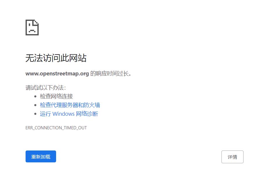
1、以openstreetmap.org结尾的所有网站均无法访问,显示为TIMED_OUT。包括但不限于osm主站、osmwiki、网页iD编辑器、论坛和用户日志。

使用单独网址进行的渲染方式不受影响。因此在已使用相关工具打开网页的前提下,可以浏览自行车地图、公共交通地图等渲染风格。(但是由于根本打不开网页所以这条并没有什么卵用)
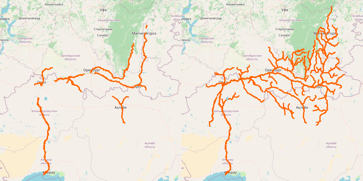
2、此前大量中国用户喜欢使用的Openrailwaymap可以正常打开网站,但是网站无法获取osm默认Carto渲染的底图,只能看到二次渲染的铁路线。
운전을 배우는 가장 확실한 방법은 바로 손수 운전을 하면서 익히는 것입니다.
하지만 이렇게 하면 너무 위험 부담이 크기 때문에 이론을 가르치고 방법을 가르치고 그리고 안전한 곳에서 익히고 그렇게 면허를 따고 나서 길로 나서는 것입니다.(면허를 따고 나서도 실제 길에 익숙해 지는 과정으로 ‘연수’라는 것도 하게 됩니다.)
OSM 그리기(매핑)은 운전 만큼 위험한 일이 별로 없기에 약간만 공부를 하고는 바로 하실 수 있습니다.
혹은 성격이 급하신 분은 바로 그리기에 손을 댈 수도 있습니다.
하지만 이렇게 하면 이미 서로 정한 규칙에 따라 그리던 것에 뜻하지 않게 방해를 하고 이미 해 놓은 것을 망가뜨리는 일도 종종 벌어집니다.
사실 OSM이 꽤 되었기 때문에 그 동안 정해놓은 원칙, 규칙 같은 것이 꽤 많습니다.
그걸 다 익히고 나서 발을 딛으려 한다면 아마 지레 지쳐 나가떨어질 것입니다.
그래서 어려운 얘기 다 빼고 가장 쉬운 것부터 해 보실 수 있도록 설명해 보고자 합니다.
먼저 가질 마음의 자세
- 가장 기초적인 것만 건드리겠다는 생각
- 내 능력 밖의 일은 다른 사람에게 맡기겠다는 생각
(고치고 있습니다.)
https://master.apis.dev.openstreetmap.org 에 가입을 해서 연습처럼 그려볼 수 있습니다.
이 곳은 OSM과는 다른 공간으로 설령 잘못 그린다 해도 OSM에는 영향이 없습니다.
실수를 할까 걱정이 되신다면, 이 곳에서 충분히 연습하신 다음에 OSM에 적용을 해도 좋을 것입니다.
다른 분들도 함께 하는 공간이기 때문에 좀 틀리는 것은 상관이 없으나 일부러 훼손을 하지는 마시기 바랍니다.
As some will know by now, crannogs are my “thing” at the moment. I was hoping to produce a couple of videos about them on my channel, but it takes a bit longer to get the tag approved than expected. And I can’t tell people how to map crannogs when there is no standard.
But I digress…
While mapping buildings in Co. Cavan in Ireland, I had discovered 12 suspiciously circular features in the lakes within the last 3 weeks, and I had reported them to the National Monuments Service this week. They got back to me yesterday and confirmed 3 as actual crannogs (the rest were apparently just naturally occurring circular vegetation).
If you want to check them out, Bing or Esri Clarity imagery are best.
There are a couple more to report, but I’d rather do it in bulk than send an email every 3 days or so.
I made a quick video about it: https://youtu.be/7BJukQ8hKXw
So, two of my interests are tagging waterways and highways. And of course, where they intersect, there is often a bridge. Here is how my bridge tagging method has progressed over time:
-
Bare minimum - split the highway (using e.g. aerial imagery), set
bridge=yesandlayer=1. This is conventional, if not particularly informative.
Then I found the National Bridge Inventory, which contains not all, but certainly many of the significant bridges in the USA. This data is quite interesting, it includes detailed info on the bridge structure and its integrity.
One can use this to verify the length of the bridge as drawn on the map, in many cases what’s shown in aerial imagery matches to within 1-2m of the specified length. You can also find data on when the bridge was constructed or rebuilt.
-
Added context - add
start_datetag.
Today, I was thinking, it’s not much more difficult to add an area object for the bridge structure itself using the man_made=bridge tag. In fact, one could then move such tags as start_date and bridge:structure into the separate object.
There is also an existing Here’s my idea. What if we used the NBI structure/bridge number, where available (in the USA)? You might wonder why that would be useful. bridge:ref tag which is loosely defined.Well there is a site https://bridgereports.com, which parses the NBI database with some additional refinements, and displays a nicely formatted summary. A plugin might use the structure/bridge number to display such data.
Something like the following. For the highway:
bridge=yes
highway=secondary
layer=1
ref=KY 218
And for the bridge structure [edit: updated per discussion in comments]:
ref:US:nbi:state_code=21
ref:US:nbi:structure_number=044B00032N
structure=beam
layer=1
man_made=bridge
start_date=1978
Here’s how the metadata could be displayed (using bridge ID “044B00032N”):
https://bridgereports.com/1211803
He subido un par de infografías al wiki de OpenStreetMap para ilustrar de forma esquemática cómo mapear zonas de estacionamiento en la calle que incluyan plazas reservadas para personas con movilidad reducida y plazas reservadas para recarga de vehículos eléctricos. Ambos tipos de plazas de estacionamiento ya se encuentran en el mapa del municipio de Málaga gracias a una importación reciente.
Infografía que ejemplifica de forma esquemática la forma de mapear una zona de estacionamiento en la calle que incluya plazas de estacionamiento reservadas para personas con movilidad reducida. Fuente: trabajo propio (CC BY-SA 4.0) disponible en el Wiki de OpenStreetMap.
Hallo
Freue mich immer über hilfreiche Tipps und Hinweise, was ich hier besser machen kann.
LG M.
매핑에 서툴러서 저가 하는 것이 제대로 되었는지 검증받고 싶거나, 확실하지는 않지만 뭔가 흠이나 탈이 있어 보이거나, 할 수 있는 한 정확하게 편집한다고 했지만 더 잘 알 만한 사람이 검증해 주었으면 싶거나, 바뀌었거나 아닌 것은 확실하나 어떻게 바뀌고 어떻게 아닌지 까지는 잘 모르거나, 그 밖에도 사람 땅그림이들이 검증하거나 더 자세히 고쳐주었으면 하는 것이 있으면 ‘고쳐주기’ 속성에 확인해 줄 사항을 적어주면 됩니다.
古橋先生のツイートを見て、自分もマッパーになれるかなと思い、やってきました。
もともと地図を見るのが大好きで、旅行に行く前には部屋に地図を貼って毎日ルートや地形を考えながら過ごし、現地での写真は位置情報つきで保管して、あとでルートを思い出しながら長期間ニヤニヤします。名所旧跡を見るより、道を辿るのが好きで、乗り物に乗り続けて移動するのが好きです。
自宅付近は怖いので、旅行先を登録していきたいと思います。道路情報などは地元の方に敵いませんが、できることから。
도움이 필요합니다. ‘가격 정책’에 대한 태그를 제안해 보려 합니다.
I need help. I would like to suggest a tag for ‘price policy’.
- ‘가격 정책’에 대한 태그를 제안해 보려 합니다. 한국말과 영어가 능숙하신 분들의 도움의 손길을 부탁드립니다.
- 먼저 ‘제안‘과 ‘제안 절차‘라는 OSM 위키 문서가 있는데 한말글로 번역이 되어 있다면 관심을 가지는 분들이 좀더 늘어날 것 같습니다.
내용
(물건에 대한 가격은 아니고)어떤 장소나 시설물에 대한 가격 정책 안에는 여러가지 하위 정책을 가진 경우가 많습니다. 대한민국을 보기로 들어, 노인 우대, 어린이 할인, 학생 할인, 유공자 할인, 지역민 할인 혹은 무료, … 이런 수많은 정책들을 속성에 반영해 둔다면 자료를 추출하거나 필터링할 때 큰 도움이 될 것 같습니다.
(작성 중……)
El mapa está manipulado por regiones según he observado y mi experiencia de trabajo.