Users' Diaries

Recent diary entries

on 29/06/2022 i started on remote mapping of entebbe municipality inorder to clean up the map so that it be ready for those who wish to use it and also to prepare for the fieldwork where by healthcare facilities can be added on it after capturing them by use of ODK hence helping the community to identify the locations of these facilities

Location: Kitaasa, Entebbe City, Central Region, Uganda

Esse foi meu primeiro projeto de importação semi-automatizada. Na maioria das vezes prefiro usar o MapRoulette para poder conferir os dados e corrigir se necessário. Isso acaba dando um pouco mais de trabalho mas isso é melhor para dados mais complexos como escolas, postos da policia, clínicas e outros dados.

Como estou sempre procurando novas bases de dados que possam ser usadas para melhorar o OSM acabei encontrando o GeoDourados, que é uma base bastante rica de dados sobre a cidade de Dourados, alem de contar com ortofotos de alta resolução.

Mandei um e-mail para os responsáveis pedindo permissão para usar os dados no OSM e, apesar de ter enviado mais de 10 e-mails para cidades diferentes, a única que respondeu foi Dourados. Por isso gostaria de agradecer ao Departamento de Geoprocessamento de Dourados, em especial ao Ênio Alencar, por ter dado suporte com esse projeto.

De todos os dados possíveis para utilização no OSM, decidimos começar pelas árvores, visto que além de ser um dado útil, seria mais simples de importar inicialmente. Não há duvida da importância das árvores para o ambiente das cidades, além de promover conforto nos dias mais solarizados também servem para absorver os ruídos produzidos nas grandes cidades.

Caso queira saber mais sobre arborização e o OSM na ultima terça feira houve um webinar sobre o OSM e arborização urbana para comemorar o dia da árvore link

O trabalho de importação só foi possível com a ajuda do Matheus Gomes que teve todo o trabalho administrativo, pedindo permissão da comunidade, escrevendo na Wiki e preparando os dados para serem importados. Sem ajuda sua ajuda não saberia nem por onde começar, obrigado!

Com os dados já prontos e com autorização, tive que começar a limpar áreas de conflito que já tinham árvores mapeadas. Usei o overpass turbo para baixar esses dados e comparei com os dados que seriam importados.

See full entry

Location: -22.230, -54.790
Posted by kanoalgiz on 29 June 2022 in English. Last updated on 30 June 2022.

{Insert standard apology about poor english from non-native speaker here}

So, I've found this beautiful thing, the OSM, I'm feeling so inspired and motivated - finally a platform where I can make contribution and fixes knowing that my efforts will not be in vain!

I'm currently living in Gyumri, Armenia, and maps here... have issues. On Google Maps, seems that building were autogenerated from satellite images - there are obvious errors, missing buildings, nonexistent buildings, buildings with weird geometry, buildings that are crossing roads or each other, roads that in reality are footpaths, footpaths that are ending abruptly (because they are partly hidden by trees on satellite image) - you name it. Addresses are absent on 90% of buildings. In my city, all you can do in Google Maps - 'add missing place' or 'add missing address' ('fix road' option in my area is not available), by filling some form and hope that it will be accepted by somebody someday. But where should I add address if the building itself is not present on the map!?

See full entry

Location: Ani district, Gyumri, Shirak Province, Armenia

依據高雄市政府觀光局2022.06.27發布政府開放資料 其中包含壽山國家自然公園轄管山區及高雄觀音山範圍之通訊標示 https://khh.travel/zh-tw/event/news/4565 總計61處,經比對有1處坐標有問題(已經向高雄市觀光局詢問) 其餘多數壽山國家自然公園內多是補充電信業者資訊(之前已建置遠傳和台哥大,這次多新增中華電信和亞太電信) 至於高雄觀音山為本次新增項目。

台灣政府最早由林務局羅東林區管理處與電信業者合作測試及設置通訊牌誌,並請RUDY協助匯入OSM中,隨後經累積林務局各林區管理處、玉山國家公園、雪霸國家公園、壽山國家自然公園管理處、新北市政府相關單位建置之通訊資料已達1300處,台灣登山迷途案件占山域救援案件近5成,本次增加可以補充相關電信業者,讓民眾知道哪裡可以通報,提升台灣民眾登山安全。

Location: 正德里, 鼓山區, 柴山, 高雄市, 804, 臺灣

Un projet occupe une poignée de contributeurs OSM en Belgique: l’import des batiments, c’est-à-dire compléter tous les batiments à partir des données officielles et ajouter la référence de ces données officielles aux batiments existants.

Depuis des contacts initiés fin 2021 avec le service public de Wallonie (SPW), cet import est également disponible pour la Wallonie, sur base des données du PICC: la base de référence pour les batiments en Wallonie.

Cet article expose brièvement la méthodologie suivie et des premiers résultats sur 3 sections administratives de la commune de Neufchâteau, principalement en repérant des nouveaux batiments et des batiments détruits.

Quid des batiments en Belgique?

À ma connaissance, il n’y a pas eu d’état des lieux récents de la complétude des batiments en Belgique. D’une manière générale, la majorité des batiments ont été cartographiés, souvent à la main, sur base d’images aériennes (ou du fond de plan du PICC en Wallonie). Les contributeurs trouvent en cherchant un peu des communes où il manque davantage de batiments que d’autres, ou bien des endroits où les batiments devant avoir une adresse n’en ont pas. On pourrait faire une analyse plus détaillée par commune pour estimer le taux de complétude des batiments.

Quoiqu’il en soit, voici une carte de l’état d’avancement de l’import: http://umap.openstreetmap.fr/fr/map/building-import-status_714473#8/49.792/5.823; Attention, comme dit plus tôt, une majorité de batiments ayant déjà été cartographiés par le passé, cette carte ne renseigne que sur l’import récent des batiments ainsi que l’ajout des références officielles.

Comment ça marche?

See full entry

Location: Neufchâteau, Luxembourg, Wallonie, 6840, Belgique
Posted by Mukesh J on 27 June 2022 in English. Last updated on 13 September 2022.

Who am I?

Hi, everyone!

Since this is a diary, I’ll try to keep it that way.

I am from Nepal & a Software Engineering undergraduate student at CODE University in Berlin, Germany since 2019.

That makes me a non-EU international student. Like most students in technology, I also work part-time at a startup for experience and other perks.

I like the process of creating a tech product, particularly ideation sessions, user stories & figuring out tech problems.

Why GSoC?

There were a few students who completed GSoC at our university and organized a session sharing their experiences. That made me curious. I found OpenStreetMap(OSM) from the list of organizations, mapped my home, and liked the product.

You can find my application here

What am I building?

Geo-referenced image viewer

User story

  • An OSM user takes photos of different restaurants, supermarkets, and other cafes from his/her phone on a given day

  • The user now wants to update the opening and closing hours of one of the restaurants with help of the photos he/she took some time ago

  • By dragging and dropping (or importing) those photos in the iD editor, the user wants to see all the photos on the OSM & fill out the business hours (opening and closing) side-by-side

A pictorial representation of the user story can be found here

How to reach out to me?

Github or

mukesh.jaiswal@code.berlin

Location: Friedrichshain, Friedrichshain-Kreuzberg, Berlin, Germany

Con oggi, 26 giugno 2022, è stato completato da parte mi il lavoro di rifacimento delle relazioni delle seguenti reti urbane autobus del Friuli Venezia Giulia: urbana Monfalcone, urbana Lignano, urbana Grado

MONFALCONE (aggregato Ronchi e Staranzano)

LIGNANO SABBIADORO (annesse fraz. Pineta e Riviera)

GRADO (annesse fraz. Pineta e Valle Cavarera)

TRIESTE

Aggiunta diramazioni linea G51 per la Wartsila e per Piazza Oberdan, nonchè la correzione dei tratti e delle fermate mancanti della tratta per l’Aeroporto di Ronchi. Aggiunta in data odierna anche la linea 20 express per Muggia.

Oltre alle relazioni sono state create (ove mancanti) le fermate ed i vari spezzoni per permettere l’inserimento del percorso; inoltre ho aggiornato le etichette nelle fermate con tag e valori obsoleti.

  • Alessandro Carmeli
Location: Grado, Gorizia, Friuli-Venezia Giulia, 34073, Italia

(original post in English)

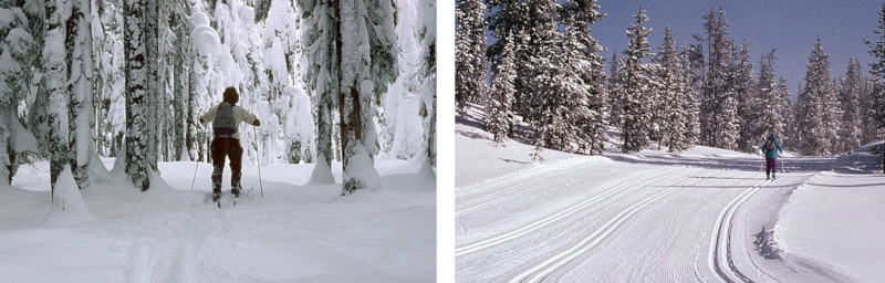
Selon les régions considérées, la pratique habituelle du ski nordique est différente. Si en Europe de l’ouest, dans la grande majorité des cas on peut s’attendre à ce qu’une piste de ski de fond soit préparée avec un plan lisse pour le skating et au moins un paire de rails pour le style classique, ce n’est pas le cas partout dans le monde.

Dans certaines régions, la préparation des pistes est plus légère, et la pratique du ski de fond majoritaire est plutôt celle du « ski de randonnée nordique » avec des skis larges. Image Crosscountry vs classic, skating

Sur OpenStreetMap, pour différencier ces pratiques très différentes, on utilise le tag piste:grooming .

Mais aujourd’hui (25.06.2022), pour 24 % des pistes de ski fond, soit tout de même 22’303 km, impossible de savoir quels skis prendre.

Alors cet été, à défaut de sortir la dameuse du hanger, à vos souris pour renseigner les pistes que vous connaissez !

See full entry

31.05.2022 I have published an open letter to the members of the OSMF foundation board regarding the problems I believe the community is facing in creating the main style of OpenStreetMap. The heated discussion that took place around this topic surprised me a lot. I didn’t think that so many involved editors from different parts of the world share my concerns.

On 06.06.2022 at the Engineering Working Group meeting this topic was raised, there is a note about this in the meeting record:

Follow up on osm-carto frustration

Brandon notes that the OWG have an outstanding issue on their public >tracker related to possible technology alternatives to OSM Carto. Unfortunately, >discussion is cut short as the scheduled meeting time is about to end.

As for me it is a bit of a pity.

30.06.2022 13:00 UTC At the meeting of the Board of Directors the mysterious topic of OSM Carto will be discussed. I am already looking forward to my participation in this event. Will you also take part in it? Here is the link for those who are interested:

(https://osmvideo.cloud68.co/user/ror-nt7-6tu)

I hope that this time I will not be disappointed and the board will find a solution to this problem, or at least start a consultation among the community. Which will contribute to the democratisation of the process of creating our flagship style

[out:csv(name,
         highway,
         bicycle,
         cycleway,
         "cycleway:both",
         "cycleway:left",
         "cycleway:right",
         "sidewalk:bicycle",
         "sidewalk:both:bicycle",
         "sidewalk:right:bicycle",
         "sidewalk:left:bicycle",
         length)]
[timeout:120];
area["de:amtlicher_gemeindeschluessel"=08421000]->.a;
way(area.a)["highway"];
convert result ::=::,::geom=geom(),length=length();
out geom;

I’m working on publishing a summary of sites using tile.osm.org and want to know what format would be most useful for people.

The information I’ll be publishing is requests/second, requests/second that were cache misses, and domain. The first two are guaranteed to be numbers, while the last one is a string that will typically be a domain name like www.openstreetmap.org, but could theoretically contain a poisoned value like a space.

The existing logs which have tiles and number of requests are formatted as z/x/y N where z/x/y are tile coordinates and N is the number of accesses.

My first thought was TPS TPS_MISS DOMAIN, space-separated like the existing logs. This would work, with the downside that it’s not very future proof. Because the domain can theoretically have a space, it has to be last. This means that any future additions will require re-ordering the columns, breaking existing usage. Additionally, I’d really prefer to have the domain at the start of the line.

A couple of options are - CSV, with escaping - tab-delimited

Potential users, what would work well with the languages and libraries you prefer?

An example of the output right now is

1453.99 464.1 www.openstreetmap.org  
310.3 26.29 localhost
136.46 39.68 dro.routesmart.com
123.65 18.54 www.openrailwaymap.org
107.98 0.05 www.ad-production-stage.com
96.64 1.78 r.onliner.by
91.42 0.16 solagro.org
87.83 1.53 tvil.ru
84.88 12.98 eae.opekepe.gov.gr
74.0 2.32 www.mondialrelay.fr
63.44 1.93 www.lightningmaps.org
63.22 14.01 nakarte.me
55.1 0.74 qualp.com.br
52.77 11.25 apps.sentinel-hub.com
46.68 4.07 127.0.0.1
46.3 1.96 www.gites-de-france.com
43.47 1.15 www.anwb.nl
42.46 10.52 dacota.lyft.net
41.13 6.63 www.esri.com
40.84 0.69 busti.me