 OpenStreetMap

لخدمات الانترنت
Users' Diaries
Recent diary entries
Posted by LySioS on 12 November 2021 in French (Français).

Quand je suis arrivé dans les PO, on m’a conseillé ce parc pour y emmener les enfants. Premier réflexe de tout contributeur OSM qui se respecte, regarder comment c’est cartographié.
(clic pour agrandir)

À première vue, peu d’infrastructures mais une grande zone prometteuse avec un plan d’eau.
Arrivé sur place, on se rend vite compte que le parc fourmille d’équipements pour tous :
- terrains de sport (skatepark, basket, ping pong, balade en poney, pétanque, circuit VTT, zone fitness)
- nombreux foyeux et tables de pique-nique
- plein de mes petits TOC (points d’eau, Pvélo, sacacaca, borne de recharge)
- et surtout, un petit espace zoo et attractions (manège, pêche aux canards) génial pour les petits
Vous vous revoyez enfant rentrant à la Cure Gourmande ? Même sensation 😁
Après quelques visites, de nombreuses photos et traces GPS, voici le changement.
Posted by Gustavo22Soares on 12 November 2021 in Portuguese (Português).

Hoje estou completando dois anos como contribuidor do OpenStreetMap então para comemorar farei uma breve retrospetiva sobre esse ultimo ano. 2021 não foi um ano fácil para os brasileiros com a negligencia do governo atingimos a marca de 600k mortos pela Covid-19, além da volta da fome e a inflação alta mas com diria Belquior posso me considerar um sujeito de sorte, editar no OSM me deu forças para aguentar muitas coisas, mapear esse ano foi como uma terapia. Esse ano também tive a oportunidade de conhecer projetos e pessoas incríveis!
Estáticas
Alguns números:
- 22.503 Edições enviadas
- 170.425 Edifícios mapeados
- 15.202 Km de vias mapeadas
- 9.926 Pontos de interesses mapeados
- 4.323 Km de rios mapeados
O que aconteceu com o Mapeia.Space?
É uma historia complicada, primeiro tivemos que mudar apos o DAMN mudar totalmente a forma de trabalhar e como o Hot TM parecia ter amadurecido na questão de desempenho então resolvemos mudar para o Tasking Manager o que aconteceu é que tivemos que começar do zero novamente… tivemos um problema com nossa hospedagem na mesma epoca recebi o convite para poder usar o HOT Tasking Manager (Obrigado Wille e Vitor George por essa oportunidade) desde então foram 7 projetos publicados. Então não havia por que manter uma instância própria do Tasking Manager então o mapeia.space acabou sendo encerrado apesar de que tentei criar uma organização em torno do Mapeia para promover mapeamento o que também acabou não dando certo mas no final acabou dando como fruto a pesquisa de uso de mapas online.
Você pode visitar o perfil do OSM Brasil no Tasking Manages link
Importação?

First time I’ve really messed with this so yep

I mapped all Primary and Secondary schools in the Corozal District according to this list by the Ministry of Belize.

A great team effort to map missing residential buildings in Germany was recently concluded. Many motivated mappers worked together to add 360,000 buildings all over Germany.
If you’d like to take part in the next round, come join the party at
➡️ MapRoulette: Add buildings in Germany!
Background
This mapping effort began when populated areas in Germany were identified that had neither buildings nor residential land use mapped. A MapRoulette challenge was set up and 14,330 new land use areas and 17,440 buildings were mapped in only 43 days. You can read about the details in my previous blog post MapRoulette: Unmapped residential areas in Germany.
This blog post is about the second round that started afterwards in January 2021.
Procedure
The idea was to find residential or farm yard areas without any buildings. These should contain buildings for sure, or the land use information should be corrected. (Later it turned out that farmyards without fixed buildings are legitimate.)
To this end I imported the Germany dump of OSM into a PostGIS database while already filtering for the desired land use and building types. In PostGIS I spatially intersected the buildings with the land use polygons and removed all land use areas which touched any building.

Waa Ahmed Caluushe, map shaqo ayaa ku socota

Hey guys, i am looking for a high definition satellite map, which is free and has a very high resolution. I saw some chargeable maps with a 8cm resolution. But is there something similiar on the open source market?
Thanks!
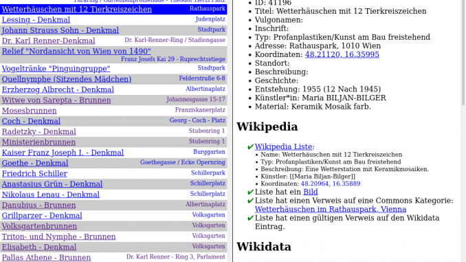
Ich hab ein kleines Tool geschrieben, welches dabei hilft OGD Datensätze mit Wikimedia (Wikipedia, Wikimedia Commons, Wikidata) und OpenStreetMap abzugleichen. Es findet sich auf hier: https://www.openstreetmap.at/checker.
Da das Tool nicht ganz selbst-erklärend ist, hab ich ein kleines Erklärungsvideo gemacht: https://www.youtube.com/watch?v=e9Is-3ssA7U
Der Source Code findet sich auf Github. Ich freue mich über Kommentare, Ideen und Code-Beiträge!
Posted by RicoElectrico on 10 November 2021 in English.

There are some users who register an account and then wait a few years before making their first edit. But this is the longest period, which I stumbled upon when browsing https://welcome.osm.be/ :
Registered in 2009-12-04, first edit 2021-11-06.
Who will give more? :)

I copied the outline of another roundabout on bass and put it on where it is. Sadly, I cannot yet get accurate GPS tracks. I implore anyone who can get those tracks and post them publicly or trace them out yourself. There are also some other need items like advised speed limit, join and exit roads, give way signs, and lane attributions as the minimum. But for the time being, I just want it to be mapped at least.

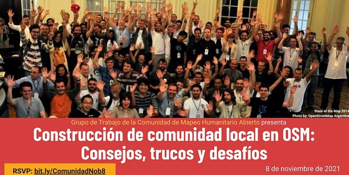
Yesterday, November 8, the event Local Community Building at OSM: Tips, Tricks and Challenges was held, organized by the Hotosm Community Working Group for Spanish-speaking OpenStreetMap communities.
As in any event worth its salt, there is a Document -in Spanish- with the notes on the presentations, conversations and chats, in addition to the video, of course (the video is -again- in Spanish).
I used the aforementioned document to make a live tweeting of the event from the @esopenstreetmap Twitter account, and then it occurred to me to make a thematic summary of the event based on the same notes, in order to facilitate the generation of future actions by the leaders of the communities. That summary is what I present in this post.
Topic Brief: Building Local Community in OSM
最近湖南株洲一带怎么多了这么多中南大学地信的学生?这是老师留的啥作业啊?
Posted by Cyberjuan on 9 November 2021 in Spanish (Español).
El día de ayer, 8 de noviembre, se llevó a cabo el evento Construcción de comunidad local en OSM: Consejos, trucos y desafíos, organizado por el Community Working Group de Hotosm para las comunidades hispanohablantes de OpenStreetMap.
Como en todo evento que se precie quedó un Documento con las notas sobre las presentaciones, las conversaciones y los chats, además del video por supuesto.
Usé el mencionado documento para hacer un live tweeting del evento desde la cuenta @esopenstreetmap, y luego se me ocurrió hacer un resumen temático del evento tomando como base las mismas notas, con el fin de facilitar la generación de futuras acciones por parte de los líderes de las comunidades. Ese resumen es lo que presento en esta publicación.
Resumen temático: Construcción de comunidad local en OSM

It’s great to see Users doing OSM editing for Humanitarian use. I live in a Highlands area prone to Frost, and droughts for longer period causing havoc to communities.
I hope to see Relief agencies using our OSM Maps for providing assistance during time odf disaster. Thankyou you OSM, if it hadn’t been your key role in providing open-sourced maps, I don’t think Government agencies will be willing to provide maps to its citizens during times of great need.
Government agencies and Departments don’t provide maps readily and would often come at cost which some can not really access it readily for their use.
I really appreciate the effort by the Developers of OSM and the selfless devotion in creating new features for all Mappers around the world to work on this vital platform for common good for humanity.
Thanks all and happy mapping form Papua New Guinea.

Aha, Blogeinträge.
Das ist ja eigentlich fast schon retro, mittlerweile.
Und jetzt?

Всем привет!
Сегодня тот день, когда Качаров Михаил пришёл в проект “OpenStreetMap” и начал вносить правки
Jo inbianco

TrackExplorer
TrackExplorer is a solution based on the idea of RaceDirector. The difference is that with TrackExplorer you can use any GPX file - with or without timestamps. You can choose different activities and no matter where on earth you have recorded GPX data, the data can be displayed in an 3D environment.
TrackExplorer Quick Overview
Via the website TrackExplorer Upload you can easily upload any GPX file. If your GPX file does not have a timestamp, you can decide during the upload the speed your data should be displayed in TrackExplorer. This is necessary if you create the GPX file with a route planner – in most cases there are no timestamps available. TrackExplorer offers different activity categories. Depending on your selection, your uploaded GPX data will be displayed with your chosen activity.
TrackExplorer Activities


Espaço para realização de festas e eventos. Sítio para aluguel.