Users' Diaries

Recent diary entries

There is going to be an OSM-Carto map reading workshop run by me at this year’s virtual State of the Map conference on July 11 at 12:15 UTC. This is going to be a new, experimental format i would like to try where i will explain the cartography and the reasoning behind styling decisions of the standard style shown on openstreetmap.org based on case examples you can submit beforehand.

For that purpose i have created a wiki page as well as an Etherpad where you can submit such examples. In the simplest form such an example is just a link with the URL pointing to a certain place on the map you would like to see discussed and explained. Ideally you should add a few words on what specifically you would like to see discussed because often there will be other things visible in the map as well.

I plan to make this an interactive workshop allowing those who submit an example to participate in the discussion if they would like to (though this is strictly optional of course). But to allow me to prepare for the case examples it would still be desirable to submit those in advance.

You can submit your case examples on any topic and any place on the map but of course i reserve the right to pick those examples from the submissions i consider most interesting for a wider audience (and you can also indicate if you are interested in examples submitted by others on the wiki/pad). If there are more examples submitted than can be covered in the workshop i will try to discuss them on the wiki after the conference.

Feel also free to add any comments and thoughts on the workshop idea and format here or on the wiki talk page.

Esta es una guía que pretende sacar dudas cuando te encuentres con una estación de ferrocarril durante tu mapeo. Contiene las etiquetas básicas.

Las estaciones de tren se asignan normalmente con un NODO en el centro o dentro del edificio principal, sin pegar a la vía. En el nodo estarán todos los datos de la estación como el nombre, operador, red, Wikidata, etc. También se puede asignar cómo área, pero generalmente es difícil saber los límites de la misma. El nombre no debe contener la palabra estación. El edificio principal debe estar como building=train_station y no contener los datos de la estación.

Estación con uso de pasajeros

  • railway=station (o halt) +
  • public_transport=station

Agregar un nodo en el centro de la estación o dentro del edificio principal. Estación Merlo de la Línea Sarmiento

Estación sin uso de pasajeros

  • railway=station (o halt)

No usar public_transport

See full entry

Location: Caballito, Buenos Aires, Comuna 6, Ciudad Autónoma de Buenos Aires, Argentina

Pelo Top 500 Brazil, nos últimos 2 meses, 37% dos contribuidores pertencem a corporações, respondendo por 80,29% dos changeset e por 41,83% das modificações no mapa. Parece que o interesse dessas empresas está mais no mapeamento de vias (criação das geometrias, denominação e restrições de conversão),

Fiquei impressionado em como cresceu a participação das empresas no OSM.

As tabelas abaixo foram feitas com as estatísticas de 11 de Junho de 2021.

See full entry

Location: Centro, Sede, Santa Maria, Região Geográfica Intermediária de Santa Maria, Rio Grande do Sul, Região Sul, Brasil

I have a few passions in life. Two of them overlap in an interesting fashion…

A number of years ago, I decided to look at how engineering (and specifically full-lifecycle analysis) could support improvements in road safety. While many road safety issues are primarily behavioural (speeding, awareness, road rage, etc), I strongly believe that infrastructure should guide road users to making better decisions over time through feedback, reinforcement of good behaviours, etc. Anyway… I decided to buy a dashcam and figure out if there was a way to collect data in a way that would provide strong arguments for change at both a local and national / international level. Due to other commitments and a lack of interest from the general public I haven’t made much progress. :(

My other rationale for getting a dashcam was to allow imagery capture to support mine and others’ OpenStreetMap activities. I drive quite a bit on my way to climb mountains and explore the south coast of Ireland (sometimes to play MMORPG Ingress). Capturing imagery and contributing it to the global community seemed like a good way to get additional “mileage” out of my travels!

But dashcams aren’t setup for sending data to Mapillary I here you say… True… but I never give up!

The OpenStreetMap Ireland community recently decided to capture imagery and authoritatively map the #WildAtlanticWay, a 2500+ km route along the west coast of Ireland. While there is some existing imagery of the route, there are some notable gaps and we wanted to fix that.

Being one of the primary contributors in Cork (Ireland’s largest county by land area), I was motivated to try and contribute more imagery in Co. Cork and Co. Kerry. So I started digging into the tools available for processing and uploading data again (to see what improvements had been made since I last tried).

Processing dashcam videos so they are usable my mapillary

See full entry

Location: Centre B ED, Cork, County Cork, Munster, Ireland

PE̍H-ŌE-JĪ pán-pún:

Góa tī-teh MapComplete Telegram kûn-cho͘ ê liû-giân:

Kí-gōa nî-chêng, Tâi-oân ū-chi̍t-kóa tô͘-kheh khai-sí Lim-chúi tōe-tô͘, chia-ê tô͘-kheh put-chí-sī piáu-sī lim-chúi-tiám, mā siūⁿ-boeh kā Lim-chúi tōe-tô͘ bāng-chām ê têng-sek-bé, ōaⁿ pa̍t-ê chú-tê thui-chhut lēng-gōa ê chú-tê tōe-tô͘, lâi thui-sak Khai-hóng kòe-tō͘. M̄-koh chiâⁿ khó-sioh bô-hoat-tō͘ the̍h-tio̍h chu-goân lâi thui-sak bô-kâng ê chú-tê tōe-tô͘, khip-ín Tâi-oân-lâng lâi chham-ú Khai-hóng koe-tô͘.

Chin-hoaⁿ-hí MapComplete ē-tàng tit-tio̍h Khai-hóng Koe-tô͘ Ki-kim-hōe, Khai-hóng Tì-sek Pí-lī-sî, Trage Wegen, OSGeo Belgium, Jîn-tō Kiù-oān Khai-hóng Koe-tô͘ Sió-cho͘, Ûi-sit Tōe-tô͘ téng-téng ê chi-oān, ē-tàng hō͘ kong-iōng pán-pún ê chú-tê tōe-tô͘ 成為 chi̍t-chióng khó-lêng.

Chìn-chêng choān-siá Lim-chúi Tōe-tô͘ siong-koan ê bûn-chiuⁿ, ē-tàng khah chheng-chhó liáu-kái siā-kûn kah NGO chih-chiap ê būn-tê: 1, 2

Tâi-lô pán-pún:

Guá tī-teh MapComplete Telegram kûn-tsoo ê liû-giân:

Kí-guā nî-tsîng, Tâi-uân ū-tsi̍t-kuá tôo-kheh khai-sí Lim-tsuí tuē-tôo, tsia-ê tôo-kheh put-tsí-sī piáu-sī lim-tsuí-tiám, mā siūnn-bueh kā Lim-tsuí tuē-tôo bāng-tsām ê tîng-sik-bé, uānn pa̍t-ê tsú-tê thui-tshut līng-guā ê tsú-tê tuē-tôo, lâi thui-sak Khai-hóng kuè-tōo. M̄-koh tsiânn khó-sioh bô-huat-tōo the̍h-tio̍h tsu-guân lâi thui-sak bô-kâng ê tsú-tê tuē-tôo, khip-ín Tâi-uân-lâng lâi tsham-ú Khai-hóng kue-tôo.

Tsin-huann-hí MapComplete ē-tàng tit-tio̍h Khai-hóng Kue-tôo Ki-kim-huē, Khai-hóng Tì-sik Pí-lī-sî, Trage Wegen, OSGeo Belgium, Jîn-tō Kiù-uān Khai-hóng Kue-tôo Sió-tsoo, Uî-sit Tuē-tôo tíng-tíng ê tsi-uān, ē-tàng hōo kong-iōng pán-pún ê tsú-tê tuē-tôo 成為 tsi̍t-tsióng khó-lîng.

Tsìn-tsîng tsuān-siá Lim-tsuí Tuē-tôo siong-kuan ê bûn-tsiunn, ē-tàng khah tshing-tshó liáu-kái siā-kûn kah NGO tsih-tsiap ê būn-tê: 1, 2

漢字版本:

我佇咧 MapComplete 群組的留言:

幾偌年前,台灣有一寡圖客開始啉水地圖,遮的圖客希望不止是標示啉水點,嘛想共佮啉水地圖網站的程式碼,換別的主題推出另外的主題地圖,來推捒開放街圖。毋過誠可惜無法度提著資源來推捒無仝的主題地圖,吸引台灣人來參與開放街圖。

See full entry

Location: 九層坑, 豐丘村, 信義鄉, 南投縣, 556, 臺灣
Posted by Supaplex on 10 June 2021 in Chinese (Taiwan) (‪中文(台灣)‬). Last updated on 20 June 2021.

我在 MapComplete Telegram Group 留言:

很多年前,台灣有些圖客開始飲水地圖計劃,這些圖客不只想要標示飲地點,還要把製作飲水地圖網站的程式碼,換不同的主題來推出另一個主題地圖,藉此推廣開放街圖。但很可惜無法拿到足夠資源來推展不同主地圖,來吸引台灣大眾參與開放街圖。

很高興 MapComplete 得到開放街圖基金會、開放知識比利時、Trage Wegen、OSGeo Belgium、人道救援開放街圖小組、遺失地圖等等的的支援,讓公用版本的主題地圖成為可能。

先前撰寫有關飲水地圖的文章,可以較較清楚瞭解社群與 NGO 接觸遇到的問題:12

Вот продолжение моих попыток вводить POI сразу на месте из OsmAnd. В этот раз я обошёл вокруг квартала Московский-Смоленская-Заозёрная-Обводный. Этот заход оказался относительно успешным. Мне удалось ввести большую часть POI из тех, которые я бы ввёл обычным двухэтапным способом. Одна из причин успеха — в этом месте до меня было отмечено не слишком много POI. Соответственно, практически не возникало проблем сопоставления отмеченного с реальным. Одна из причин этой одной из причин — наличие свежепостроенных зданий, в которых очевидным образом не может быть обозначенных точек десятилетней давности.

Новые здания, как на Смоленской улице, также облегчают задачу сопоставления самих себя со своими образами на карте. Их обычно не строят в упор друг к другу, благодаря чему гадать об их границах не приходится. Зато там, где дома более-менее старые, что в моём случае наблюдается вдоль Московского проспекта, непонятные границы зданий возникают вновь. И, как обычно, далеко идти за ними не приходится. Начав обход с угла Московского проспекта и Обводного канала, прямо на этом углу я обнаружил дом № 62 со своим соседом № 64 или один дом № 62-64. Табличек с номерами там две,1 но это ещё не значит, что и дома два. Если таблички убрать, то, скорее, покажется, что дом один, если смотреть на него с улицы. Взгляд со стороны двора, возможно, произвёл бы другое впечатление, но я же не буду обходить каждый дом со всех сторон, когда ищу POI на улице. Но это ещё не самый сложный случай, потому что даже и с улицы ясно, какому месту соответствует видимая на карте граница между зданиями. Следующая же граница между домами № 64 и № 66 в том месте, где она нарисована, не видна совсем.

See full entry

Sziasztok! Június 25-én mit szóltok egy mapping partyhoz Pestújhelyen? A környék nagyon üres POI és házszám ügyben. Gyertek térképezni velünk! Tali helynek a Vanilin Cukrászdát javaslom.

További infók, programok, elérhetőség: https://wiki.openstreetmap.org/wiki/Hungary/2021-06-25-pestujhely-mapping-party

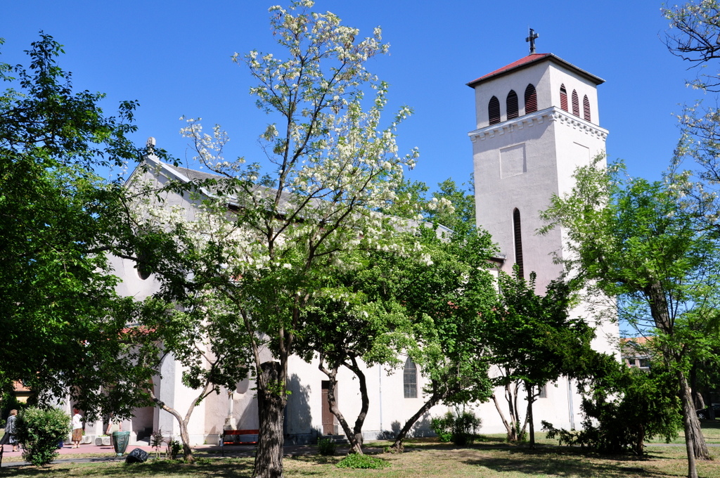
Pestújhelyi téri templom

Location: Pestújhely, XV. kerület, Budapest, Közép-Magyarország, Magyarország
Posted by wielandb on 9 June 2021 in German (Deutsch). Last updated on 11 June 2021.

Hintergrund

Ich bin sehr viel mit StreetComplete unterwegs. Mir ist dabei immer wieder aufgefallen, dass es einen bestimmten Typ Straße gibt, für den es überdurchschnittlich wahrscheinlich ist, dass man angesprochen - oder wenn man Pech hat: angepöbelt wird.

Ich nenne diesen Typ Straße “Sackgassenwohngebiet”. Also Straßen, an denen (meistens Einfamilien-) Häuser stehen, die aber nirgendwo sonst hinführen. Bedeutet: Wer dort nicht wohnt, hat dort auch eigentlich nichts zu schaffen. Zur besseren Visualisierung, so etwas meine ich: Eine Karte von einer Sackgassenwohnstraße

See full entry

Due to ill-considered from the Wikidata community using old and outdate 2017 dataset from Directorate General of Budget, Accounting and Statistics (DGBAS), Executive Yuan, Taiwan, the newly found villages in 2018, like the villages mass modification in Taiwan in 2018, or split villages due to increase population, these new villages was not included and imported into Wikidata. So there are some OpenStreetMap village relations could not link to Wikidata.

For the OpenStreetMap part, typebook using relative new and up-to-date shape files from National Land Survaying and Mapping Center, Ministry of Interior Affairs, to add the Code of Household Registration and Conscription Information System (HRCIS Code) and the followup Wikidata item. There are only mssing Zhengxin Village, Dauliu City, Yulin County on OpenStreetMap. OpenStreetMap Taiwan community could just add relation to fix the problem on OpenStreetMap.

For the Wikidata part, there are several users start to import villages data to Wikidata, which started from 2019. If you look closer to some of the Wikidata items, the reference they used link to files from the DGBAS, which is out-of-data and the last update time is 2017-01/31. DGBAS decide to switch to use the HRCIS Code. It indicated that Wikidata users using old dataset to import villages, so the 75 new villages was not included, is missing on Wikidata database.

When Wikidata Taiwan community start to deal with the villages data in 2020, there are many villages already combined in disappear. But due to the fact they used DGBAS out-of-date dataset, they could not found out their are missing mass amount of villages. The DGBAS also missing the villages English name, so we see the imported item missing English label.

See full entry

Location: Shuanglong Village, Xinyi Township, Nantou County, Taiwan

OpenStreetMap не исключение.

МВД РФ не может работать 24/7 для целой планеты.

Нужны нормальные юр. лица. Нужны нормальные графики работы.

Законы в США или Ирландии это шутка. Где сейчас сервера OpenStreetMap стоят?

Я за тегирование по законодательству каждой из стран.

Законодательство РФ использует русский язык как один из государственных языков в РФ.

В английском языке и англоязычных странах не было столько троллейбусов.

Про международные стандарты это более тонкая тема для отдельного разговора.

Ключа “это” не было в OpenStreetMap. Был пяток-десяток других, у которых мало смысла.

https://taginfo.openstreetmap.org/keys

Тегов OpenStreetMap никогда не было достаточно для описания даже троллейбусной сети в РФ.

Лично я слежу за OpenStreetMap около 15 лет.

Вывод только один.

OpenStreetMap это преимущественно любительский проект. Не нужно его оценивать слишком высоко.

Не нужно слишком долго искать смысл в тегах OpenStreetMap. Не нужно слишком долго искать смысл в процедурах OpenStreetMap.

osm.org/user/d1g/diary/39847

Я чудовищно заблуждался в этих “чудо” проектах от Bomis (Wikimedia Foundation). Я чудовищно заблуждался в умалишённом фанатике Jimmy Wales из США-Великобритании.

Я чудовищно заблуждался в способностях МВД РФ. Я чудовищно заблуждался в способностях ФСБ РФ. Я чудовищно заблуждался в способностях Генеральной прокуратуры РФ.

Posted by AkuAnakTimur on 8 June 2021 in English. Last updated on 9 June 2021.

In the year of twenty-twenty one, I still map using an external Bluetooth GPS receiver unit (yes, and yes, GPS explicitly refers to the American constellation only).

The device in question is Qstarz BT-Q818XT. It was updated with a firmware that kinda fixes the Y2K problem of GNSS.

Of course things can work with Android devices

Purchased in 2014, I used to hook it up with the BlueGps app with a tablet running Android Jelly Bean.

Latest Android versions shipped with devices come with time. The BlueGps app stopped working in Android KitKat. Luckily, there’s another app in the Google Play Store that still could do exactly that: it’s simply called as Bluetooth GPS. The APK copy of it is still able to function independently in devices without Google Play Services.

With latest dessert release, things start breaking up

Fast forward to the dessert release of Pie. Significant changes in more recent releases of Android means apps that no longer patched, with several legacy API calls begin to cease functioning properly. At least the app would just still work on Android 8.1.0 Oreo.

What other alternative is available?

Browsing through the Google Play Store appeared to be hopeless at first. Similar apps like Bluetooth GPS are common - they stopped received any updates for quite a long time. I don’t want to take the risk to give those shady apps a go, until I stumbled upon Bluetooth GNSS - GPS, Galileo, GLONASS and BeiDou. What a long, descriptive name for an app.

No adverts? Cool? More like cooler! I took a dive.

Yes, it works on Android 9.0 Pie. As the time of writing (the app received an update on 26 May 2021), the app simply works on Nokia 2.2 running Android 11 (warning: a 6MB GIF!). I suspect it would run OK on devices with near vanilla Android (Pixel, Android One, etc).

Some disclaimer: I don’t receive anything to share this.

Custom ROMs and the Bluetooth GPS receiver unit thingy

See full entry