Toutes les modifications OSM générées via ce profil sont faites dans le cadre d’acquisition de données des SERM. Pour plus d’informations au sujet de ces modifications: osm.wiki/France/Gares_SERM
Users' Diaries
Recent diary entries
Posted by coteyka on 13 March 2025 in Russian (Русский).
Last updated on 10 April 2025.

Зачем же? Поправить мои правки!
Не так давно я добавил магазины сети Батон на карту, а сейчас начал расставлять магазины сети Русский Разгуляйка.
Проблема? Я расставлял POI с точностью до адреса дома, а не до двери. Поэтому, если кому то нечего делать, приглашаю вас рассмотреть мои пакеты правок[3][4][5][6], и обращаясь к Яндекс Панорамам (или любым другим источникам данных) разметить POI’шки точнее, к дверям.
Буду рад помощи, и спасибо!
upd 14.03.2025
самостоятельно поправил магазины сети “Батон”
Went back to Henderson to finalize the updates. I think i updated all i could with out starting to assume details. Also some mappers suggested straightening out the roads, so i did that across the entire town.
Final Edit:

as a reminder, this is how it started:
Posted by JanezPavelZebovec_import on 11 March 2025 in English.
Last updated on 13 December 2025.

Source: https://gurs-import.karlas.si/project/1 (previous URL: https://osm.karlas.si/project/1)
- YYYY-MM-DD = date of import
- XXXXXX_X = number of task in Simple Task Manager
- Name of the settlement
- N i. b. = number of imported buildings according to the source.
Changesets/imports:

在博客中查看
这个OpenStreetMap变更集的范围原本应是12*8km,范围不超过福州四区的福马路部分。但在我编辑地图期间有人修改了台州部分的104国道,八杆子打不着的地方硬是因为一个104国道的“关系”需要在发布变更时选择使用本次编辑亦或是使用上个版本的编辑(放弃这次修改)。这两个选择极具迷惑性,不会有超出选项栏提示字以外的更多解释。且ID编辑器没有第三个选项,你不能同步后再修改。
相同的逻辑,如果我分解了连霍高速连云港路段作为路堤,但在我发布这些修改前有人在伊犁的连霍高速入口增加了收费站路段分割车道。我的变更集范围岂不是就扩大到半个中国了?这时候,任何人,在伊犁以东南,连云港以西,徐州以北的范围点击网站顶部导航栏的“历史”就能看到这个本应该是连云港范围的变更集莫名其妙的就出现在了历史列表里?
Tenkeli (Тенкели) Mapping Project
Overview
Over the past 3 weeks I’ve discovered, researched and mapped out the area of the abandoned Russian town of Тенкели, located in the middle of Siberia.
The location had only a rough outline of the town mapped along with the airport runway and main road. There were no buildings, no roads and the landuse was tagged incorrectly. The quarries were tagged as ‘landfills’. Apart from that, the nearby settlement, Суор, was also not even tagged. I decided to take matters into my own hands.
I found this video which proved a great help in learning the history and details of the place. Based on this, satellite imagery and images scattered along random, long forgotten forum websites (as well as TimeMachine snapshots from tenkeli.ru), I pieced together the most (if not only) accurate map of this settlement.
I plan to continue this project until the entire area is detailed up to a standard I deem sufficient
Changes made
- Added nature landuse in the vicinity
- Removed unsupported and old tags
- Added every building in Тенкели/Суор with their respective tags
- Added the road system with specified smoothness and surface types
- Added lakes/reservouirs
- Adjusted rivers
- Cleaned up existing things
Stats (as of 11/03/2025)
- Changes - 41 266
- Changesets - 67
- Average Changes/Changeset - 615,91
- Average Changeset/Day - 3,7
To Do List
- Improve the river system near Суор
- Fix the mediocre nature tags in the area
- Specify building tags around Суор and the industrial area below Тенкели
- Find addresses and street names (If anyone has any information on that, contact me)
Before (General)
Posted by SandraN25 on 10 March 2025 in Spanish (Español).
En un mundo donde la tecnología y la información geoespacial juegan un papel fundamental en el desarrollo de comunidades y territorios, estudiantes y docentes de la Institución Educativa Ciudad de Ipiales tuvieron la oportunidad de sumergirse en el fascinante universo de la georreferenciación. Gracias a la colaboración del instructor Sebastián Bravo, los participantes exploraron herramientas innovadoras como OpenStreetMap y Mapillary, descubriendo su potencial para la cartografía digital y la representación de datos geográficos.
Picked another town nearby. Patterson NY. Added most of the buildings in the area. Now need to work on the lots and land cover.
Before:


I must be mad as I have started two proposals in a day.
- Deprecate socket:tesla supercharger and socket:tesla destination
- Rules for marking some Mailing Lists as archived
I have also started a conversation (and am looking for proposals) on bicycle charging tagging.
I welcome all your comments on them.

97390 addresses completed
A few minor changes, so this is more an update, but with close to full details.
The tools;
- Forward looking 8.3MP/4K dashcam 2FPS.
- Left facing (270 degrees) old Samsung 8MP phone 1FPS. (Out passenger window)
- Left rear facing (225 degs) old Samsung 3.6MP phone 0.6FPS. (Out passenger window)
- The dashcam records audio (my voice) in one minute chunks.
- All photos and audio are geo-referenced to their current location.
- The Garmin navigation GPS has a current OSM based (mkgmap) map, a POI set of OSM FixMe’s.
- I am a permanent road dweller, retired and wandering Australia. For 10 years now.
The methods - Start of day;
- Start a GPS/NMEA (USB via laptop) UBLOX recording function that also flags movement >3kph and <40kph.
- Start an APRS beacon for those that like to track me. (msg me for details)
- Mount/power up the side facing phones and launch their (laptop) 3>40kph recording scripts.
- Power up the dashcam and let its own GPS settle for 2-3 mins. This is also the voice notes recording device.
The methods - Basic drive;
- Open high speed road 70*100kph. Just let it capture doing voice as below.
- Can’t really play music as it can trigger voice events.
The methods - Voiced items;
This is a backlog of before and afters. I went up the road a little bit to another town with not too much mapped. Mapped the buildings in the immediate town center and a bit of the green. I need to continue mapping the greens near the town center to fill it out a bit more.
Link to the map area Middletown Springs VT
Before

After
Hier startet die Schweden-Resoe 2025
Picked another small town name in Vermont. There wasnt too much to map here. Dont have details on the ground.
Before:

and After:
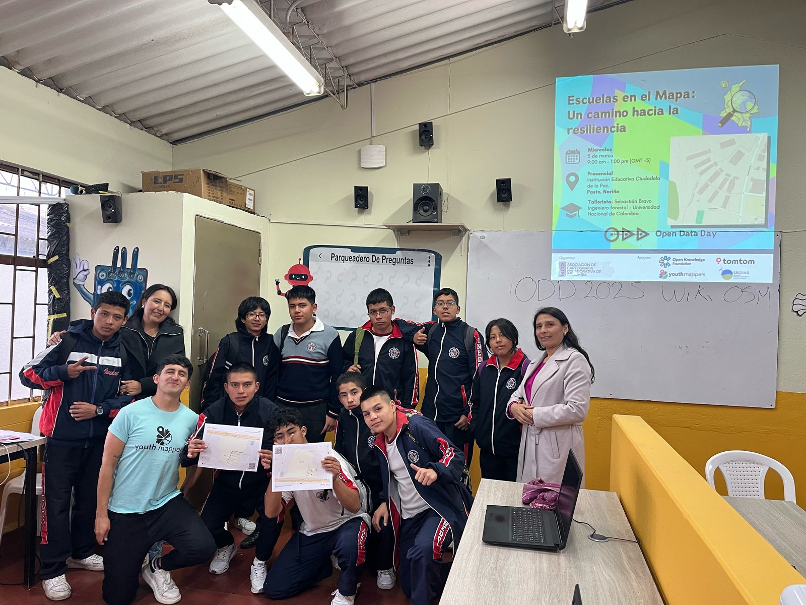
Posted by sangonzag on 9 March 2025 in Spanish (Español).

Open Data Day 2025
Desde la Asociación de Cartografía Colaborativa de Colombia - AC3 , lideramos uno de los eventos del Open Data Day (ODD) 2025 en Colombia. La temática de esta año fue “Policrisis”. La policrisis se puede etender como la ocurrencia de múltiples sucesos simultáneos que afectan a la sociedad, y donde abordarlos de manera individual es, en cierta medida, inútil, debido a sus correlaciones e interdependencias (ver artículo).
Nuestra propuesta
Nuestra apuesta para combatir la policrisis se basó principalmente en dos (2) elementos:
-
El fortalecimiento de las capacidades en STEM y TIC de los niños, niñas y jóvenes, prepaŕandoles para el futuro (y el presente).
-
El mapeo adecuado de Sedes Educativas como herramienta para la respuesta a crisis humanitarias.
El Open Data Day 2025 en El Carmen de Viboral, Antioquia, Colombia
En varias ciudades de Colombia se realizaron eventos en el marco del ODD 2025. Dentro de estas, estuvo El Carmen de Vibora, Antioquia, Colombia, donde realizamos una actividad con los estudiantes del pregrado en Desarrollo Territorial de la Universidad de Antioquia.
La mayoría de los y las estudiantes no conocían OpenStreetMap (OSM), o por lo menos no con nombre propio.
Iniciamos la jornada del 04 de marzo de 2025 haciendo una breve introducción a qué es OSM, cómo se pueden usar los datos, y cómo hacer ediciones a través del iD Editor.
I am a visually impaired user of Open Street Map, and I already contributed some places to the city of Simi Valley and a few surrounding areas. I think it would be nice to create a Navilens tag for Open Street Map. I don’t mean an actual Navilens QR code, just a tag saying that there is navilens available at a particular place. This is just a sort of true-or-false or yes/no tag. Navilens is a service that allows visually impaired people to navigate using special QR codes detected by a celphone from several meters away without the camera pointing to the code. Now if the Navilens tag gets implemented into OSM, Navilens themselves could contribute directly to Open Street Map for places that have Navilens codes, especially bus stops. We could also contribute to Open Street Map if we know for sure that a place has Navilens. That way, visually impaired people around the world know what places they can use the Navilens app for navigating.
Posted by jbcharron on 8 March 2025 in French (Français).
Last updated on 11 March 2025.
Contexte :
- Le gestionnaire du réseau de transport de gaz en France GRTgaz, a changé de nom le 30 janvier dernier https://www.natrangroupe.com/medias/communiques-de-presse/grtgaz-devient-natran Ce changement de nom a nécessité une migration des objets contenus dans la base OpenStreetMap mais cela permet aussi de faire un état des lieux du réseau gazier français dans notre base de données.
Les données existantes :
- Comme pour le réseau électrique, le réseau gazier a commencé à être intégré dans OpenStreetMap il y a plus de dix ans, avec comme sources l’imagerie Bing ou le Cadastre pour identifier les stations de compression, les stockages souterrains de gaz et les artères principales du réseau.
- Il y a environ 7 ans lors de la mise à disposition du tracé des réseaux en OpenData et l’amélioration d’année en année de la qualité des vues aériennes, la cartographie s’est intensifiée permettant d’affiner le tracé du réseau, d’ajouter les tronçons de conduites manquantes, d’identifier les bornes jaunes dans le paysage ou encore d’ajouter les sous-stations gaz de distribution.
- Les différentes propositions réalisées pour ajouter, modifier ou déprécier des tags sur les réseaux transportant des fluides (Proposition pour décrire les vannes ou la proposition pour améliorer la cartographie des bornes) ont permis de faire un « entretien » régulier et d’enrichir les données de façon continue.
- Du fait que le sujet des réseaux gazier est moins connu par la communauté OpenStreetMap que d’autres sujets comme les réseaux électriques, les contributeurs ont parfois utilisés des tags assez génériques ou peu adaptés pour décrire les installations.
Exemples de tags utilisés pour décrire les sous-stations gaz :
As an OpenStreetMap contributor, I always pay attention to how maps are used in media and various software applications. It is fascinating to see OSM data appear in unexpected places. Previously, I noticed that OpenStreetMap was used in the movie Mission: Impossible.
Recently, I came across an example of OSM’s osmCarto style being used in the software of the Skyranger 35, a highly mobile air defense system.

Posted by ValenGi on 8 March 2025 in Spanish (Español).
Open Data Day 2025: Mapeando el Futuro de la Educación en Casanare
Hoy celebramos el evento Open Data Day 2025 en la Universidad Internacional del Trópico Americano (Unitrópico), junto a mis compañeros del capítulo de YouthMappers en el área de cartografía. Bajo la dirección de la ingeniera Doris Ruiz, nos centramos en el uso de herramientas como OpenStreetMap para llevar a cabo actividades de mapeo colaborativo, contribuyendo a hacer frente a la policrisis que enfrenta nuestra sociedad.
 Nuestro objetivo principal fue mapear la infraestructura de las instituciones educativas en el departamento de Casanare. Este mapeo incluyó no solo los edificios, caminos y vías, sino también áreas naturales como jardines, árboles, prados y otros elementos. A través de OpenStreetMap, pudimos identificar múltiples áreas y elementos, empleando técnicas de fotointerpretación con las imágenes de **BING y ESRI disponibles en la aplicación.
Posted by nestorsuat on 8 March 2025 in Spanish (Español).
Open Data Day 2025 en Colombia
En Colombia, por segundo año consecutivo, se celebró el Open Data Day, esta vez en su edición 2025. Seis ciudades participaron en el evento: Pasto, El Carmen de Viboral, Ipiales, Yopal, Pore y, por supuesto, Villavicencio, Meta.
En esta ocasión, el 6 de marzo de 2025, se llevó a cabo una jornada de mapeo junto con estudiantes de la Universidad de los Llanos (Unillanos), para muchos de los cuales era su primera experiencia en este tipo de actividad.

Objetivo del mapeo
Este año, el objetivo del mapeo fue identificar y registrar puntos de interés en instituciones educativas, permitiendo a los estudiantes comprender el papel fundamental que juegan las escuelas y centros educativos en contextos de crisis humanitarias, desplazamientos forzados y desastres naturales. Históricamente, estas instituciones han servido como refugios temporales para las víctimas, brindando apoyo mientras se encuentran soluciones para su retorno a sus territorios.