
Today i mapped the tiny village of Vlashaj in Bulqize. I also mapped a little the village Shupenzë and the surroundings.
“#100villagesin100days #day31”
 OpenStreetMap
Today i mapped the tiny village of Vlashaj in Bulqize. I also mapped a little the village Shupenzë and the surroundings.
“#100villagesin100days #day31”
長らく使っていないため、slackにログインできなかった。(その後、ログインできた。) 記録用としては、日記の方がいいかも知れないので、少し、使ってみよう。 自分が初めてOSMに触れたのは、2015年2,3月である。 ほんの少し、非常勤講師などをやっていたが、余裕がたっぷりできた頃である。 ハイキングには地図がいる。オフライン地図を探し、OSMに出会った。 Google Mapなどに比べると、はるかに内容が乏しいが、オフラインで使えること、 自由にカスタマイズできることが魅力でOSMを使うことにした。 1、2か月で自作OSM地図が完成して、散歩やハイキングの友となった。 1年間10インチWindowsタブレットに自作OSM地図を載せた。 10インチは大きすぎ、1年で8インチWindowsタブレットに変えた。 3年ほど前から Androidスマホに変えた。 デバッグや自宅利用は 8インチAndroidタブレットを使っている。
この9年間でOSMの情報量は増え、精度も向上している。 旅行、ハイキング、散歩では OSMでさほど不自由は感じない。 観光地に限れば、Google Mapよりも詳細なことがよくある。
ただ、全国均質ではなく、地方にはマッパーがいないため、内容に極端なかたよりがある。
HTMLタグも使えるようだ。カスタマイズしたOSM地図に国土地理院の標高タイルから 得た標高データを使って等高線を重ねてみた。
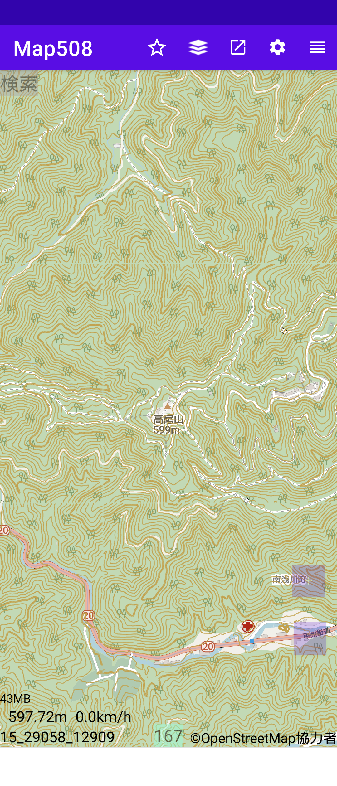
บ้านยางคำ วานรนิวาส สกลนคร
Unique Mappers Network (UMT) has significantly impacted my personal and professional growth. Through my involvement with UMT, I have gained extensive knowledge and practical skills in geospatial technologies, which have been instrumental in advancing my career. The collaborative projects and community engagement activities have allowed me to work alongside experts and passionate individuals, fostering a strong sense of teamwork and shared purpose. Additionally, UMT’s commitment to open data and mapping for social good has inspired me to contribute to impactful projects that address real-world challenges. This experience has not only enhanced my technical expertise but also deepened my commitment to using geospatial intelligence for sustainable development and community empowerment.
On behalf of all those that has benefited from my knowledge and experience, thanks Unique Mappers Network
Наверняка удобно на почтовом конверте указывать.
Today I finished mapping Shënepremte and I continued on the next village on the list. Xhan was a tiny village with just some houses scattered around the forest, so I mapped what I could and continued down the list to Floq.
Floq is a village in Korce with a population of around 1072. I was really inspired today so i went on and mapped also Pepellash and Helmës.
“#100villagesin100days #day30”
Vandaag, 4 juli 2024, gefiets naar Maria-Aalter via allerlei omwegen. Mooi weer maar veel wind. Ritje van 44 km. 1 u en 45 minuten gefietst.
Today I almost mapped Shënepremte. I will keep mapping tomorrow till I finish it.
As a Linux sysadmin, dealing with an OpenSSH vulnerability can lead to a hectic day. Ensure you’ve checked your servers and updated OpenSSH if you haven’t already.
https://ubuntu.com/blog/ubuntu-regresshion-security-fix
“#100villagesin100days #day29”
I am reading through the comment log which resulted in a 10 year ban for using junction nodes incorrectly, when can they be used
osm.org/changeset/149827539#map=12/-34.8875/138.5788
osm.org/changeset/150094405#map=12/-34.8875/138.5788
these particular junction nodes are the only junction nodes ever to be deleted and removed, how are these any different to any other junction nodes on the map and why didnt the user who deleted these ones delete any other ones?
I am just seeking help with junction nodes, not sure how to use them correctly as the reason for their removal is not a direct quote from any part of the junction nodes wiki. hoping a discussion here would help shed some light on their removal.
My name is Victor, a 300-level student of the Geography and Environmental Management Department, University of Port Harcourt.
I am very excited to announce that I have joined the Unique Mappers IT Internship program.
This opportunity aligns perfectly with my love for technology and my desire to gain hands-on experience in the field of geographic information systems (GIS) and mapping technologies.
The Unique Mappers Network Nigeria is a renowned organization due to its approach and commitment to community-driven projects, making it an ideal platform for me to enhance my skills and contribute meaningfully.
I am also excited to work with a team of talented professionals and colleagues, learning from them and sharing my ideas.
Joining the Unique Mappers IT Internship is a significant step in my career journey, and I am ready to embrace the challenges and opportunities along the way.
I started my industrial training IT internship at Unique Mappers Network, Nigeria today. I’m excited to learn and contribute to the OpenStreetMap project. So far, I’ve met the team and gotten a brief overview of the company’s goals and objectives. I’m looking forward to learning more about the projects they’re working on and how I can assist.
Goals for the next few days:
I’ll update this diary as I progress and learn more. For now, I’m just taking it all in and trying to absorb as much as I can
Today I mapped Gllavë which is a tiny village in Memaliaj.
I wandered around the map to check how this remote tiny village is connected to main streets and I found out there are many tiny villages scattered through the mountain and none of them seem to be connected (or I can not figure out how they are connected) to the main roads.
I continued mapping, and I lost count how many small villages I mapped today. I am attaching the area I mapped and if anybody knows a quick way to figure out if these villages are in any way connected to main streets can let me know in the comments.
“#100villagesin100days #day28”
Here I come to the world of OSM…. I signed up today to join Unique Mappers OSM Nigeria community and i’m so excited
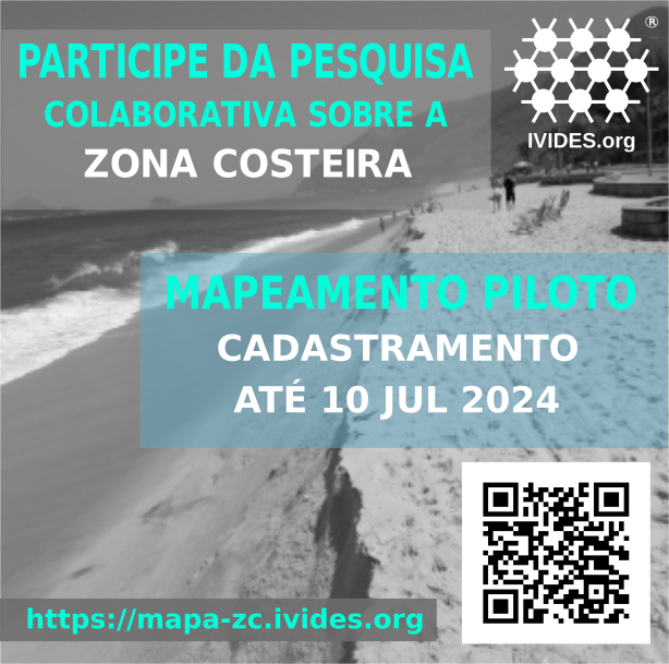
Este é um projeto promovido pelo Instituto Virtual para o Desenvolvimento Sustentável – IVIDES.org® e integrado à plataforma de iniciativas para alcance dos Objetivos de Desenvolvimento Sustentável (ODS), mantida pelas Nações Unidas.
A iniciativa, denominada Sustainable Brazilian Ocean and Coasts Initiative - Scientific community, OceanAction43529, conta com a participação da população e utiliza apenas software livre.
A pesquisa objetiva disponibilizar uma plataforma colaborativa para mapeamento de aspectos positivos e negativos das zonas costeira e marinha do Brasil, utilizando a base cartográfica digital OpenStreetMap.
NationalMap is a open and public resource, it has datasets from every state and territory.
discussion is here https://community.openstreetmap.org/t/new-nation-wide-resource-national-map-australia/115499
posting to my personal diary in-case it gets deleted from there and also for more visibility
Finally! After over four months of near-daily almost painstaking manual editing work in JOSM, entirely using aerial imagery with no automated imports whatsoever, and going through a few episodes of arm and hand cramping, all of the remaining woodland data on Vancouver Island, all the way northwest to Cape Scott, is now present in OpenStreetMap. I hope I was able to depict my own part of the world here just a bit prettier than before.
Este é o quarto entre os diários de campo que compõem o caderno de campo da minha pesquisa sobre interações sociotécnicas nos Altos e Córregos da Zona Norte do Recife e sua área contígua em Olinda, cidades localizadas na Região Metropolitana do Recife (RMR). Mais detalhes sobre a pesquisa vocês podem ver na minha tese de doutorado, publicada em https://repositorio.ufpe.br/handle/123456789/48802. Para a tese a delimitação socioespacial foram os Altos e Córregos da Zona Norte do Recife, a parte de Olinda foi agregada depois da tese.
Os diários de campo foram realizados em minhas idas ao território objeto de estudo. Nessas idas sempre registrei o percurso com o aplicativo OSM Tracker. Esse diário diz repeito a ida para a sede da EScola Pernambucana de Circo, no Alto do Burity, Recife/PE http://u.osmfr.org/m/757844/ .

Segue abaixo o diário de campo na íntegra, apenas com alterações de nomes pessoais, com o intuito de resguardar a identidade das interlocutoras:
I made a Chrome extension (which should be compatible with all Chromium-based browsers) and Firefox Add-on that hooks into the osm.org Edit buttons and redirects it to Rapid. Also, it integrates Strava heatmap support into Rapid as overlay imagery.
It’s an early version, and I’m sure there’s bugs, so please open issues (suggestions welcome too): https://github.com/emersonveenstra/rapid-power-user-extension/issues
Also, for those wondering, I am jumping back into osmdiscussiontracker development soon, I just needed to scratch this itch first :)
Happy mapping!
Éditer la carte de Genève quelques minutes par semaine.


