OpenStreetMap logo OpenStreetMap

Users' Diaries

Recent diary entries

Posted by lonvia on 23 November 2023 in English.

I’ve given a talk about the state of mapping of hiking routes in Europe at this month’s SotM-EU. A few people have asked for the slides, so here they are:

Hiking Routes - Past, Present and Future - SotM-EU 2023

I’m sorry if the slides lack some context for those who have not seen the talk. I hope there will be video recordings of the talk at some point.

Location: Het Rooi, Nieuw Kwartier, Berchem, Antwerp, Flanders, 2600, Belgium

Привет! Летом 2023 года, было, к сожалению, обнаружено, что 80% территории Кудрово смещено относительно реальных координат. Многие детали нарисованы либо крайне приблизительно или по битым источникам. Также, есть ряд неактуальностей, которые тяжело искать, из-за повышенной подробности [обратная сторона медали :(]

Решение: в течении 9 месяцев собирать треки по местности по контуру района, там где минимальные искажения от высоких зданий. Далее пройтись двор за двором, сверяя реальность и карту и таким образом “вылечить” карту.

Location: Южное Кудрово, Кудрово, Заневское городское поселение, Всеволожский район, Ленинградская область, Северо-Западный федеральный округ, 188689, Россия

In the early days of OSM, when the map was formless and empty, mappers in the United States conducted data imports without much discussion, because there were just not a lot of people to discuss with.

One example is a series of imports of USGS GNIS data. This is point data from the United States Geological Survey’s Geographic Names Information System. Some of this data was very useful, for example to populate the map with place nodes for smaller towns. But there’s also a lot of data that was not very good, and a lot of it is still on the map today.

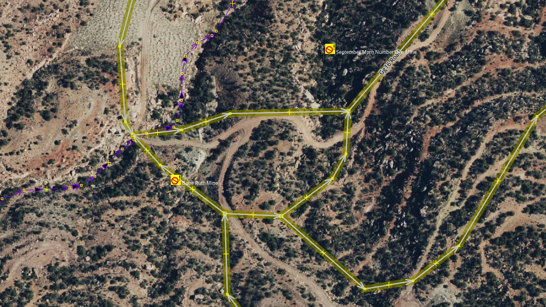
One example is the mines layer, imported with the tag gnis:feature_type=Mine. For starters, a lot of these nodes represent historic mines, of which the United States has many, especially in the West. But they were imported as landuse=quarry, a tag that should be used for nodes in the first place.

historic imported mines in JOSM

See full entry

Posted by Raquel Dezidério Souto on 20 November 2023 in Brazilian Portuguese (Português do Brasil). Last updated on 10 February 2024.

Grata! Thank you!

Agradecemos a participação daqueles(as) que assistiram ao evento no canal no YouTube, que ministraram palestras e que organizaram mapatonas!

O evento GIS DAY 2023 é uma iniciativa do IVIDES.org, como parte do evento internacional #osmgeoweek, ou OpenStreetMap Awareness Week, sendo realizado em parceria com YouthMappers internacional, TeachOSM/HOT e HUB YouthMappers Rio de Janeiro.

Mapatonas

Há três mapatonas ativas! Convocamos os(as) mapeadores(as) do OpenStreetMap a se juntarem a nós, neste grande esforço de mapeamento colaborativo das áreas de interesse do estado do Rio de Janeiro!

Vídeos do evento

  • Palestras na sessão ao vivo do GIS DAY 2023 - Link YouTube

  • Apresentação dos capítulos YouthMappers do Rio de Janeiro - Link YouTube

Materiais do GIS DAY 2023

Acesse as fotos e o sumário do evento em PDF, com as respostas às perguntas.

Para entrar em contato

A/C Dra. Raquel Dezidério Souto (+55)21 97714 7667 | ivides@ivides.org | ym.ufrj@gmail.com. Saber mais sobre: IVIDES.org e HUB YouthMappers Rio de Janeiro.

Programa das palestras ministradas em 17 NOV 2023

Mediadora: Dra. Raquel Dezidério Souto

PALESTRA ESPECIAL 1 - Link vídeo Panorama Geral da Defesa Civil de São Gonçalo em 2023 Major Felipe Nascimento de Assumpção Subsecretário de Defesa Civil de São Gonçalo (Rio de Janeiro, Brasil)

PALESTRA ESPECIAL 2 - Link vídeo O processo de construção da Gestão Integrada de Risco de Desastre - caso Maricá Major Wellington Silva de Oliveira Coordenador de Defesa Civil de Maricá (Rio de Janeiro, Brasil)

See full entry

Posted by Brent Velda on 20 November 2023 in English.

I work for the Commons. I work for the common good. But no, I will not release my edits under a “Public Domain” license.

Anyone can use my work, but under my terms. The ODbL terms. These are fair terms. It’s simple, credit us. And if you want to mix “your” data with ours, honour our time and our labour. Release it under the ODbL.

I don’t work Facebook or Amazon. I do not provide free labour for US tech companies. I am happy for you to use my data, but under my terms. The ODbL. No other license.

I want to make the world a better place. Not make a few Americans richer.

On, Friday 3rd Nov 2023 at 11:47 PM NPT midnight a strong earthquake struck the western area of Jajarkot,Nepal with witnesses saying houses in the area collapsed causing several deaths and damaged. The shock was experienced as far as New Delhi, India, shook. 154 confirmed deaths and 364 injuries are reported by the National Disaster Risk Reduction and Management Authority(NDRRMA). The epicentre lies in Karnali Province, Nepal. 26,557 houses are completely damaged whereas 35,455 houses are partially damaged.

Nepal’s National Seismological Centre said the quake was a magnitude 6.4 but the German Research Centre for Geosciences (GFZ) later downgraded the magnitude to 5.7 and the U.S. Geological Survey pegged it as a magnitude 5.6. Earthquakes have been going on continuously for some time now, with the epicenter in different places of western Nepal. Geologists say that there has not been a big earthquake for a long time, so there is a lot of seismic energy.

To summarize the major activities that we have undertaken after the Jajarkot Earthquake 2023:

See full entry

Location: Imadol, Mahalaxmi-03, Mahalaxmi, Mahalaxmi Municipality, Lalitpur, Bagamati Province, 44795, Nepal
Posted by Bart- on 19 November 2023 in English.

Last weekend I attended State of the Map EU 2023. I had a lot of fun there! Some random things to remember:

  • The OSM community is very friendly and welcoming. I made a lot of friends.
  • Being at the event gave me some insights into the history of OSM and the future. An interesting development is the realization of many companies that creating and maintaining their own map is too expensive, they need OSM. At the same time, they have problems with the laisser-faire approach of OSM and there is a push for standardization and more professionalism.
  • During the social night (loud music, drinks) I was able to whip out my laptop and receive an impromptu JOSM workshop, where I learned how to create relations with the venerable tool.
  • Luke and I gave a talk on MapLibre. Contrary to our expectations, less than half of the people at the event knew about the project. So our advocacy efforts were not in vain.
  • I met the delegation from Geovelo, they turn out to be MapLibre Native users.
  • Antwerp has a pretty interesting bike-sharing system.
  • I rode a Brompton for the first time.
  • Organic Maps and OsmAnd are not competitors. This is not an original thought from me, but a conclusion made by the developers from both projects, who attended the event. OsmAnd has a lot features and is mainly for power users, Organic Maps has a focus on being easy to use.
  • If I ever have a project that uses a certain tag, I can add that project to the list of projects that use that tag on taginfo, e.g. https://taginfo.openstreetmap.org/keys/building#projects
  • OSM has a “shoestring budget” and has one full-time paid position (DevOps). Crazy (impressive)!
Location: Het Rooi, Nieuw Kwartier, Berchem, Antwerp, Flanders, Belgium
Posted by courtiney on 19 November 2023 in English. Last updated on 20 November 2023.

I am continuously surprised by how few people outside of the community know the story of OpenStreetMap. Coming into this community from a world of writers and communicators who spend their days spinning up stories–some of them more worthy than others–sometimes feels like visiting another planet. For writers, the worst crime is what old time newspaper editors used to call “burying the lede”, meaning hide the thing that makes the story interesting. OSM might just be the biggest buried lede in the history of storytelling.

It’s surprisingly hard to tell a good story. Everyone can type an email, but not everyone can make it interesting enough to read. Stories tend to have a “beginning, middle and end,” but so do research reports, tax forms, and parking tickets. Facts and data can add up to a story, but not without interpretation. Telling someone “about” something is not a story, either. If I tell you that the Lord of the Rings trilogy is about a hobbit who travels to the ends of the world to get rid of a magic ring, would you know what happened in the story?

See full entry

Location: White River Junction, Hartford, Windsor County, Vermont, 03784, United States
Posted by catonano on 19 November 2023 in English.

I could really use some help with this question

The published app is here

A short overview: the app page is empty but in the dev tools, if I hover the tag containing my map the correct preview does pop up !

Why the main page doesn’t show it ?

What is going on here ?

If you know anything about front end, please take a look !

Location: Talsano, Taranto, Apulia, 74122, Italy
Posted by lhirlimann on 19 November 2023 in French (Français).

Pour le Capitole du Libre, nous avons organisé avec les autres Toulousains un stand dans le village associatif, comme l’année dernière. Cette année, il n’y avait ni atelier, ni conférence autour d’OSM. Impossible de remettre la main sur le kakémono de l’année dernière, heureusement Vincent en avait un deuxième. C’est désormais moi qui en ai la garde. J’avais fait une demande de swag sur le forum, mais cette année ma demande est restée lettre morte. Il nous restait des stickers de l’année dernière qui ont suffi à gérer les demandes. Cette année pas d’ordinateur de programmer pour faire des démos, je venais en train et je n’avais pas envie de m’emmerder avec un écran. Mais Julien en a prêté un car Liliane est venue avec une machine. Nous étions voisins du stand OSGeo-fr. Pas mal de monde est passé sur le stand avec toujours de bonnes questions :

  • Comment êtes-vous financé ?
  • Quelle application pour quel usage ?
  • Comment puis-je contribuer ?
  • C’est quoi OSM ?
  • Avez-vous des API pour XXX ?
  • Comment Faire YYY ?

Je dois avouer que la proximité du stand OSgeo a permis de faire un peu de ping-ong sur certaines questions (Donc QGIS c’est mieux pour ça, sinon voir aussi Lizmap).

Comme dit précédemment, nous étions moins organisés et donc moins nombreux sur le stand, mais lorsque nous étions plusieurs, nous avons bien échangé. J’ai ajouté une application de plus sur mon mobile pour OSM : everydoor. Je vais regarder dans les jours qui viennent comment la prendre en main.

Merci à l’orga de nous avoir laissé un stand. Merci à ceux qui sont venus tenir le stand avec moi. Merci aux visiteurs pour leur intérêt.

Location: Les Chalets / Bayard / Belfort / Saint-Aubin / Dupuy, Toulouse, Haute-Garonne, Occitanie, France métropolitaine, France

Hii beloved OSM Mappers, 18th November, 2023 is a signifies momentous occasion for Timor-Leste as we officially launched the > Timor-Leste OpenStreetMap Community with the Association of Geographic Information System in Timor-Leste. We extend our sincere appreciation to all the esteemed presenters whose insights and perspectives have enriched this launched session, shedding light on the significance and advantages of open-source platforms like OSM.

Alt text Figure 1: We are happy in celebration our community is launched.
Themed for this event is "OSM Community Meet-Up and Official Launching 2023", this event stands as a pivotal part of our year-long OSM activities, inviting diverse voices to converge, share advice, and collectively drive the development of OSM in Timor-Leste.

See full entry

Location: Praia dos Coqueiros, Bebunuk, Dom Aleixo, Dili, East Timor

Euh, bonjour? Non je sais pas…

Enfin bref, je mappe principalement sur Seraing depuis un peu plus d’un an (ça arrive de m’aventurer ailleurs… parfois) et depuis environ six mois, j’enregistre parfois une session OSM (comprendre une changeset quoi) et de la poster sur Youtube pour mes… “"”nombreux””” abonnés. Assez vite, j’ai commencé une série qui s’appelle de manière très originale “Améliorons Seraing (sur OpenStreetMap)” qui est ma principale, mais j’ai aussi des sorties VTT qui sont également utilisées pour faire des modifications ici et sur chemins.be par exemple (souvent en tout cas).

On m’a conseillé de faire un peu la promo de ces vidéos ici et vu que je ne fais rien avec ce “journal”, pourquoi ne pas essayer après tout?

Pour le moment, je fais pas mal de micromapping et quelques updates du côté d’Ougrée depuis l’ouverture du nouveau tronçon du boulevard urbain de Seraing (dont j’ai appris l’ouverture à la circulation et le nom ici, no joke).

Je vais pas mettre toutes mes anciennes vidéos ici bien sûr, juste les dernières :

Améliorons Seraing (sur OpenStreetMap) - Épisode 11 (Seraing et ses “problèmes”) - Une session où je dégage le plus de “problèmes” et demandes de correction possibles

Ce cycliste part en quête de bornes SNCV à Seraing pour les ajouter sur OpenStreetMap - Sortie VTT avec un objectif assez clair je pense ;)

Ce cycliste continue sa quête de bornes SNCV et retrouve une vieille connaissance à Boncelles - La suite de la vidéo précédente

Améliorons Seraing (sur OpenStreetMap) - Épisode 12 (L’art du micromapping) - Un peu de micromapping à l’Hôpital du Bois de l’Abbaye

Ce sérésien et sa quête absurde pour faire renaître le sentier vicinal 54 de la Chatqueue (Partie 1) - Si vous vous demandez pourquoi il y a un sentier non-accessible à la Chatqueue, voici un début de réponse

Améliorons Seraing (sur OpenStreetMap) - Épisode 13 (Micromappons le Bois de l’Abbaye) - Je vous avais prévenu ;)

See full entry

Location: 50.615, 5.509
Posted by CjMalone on 18 November 2023 in English. Last updated on 21 November 2023.

We care about having the best data. We care about having best the map. We care about having the best mapping community.

“We” is doing a lot here. Honestly, I don’t care about the render. Sure I’ve wanted some things rendered before, sure I’ve been emotional when it didn’t magically happen. But I’ve only though about rendering for a few minutes. People care a lot more then me, in retrospect, I’m sorry. I should have trusted you.

Honestly, I don’t care about the intricacies of tagging/”schemas”. Sure I’ve gotten emotional on the mailing list, and I’ve even talked about “you” (the list) behind your back. But you’ve thought about this more than me, I should have trusted you. Sorry.

I have thought a lot about the quality of our data, it’s not perfect. About the usability of our data, there are issues. About the accessibility of our data, it could easier. But actually we are doing pretty good. We are even doing better than the commercial datasets.

So trust the people that care the most, support us, encourage us, give us data and tooling, but most importantly, don’t get in our way. We’ve got this.

I organize the OpenStreetMap Salt Lake City monthly meetups. I don’t usually write reports on the individual meetups, but I had even more fun than usual last night so I thought I would write a quick report!

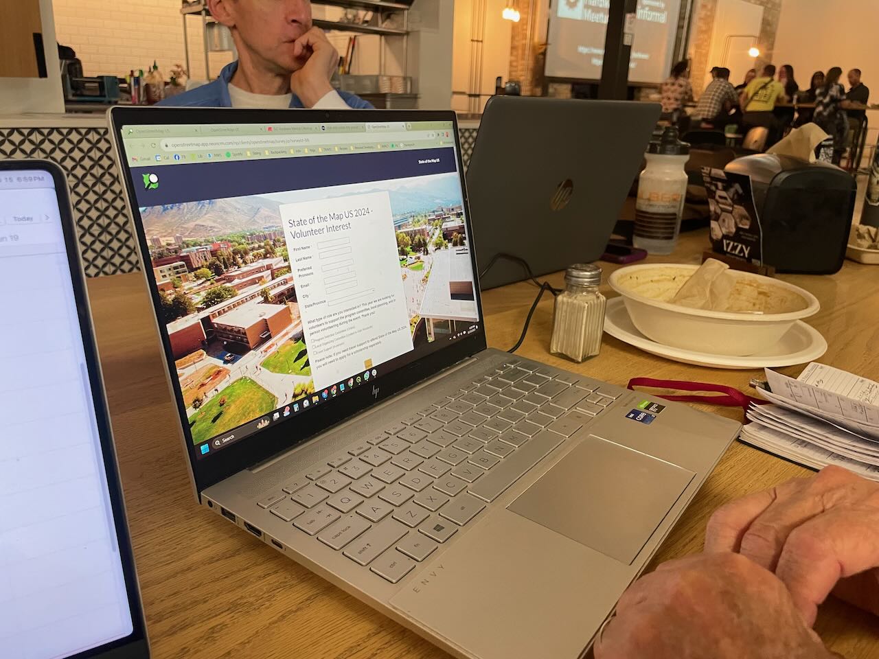
We had a great evening (as always) and with a good turnout too! We talked about SOTM US 2024, to be hosted in our fine city next June, and everyone signed up as a candidate volunteer for the event!

people signing up as volunteers

We also shared some knowledge about drones and related software; I know next to nothing about drones and haven’t kept up with the technology, so that was really interesting to me. We may pursue a small grant to acquire one for our OSM group. I am not sure from where yet.

As usual, we discussed recent business openings and closings to keep the map up to date. We have good resources like Gastronomic SLC (a weekly newsletter and website with news about restaurants and bars in the area) and City Weekly, a local newspaper, and of course our own observations.

See full entry

Location: Ballpark, Salt Lake City, Salt Lake County, Utah, United States
Posted by SimonPoole on 15 November 2023 in English.

Way back in 2015 I wrote this diary post Is OSM business unfriendly? on how core OSM limiting itself to data collection had fostered a bustling ecosystem.

Organisations from small to large, commercial and non-commercial have built their businesses on building OSM know-how, normalizing the data, aggregating it with other sources, and providing services on top of it. It is one of the major factors that has made OSM not just a hobby project, but a notable player on the global stage.

Yes, the Linux Foundations OMF is disruptive, but the disruption is mainly in that it will remove a major part of the raison d’être for these organisation in the wider OSMspace.

The surprising bit at SOTM-EU over the weekend was just how hilariously unaware both Linux Foundation members and representatives were that their main effect will be stomping out a whole raft of SMEs, and the sudden realisation by the victims that US big tech and their non-profit front are not their friends.

What does this mean for core OSM?

I’ve argued that we should be moving the boundary of what we do outwards so that we can at least provide more of what was provided by the layer of service providers. Not all of the market for geo data and services outside of the US tech bubble is going to enthusiastically embrace that their choice of suppliers has been reduced to a duopoly. But I will concede that doing nothing and letting the market forces play out is the more OSMish reaction.

PS: I would point out that all of the above has already chewed though multiple times in public. Maybe if the Linux Foundation doesn’t want to be put on the spot and look very very out of touch they should read what other people are saying about them.