Users' Diaries

Recent diary entries

Posted by Bart- on 19 November 2023 in English.

Last weekend I attended State of the Map EU 2023. I had a lot of fun there! Some random things to remember:

  • The OSM community is very friendly and welcoming. I made a lot of friends.
  • Being at the event gave me some insights into the history of OSM and the future. An interesting development is the realization of many companies that creating and maintaining their own map is too expensive, they need OSM. At the same time, they have problems with the laisser-faire approach of OSM and there is a push for standardization and more professionalism.
  • During the social night (loud music, drinks) I was able to whip out my laptop and receive an impromptu JOSM workshop, where I learned how to create relations with the venerable tool.
  • Luke and I gave a talk on MapLibre. Contrary to our expectations, less than half of the people at the event knew about the project. So our advocacy efforts were not in vain.
  • I met the delegation from Geovelo, they turn out to be MapLibre Native users.
  • Antwerp has a pretty interesting bike-sharing system.
  • I rode a Brompton for the first time.
  • Organic Maps and OsmAnd are not competitors. This is not an original thought from me, but a conclusion made by the developers from both projects, who attended the event. OsmAnd has a lot features and is mainly for power users, Organic Maps has a focus on being easy to use.
  • If I ever have a project that uses a certain tag, I can add that project to the list of projects that use that tag on taginfo, e.g. https://taginfo.openstreetmap.org/keys/building#projects
  • OSM has a “shoestring budget” and has one full-time paid position (DevOps). Crazy (impressive)!
Location: Het Rooi, Nieuw Kwartier, Berchem, Antwerp, Flanders, Belgium
Posted by courtiney on 19 November 2023 in English. Last updated on 20 November 2023.

I am continuously surprised by how few people outside of the community know the story of OpenStreetMap. Coming into this community from a world of writers and communicators who spend their days spinning up stories–some of them more worthy than others–sometimes feels like visiting another planet. For writers, the worst crime is what old time newspaper editors used to call “burying the lede”, meaning hide the thing that makes the story interesting. OSM might just be the biggest buried lede in the history of storytelling.

It’s surprisingly hard to tell a good story. Everyone can type an email, but not everyone can make it interesting enough to read. Stories tend to have a “beginning, middle and end,” but so do research reports, tax forms, and parking tickets. Facts and data can add up to a story, but not without interpretation. Telling someone “about” something is not a story, either. If I tell you that the Lord of the Rings trilogy is about a hobbit who travels to the ends of the world to get rid of a magic ring, would you know what happened in the story?

See full entry

Location: White River Junction, Hartford, Windsor County, Vermont, 03784, United States
Posted by catonano on 19 November 2023 in English.

I could really use some help with this question

The published app is here

A short overview: the app page is empty but in the dev tools, if I hover the tag containing my map the correct preview does pop up !

Why the main page doesn’t show it ?

What is going on here ?

If you know anything about front end, please take a look !

Location: Talsano, Taranto, Apulia, 74122, Italy
Posted by lhirlimann on 19 November 2023 in French (Français).

Pour le Capitole du Libre, nous avons organisé avec les autres Toulousains un stand dans le village associatif, comme l’année dernière. Cette année, il n’y avait ni atelier, ni conférence autour d’OSM. Impossible de remettre la main sur le kakémono de l’année dernière, heureusement Vincent en avait un deuxième. C’est désormais moi qui en ai la garde. J’avais fait une demande de swag sur le forum, mais cette année ma demande est restée lettre morte. Il nous restait des stickers de l’année dernière qui ont suffi à gérer les demandes. Cette année pas d’ordinateur de programmer pour faire des démos, je venais en train et je n’avais pas envie de m’emmerder avec un écran. Mais Julien en a prêté un car Liliane est venue avec une machine. Nous étions voisins du stand OSGeo-fr. Pas mal de monde est passé sur le stand avec toujours de bonnes questions :

  • Comment êtes-vous financé ?
  • Quelle application pour quel usage ?
  • Comment puis-je contribuer ?
  • C’est quoi OSM ?
  • Avez-vous des API pour XXX ?
  • Comment Faire YYY ?

Je dois avouer que la proximité du stand OSgeo a permis de faire un peu de ping-ong sur certaines questions (Donc QGIS c’est mieux pour ça, sinon voir aussi Lizmap).

Comme dit précédemment, nous étions moins organisés et donc moins nombreux sur le stand, mais lorsque nous étions plusieurs, nous avons bien échangé. J’ai ajouté une application de plus sur mon mobile pour OSM : everydoor. Je vais regarder dans les jours qui viennent comment la prendre en main.

Merci à l’orga de nous avoir laissé un stand. Merci à ceux qui sont venus tenir le stand avec moi. Merci aux visiteurs pour leur intérêt.

Location: Les Chalets / Bayard / Belfort / Saint-Aubin / Dupuy, Toulouse, Haute-Garonne, Occitanie, France métropolitaine, France

Hii beloved OSM Mappers, 18th November, 2023 is a signifies momentous occasion for Timor-Leste as we officially launched the > Timor-Leste OpenStreetMap Community with the Association of Geographic Information System in Timor-Leste. We extend our sincere appreciation to all the esteemed presenters whose insights and perspectives have enriched this launched session, shedding light on the significance and advantages of open-source platforms like OSM.

Alt text Figure 1: We are happy in celebration our community is launched.

Themed for this event is "OSM Community Meet-Up and Official Launching 2023", this event stands as a pivotal part of our year-long OSM activities, inviting diverse voices to converge, share advice, and collectively drive the development of OSM in Timor-Leste.

See full entry

Location: Praia dos Coqueiros, Bebunuk, Dom Aleixo, Dili, East Timor

Euh, bonjour? Non je sais pas…

Enfin bref, je mappe principalement sur Seraing depuis un peu plus d’un an (ça arrive de m’aventurer ailleurs… parfois) et depuis environ six mois, j’enregistre parfois une session OSM (comprendre une changeset quoi) et de la poster sur Youtube pour mes… “"”nombreux””” abonnés. Assez vite, j’ai commencé une série qui s’appelle de manière très originale “Améliorons Seraing (sur OpenStreetMap)” qui est ma principale, mais j’ai aussi des sorties VTT qui sont également utilisées pour faire des modifications ici et sur chemins.be par exemple (souvent en tout cas).

On m’a conseillé de faire un peu la promo de ces vidéos ici et vu que je ne fais rien avec ce “journal”, pourquoi ne pas essayer après tout?

Pour le moment, je fais pas mal de micromapping et quelques updates du côté d’Ougrée depuis l’ouverture du nouveau tronçon du boulevard urbain de Seraing (dont j’ai appris l’ouverture à la circulation et le nom ici, no joke).

Je vais pas mettre toutes mes anciennes vidéos ici bien sûr, juste les dernières :

Améliorons Seraing (sur OpenStreetMap) - Épisode 11 (Seraing et ses “problèmes”) - Une session où je dégage le plus de “problèmes” et demandes de correction possibles

Ce cycliste part en quête de bornes SNCV à Seraing pour les ajouter sur OpenStreetMap - Sortie VTT avec un objectif assez clair je pense ;)

Ce cycliste continue sa quête de bornes SNCV et retrouve une vieille connaissance à Boncelles - La suite de la vidéo précédente

Améliorons Seraing (sur OpenStreetMap) - Épisode 12 (L’art du micromapping) - Un peu de micromapping à l’Hôpital du Bois de l’Abbaye

Ce sérésien et sa quête absurde pour faire renaître le sentier vicinal 54 de la Chatqueue (Partie 1) - Si vous vous demandez pourquoi il y a un sentier non-accessible à la Chatqueue, voici un début de réponse

Améliorons Seraing (sur OpenStreetMap) - Épisode 13 (Micromappons le Bois de l’Abbaye) - Je vous avais prévenu ;)

See full entry

Location: 50.615, 5.509
Posted by CjMalone on 18 November 2023 in English. Last updated on 21 November 2023.

We care about having the best data. We care about having best the map. We care about having the best mapping community.

“We” is doing a lot here. Honestly, I don’t care about the render. Sure I’ve wanted some things rendered before, sure I’ve been emotional when it didn’t magically happen. But I’ve only though about rendering for a few minutes. People care a lot more then me, in retrospect, I’m sorry. I should have trusted you.

Honestly, I don’t care about the intricacies of tagging/”schemas”. Sure I’ve gotten emotional on the mailing list, and I’ve even talked about “you” (the list) behind your back. But you’ve thought about this more than me, I should have trusted you. Sorry.

I have thought a lot about the quality of our data, it’s not perfect. About the usability of our data, there are issues. About the accessibility of our data, it could easier. But actually we are doing pretty good. We are even doing better than the commercial datasets.

So trust the people that care the most, support us, encourage us, give us data and tooling, but most importantly, don’t get in our way. We’ve got this.

I organize the OpenStreetMap Salt Lake City monthly meetups. I don’t usually write reports on the individual meetups, but I had even more fun than usual last night so I thought I would write a quick report!

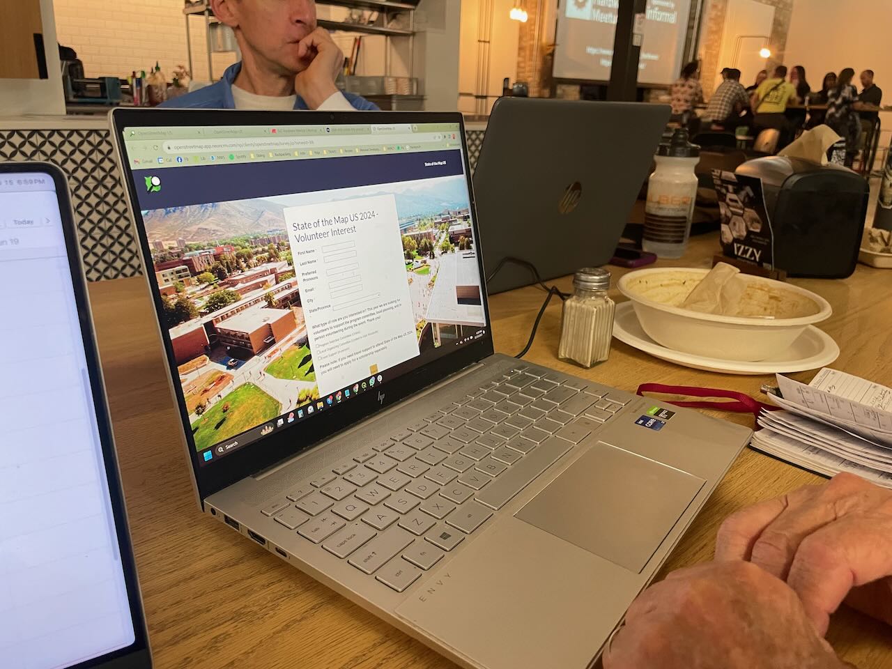
We had a great evening (as always) and with a good turnout too! We talked about SOTM US 2024, to be hosted in our fine city next June, and everyone signed up as a candidate volunteer for the event!

people signing up as volunteers

We also shared some knowledge about drones and related software; I know next to nothing about drones and haven’t kept up with the technology, so that was really interesting to me. We may pursue a small grant to acquire one for our OSM group. I am not sure from where yet.

As usual, we discussed recent business openings and closings to keep the map up to date. We have good resources like Gastronomic SLC (a weekly newsletter and website with news about restaurants and bars in the area) and City Weekly, a local newspaper, and of course our own observations.

See full entry

Location: Ballpark, Salt Lake City, Salt Lake County, Utah, United States
Posted by SimonPoole on 15 November 2023 in English.

Way back in 2015 I wrote this diary post Is OSM business unfriendly? on how core OSM limiting itself to data collection had fostered a bustling ecosystem.

Organisations from small to large, commercial and non-commercial have built their businesses on building OSM know-how, normalizing the data, aggregating it with other sources, and providing services on top of it. It is one of the major factors that has made OSM not just a hobby project, but a notable player on the global stage.

Yes, the Linux Foundations OMF is disruptive, but the disruption is mainly in that it will remove a major part of the raison d’être for these organisation in the wider OSMspace.

The surprising bit at SOTM-EU over the weekend was just how hilariously unaware both Linux Foundation members and representatives were that their main effect will be stomping out a whole raft of SMEs, and the sudden realisation by the victims that US big tech and their non-profit front are not their friends.

What does this mean for core OSM?

I’ve argued that we should be moving the boundary of what we do outwards so that we can at least provide more of what was provided by the layer of service providers. Not all of the market for geo data and services outside of the US tech bubble is going to enthusiastically embrace that their choice of suppliers has been reduced to a duopoly. But I will concede that doing nothing and letting the market forces play out is the more OSMish reaction.

PS: I would point out that all of the above has already chewed though multiple times in public. Maybe if the Linux Foundation doesn’t want to be put on the spot and look very very out of touch they should read what other people are saying about them.

Всем привет кого давно не видел)

Возраст первой (уцелевшей) правки в разных местах. First Edit age

Удивительны две вещи: 1) Импорт Тайгера в США до сих пор виден. 2) еще можно отыскать место, в котором данных нет и сделать первую правку.

Ну и до кучи средний возраст объектов.

See full entry

So the SotM EU just ended (guys from UK asked to call it “Europe”, not “EU”). We had a lot of talks, hundred people from the States and Belgium, met many friends. And also learned a bit more about Overture Maps. Nothing new since my Shtosm post, but updates my post about donating money. This is a rough DeepL translation of this and this telegram posts.

Marc’s Address

First, a simple one. Overture is not OpenStreetMap. Marc started by saying that the target audience for Overture Maps is developers. Just as Ballmer once chanted: developers, developers! And he’s right: Overture makes working with data much easier for developers. The data is collected, cleaned, in a convenient format, take it and build it into the product.

So the audience is product developers. Who know little about geo, but a lot about building products. As I wrote in the reddit about VLC, there are developers and there are developers. The audience here are opensource developers: god knows how to organize them. They are not the TA of Overture. They’re doing OSM. So when Mark encourages developers to use (and of course improve) Overture here, he’s kind of leading developers away from OSM. And that’s the first thing that was a bit tone deaf in his presentation.

The second is what I detailed in my question after the talk. That is, I’ve written before that Overture is an awesome wrapper to OSM. It sells data, it sells an idea, it does all the things we don’t want to do. But at the same time, the attitude towards Overture and the community was: you’re doing a great job, all these maps are very good, the tools you’ve written are great too, keep it up.

See full entry

Posted by unsungNovelty on 14 November 2023 in English.

OpenStreetMap (OSM) is fun and fantastic for so many reasons. One being able to roam around the world from the comfort of your chair. I started mapping on OpenStreetMap in 2015 by coincidence through a friend. And OSM later became part of my work at Mapbox. Where I went through out the world as an armchair mapper. I used to maintain a list of interesting places as I encountered them. Then map it later when I am free. Here are my 3 memorable OpenStreetMap edits.

Valparai, Tamil Nadu, India

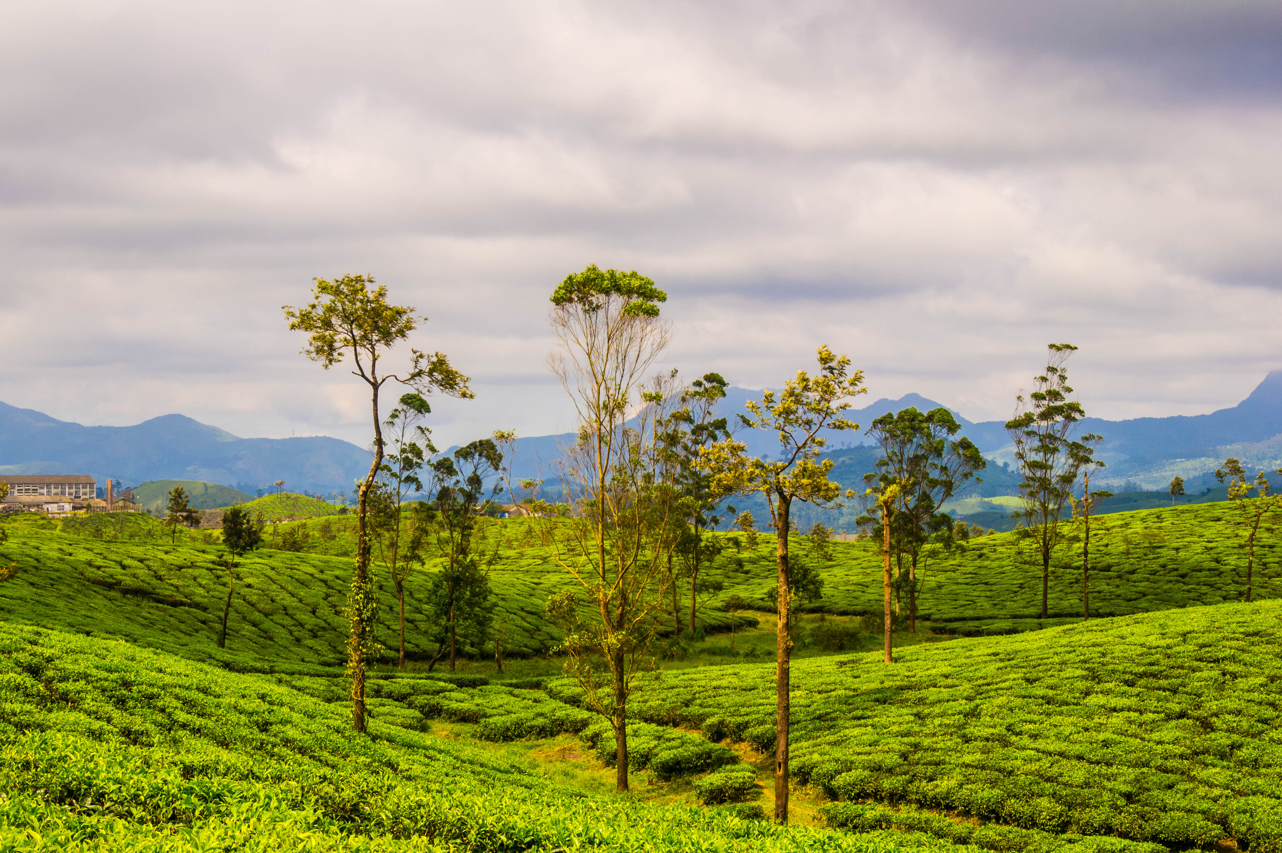
Tea plantations in Valparai by Thangaraj Kumaravel | Image license: CC BY 2.0 Deed

See full entry

Posted by gregorywpower on 13 November 2023 in English.

Mapping Cary’s Downtown Park

First Contribution

This was my first attempt at trying to map out a public park from the original CAD drawings attempting to draw out this map by hand using JOSM. If there’s a way that I could trace polygons from QGIS and be able to save them, I’ll probably end up trying to go that route.

What I Learned

  1. AutoCAD files aren’t always geocoded
  2. GeoParquet files are your friend
  3. Geodatabases are your best friend
  4. Don’t trust Aerial Imagery, field surveys
Location: Cary, Wake County, North Carolina, United States

Let’s take a look at addition and division mapping of natural and landuse. First we will look at the inconveniences that exist when mapping such areas. Next we will look at the method behind division mapping and scenarios of how to apply it. And finally take a real world example of how these two mapping styles were applied.

The definition of addition mapping is the act of adding new data to a white spot area aka an area with no data.

The definition of division mapping is the act of taking an existing object and dividing it down into smaller partitions.

Inconveniences when mapping natural and landuse

There are two main inconveniences when mapping natural and landuse from aerial imagery. First, depending on the resolution of the imagery, deciding where to make a clear cut if it is a distinct natural or landuse area. And second, the amount of clicking required to create a new area.

For the first inconvenience, more or less, it is personal choice and level of details. E.g. try to answer this question: when would one make a distinction between natural = scrub and natural = wood? The difficulty exists in the fact that the value scrub permits trees and lots of time these trees are/aren’t growing close enough to each other.

For the second inconvenience, lots of editors have the option to split a way (aka division mapping). In JOSM you can split an area with ALT+X (UtilsPlugin2 required). Or manually split the circumference of an area at two nodes and then separately connect the two arcs.

UtilsPlugin2 - Split Object tool

Let’s say one needed to create 4 square farmlands in a grid layout. How many node clicks are required?

Mapping the traditional way (aka addition mapping) 16 node clicks are required. One square has 4 nodes, and there are 4 squares, so 4 * 4 = 16.

Mapping with UtilsPlugin2, it takes 8-10 node clicks. There are two methods to achieve this. The first step is equivalent for both methods by drawing the circumference which is 4 node clicks.

Method 1

See full entry

Location: Bencetići, Mjesni odbor Mrzljaki - Goljak, Municipality of Draganić, Karlovac County, 47201, Croatia