Users' Diaries
Recent diary entries


Ever been so tired that you miss a day without even noticing? :P
In my head, I had already mapped the village for yesterday, and I was wondering why it was showing “No Changesets”. Had to refresh multiple times before realizing that I had indeed not mapped the village.
Anyway, today I mapped Lapulec a village in Mallakaster, Fier and the surroundings.
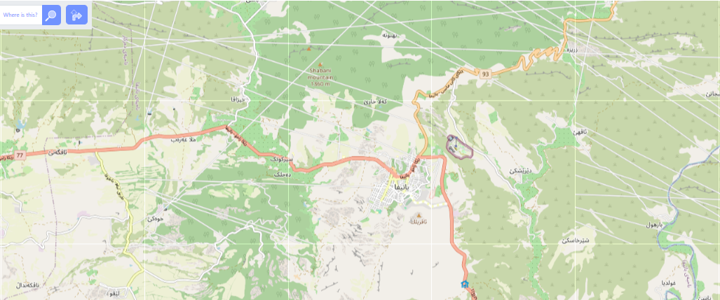
Following the suggestion from a comment on one of my previous diary entries i am also adding link to the mapped area osm.org/node/728420122#map=17/40.62743/19.73867 .
I am not sure how to add images in here. Will get there!
“#100villagesin100days #day14”
OMGuru Validation Fellowship 2024 Journey
This year 2024 I got a OMGuru Validation Fellowship of OpenMappingHubAsiaPacific. Fellowship was started in January 2024 and end will be June 2024.I had a great experience in the 6 month fellowship. I validated 125 task in tasking manager. OSM Data quality issue cleaned by OSMOSE or OSM Inspector. I created a Connected highway/cycleway MapRoulette Challenge
.
And I validated the OSM data cleaning by OSMCha base on Mapillary Imagery. ##I also participated the training session : 1. JOSM Plugins 2. MAPSWIPE FOR WEB DEMO 3. Communication Skills + Miro Board Training. 4. Disaster Activation. 5. Rapid Editor with Meta 6. OM Guru Network X HOT Tech Training: Accessing and Visualizing Open Map Data 7. QGIS for Specific Use Case Scenarios: Flooding/Landslide, Land Tenure 8. QGIS to JOSM Workflow Training. 9. Overpass Turbo - Unleashing the Power of Querying OSM Data

Using OpenStreetMap for the first time after meeting with one of the core devs on meetup.com! Decided to start small and add/edit some entries around my neighbourhood.

OpenStreetMap to projekt społecznościowy, oparty na dobrowolnym i wolicjonalnym wkładzie jego uczestnika. Czyli na czym? Na dobrej woli i na chęci poświęcenia tej woli na rzecz dokonania wkładu względem projektu. OpenStreetMap, podobnie jak Wikipedia, opiera się na “szaleńcach” (z punktu widzenia ekonomii kapitalistycznej i koncepcji “homo oeconomicus”), którzy dają coś (a właściwie: pracę) od siebie na rzecz społeczności (społeczeństwa) bez oczekiwania zysku w rozumieniu wynagrodzenia pieniężnego. Co ich ku temu motywuje? Mogę od siebie podać kilka takich czynników, które są moim “motorem”:

The greatest motivation for my mapping journey was to map those numerous people who do not exist on a global footprint and are overlooked. It’s not just about filling the blank spaces but validating their existence, recognizing these people and making sure that no one is left behind. Validation of the data makes sure that each data we create on OpenStreetMap (OSM) is accurate enough to create an inclusive and complete world. Through this diary, I share my enormous journey of these 5 months showcasing my motivation, challenges and triumphs that I encountered in maintaining the accuracy and quality of data in OSM.
Learning the Ropes
“Everything starts from a dot” - Wassily Kandinsky The journey from a beginner mapper to being an advanced mapper, trainee, a trainer has brought me here where I stand as a Validator Fellow from being a validator at HOT Global Validator. The opportunity provided by Open Mapping Hub Asia Pacific as an OM Guru Validation Fellow has not only boosted my validating skills but also opened the door to explore more new, powerful and qualitative tools to increase the speed as well as the quality of the validation. Validating tools like OSMCha, OSMose, Maproulette and many more have created an environment where we see the quality of the data through the lens of the mappers and make sure that they are adding quality data into the existing database of OpenStreetMap. There’s a saying “Practice makes men perfect”. I believe that practice along with patience and motivation makes men perfect and you have to be patient and there must be someone to motivate you while you’re mapping to embark on your mapping journey. The constant motivation and praises from mentors like Dinar, Mikko, and Honey have made this journey look great and fruitful.
Collaboration and Community
Санаторий Знание

set up JOSM, and intend to use it for most of my future changesets.


I am excited to share my experiences leading in-person training sessions with Open Mapping Guru under the Open Mapping Hub Asia-Pacific. These sessions have significantly contributed to my professional growth and self-discovery, offering valuable opportunities to connect with others.
As an Open Mapping Guru with the Open Mapping Hub Asia-Pacific, participating in this year's fellowship and completing my second year with OMGuru has been profoundly enriching. My initial involvement began in 2023, and I am deeply grateful to OMH-AP for providing me with another opportunity this year to further develop my skills as a trainer.
It took me 4 days to finish mapping this village because I could only map for 5–10 minutes every day for the past 4 days. It was fun, though, mapping during the coffee breaks while volunteering on WordCamp Europe.
Contributing to an open source project does not mean contributing to code. There are so many ways to do from translation, meetups, volunteering, etc. My favorite one, especially for WordPress, is to volunteer for WordCamps and this one was my second. It is tons of fun contributing to bringing together around 3000 participants in a 3-day event from all over Europe and more.
Next year will be my third year contributing to WordCamp Europe and I already applied to join the organizing team. Can not wait to start working on it.
Good news is from tomorrow, I will be continuing my personal challenge and keep mapping!
“#100villagesin100days #day13”
Greetings! Welcome to the first entry of my diary. Here I’ll be sharing my experience as an OMGuru, i.e., Open Mapping Guru.
Open Mapping Guru is a training program for next generation individuals who are seriously interested in community driven Open Mapping, just kidding, it’s for anyone who wants to help the community by mapping.
There are a plethora of skills and softwares/interfaces to be learnt here, but more importantly meeting a lot of people of the same mindset is a boon.
For starters, I never got to enroll this with the others as a batch. I got to know about it after two months passed when two people left two seats open. But, the people working in OSM AP Hub are gems. They guided me in every way possible. I could cover all the necessary requirements in a very short amount of time, earning the skills in the way.
When I first started, I was reluctant.. thinking how can this mountain of tasks be covered within such a miniscule amount of time? But our guide from OSM AP Hub curated the tasks so well that I started enjoying it.
Then the Climate Change Challenge event started where we had to pair up as a team.i love it how they gamify the events and we learn the skills in the process. The person who came up with this idea is a genius.
I can’t fathom how it ended so soon. I’m so glad that I could get this opportunity. I determine to enroll again if they permit me, moreover help other aspirants get enrolled in the process.
Thank you for such patience. I’m really grateful.

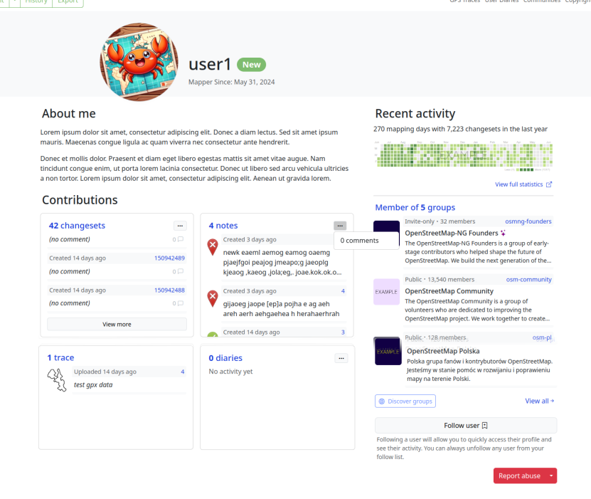
Welcome to the eleventh OpenStreetMap NextGen development diary.
This week has been focused on the design and implementation of new user profile pages. Today’s profile pages are boring and quite limited — let’s fix that! 🧑
🔖 You can read my other development diaries here:
osm.org/user/NorthCrab/diary/
⭐ This project is open-source and publicly available:
https://github.com/Zaczero/openstreetmap-ng
🛈 This initiative is not affiliated with the OpenStreetMap Foundation.
Last Week’s Recap
Last week the project was opened for new contributors. The codebase is now stable enough to allow for greater cooperation. There are also contributor incentives to ensure your work is always appreciated.
New Profiles
In summary:
da tauchen in bestimmten Zoomleveln falsche Straßen auf! In allen möglichen Sprachen Beispiel:
Bei der Objektabfrage werden diese Elemente nicht aufgelistet.
Gruß Skopeia
Depending on the zoom level, the CycleOSM Layer is corrupted with a large number of false straight roads. I’m looking at a region near Angers, France.
何ら目新しさも、便利さもないマップで、期待できない。
Someone is littering openstreetmap with streets that do not exist. A Russian hacker is the cause and one other person.

In January, I introduced Overpass Ultra v2. Today, I’m pleased to announce some updates to further improve Overpass Ultra’s customization capabilities, enabling you to make custom maps like this one:

Loading queries from URLs & Gists
In order to facilitate sharing updatable overpass queries&maps, Overpass Ultra is now able to load queries from a URL or Github Gist.
To use this feature, specify either query=url:... or query=gist:... in the hash parameters. For example to load a Gist:
https://overpass-ultra.us/#query=gist:02ab2139d146dd2ee0306a38d96a9c9d
or to load that same Gist with the more flexible (but more verbose when using Gists) url: option:
Improved configurability for the Overpass Ultra “interactive map” view
The YAML-frontmatter options key

FOSS4G is the annual recurring global event hosted by OSGeo, the non-profit organization that supports and promotes the collaborative development of free and open source geographic technologies and open geospatial data.
🔸 CFP for Submission of workshop: From May 8 to July 12, 2024.
🔸 Workshop Evaluation: From July 22 to 31, 2024.
🔸 Full FOSS4G 2024 program: September 1, 2024.
More information in https://2024.foss4g.org

I was recently asked how I find and review notes on the OSM US Discord (you should check it out!).
I use the following links to see recent notes. This one is all note actions, last 1k notes: https://resultmaps.neis-one.org/osm-notes-country?c=United%20States
This one is only open notes. It is only opened, commented and reopen actions. You can see the last comment. https://resultmaps.neis-one.org/osm-notes-country-custom?c=United%20States&query=open
I start with the most recent notes and work my way back. The notes can vary wildly. Some are onosm.org ones where a business submitted a request to be listed and all that is needed is to validate it exists, the tags are correct, and it is correctly located (according to reported address), and then you add the business w/ appropriate tags. Some are to identify an error or addition that is beyond the editor being used. Some are clearly spam (Ex: Give CurlingMan13 a beer and a raise!), but you get a feel for it after a while.
Now before I submit that single changeset, I look around the map in that region and search for other notes that I can resolve (some are related, some are easy).
Another good source is NotesReview. You can search for specific text, age, specific users, etc. This one is really good if you want to kill off the oldest notes. https://ent8r.github.io/NotesReview/

its been 4 days i see this lines like exploded roads … when zooming map location , i tried showing amusement park when editing , it also showed exploded road lines hope ( OSM Servers ) Are fine , and its necessary for a company to do monthly backup for all data
take a look at picture: