Users' Diaries

Recent diary entries

Hace unos meses comencé a revisar la página del wiki acerca de Objetos del mapa buscando arreglar las entradas que aún estaban en inglés. Para mí, esta es una de las páginas más importantes del proyecto OSM, ya que es la carta de presentación de lo que se puede hacer o encontrar en el mapa. Inclusive, muchos lugares externos referencian esta página (la de inglés principalmente), para promocionar el proyecto y mostrar sus capacidades. Sin embargo, cuando uno entra al proyecto, y descubre todos los posibles caminos, esta página uno la termina olvidando. Cuando uno ha mapeado mucho, ya conoce qué se puede hacer, cómo buscar lo que desconoce, etc., pero esta página de características del mapa no se vuelve a consultar. Es verdad que es una página muy grande (y demorada en cargar) pero permite entender el potencial del proyecto. Por eso, quise arreglar su versión en español para que estuviera más sincronizada con su versión en inglés.

Primero comencé a entenderla, ya que al editarla, no se ve tan compleja. El problema es que hace referencias a muchas otras páginas que se incrustan, y estas otras páginas tienen unas tablas. Entonces toca activar el espíritu investigativo y comenzar a abrir páginas y comenzar a imaginar cómo funciona todo esto. Es verdad que la edición del wiki en esto tan básico como agregar una nueva etiqueta a este listado, no está descrito en ningún lado. Pero esta aventura me ha enseñado muchas cosas, y me ha permitido hablar con muchos editores del todo el mundo.

See full entry

Project Abstract

The primary aim of this Google Summer of Code project is to re-introduce transit support in Valhalla, the OpenStreetMap based Routing Engine. Initially, Valhalla supported a mode to route transit, but due to a bottleneck from a third-party library, it became unviable to continue support transit routing. Therefore, the aim of the project is to directly parse raw General Transit Feed Specification (GTFS) data and remove the dependency.

The high level overview of the project is visible here:

GitHub Project

Specific details of each pull request will be described below.

What has been done

The first stage of the project was importing GTFS and ensuring that we can parse the data. GTFS is a set of text files, and rather than iterating through them manually, I decided to use a third party library to automize the read-write process. Just_gtfs allows us to read and store transit data in variables rather than manually trying to parse text. Moreover, I can create sample test data without being concerned about creating invalid data.

After parsing GTFS data, the next step was to pre-process them so that they could fit into Valhalla’s existing data format. Firstly, since the map is divided into tiles – square regions of equal area – I sorted the data according to which tile it belongs to. Tiles are beneficial to save computing power because only the information that belong inside the tile need to be processed when routing through small regions.

Parsing GTFS Pull Request

The sorted data then needed to be built into protobufs, which are used as intermediary data storage before they are converted to tiles. Protobufs are much more condense and versatile than raw GTFS data, so we extract the relevant information from GTFS into protobufs and gather the data. This is further useful because instead of iterating through each stop or trip of a tile, the tile could be read as one whole entity, streamlining the reading process.

Creating Protobufs Pull Request

See full entry

Location: University, University—Rosedale, Toronto, Golden Horseshoe, Ontario, Canada
Posted by matheusgomesms on 10 September 2022 in English. Last updated on 11 September 2022.

Original post in Portuguese here

After some time from the return of State of the Map 2022 in Florence, and after a brief reflection on my experience at the event, I would like to share my views on SotM 2022.

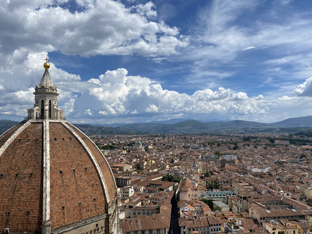
Duomo View

Initially, I would like to thank the State of the Map Working Group for providing grants to participate in the event, which I was awarded (more on this later).

About the event, it was 3 very intense days (and sometimes overwhelming)! During SotM, I thought I could enjoy it more, but looking back, I see that it would be practically impossible. Several very interesting presentations at the same time, amazing people to meet and talk to, very well constructed and presented posters, in short, a lot happening at the same time.

See full entry

Location: Meireles, Fortaleza, Ceará, Northeast Region, Brazil

English version here

Depois de algum tempo do retorno do State of the Map 2022 em Florença, e após uma breve reflexão sobre minha experiência no evento, gostaria de compartilhar minha visão sobre o SotM 2022.

Vista do Duomo

Inicialmente, gostaria de agradecer ao State of the Map Working Group por fornecer bolsas para a participação no evento, na qual fui agraciado (mais sobre isso adiante).

Sobre o evento, foram 3 dias muito intensos! Durante o SotM, pensava que poderia aproveitar mais, mas olhando para trás, vejo que seria praticamente impossível. Várias apresentações interessantíssimas ao mesmo tempo, pessoas incríveis para conhecer e conversar, pôsteres muito bem construídos e apresentados, enfim, muita coisa acontecendo ao mesmo.

See full entry

Location: Meireles, Fortaleza, Ceará, Região Nordeste, Brasil

versão em português

In these last 2 years as a full time volunteer, I have developed several mapping projects around Brazil, because I believe it is my duty to contribute because of the deficit the map had in my region. My goal as a mapper is to try to decrease the blank spaces in OpenStreetMap so that more people can use them and thus more mappers emerge.

I understand that not everyone has time or interest in mapping, the most they can do is the basics, and many times they forget about OSM because they can’t use it on a daily basis, even more in a country like Brazil where hardly a worker would have time to be updating maps.

I have dedicated myself daily to OSM, but unfortunately this has a cost and since I am no heir, it has been very difficult to reconcile my volunteer work and my personal life, I have gone through some very complicated phases since I decided to dedicate myself full time, but I also had a lot of help.

Working at OSM is not an easy task, because your work is never finished, there are always new changes that need to be mapped, mistakes to be corrected, it’s a continuous job that requires a certain level of knowledge and experience acquired over time.

One of the first projects I did was using DAMN and then Taskmanger to be able to manage and map entire cities, with this project almost 20 cities were fully mapped from roads to buildings.

See full entry

Location: São Benedito, Timon, Região Geográfica Imediata de Timon, Região Geográfica Intermediária de Caxias, Maranhão, Northeast Region, 65630-970, Brazil

English Version

Nesses últimos 2 anos como voluntário em tempo integral desenvolvi vários projetos de mapeamento pelo Brasil, por acreditar ser meu dever contribuir por conta do deficit que o mapa tinha na minha região. Minha meta como mapeador é tentar diminuir os espaços em branco no OpenStreetMap para que mais pessoas possam usá-los e assim mais mapeadores surgirem.

Entendo que nem todo mundo tem tempo ou interesse em mapear, no máximo fica no básico e muitas vezes acaba esquecendo do OSM por não consegui usar no seu dia a dia, ainda mais em um país como o Brasil onde dificilmente um trabalhador teria tempo para ficar atualizando mapas.

Tenho me dedicado diariamente ao OSM, mas infelizmente isso tem um custo e já que não sou nenhum herdeiro, tem sido bem difícil conciliar meu trabalho como voluntário e minha vida pessoal, já passei por fases muito complicadas desde que eu decidi me dedicar em tempo integral, mas também tive muitas ajudas.

Trabalhar no OSM não é uma tarefa fácil, pois seu trabalho nunca está concluído, sempre há novas mudanças que precisam ser mapeadas, erros a serem corrigidos, é um trabalho contínuo que exige certo nível de conhecimento e experiencia adquirida com o tempo.

Um dos primeiros projetos que eu fiz foi usando o DAMN e depois o Taskmanger para poder gerenciar e mapear cidades inteiras, com esse projeto foram quase 20 cidades que foram totalmente mapeadas desde as estradas aos edifícios.

See full entry

Location: São Benedito, Timon, Região Geográfica Imediata de Timon, Região Geográfica Intermediária de Caxias, Maranhão, Região Nordeste, 65630-970, Brasil

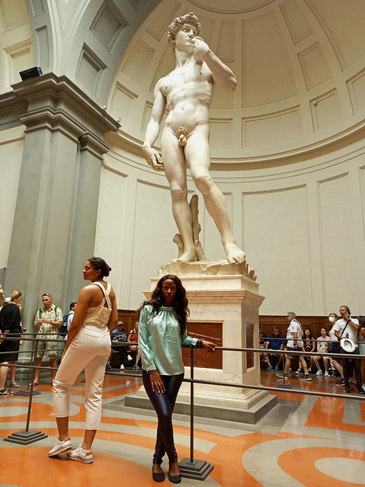
It was a joyful moment, having been selected and given a scholarship to attend the hybrid conference, SOTM 2022 in Firenzi Italy, first time to board a plane so it was a whole lot of new experience and excitement, I arrived in Firenzi on the 18th of Thursday evening just in time for the event. The historical city of Firenzi is a beautiful city with a whole lot of sculpture, just like what I see in the movies. text

See full entry

First stop, Cercedilla

The Spanish government has decided to fully subsidise the regional train services around major Spanish cities for the rest of the year, to try and encourage people to use public transport more. Now I don’t use Madrid’s Cercanias services very often, because I work mostly from home, but I decided to get my free ticket and explore the region a bit more. Then it occurred to me that I could also take advantage of the offer to do a bit of OSM mapping in different places.

So yesterday I got on the train and headed to Cercedilla, sitting at the foot of Madrid’s mountains. It’s a station I have been to many times, but always to start a hike - you can walk straight out of the station and onto a trail that takes you up to those mountains. This time I headed for the nearby village, gathering addresses and points of interest as I went.

I was giving a test run to the Every Door application, presented by Ilya Zverev at this year’s State of the Map event in Florence. It worked very well for capturing the points of interest, the address and building interface was a little trickier to understand - but I liked it and will use it again. I need to check whether I can configure it a bit more so that I don’t need to add so much to the data later at home. But I can stop being the mapper with the old Garmin GPS for a while.

More OSM away days around Madrid will come, the free ticket lasts until the end of the year!

Location: 40.741, -4.056

Aachener Stammtisch 2.0 - 1. Treffen am 21.09.2022

Zeit und Ort

Am: Mittwoch, den 21.09.2022 um 18:00 Uhr Wo: Chaos Computer Club Aachen - Schützenstraße 11, 52062 Aachen

Für Getränke (gegen Unkostenbeitrag) ist vor Ort gesorgt.

Wenn ihr Lust dazu habt, kommt einfach vorbei!!!

Location: Burtscheid, Aachen-Mitte, Aachen, Städteregion Aachen, Nordrhein-Westfalen, 52066, Deutschland
Posted by poornibadrinath on 8 September 2022 in English.

It is always amazing to connect with like-minded people on topics you are interested in and talk about making it better. That’s what State of The Map has always been to me. And this time, thanks to HOT UnSummit, I got a chance to attend one as a student, and understand the use cases of maps from a very fresh perspective.

After more than 5 years of working in the mapping sector, I decided to pursue my Master’s in Cartography and being a student again, both of the conferences of SoTM and FOSS4G proved to be very beneficial to attend and understand the ways the mapping community are branching out in.

Alt text

I have been a part of the SoTM community for a few years now and have got a chance to even present some of the talks on OSM and validation. However, the whole experience at Florence this time was very different and engaging. The first in person conference after COVID, it was fantastic to meet everyone I knew in person and connect on maps and more.

See full entry

Location: Innere Altstadt, Altstadt, Dresden, Saxony, Germany
Posted by Zing929645 on 7 September 2022 in English. Last updated on 19 September 2022.

Introduction to JOSM Route Visualization

Hi, this diary is for showing what I have done in GSoC 2022. Two months went so fast that I suddenly realize the final date has come. But I still want to follow the guidance and try something I haven't done before, and I can't wait to show the power of this plugin and some new functions that help.

JOSM route visualization plugin is for displaying the full picture of the public transport routes, which is convenient for users to query and greatly improves the efficiency of route maps and members modification.

Checking the relevant function, you can open the relation editor of some route or public transport objects , and then grasp a big picture of the distribution of routes by specially enhanced image instead of a list of way members. In the meanwhile, the path-finding algorithm and logic handling is great for users to choose the next way to extend existed routes from given options rather than add ways needed manually.

Previous Posts

Greetings

Progress in First Half

First Half Summary

  • Fix the problem that target route figure is under the layer of other irrelevant models.[merge_request1][merge_request2]
  • Make the ways under the route relation of same type as the selected relation of route more evident and add waterway features.[merge_request2]
  • Mark the selected stop in main window[merge_request3]
  • Listing distance from next and previous stops and relation routes in the dropdown of clicked stop[merge_request4]

Second Half Summary

  • Add turn restriction to guarantee path-finding logic to avoid ways it shouldn't be turning to. [merge_request5]
  • Add access restriction to guarantee path-finding logic to avoid ways that have no permission for route extension according to transport mode match.[merge_request5]
  • Handling Roundabout[merge_request6]

Effect Contrast (Part of visual effects display)

Target route floating problem:

See full entry

Location: Allston, Boston, Suffolk County, Massachusetts, United States
Posted by david_daish on 6 September 2022 in English.

Removing duplicate bike paths, updating details of bike paths, and improving routing information is fun! The Sockburn roundabout and bridge is one of the most hostile places for bikes and pedestrians I have ever visited. In the process of surveying it with a fieldpaper map, I almost got hit a few times. To be fair, I was biking with one hand, the other was holding the map XD. I sent an email to the CCC asking if they were intending to improve it.

Adding businesses in the Upper Riccarton chinatown area was great fun! It adds so much texture when you really get down to the fine details. Such an interesting place that I never hear people talk about. I really recommend Ramen Miyako, it slaps.

Location: Upper Riccarton, Christchurch, Christchurch City, Canterbury, New Zealand