 OpenStreetMap

It was my first time when I participate in The State of the Map Africa (SotM Africa) conference which is a bi-annual regional conference that celebrates the culture of open mapping, open data, GIS, and its impact across Africa. This year the conference was built on a new strategy envisioned for OpenStreetMap Africa as a renewed, strong, and growing network, and as part of the global open mapping movement. especially on the theme of leaving no one behind and underrepresented communities as well as emerging from a global pandemic. I could say the conference explored the topics Beyond mapping and Reusing OpenStreetMap data/FOSS4G. where I learned how the community can make use of available Geodata for personal and institutional development.
Users' Diaries
Recent diary entries

En tant qu’utilisateur et contributeur des données OpenStreetMap. La conférence sur State of The Map 2021 m’a permis de comprendre l’importance des données OSM dans la gestion des crises humanitaires. De nos jour qui parle de dévloppement parle forcememnt des données disponibles, c’est pourquoi les utilsasteurs OSM contribuent et mettent à jour les données sur toutes les infrastructures socio de bases pour répondent immédiatement aux défis du développement durable. Pour soutenir cette communauté mondiale libre participant à la mise en place des infrastrucutres de données pour les chercheures, les éducateurs, les privés, les acteurs socio-economiques. State of The Map est une opportunité pour l’ensemble des utilisateurs de comprendre l’écosystème OpenStreetMap. Enfin, l’objectif de cette communauté libre est de numeriser toutes les infresatuctres conexes afin d’atteindre les objectifs du développement durables.
Posted by ortho_is_hot on 9 December 2021 in English.
Last updated on 25 December 2021.

Well, this is my first diary entry. Here I will outline the tools and process I use when editing on OSM.
Editors
- I prefer to use JOSM when doing detailed edits, particularly when doing any work with route relations. Enhanced road and lane attributes is a very useful map paint style when lane mapping, and the reverter plugin is useful for handling more complicated reverts (or partial revers)
- iD is useful for quick or simple edits, and I also find the master branch of iD useful when adding things like powerlines or other objects where every node needs tags (yes this can be done with JOSM however I prefer iD for this task)
- Vespucci is good when doing in-depth edits on a mobile phone
- Other editors like Level0 or RevertUI can be used for more simple tasks, such as changing a single tag in the case of the former or reverting a simple changeset with the latter
QA
- Geofabrik’s OSM Inspector is very useful for picking up problems with routing in particular, which I generally check and fix most obvious errors every couple of days or so; there are also other useful things it can check for
- Osmose is also good for picking out other errors
- I keep track of edits using osmcha, using the area boundary tool and a custom bounding box
Other tools
- hdyc by neis-one is useful for keeping track of my (and other’s) editing statistics, as well as collating changeset comments in a single place
- I do have a page or two on the OSM wiki, however work has been pretty stagnant for a while
Third-party data
- Transport related tasks in NSW can use TfNSW’s GTFS data, some of which I have imported (along with others); route relations can be created manually using
- Mapillary and KartaView are useful when the area you’re editing has imagery available (I prefer to use the web interfaces on another monitor when available, rather than the in-editor tools)
Hardware
Posted by rebekah24 on 8 December 2021 in Kinyarwanda (Ikinyarwanda).

Nitwa Nyinawumuntu Jeannete Rebecca ! nka ndumwe mubagize umuryango mutoya wa OSM Rwanda nka nanawubereye umuyobozi, mumwaka wa 2017 nitabibiriye SOTM Africa muri uganda icyo gihe icyorezo cyari kitaratera kwari uguhurira hamwe nibihugu bitandukanye, twahagiriye ibihe byiza twahuye na za kominote nyishi ziturutse hirya no hino kwisi ndetse ubunararibonye bwazo twabwigiyeho byinshi
Ariko muruyu wa 2021 SOTM Africa yabereye kuri murandasi yaradutunguye cyane ntago twari twitezeko izatunyura bingana kuriya kuko ntago twari tubimenyereye Gusa igitangaje nuko naho twagise experience nziza ibiganiro byayo twari tumeze nkabahuye barikumwe muri salon neza neza!
habayeho Mapping Marathon ishimishije nubwo bamwe batabashije gutanga umusanzu nyawo ,kubera impanvu zubunararibonye budahagije ariko twigiyemo byishi , yewe dufata ningamba zitandukanye zishingiye kubyavugiwemo.
Mbonereho gushimira byumwihariko abagize uruhare mugutegura iyi State of the Map Africa ya 2021.

Humanitarian OpenStreetMap Team’s Data Quality Internship 2021 was a twelve week programme. An opportunity to become deeply involved within the Humanitarian OpenStreetMap Team and community while gaining readily transferable geospatial skills.
The interns focused on validating priority disaster response projects, projects with imminent field mapping and also on tackling the backlog of un-validated HOT projects. In total, they validated 74 projects across 12 countries, See here
The interns were led through a series of webinars hosted by a range of professionals in the humanitarian mapping sector. Meta, Kontur, Mapbox and OSGeo ran skill sharing sessions for the interns - this involved training the interns how to use tools which the organizations had created, for example Disaster Ninja, OSGeo Live and RapiD. This broadened the interns knowledge of geospatial tools and enhanced their ability to validate.
In addition several key individuals in the geospatial sector participated in Ask Me Anything sessions, where the interns heard about their inspiring geospatial career paths and had the chance to ask insightful questions
Interns also received live training in a wide range of geospatial tools culminating in their ability to confidently validate the work of other mappers.
Some of the training sessions were recorded, please view this playlist to see all of these in order. Of particular interest might be:
- If you’ve never used QGIS before but are keen to learn, here is how to setup and use QGIS to create maps from scratch in this two part series Episode 1, Episode 2
- If you’re already into validation but want to learn about the mysterious art of “3rd pass validation” check this video.
Highlights
Posted by Reibert on 7 December 2021 in Russian (Русский).
Last updated on 31 December 2021.

Удалено.
Posted by Harry Wood on 7 December 2021 in English.
Last updated on 12 January 2022.

“30 Day Map Challenge” happened over November. Remembering this from last year, I knew we were in for a bombardment of cartographic creations on the #30DayMapChallenge hashtag. Combining this with a search for “OpenStreetMap” mentions I sat back and let the mappy goodness flow into my tweetdeck for the whole month.
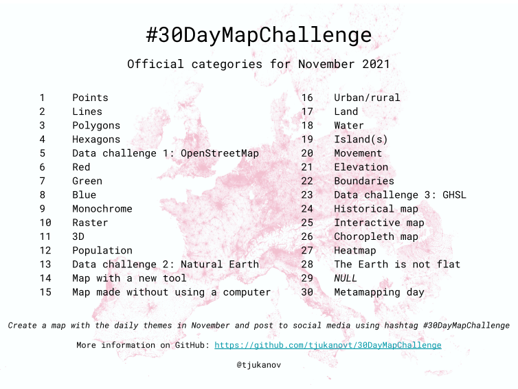
Here’s some I particularly liked:
During the State of the Map Africa 2021 conference especially on theme of leaving no one behind and underrepresented communities as well as emerging from a global pandemic, as a women I understood the importance of inclusion and equity, I got to know the role of Representing a local community in the geospatial data collection on the OSM and discovered that is no longer impossible but it easy and applicable on any achievable scare any local growing Local community can afford .
Therefore, with all the ideas speakers emphasized at the conference we fully explored the topic of Beyond mapping and Reusing Open Street Map data/FOSS4G where we were able to learn how community can make use of available Geodata for personal and institutional development.
Also taking about the free software we were able to understand further the four major advantages that come with the free software like the run, improve, share , and Study. Generally, on our side, the experience was good especially the marathon, keynotes from different speakers, panel discussions, and lightning talks were really exciting . During this conference, I came to learn about the Open Mapping Hub ESA and the roles the hub has played to expand the Mapping communities in the region through the funding of various projects like the Open Cities Project in collaboration with other international institution.
In fact what I can say is, yes we still have a lot to learn about challenges and opportunities available , as well as tools to use . but the biggest interest everyone took as a take away considering my local community members who managed to attend , is that , it is no longer impossible for women , mothers and underrepresented community youths in general .
Posted by Mbunzama Narcisse on 6 December 2021 in English.
My name is Mr. Mbunzama Narcisse an Open street Map enthusiast based in the democratic republic of Congo. I had the chance to participate in the virtual Open Street Map Africa 2021 conference.
This conference was an opportunity for me first to learn about different projects on the Open Street Map implemented across the Africa continent, I also had the chance to acquire new knowledge on Open street Mapping tools and to meet and interact with other mappers from across the continent.
The sessions, the workshops were a unique opportunity for me to better understand certain concepts and to have a great insight on open street map use in Africa, going from different fields such as the Open street Map uses in School, women active in geospatial fields, the use of JOSM to map, Open street Map in health areas and other humanitarian and environmental fields where Open street Map use hugely use.
Overall the conference went well, and it was a success. However for a virtual conference and taking into account the time of the conference, it seemed very long taking into account other realities that we sometimes have in Africa such as regular power cuts, connection problems to the Internet. Internet. It would be better for future virtual conferences to see how to reduce the time of online meetings (For example from 12:00 to 18:00 will be very easily followed than a meeting from 10:00 to 20:00) and also to directly record the sessions and upload these videos to allow participants to review it even after the conference.
Based on the State of the Map conference 2021 theme of leaving no one behind and emerging from a global pandemic, as a student I understood the important role universities play in the geospatial data collection on the OSM. Therefore, with much emphasis from speakers at the conference we fully explored the topic of Beyond mapping and Reusing Open StreetMap data/FOSS4G where we were able to learn how students and the community can make use of available Geodata for personal and institutional development. Also taking about the free software we were able to explore further the four major advantages that come with the free software like the RUN, SHARE, IMPROVE, and STUDY. Generally, on my side, the experience was great especially the marathon, keynotes from different speakers, panel discussions, and lightning talks were great. During this conference, I came to learn about the Open Mapping Hub ESA and the roles the hub has played to expand the Mapping communities in the region through the funding of various projects like the Open Cities Project in collaboration with the World Bank.

hi everyone

My name is Walter Mayeku, a postgrad urban planner and currently working as a geospatial engineer and a volunteer at the OSM Kenya working group. So initially when we were bidding to host this year’s conference all our hopes were revolving around having a physical conference you know… The interactive sessions and the entire networking platforms. Thanks to the entire SOTMA 2021 committees and the local community (OSM Kenya) for putting so much selfless efforts to see us have such a great first virtual conference. Personally I enjoyed and left enlightened because it was more that what I anticipated. If there is much I have learnt from the pitching, speeches and networking is that you can not underestimate the role of partnershipsand local government involvement in the development of bigger community based groups and projects. Listening to some of the most enlightening presentations has helped me on how to analyse existing community projects as we as a community plan to undertake bigger projects from this new phase. Thank you for making the event a success.
Posted by Innocencia Sigfrid on 5 December 2021 in English.

My name is Innocencia Sigfrid a crowd2map intern in Everywhere She Maps project where female mappers are given chance to strengthen their network and also adding underrepresented places to the map.
I had a chance to attend the online conference State of Map Africa (SotMAfrica) Which is a biannual regional conference that celebrates the culture of open mapping,open data, Geographical information system (GIS) and its impacts across Africa.
It was my first time to attend to this conference and the experience was extraordinary as I happed to gain more insights about open street map Africa and found out that Open Street Map Africa is a strong and a growing network and from this network personally I can bring a lot of positive changes in my community.
During the conference I got the chance to participate in different sessions hosted by different people, organizations, youth chapters where I learned on how they perform different projects and other activities in their community and it was during this time that I convinced my self that everything is possible when a team is well organized and have same goal to accomplish. I was inspired by all speakers but more with OMDTZ, IRDP, ENOCK who presented about beyond mapping,SHAMILLAH &CLAIR who presented about the lessons learned from building footprints import,TONNY JOHN,
Posted by salumeuganda on 5 December 2021 in English.
Last updated on 9 December 2021.
My name is Angolo Salume a, a member of vision youth mapper chapter in Uganda ,first and far most i want to thank the organizers of this event it was really educative may God bless you . this was my first time to attend the state of map marathon but for the time I attended it really changed me and one of the persons who inspired me is Eric T Tamba who is a region ambassador of Tanzania , i attended his session and how he presented his projects and activities carried out in their youth chapter. I also attended the session where Christine from OSM Malawi who was talking about OSM sustainability in Malawi During the break time session i was able to interact with different people and it was amazing ,thank you for the opportunity given and would love to attend it next year again GOD BLESS everyone
Posted by Hungerburg on 5 December 2021 in English.
Last updated on 21 October 2022.

During the summer, a number of wild-life sanctuaries found their way into the openstreetmap data around the area of my local knowledge. Legal provisions place a simple conditional restriction on accessing the protected areas: From November 16 up to April 30 one must not stray from tracks, well-known paths and pistes. Some days ago, I started to think about ways to add that to the data, and came up with access:conditional=only_trail_use @ (Nov 16-Apr 30). That felt pretty good human readable, Apart from a new restriction, it was very much in line with what the documentation on conditional restrictions proposes. The new value itself follows established naming conventions of documented restrictions.
Still, that seemed too little, to pitch this tagging to a consumer of openstreetmap data in close vicinity, developing an online slippy map, that sets out to highlight protected areas to the interested public, i.e. skiers and other winter sport enthusiasts. I searched for a reference implementation, that parses openstreetmap conditional restrictions, and I did not find a single one.
So I had to start from scratch: Below some lines of python, that take the (very simple) tag value from above, and find out, if the restriction applies at a certain date. In all its simplicity, there are some pitfalls worked around. For more complete coverage, it might still be wise to look for a full blown calendaring module to evaluate time constraints, and of course a full blown parser of the myriad of expressions available in conditionals.
Posted by amapanda ᚛ᚐᚋᚐᚅᚇᚐ᚜ 🏳️⚧️ on 5 December 2021 in English.

Hi 👋, I’m Amanda McCann, I’m an current OSMF Board Member, and I’d like you to vote №1 to re-elect me to the OSMF Board. 🙂 Here’s my manifesto.
So who am I?
I’m a (craft) mapper. I’ve loved maps for a long time, and hence was drawn to OSM. I try to edit every day, and I’m doing pretty well that way. hdyc tells me I have mapped 2,700 days. For the last several years, I have mapped for 300+ days per year. I love the term “craft mapper”. I view my mapping contributors to OSM with pride, like a craftsperson of old would look at their work.
We must remember what’s important. If you don’t like maps, what are you even doing here? A board member that keeps mapping will be more aware of what most OSMers are experiencing, and will have insight into what is important, what’s easy, what’s hard, for lots of OSMers. That will make them a better OSMF Board members. OTOH I do lots of contributions which cannot be included in my OSM edit count.
I’m a hacker. I’ve been using linux for 15+ years. I’m a free software programmer. Computers & the internet are wonderful tools for the good in the world. We can use them to make our lives & our society better. You should be able to understand the computing machines around you, and to control them and make them better. In my day job I’m a regular sysadmin for the small OSM consultancy company Geofabrik, so I’ve installed lots of OpenStreetMap software & map styles. I’m pretty good at writing bash scripts, and I can write long PostgreSQL queries to work with your OSM data.
I’m a queer trans woman. I came out as trans & transitioned in mid-2021. (So you might see references to my old name, which started with “R”). Everyone in OSM has been wonderfully supportive about this. Honestly, it’s surreal how anti-climactic it has been in the OSM space. OSM is pretty cool. I founded the RainbOSM telegram group. for LGBTQ+ people & allies in OSM. I guess sometimes OSMers can adjust to a new tagging scheme quickly.

09195925282

-
Install Java Development Kit for ARM 64 processors. JOSM developers now recommend Azul or Bellsoft Liberica JDK’s. At the moment, I’m using the Azul build: https://www.azul.com/downloads/?package=jdk#download-openjdk
-
Download josm-tested.jar https://josm.openstreetmap.de/josm-tested.jar
-
Drag and drop josm-tested.jar into the Dock
-
Run JOSM!

PS: Updated recommendations for JDK
UPD April 20, 2024: The instructions are effective; however, the JOSM development team now produces a build that supports both Intel and Apple Silicon processors. Currently, I download and install JOSM using Homebrew.
Posted by Robhubi (inaktiv) on 4 December 2021 in German (Deutsch).
Die Graphenintegrations-Plattform (GIP) enthält österreichweit eine Vielzahl an Verkehrsinfrastrukturdaten in hoher Detailliertheit. Die GIP beinhaltet Daten für alle Verkehrsformen inkl. Schiffe, U-Bahnen, Seilbahnen, Busse, KFZ, Radfahrer und Fußgänger. Die GIP ist kein fertiges Produkt, sondern wird laufend erweitert. Das betrifft sowohl Inhalt als auch Struktur.
Seit Anfang 2016 werden aktualisierte Datenauszüge der GIP als Open Goverment Data (OGD) in regelmäßigen Abständen veröffentlicht. Das Basisnetz wird in dem einfach zu verwendenden GeoPackage Format angeboten. Der detailreiche Routingexport ist nur im CSV-Format verfügbar.
Der Datenauszug „Routingexport“ ist besonders interessant, da er für das Routing in allen Verkehrsmodi die relevanten Informationen enthält. Unter anderem das routingfähige Netz, die Querschnittselements mit den Erlaubnissen und Verboten nach der StVO u.v.a.m.
Mich interessierten besonders die Daten für Radfahrer. Öfters gibt es Situationen wo die Befahrbarkeit für Radfahrer unklar ist. Beim Abwägen der Merkmale ist die behördliche Sicht natürlich auch ein Argument. Aber nicht mehr, von einer Richtigkeit gehe ich nicht aus.
Ein Blick in die Daten
SynerGIS [2] stellt eine Web-Applikation bereit, die eine kleine Auswahl der Rohdaten mit Raumbezug visualisiert. Der Datenstand wird mit Juli 2018 angegeben. Die Interpretation der Daten ist schwierig, da die Bit-Kodierungen nicht aufgelöst werden. Dennoch, eine nette App für einen ersten Blick auf die Daten.
Einige Länder-GIS [3] präsentieren auch GIP-Daten. Die GIS-Steiermark stellt z.B. bei aktivierten „Fußweg“ Lage und Typ des Nutzungsstreifens für den Langsamverkehr dar. Die Legende gibt dazu näher Auskunft. Bei der Interpretation ist Vorsicht angebracht: Typ des Nutzungsstreifen und Befahrbarkeit werden im GIP immer getrennt modelliert. Eine schmale Begleitstraße (<3 m) wird z.B. im GIP mit Typ 36 „Geh- und Radweg“ bezeichnet. Wer dort fahren darf ist damit nicht gesagt.

“Have I offended someone?”, someone asked.