Users' Diaries

Recent diary entries

Posted by Deepthij on 21 August 2021 in English. Last updated on 5 September 2021.

The article represents the method I have used to generate a stream network in a high altitude region in Kerala. The stream network of Devikulam in Munnar is the selected study area and stream and basin is generated using some tools available in QGIS. I am using SRTM DEM with a 30m resolution clipped to the study area and a set of SAGA tools available.

The steps are as follows:

  1. Load the DEM and reproject using the Warp/reprojection tool

The first step is to clip and reproject a DEM into a projected coordinate system. Screenshot Use the option, Raster > Project > Warp/Reproject
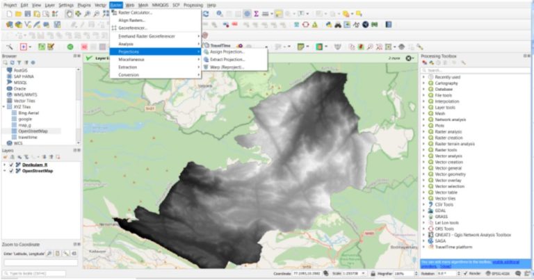
Select the required Projected coordinate system with reference to the study area.

  1. Fill Sinks in the reprojected DEM

This step is done to correct any unusual distortions of the DEM and to obtain a continuous hydrological network.

See full entry

Location: Devikulam, Idukki, Kerala, 685613, India

Moin!

vor einigen Tagen hatte ich einen Link gepostet leider mit Fehler.

Damit dieser nochmal “in Vordergrund geholt wird” hier nochmal

https://lvermkv.maps.arcgis.com/apps/webappviewer/index.html?id=da78a306408441769ff803ec349789bc

Hinweis: Daten sind stets vor Ort zu prüfen, da unbekannt wie aktuell diese noch sind.

Jan

Posted by imagico on 20 August 2021 in German (Deutsch). Last updated on 21 August 2021.

Machine translation in English by deepl.com can be found below, should not be read under the assumption of semantic equivalence though.

Die OpenStreetMap Foundation OSMF hat vor kurzem angefangen, Ihre Pläne und Ideen zur Verhaltensregulierung auf Kommunikationskanälen unter Kontrolle der OSMF öffentlich vorzustellen. Und ich habe von mehreren Seiten die Erwartung kommuniziert bekommen, dass ich dazu Stellung nehme - vor dem Hintergrund, dass ich zu dem Thema Verhaltensregeln in OpenStreetMap sowohl ganz grundsätzlich als auch zu konkreten Ideen und den diesen zugrunde liegenden philosophischen Konzepten und Wertvorstellungen schon einiges geschrieben habe.

Ich tue dies hier wie bereits zuvor in meiner Muttersprache, insbesondere um klarzustellen, dass englischen Muttersprachlern zu diesem Thema keine Deutungshoheit über die Begriffe und Argumente zusteht. Eine maschinelle Übersetzung auf Englisch ist unten der Einfachheit halber angefügt, diese ist aber ausdrücklich nicht dafür gedacht, unter der Annahme der Bedeutungsgleichheit gelesen zu werden.

See full entry

श्री भगवान विद्यालय, बालमटाकळी, तालुका शेवगांव, जिल्हा अहमदनगर. जि.प. प्रा. शाळा, बालमटाकळी, तालुका शेवगांव, जिल्हा अहमदनगर. कर्मवीर एस. एन. हायस्कूल, न्यू बालाजी नगर, औरंगाबाद. Government Polytechnic Aurangabad. Maharashtra College of Engineering, Nilanga Dist. Latur. Swami Ramanand Teerth Marathwada University, Nanded. Maharashtra State Board Of Secondary and Higher Secondary Education, Pune Divisional Board Aurangaabad. अभिनव चित्रशाला, नांदेड। श्री बालंबिका सांस्कृतिक मंडळ बालमटाकळी ता. शेवगाव. महाराष्ट्र राष्ट्रभाषा सभा पुणे। मराठवाडा विज्ञान विकास मंच, औरंगाबाद. श्री शारदा मंदिर कन्या प्रशाला औरंगाबाद. अमानविश्व विद्यालय, औरंगाबाद. मराठवाडा शिक्षण प्रसारक मंडळ. देवगिरी हायस्कूल औरंगाबाद. वेद विज्ञान अनुसंधान संस्था, शिवपुरी अक्कलकोट. महाराणा प्रताप हायस्कूल औरंगाबाद. जगदंबा शिक्षण प्रसारक मंडळ मंठा. सुधाकरराव नाईक हायस्कूल, औरंगाबाद. भ्रष्टाचार विरोधी जन आंदोलन समिती औरंगाबाद. औरंगाबाद जिल्हा यशवंतराव चव्हाण पुण्यतिथी समिती. कर्मवीर श्री शंकरसिंग नाईक हायस्कूल, औरंगाबाद. Directorate of Employment & Self-Employment. Department of Youth Affairs & Sports. Government of India and State Sports Directorates. INDO GERMAN TOOL ROOM, AURANGABAD. The Institution of Engineers (India). ABHINAV VIDYA MANDIR, BHAYANDAR (E), DIST. THANE, MAHARASHTRA. महाराष्ट्र लोकसेवा आयोग. INDIAN ARMY/NAVY, Selection Centre, Bhopal. INDIAN ARMY Selection Centre, Bangalore. कमला नेहरु शिक्षण संस्था, औरंगाबाद. मेहेरसिंग नाईक विद्यालय व कनिष्ठ महाविद्यालय, औरंगाबाद. श्री रंगदास स्वामी शिक्षण विकास मंडळ, आणे.

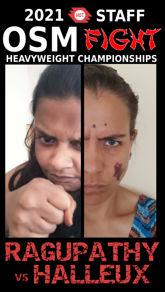
At HOT’s ‘all staff meeting’ today, we held live finals of the 2021 HOT Staff OSM FIGHT Heavyweight Championship!

2021 HOT Staff OSM FIGHT Heavyweight Championship poster

For those that don’t know, OSM Fight is a website that allows two OSM mappers to compete against each other based on a number of different metrics.

We had started a few weeks ago with team ‘group stages’ and then entered a knock out competition phase. Only the semi-final and final were left to play…

See full entry

У ОСМ в России большая проблема с деревнями. Деревни есть, а домов нет. Раньше были проблемы с космоснимками, а сейчас с этим проблем нет.

В общем озадачился, начал потихоньку обрисовывать дома и столкнулся с некоторыми неудобствами. Визуально искать неотрисованные деревни сложно и велик шанс пропустить их.

Поэтому нужно было создать квест на MapRoulette, чтоб можно было последовательно обрисовывать деревни, а данные можно загрузить с помощью Overpass.

Пришло время осваивать Overpass

В ходе изучения была найдена старая тема на форуме “Overpass API - примеры запросов”. Собственно там и был найден и немного модифицирован подходящий запрос.

Для эксперимента был выбран Хиславичский район Смоленской области. Из-за большой нагрузки приходится ограничиваться областью района.

area
  ["boundary"="administrative"]
  ["name"="Хиславичский район"]
->.b;

(
  node(area.b)
  	["place"~"hamlet|village|locality"];
)->.c;

(
  way[building](around.c:500)->.build;
) -> .build;

(
  node(around.build:100)
  	["place"~"hamlet|village|locality"];
) -> .d;

(.c; - .d;)->.result;

.result out center;

Что делает данный запрос?

Выбираем район и сохраняем в переменную b:

area
  ["boundary"="administrative"]
  ["name"="Хиславичский район"]
->.b;

Далее ищем деревни в этой области. Значением locality отмечаются заброшенные деревни, решил тоже выделить чтоб перепроверить.

(
  node(area.b)
  	["place"~"hamlet|village|locality"];
)->.c;

Ищу деревни в которых есть обрисованные здания в радиусе 500 метров. К сожалению я не понял как с помощью Overpass написать запрос где наоборот нет зданий.

(
  way[building](around.c:500)->.build;
) -> .build;

У меня есть набор зданий, но я не знаю как мне найти точку населенного пункта. Придётся делать схожий запрос, но теперь ищем точку НП в радиусе 100 метров от здания и сохраняем в переменную d. 100 метров будут гарантировать что точка деревни точно относится к зданию, а не к ближайшей деревне.

See full entry

Mevzubahis dosyanın bulunduğu adres

Dosyanın görünüşü

Bu dosyaların varlığından Türkiye OSM camiasının duayenlerinden olan ve “Katpatuka” rumuzuyla katkıda bulunan uğraştaşım Roman Bey sayesinde haberim oldu. Onun da benden yine başka bir uğraştaşım olan Nesim Bey sayesinde haberi olmuş. Öncelikle ne kadar okuyup okumayacağınızı bilemesem de ikinize de OSM Türkiye verisine bulunduğunuz büyük katkılardan dolayı minnettar ve müteşekkirim.

Gelelim dosyaya. Dosyada bazı ilçelerin sınırları aşırı tahminî ya da yanlış çizilmiş.

İstanbul

See full entry

I’ve been working on a project for a few months now, and keep getting stuck with time out errors from the Overpass API, which I think might be due to the fact that there are so many postboxes and post offices in the world. (Maybe?)

**Background on the project and ideal vision:

I’m helping the guy who runs postcrossing.com (a free website where people from all over can pull an address and send and receive postcards from each other) to build a map where people can easily find the postbox or post office closest to them in order to mail their postcards. This could be especially helpful if people are on holiday or not close to home and are not super aware of the postboxes and post offices in the area. This would be a map that is embedded in a website - there is no app yet for postcrossing.com and does not seem like there will be on in the near future.

I want the postboxes and post offices to be on different layers, so that I can style the icons individually.

The map should be easy to understand and ideally, would also offer the option to edit if need be (i.e add a postbox or post office that does not yet exist on the map, and be able to add opening hours for the post offices and collection times for the postboxes. There would also be the option to add a photo of the postbox or post office.

**Progress thus far:

I began this project using the Overpass API and putting that information into a uMap, which you can find here: http://u.osmfr.org/m/528331/

I set up the cache under remote data to be once a day, but I still get a red error message that says, “problem in the response,” and gets a 429 error in the console when I move about the map.

I first wrote an OSM Diary entry about this project here: osm.org/user/Nicolelaine/diary/396957

Someone suggested that I create a bounding box, following this French tutorial here: https://wiki.cartocite.fr/doku.php?id=umap:10_-_je_valorise_les_donnees_openstreetmap_avec_umap

See full entry

Introduction

Hi everyone! As GSoC 2021 is coming to a close, I am writing this diary entry as a final report on the progress of my GSoC project, the OpeningHoursEvaluator, in the second period of GSoC.

Previous entries

Project Summary

An evaluator for opening hours tag according to OSM opening hours specification.

Second Period’s Summary

Just to recap, the evaluator from the first period supports almost all the syntaxes defined by the specifications, ranging from something as small as time and a wider range such as year. Building from my previous progress, I have added geocoding to the evaluator, for use in calculation of variable time such as dawn, dusk, sunrise, sunset. I have also added support for holiday data for the corresponding opening hours tag PH and SH, which currently supports 168 countries. Combined with my progress in the first period, the current evaluator now supports evaluation of all the syntax defined by the grammar, and is ready for use in production.

Source code

GitHub repository: https://github.com/goodudetheboy/OpeningHoursEvaluator

Timeline

See full entry

Posted by Vishāl Bāgadē on 17 August 2021 in English. Last updated on 20 August 2021.

District Court, Aurangabad, Government Polytechnic Aurangabad, Collector Office Aurangabad, Zila Parishad Aurangabad, Regional Commissioner office, Municipal Corporation, MSEDCL, BSNL Customer Care Centre, BSNL Mobile, HP Gas, Government College of Engineering, CIDCO, HUDCO, MIDC, ASCDCL, Siddharth Garden and Zoo, DTE, ITI, Central Bus Stand, CIDCO Bus stand, City Smart Bus, Railway Station, Airport, Police Commissioner office, High Court, Cannaught place, IT park, Stadium, Theatre, Market, Canteen, police station, post office, CADA, TV Centre, Akashwani, Old Mondha, New Mondha, Bank, ATM, Government Hospital, petrol pump, Ration Distribution Centre, University, College, School, Maharashtra State Board Of Secondary & Higher Secondary Education Pune Divisional Board, RTO

Posted by Darkshredder on 16 August 2021 in English. Last updated on 17 August 2021.

Source Code

Nominatim-Feedback-Reporter

Previous Posts

Hosted server

About the project

This is a Google Summer of Code project, which has been developed over the Summer of 2021 by Yash Srivastava (darkshredder). This project is mentored by Marc Tobias (mtmail) and Sarah Hoffmann (lonvia).

Project Description

OpenStreetMap’s main search engine Nominatim did not provide a way to report feedback on the search results that they think to be wrong.

This project aims to provide a web interface to report such feedback and store them in a logs file. So that the feedback can be analyzed, fixed and can be re-run by the maintainers to see if the problem is still there.

Implementation

The following step was followed to implement this project:

  • Selecting the frontend and backend framework for the project.
  • Finding a way to fetch multiple results for reverse geocoding as nominatim only returns a single result.
    • We used overpass API to fetch multiple results and then to provide an option to select a correct result base on reverse search results.
  • Hosting the frontend and backend code on the server.
    • Our frontend UI can be found here.
    • Our backend API can be found here.
  • Testing the frontend and backend code.
    • We used puppeteer and mocha to add integration tests to the frontend.
    • We used pytest for unit testing backend code.
  • Setting up the continuous integration pipeline.
    • We used GitHub Actions to integrate the CI pipeline to test as well as build our frontend and backend code.

Final product at the end of the GSoC

See full entry

Location: Vijyant Khand, Chinhat, Lucknow, Uttar Pradesh, India

Nota: Esta traducción al español es posible gracias a Cyberjuan, ¡gracias! Puedes leer la versión en inglés aquí. (Note: This translation to Spanish is made possible by Cyberjuan, thank you! You can read the English version here).

Tuve la suerte de ser seleccionada como uno de los académicos de la conferencia State of the Map 2018 (mis reflexiones aquí). Este año, tuve la oportunidad de ser parte del Grupo de trabajo (WG) del SotM 2021 organizando la conferencia en línea SotM 2021.

Principalmente he trabajado en el Equipo de Comunicaciones. Comparto en este diario mi experiencia como organizadora y mis aprendizajes, ya que esto puede ayudar a otros organizadores a planificar sus eventos en línea, o similares.

¡A continuación una larga lectura!

1. Reclutamiento de voluntarios para SotM WG (vea la invitación a la Convocatoria de voluntarios mediante la lista de correos)

Debido a la pandemia, el SotM se volvió virtual. Dado que no había un ofrecimiento comunitario involucrado, la presidenta de SotM invitó a los miembros de la comunidad de OSM a unirse al SotM WG. Ella promovió esto a través de la lista de correo y fue compartido por miembros de la comunidad a través de las redes sociales y otros canales comunitarios.

Clave: Definir claramente la estructura del grupo de trabajo (sub-grupos/sub-equipos), sus funciones y quién dirige los equipos, y cómo unirse (tan simple como enviar un correo electrónico).

2. Organización de la estructura/flujo de trabajo del equipo (comunicación sincronizada y asincrónica)

Como se ve en la invitación, hay pequeños grupos/sub-grupos de trabajo dentro del Grupo de trabajo del SotM para una coordinación más organizada.

Claves:

See full entry

Location: Willow Springs, Jefferson County, Colorado, Estados Unidos de América

Moin!

ich muss jetzt einfach einmal einige Worte loswerden.

Wir mappen in der ganzen Welt wenn irgendwo eine Flutwelle über das Land herbricht oder auch die Erde erbebt.

Mir ist bekannt, dass zu Beginn der Hochwasserkatastertrophe im Ahrtal und auch in den anderen Gebieten, die vermutlich nicht so bekannt sind - dennoch schwerst getroffen sind, darum gebeten wurde die Karte unverändert zu lassen.

Zwischenzeitlich erkennt man in den Karten die eine oder andere Behilfsbrücke und auch die als zerstört gekennzeichneten Straßen.

Aber ansonsten ist es in den OSM-Kanälen sehr ruhig um das Human-Mappen im eigenen Land.

Ich sehe gerade einen Bericht mit Markus Wipperfürth, einem der Helfer der ersten Stunde, und wieder wird auf Google Maps verwiesen. Dabei sind das doch mehr als veraltete Daten vermutlich.

Irgendwo hatte ich einmal von Bilder einer Befliegung etwas gehört, aber dann ist es wieder stumm geworden.

….

Ich lasse hier meinen Beitrag einmal offen enden.

Gruß Jan

Posted by mariotomo on 16 August 2021 in English. Last updated on 18 August 2021.

This is a follow-up to a pedrito1414 diary entry on Silvester 2020, which itself, at least from my point of view, was a follow-up to a IRC chat the two of us held on 2020-12-15.

From our chat Pete distilled a short list of nine more or less urgent “issues to address / aspects to improve”. We’re 8 months later and a few days ago I downloaded the online HOT projects summaries, to choose some statistics that might let us measure the process and how it has been improving. Of these 9 points I think that the easiest to measure are #6: “TM projects don’t always get closed out” and #2: “Tasking manager transparency - project creators”.

Let’s start from #6 about non closed projects.

The one thing that HOT is not doing, they are not systematically setting a limit to the projects they host nor directly run: of the 3009 still active projects, 2848 (94%) does not have a due date. for the 587 projects that have been created this year 2021, 460 (78%) does not have a due date. it is a small improvement. limiting this to directly HOT owned projects, it’s a total of 315, of which 297 (94%) do not have a due date. This year it’s 111 projects directly owned by HOT, 94 (85%) of which without due date.

I’ll mention the two top outliers, which did set a due date goal for all their projects: osm-libya (37 projects) and unique-mappers-network-nigeria (5 projects).

Without a due date, it’s easy to let things slip through your fingers, so no surprise there’s still 2 open projects from 2012, 24 from 2013, 27 from 2014, and a total of 1378 unclosed projects published before 2020.

The other issue, #2 about project creators, in my opinion it has to do with local involvement, or lack thereof.

See full entry