Users' Diaries

Recent diary entries

osm3000 世界にはOSM編集日数4000日、5000日クラスの先人マッパーもいらっしゃいますが、私事、Active Mapping Daysを3000日を越えることができました。ここまでOensStreetMapを続けられたことに最大の感謝の意を表したいと思います。 世界、日本、福島、全てのOpenStreetMapコミュニティー、そして私の家族に感謝します。 数え切れない人との出会い、光景、マッピングが目に浮かびます。

ありがとうOpenStreetMap。


マッピング日数は“How did you contribute to OpenStreetMap?”を参考にしています。Pascal Neis氏に感謝します。

遠いアイルランドまで旅して参加したState Of The Map 2008、私にとって貴重な贈り物をいただきました。OSMって何?、OSMコミュニティーは?、どんな人々が参加している?と興味津々で参加して、つたない英語力で発表を見聞きしても、得るものは数多くありました。その中で最も心動いた場面は、まだOSMの活動が始まったばかりの遠い日本から参加したmiururさんの発表に、会場の皆さんが背伸びして見入り、真剣に聞こうとしてる会場の雰囲気でした。まさしくWelcome to OpenStreetMap!という光景に心動かされましたし、自分のことのようにうれしかったです。こちらにも当時の会場の反応が映っています。 私は得ることしか頭になくイベントへ参加しましたが、自分が与える貢献するという目線はさすがになかったことに気づかされました。どんな小さなことでもよいから自分も何かを与える貢献をしたいと思いました。それが次の年に繋がるのでした。

SotM2008公式ビデオ

Active mapping days 3000日の一か月前から書き始めればこの十数年間をふり返り日記に残せるかと思っていましたが、全く進まず2999日を迎えました。せっかく書き始めたので、このまま、3000日を過ぎても今までのふり返りを日記に記していきたいと思います。


Active mapping daysがこの3月で3000日となります。 記念としてカウントダウン的にOSMに関わる出来事についてふりかえり日記を書いています。 マッピング日数は“How did you contribute to OpenStreetMap?”を参考にしています。Pascal Neis氏に感謝します。

Posted by c tito young on 5 March 2021 in English. Last updated on 17 April 2021.

A geoglyph of a figure 60m long x 40m wide oriented east (head) to west (feet) on moderately sloped land is depicted as appear in pursuit by an alligator. The etching of the alligator, just 15m away is drawn moving in the same direction and path as of the man. It is unclear to determine if the man gets away or not from the alligator. The man appears to be doing a crawl stroke.

15°16′58″S, 74°32′23″W -15.2827612, -74.5398436 Acarí, Province of Caravelí, Arequipa, Peru

Location: Acarí, Province of Caravelí, Arequipa, Peru

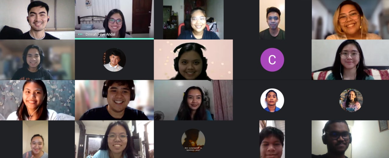
Last 20 February, I hosted an OpenStreetMap workshop and Mapathon with the local YouthMappers chapters in the Philippines. It was attended by the members and volunteers from UP Resilience Institute Youth Mappers, FEU - Alabang ACM Chapter, and JPCS - National University. Together, we mapped San Ignacio, Tarlac. This was a great avenue for the students to meet and get together and help the local government of San Ignacio and support MapBeks’ initiative #UNMAPPED2021

Taken 20 February, PH YouthMappers unite to map San Ignacia, Tarlac

From this activity, we were able to add and validate a total of 2,146 buildings. We are hoping to add more and validate more data in the coming months!

I am also happy to share with you that University of Makati - Computer Society is the 5th local YouthMappers chapter in the Philippines! I am aiming to recruit more organizations to join the OSM community and YouthMappers network from Visayas and Mindanao islands in PH.

See full entry

Mapathona Maranhão

Sábado dia 06 de Março de 2021, Entre 00:00h e 23:59h, (UTC-3), horário de Brasília.

A UmbraOSM ( União dos Mapeadores Brasileiros do Openstreetmap) lança um desafio para os mapeadores do OpenstreetMap no site Maproulette e tem como objetivo corrigir Nomes de Ruas e Avenidas no Estado do Maranhão.

O desafio terá os exemplos de como corrigir os Nomes de Ruas e Avenidas e tem a camada de Nomes de Rua para ser inserida no Editor ID na opção Customizada do Editor ID, e só inserir a url ,

Inserindo a Camada Customizada no ID.

https://api.maptiler.com/maps/b2037b15-5614-4fed-9608-9830b8dc574a/256/{zoom}/{x}/{y}.png?key=YmPoUxbTlEHlrASzv56Z

Inserindo a Camada Customizada do Editor ID, Vai aparecer os nomes de Ruas e Avenidas na Cidade onde está sendo Mapeada. contamos com a participação de todos os mapeadores nesse importante desafio.
Cidades a Serem Mapeadas no Estado do Maranhão.

Nomes de Rua na Cidade de Urbano santos-MA. https://maproulette.org/browse/challenges/17039

Inserir Nomes de Rua na Cidade de Pedreiras-MA. https://maproulette.org/browse/challenges/17040

Nomes de Rua na Cidade de Trizidela do Vale-MA https://maproulette.org/browse/challenges/17041

Inserir Nomes de Rua na Cidade de Grajaú-MA. https://maproulette.org/browse/challenges/17042

Mapeamento de Estradas e Edificios. https://tarefas.mapeia.space/?area=6876

Vamos Mapear no dia 06 de Março no #OpenDataDay

Desafio UMBRAOSM – Inclusão de Nomes de Ruas e Avenidas no Estado do Maranhão. Brazil.

Raphael de Assis

Mapeador Brasileiro.

UMBRAOSM - http://www.umbraosm.com.br

==================================================

Mapathona Maranhão

Saturday, March 6, 2021, Between 00: 00h and 23: 59h, (UTC-3), Brasília time.

UmbraOSM (Union of Openstreetmap Brazilian Mappers) launches a challenge for OpenstreetMap mappers on the Maproulette website and aims to correct names of streets and avenues in the state of Maranhão.

See full entry

Posted by Cascafico on 3 March 2021 in Italian (Italiano). Last updated on 14 April 2021.

Intro

I bumped into an interesting overpass query by OSM mappers Musuruane and Albani which underline missing townhalls. How could I use this stuff? Coincidence (and considering that the italian opendata scenario is not particulary exciting) I was surprised to find the national Public Administration addresses dataset released in CC0 :-)

Preparing a manual import

Required:
* Public Administration (PA) offices dataset
* Openrefine tool

  • Create Openrefine project from PA offices dataset. Filter as needed (ie: titolo_resp=”Sindaco” and Regione=Abruzzo)

  • Generate Abruzzo municipalities without townhall with overpass-turbo query;
  • find the link of “Exporting raw data directly from Overpass API”;
  • copy&paste link in Openrefine Create project Web Addresses (URLs);
  • apply cross table funtions as needed (ie: cell.cross(“Indice PA”, “Comune”)[0].cells[“Cap”].value
  • Openrefine custom tabular export the file somewhere online;
  • feed above file to umap remote data with useful tags displyed in popup (layer interaction)

Umap

Here you can find the resulting umap that is being used for add and detail missing municipality townhalls.
Blue layers are from PA (input) dataset. Red layers are on-the-fly OSM queries with missing townhalls.
You can clone it and expolre layers and its remote data used.

Importing

  • In umap select useful layers and zoom in to display markers;
  • find a missing townhall (red ball marker)
  • click matching blue marker (candidate townhall) and copy tags;
  • activate iD editor and paste tags accordingly;
  • toggle blue layer to spot others and repeat.

Notes

Blue marker alone means townhall already in OSM, red marker alone, means no PA data available.

Remember to allow OSM and Overpass-turbo servers to update red layers (generally it takes less than a minute).

Use proprietary imagery just a generic guidance.

Para mapear elementos rurales se pueden verificar datos a través de fuentes oficiales en portales digitales. Mis referencias en el mapa no incluyen sitios web porque estas suelen cambiar de dirección en cuanto cambia la administración del gobierno.

Mencionaré una lista de algunas fuentes que utilizo para temas rurales y naturales con sus direcciones actuales al momento de la escritura de este post:

  • INEGI Mapa Digital de México: portal interactivo que contiene capas de muy diversos temas que pueden solaparse en fondos tanto de INEGI, OpenStreetMap, Satélite de Google, entre otros. http://gaia.inegi.org.mx/mdm6/

  • INEGI Uso de Suelo: Contiene cartas impresas de información de vegetación y sus clasificaciones en diferentes escalas. https://www.inegi.org.mx/temas/usosuelo/

  • INEGI Topográficas. Contiene cartas impresas de elementos en el paisaje (nombres de localidades, granjas, nombres de lugares no poblados, picos sierras, valles, ríos, etc) en diferentes escalas. https://www.inegi.org.mx/temas/topografia/

  • Red Nacional de Caminos (oficial): contiene un mapa interactivo de diseño muy burdo pero muy útil que muestra información detallada de cada camino. http://189.254.204.50:83/

  • CONABIO Sistema Nacional de información sobre Geodiversidad: Contiene capas con muy variados temas de información de biodiversidad, reservas ecológicas, uso de suelo, estudios muy específicos o generales. Agrupados en categorías y con enlaces a fundamentos, metodología y vigencia de la información. Es interactivo y se puede solapar con fondos de OpenStreetMap, Esri, y Mapbox. http://www.conabio.gob.mx/informacion/gis/

  • Geoportal CONABIO Contiene la misma información del portal anteriormente mencionado, pero se puede solapar en mapas de Google, tanto satélite como relieve. http://geoportal.conabio.gob.mx/

Posted by Rabin Ojha on 2 March 2021 in English. Last updated on 14 September 2022.

In 2020, I made at least one edit a day for 332 days. You can see the screenshot of my HDYC profile on March 2, 2021. During the year, I mostly mapped buildings, roads, and landuse around Nepal and Afghanistan.

I have an ambitious goal of making at least one edit per day in 2021. Let’s see how far can I go!!

Location: Panipokhari, Kathmandu-03, Kathmandu Metropolitan City, Kathmandu, Bagamati Province, 10378, Nepal
Posted by c tito young on 2 March 2021 in English. Last updated on 17 April 2021.

Shown are two straight geoglyph lines in perpendicular form a geoglyph 80m (oriented east / west) and 50m (oriented north / south) a fractions of a degree greater than a perfect right angle. Rarely seen are geoglyph samples of Nazca lines display anything resembling right angles. These two line proves to be obtuse in geometry measuring 90.9+/- degrees. Within the perpendicular area of those two lines are two other lines that resemble the letter V. They are significantly smaller in size being about 20m max all drawn on fairly flat land.

14°39′23″S, 75°18′3″W -14.6563906, -75.3007687 Changuillo, Province of Nasca, Ica, Peru

Location: Cabildo, Changuillo, Province of Nasca, Ica, Peru

Bing Aerial Refresh

In fall of last year the Bing aerial imagery of Springfield, IL was refreshed, finally fixing a huge north/south tear down the middle of the city that had made adding accurate geometry within it nearly impossible. The new imagery is from that summer and is absolutely fantastic. It even covers outlying towns like Chatham, Rochester, Riverton, and Spaulding. I’ve been hard at work fixing alignment problems and adding new roads and buildings that I had heard about but hadn’t had a chance to survey. This and the pandemic are largely responsible for taking me over 270 mapping days last year, a personal best.

Accessibility

I’m not really hardcore about adding individual parking spaces, but when I saw the iD preset for accessible parking spaces I knew it was something I could and should add whenever possible. As a result, over 5,400 accessible parking spaces in the Springfield metro area are now mapped, accounting for more than half of those mapped in the United States as of this post.

I’ve been pretty good about denoting accessible crosswalks, even those with tactile pavement, but I definitely need to do another pass through some neighborhoods now that the imagery has been updated. The city does have a rather robust sidewalk/crosswalk improvement program and there are probably dozens of walkways that have been upgraded since I last mapped them all. Additionally, I’d like to be more fastidious about adding entrances to buildings/businesses so that distances can be determined between them and their associated accessible parking spaces.

Roadway Detail

For the longest time I was hesitant to delve into adding lane information for segments of roads, because… well, I just didn’t like the idea of splitting roads into a bunch of different segments. I thought it would make it more tedious to update speed limits and things like that going forward.

See full entry

Posted by c tito young on 2 March 2021 in English. Last updated on 11 April 2021.

In an area of about 600m long and 400m wide, hairpin geoglyphs mark the landscape. Multiple lines possibly added up over 10,000m are characterized by successions of hairpin turns on the flat valley floor. The lines appear in a straight north / east to south / west direction and result in distances approximately 3m from one another and terminates into a 180 hairpin turn curves repeating itself multiple times. Erosion has erased some of the hairpins and possibly details.
To the north of the site, is what appears as a large 110m x 100m viewing / gathering area atop a hill. The entire site except for the viewing areas appear rather flat with a gentle slope.

14°35′20″S, 75°18′12″W -14.5889989, -75.3034115 Santa Cruz, Province of Palpa, Ica, Peru

Location: Media Luna, Santa Cruz, Province of Palpa, Ica, Peru
Posted by c tito young on 2 March 2021 in English. Last updated on 15 April 2021.

A geoglyph of a 100m figure with an elongated head (25m x 50m) wearing a hat and scarf, oriented north to south on a change of elevation of 10m. This geoglyph shows this front facing elongated head. The large scarf and short brim hat worn by the figure is positioned in a way that suggests its resting on a rock facing the southwest direction.

14°53′20″S, 74°53′49″W -14.8889740, -74.8969612 Vista Alegre, Province of Nasca, Ica, Peru

Location: Vista Alegre, Province of Nasca, Ica, Peru