 OpenStreetMap
.jpeg)
Sumatra is currently underwater. I haven’t been here in a while and I don’t know where the opening is.
Users' Diaries
Recent diary entries

Enfin une 1ère contribution. Pour le coup, j’ai essayé de reporter le tracé du chemin du Bois des Pesses. Je ne doute pas qu’il y aura par la suite des modifs à apporter mais c’est un début et je trouve (tardivement) formidable de pouvoir ainsi apporter une pierre à un édifice aussi génial. Ne connaissant pas trop le principe du journal, merci de me dire svp si mon message n’a pas sa place ici

I’ve always being irked by OSM giving the wrong Postcode for some roads near my home area. Some roads give postcode 42000 but for some nearby it gives 41200.
Reading what Ionvia says enlightens …
- Nominatim has to go a different way to determine the most likely postcode for a place where no addr:postcode tag exists.
- First - search address from specific up to country, use postcode for first found addr:postcode tag.
- Second - area search, the closest postcode centroid is used
It turns out the roads in my area are almost exactly in between 42000 centroid and 41200 centroid as overlayed screenshot below shows …

Looks like long term solution to wrong postcode for my local area would be to tag Bandar Bukit Tinggi 2 with addr:postcode=41200 …
Montreal

Since October, I started adding municipal units and communities (admin_level 8 and 9 respectively) in Greece, wherever it’s easy/sorta easy to do, because half of Greece lacks boundaries for anything lower than municipalities (admin_level 7).
I add them whenever I’m in the mood of dealing with it, just like today, when I tried to find an “easy” in boundaries perspective area to do so. The metropolitan area of Thessaloniki had most of those boundaries ready, and it already had few municipal units (from those which exist there) but with partially wrong info.
I even found two wrongfully drawn boundaries of two municipal units. Couldn’t find if this occurred since the first version of those boundaries or later, but for some reason both of them looked like the boundaries of the respected residential area rather than the administrative one. But I confirmed with geodata.gov.gr (Greek open geospatial data) and other online maps the proper positions of the boundaries and re-draw wherever needed. These two municipal units where Agios Pavlos of Neapoli-Sykies municipality and Triandia of Thessaloniki municipality.
In general, I added the missing municipal units and communities (or communes) of the municipalities: Ampelokipi - Menemeni, Kordelio - Evosmos, Neapoli-Sykies, Thessaloniki, Pavlos Melas and Pylaia - Chortiatis.
Reason for this post? Not any specific, I just liked that I added those missing in the metropolitan area of Thessaloniki, unlike the metropolitan area of Athens and Piraeus which is mostly complete in such boundaries.
Now the area in overpass-turbo looks more complete by admin-level :P
I’ve taken on the task of mapping allotments throughout Great Britain. I think there is a similarity between allotment users and OSM contributors, even if it’s not immediately obvious. Allotments are quite often community owned or some form of cooperative, but even the commercially owned ones have roots back to the Diggers when private land was reclaimed for public good and food production.
I’ve been thinking more about the overlap between Open Data, Free Software and the common land lately. I’m starting to think it’s all the same thing, a rebellion against private property and ownership. It’s about common good, and helping your neighbour. It’s about the future and your legacy. It’s about leaving the world slightly better than you found it.
I’ve created a MapRoulette Challange based on a subset of OS Open Greenspace. For some I can add little more than a rectangle with landuse=allotments, some I can see a few more details like paths and tracks. 1 2 3
For those who are not familiar with indoor=, I recommend consulting the introductory post. In short, it’s a map that displays the interior spaces of OpenStreetmap with a level selector.
A new version is available with improvements such as the heat map and a new styling.
Heat map
To rapidly visualize locations that are indoor mapped, indoor= can now display a low zoom heat map.

It will therefore be much easier to locate indoor mapped locations. Here are a few places that I discovered:
- Chicago Airport, IL, USA
- Singapore Airport, Singapor
- House of Commons, London, UK
- The White House, Washington D.C., USA
This work was carried out by Adrien Pavie.
New styling
In order to clearly distinguish the different interior spaces, the styling has been largely revised.
Posted by NunoMASAzevedo on 24 November 2020 in Portuguese (Português).
Last updated on 28 November 2020.

Hoje participei no primeiro Mapathon online dos Médicos Sem Fronteiras - Portugal. Foi o primeiro evento deste género realizado em Portugal pelos Médicos Sem Fronteiras e durante duas horas estivemos a mapear no ID e no JOSM uma área remota da Nigéria. Foi utilizada a plataforma Zoom para a videoconferência. Após um explicação inicial por João Antunes, dos Médicos Sem Fronteiras - Portugal, que explicou a extrema dificuldade que as equipas humanitárias enfrentam no terreno devido à falta de informação geográfica e cartográfica de algumas áreas do mundo, passamos a uma apresentação mais prática sobre as tarefas de mapeamento, sendo essa informação prestada por Renata Castro e Diego Paiva, da equipa Médicos Sem Fronteiras - Brasil. Foi utilizado o Tasking Manager da HOT (https://tasks.hotosm.org/) e escolhemos para mapeamento a task 9422 (https://tasks.hotosm.org/projects/9422), por ser uma das mais prioritárias no momento.

Családi Panzió Balatonkeresztúr Iskola útca 25/D

شبكة تلفزيونية

I m here

Ternyata sudah saya petakan setahun yang lalu …
Dumai City
> addr:province	Riau
> admin_level	5
> boundary	administrative
> name	Kota Dumai
> name:en	Dumai City
> type	boundary
dan subarea nya (kecamatan) juga sudah
Relation Kecamatan Sungai Sembilan (10359427) as subarea Relation Kecamatan Dumai Barat (10359428) as subarea Relation Kecamatan Dumai Timur (10359429) as subarea Relation Kecamatan Medang Kampai (10359432) as subarea Relation Kecamatan Bukit Kapur (10359435) as subarea
tapi, belum masuk diari ini …
Indragiri Hilir Regency (7830704)
Relation Kecamatan Kemuning (10359489) as subarea
Relation Kecamatan Keritang (10359770) as subarea
Relation Kecamatan Kempas (10359795) as subarea
Relation Kecamatan Tempuling (10359802) as subarea
Relation Kecamatan Gaung (10359835) as subarea
Relation Kecamatan Enok (10359946) as subarea
Relation Kecamatan Tembilahan Hulu (10359972) as subarea
Relation Kecamatan Batang Tuaka (10360140) as subarea
Relation Kecamatan Gaung Anak Serka (10360231) as subarea
Relation Kecamatan Pulau Burung (10360420) as subarea
Relation Kecamatan Teluk Belengkong (10360516) as subarea
Relation Kecamatan Pelangiran (10360538) as subarea
Relation Kecamatan Kateman (10360564) as subarea
Relation Kecamatan Tanah Merah (10360616) as subarea
Relation Kecamatan Kuala Indragiri (10360682) as subarea
Relation Kecamatan Tembilahan (10360096) as subarea
Relation Kecamatan Congcong (10360792) as subarea
Relation Kecamatan Sungai Batang (10360822) as subarea
Kampar
Relation Kecamatan Tapung Hulu (7834727) as subarea
Relation Kecamatan Tapung Hilir (7834735) as subarea
Kampar dan Kota Pekanbaru … wew … messi
Pekanbaru (Kota)
ini berantakan banget … mau nangis rasanya … sepertinya saya backup lalu saya fix saja ya .. mohon izin buat yang mencoba membuatnya dulu, tetapi tidak menggunakan relasi … hanya main polygon saja …

Yesterday I had the pleasure of participating in the Local Chapters and Communities Congress, where we celebrated and Joost Schouppe ceremoniously countersigned new local chapter agreements. At the beginning of 2020, the OSMF had 8 local chapters, all in Europe. Today we have 14 local chapters, on five continents: Europe, South America, North America, Asia, and as of the last OSMF Board meeting, Africa. Joost as Board secretary has done the lion’s share of the work in processing six applications so far this year and deserves kudos for his efforts.
Among other things we discussed what the role of local chapters should be in OSM governance. Nothing has been set in stone, and indeed the conversation in a breakout session on the topic was free-flowing. Rob Nickerson of OSM UK suggested that the local chapters might be asked to help decide on admission of new corporate members, and also to help the Board prioritize paid work (e.g., to help decide when volunteer contributions of labor are not keeping up and OSM needs to pay somebody to fix broken software). I think these are ideas worth considering.
The conversation yielded a suggestion that the OSMF Board assist local chapters and communities with fundraising and perhaps help coordinate fundraising.
I have my own thoughts on this–I don’t think the Board itself should be a source of funds for local chapters and communities, because that could lead to dependency relationships that would undermine the decentralized nature of the OSM community, one of its strengths. That said, there is perhaps a role for the Board in cooperating with the LCCWG to assist local chapters in raising their own funds and to ensure that we don’t interfere with each other in the process.
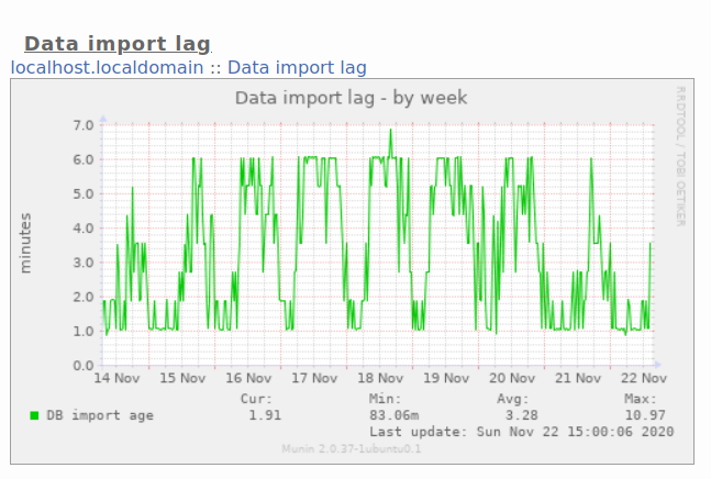
I’ve added a new page to the switch2osm guide: “Updating your database as people edit OpenStreetMap”.
It’s a bit overdue (it’s based on something I wrote about 4 years ago, and the software it uses predates that by a long way), but I think it is worth making available on the main site.
I’ve tested it both on Debian 11 and on Ubuntu 20.04 LTS, and have tried to make clear what you need to do differently in each case.
For completeness see also Ircama’s excellent guide which is well worth reading as it actually provides a lot more detail about the process, and also suggests how “osmium” may be used instead of “osmosis” to process OSM files.
Боряна 41
Setelah vakum hampir selama 1 tahun, baru saya sadari ternyata Kabupaten Siak, belum saya petakan batas kecamatannya ( admin_level 6 ). Padahal, saya punya bocoran dari pihak BPS hingga admin_level 10.
InsyaAllah saya coba update terus di diary ini progress saya…
BPS:id_provinsi BPS:id_kabkot BPS:id_kec BPS:id nama_kecamatan 14 05 012 1405012 KANDIS 14 05 020 1405020 SIAK 14 05 030 1405030 SUNGAI APIT 14 05 021 1405021 KERINCI KANAN 14 05 031 1405031 BUNGA RAYA 14 05 033 1405033 PUSAKO 14 05 026 1405026 MEMPURA 14 05 022 1405022 TUALANG 14 05 010 1405010 MINAS 14 05 023 1405023 DAYUN 14 05 011 1405011 SUNGAI MANDAU 14 05 032 1405032 SABAK AUH 14 05 025 1405025 KOTO GASIB 14 05 024 1405024 LUBUK DALAM

Pumps cartography is useful in many ways in OSM and currently practiced around water wells. It’s possible to use the pump=* key to state for a pump availability on a given well only. The key actually refers to the pump drivers, a motor or a lever to manually move the pump.
It’s an important information as to know if you’ll be able to get water with or without physical effort.
For instance, it’s not yet possible to make a significant distinction between pumps running on electricity or gasoline engines among other possibilities.
Pumps are obvious but complex devices. Wikipedia already provides a comprehensive classification with up to 15 different kinds.
Each design have different capabilities and can be driven by numerous different drivers.
OSM could get benefits from encouraging mappers to complete such detailed information with appropriate tags if they are knowledgeable to do so.
It’s clear that such information will help crisis management or emergency rescue teams to restore water supply if and only if they have appropriate generators or engines. Coming around a gasoline powered pump with a solar panel won’t help.
People themselves could be interested in case they have to bring their own material to get water.
Posted by davidfaure_bot on 21 November 2020 in French (Français).
It’s starting to work… osm.wiki/Import/FrenchPostOfficeOpeningHours generated osm.org/changeset/94525770, first fully automated upload.
%20by%20Vince%20Emond.jpg)
OSM if full of different characters and identities, so I want to know…
- Who are you?
- What is OSM to you?
- What are you here to do?