 OpenStreetMap

This is a place
Users' Diaries
Recent diary entries

In April, I asked OSM community members to help us out with a better name for the HOT unSummit (which too often was confused with something to do with the United Nations!)
We had more than 100 name suggestions, so thanks a million to everyone who put some thought into it!
The new name for the programme will be…
HOT OpenSummit
So I want to send a big thank you to Courtney Williamson for the suggestion - a token of our appreciation will be on the way soon!
We are working out how to make the actual programme better and will be re-launching it in the coming months. If you know of events (mappy and other) where you think there might be appetite for incorporating open mapping and OpenStreetMap for humanitarian and development purposes, please feel free to reach out (and thanks to those who have already done so!)

Over the weekend we had a great time micro-mapping Hyde Park in Northbridge, and made some new friends! Some attendees of the recent Geogeeks/QGIS Users’ Group presentation evening joined our mapping adventures for the first time.
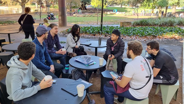

eL DIA DE HOY EDITE EL LUGAR DE LAS QUESABIRRIAS EN LA LOCALIDAD DE TUXTLA, CHICO, CHIAPAS, MÉXICO
Posted by juminet on 14 May 2023 in French (Français).

Suite à l’import des batiments et adresses en Belgique, j’avais comparé, dans un article précédent, le nombre d’adresses par communes entre OSM et la source de référence en Wallonie, le PICC, en septembre 2022.
Quelques mois plus tard, une mise à jour des principales figures.
En Wallonie, 1,097,519 adresses sont répertoriés dans OSM, contre 1,634,840 dans ICAR (67.1%). On était à 64.4 % en septembre 2022.
Voici une carte choroplète, montrant, pour chaque commune, le degré de complétion des adresses dans OSM par rapport à ICAR. Les limites de provinces sont soulignées par un trait plus gras.

Et une carte de l’évolution des adresses depuis septembre 2022.

It was really an amazing and excitting experince today at Uniport Mapathon Center, Uniport Mall Abuja Campus, University of Port Harcourt. As i and team contributted to the ENUGU STATE -MAP NIGERIA MAPATHON CAMPAIGN -LET’S MAP NSUKKA LGA FOR SDGS AND SOCIAL GOOD project.
As the new Team Lead of the center, i was so excitted and greatly encouraged by the enthusiasm and Inpiring interest shown by the team members present, who were majorly newly recruited volunteers. their passion for volunteering and Geospatial data triggered a feeling in my heart.
.
San Jose Diary
According https://www.thedrive.com/the-war-zone/25728/chinas-new-york-city-sized-earthquake-warning-system-sounds-more-like-way-to-talk-to-subs there is a huge secret ELF-antenna in China called WEM. The exact location is so far unknown, but by the fact, that it looks like an overhead powerline which forms according https://www.newsweek.com/china-giant-antenna-navy-submarine-new-york-city-secret-location-1276332 a cross shape, so it will be able to be mapped by satellite pictures.
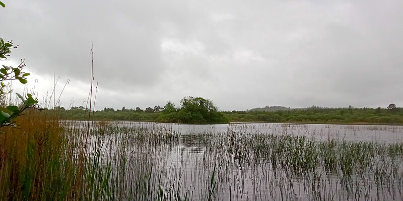
Last weekend, I had the opportunity to accompany a friend to an archaeological survey on Ballygawley Lough in Co. Sligo. He’s a metal detectorists who detects on archaeological sites - with a license. Metal detecting is highly restricted in Ireland. There were three divers - one of them had worked on Banshees of Inisheer and Vikings! (At least two of them do diving for movies regularly.) One of the divers doubled as metal detectorist as well, but he also had a sonar device on his canoe. When I had a peak at the screen, I discovered that it was using OpenStreetMap! With attribution! It’s the Lowrance Elite ti2, if anyone is interested. I can’t find any mention of OSM on their website.
There are two crannógs on the lake which was part of why I went with them. I had never seen one in real life, mapped a lot and discovered a few, but never actually seen one. I was offered the spare canoe, but I chickened out when it came to actually paddling over there.

Erweitert: osm.org/user/cyton/diary/401173
Der Ablauf ist sehr ähnlich geblieben, ich schildere aber nochmal alles, den vorherigen Eintrag muss man also nicht gelesen haben.
Interessante Layer
Straßenbäume, Anlagenbäume
Sind zwei separate Datensätze, sind aber identisch aufgebaut. Leider fehlen teils Bäume, teils an der falschen Stelle, teils um eine Nummer versetzt, oder kombinierte Fehler. Teils fehlen neue Pflanzungen, oder gefällte sind noch zu sehen. Leider haben die neuen kleinen Bäumchen scheinbar nie eine Nummer, das dauert wohl einfach immer.
Straßenbefahrung 2014
Ich habe mich auf die Bäume und anderes Straßenmobiliar konzentriert. Es gibt im “Straßenbefahrung 2014” Layer mehrere interessante WMF, aus denen ich Daten ziehen kann, um diese vor Ort zu prüfen.
département de l’Aube

Tak tahu nak tulis apa.
Posted by rupertmaesglas on 9 May 2023 in English.

I’ve been invited to go to Jordan to consult on a new OSM project involving Jordan’s Royal Scientific Society, the local Youthmappers chapter in Amman, and the Princess Sumaya University, coordinated/commissioned by the UNESCO research chair, Science Communicator Iain Stewart.
The location is Asraq (think Lawrence of Arabia, and ancient Petra; the area sometimes called the ‘Cradle of Civilisation’. Over the centuries, the area has been settled and travelled by many people - from silk-road traders to Moses’s biblical journey, incoming 11th century Druze, to modern syrian refugees.
The wetlands have different cultural significance and inspire/necessitate different cultural practices for many ethnicities, and the now desert has gone through climatic and human-influenced changes which exemplify one of Jordan - and the planet’s - biggest challenges: water supply.
As with so many Disaster Risk environemnts, the problem is compound in nature: climate change has turned once fertile wetlands into desert, whilst Jordan’s excellent record of refugee hosting has meant massive population growth. Result: decreased supply and increased demand for water supply.
I’m looking forward to working with diverse local voices to understand how OpenStreetMap might present some solutions, and am expecting a fascinating mix attitude, behaviour and shared-interest around Water Resource mapping and with Community Asset mapping.
Posted by AngocA on 9 May 2023 in Spanish (Español).

He estado haciendo una lista de aplicaciones y páginas web con propósito específico en diferentes entradas de mi diario, la cual muestro a continuación. Hoy quiero presentar una lista de aplicaciones móviles y páginas web que permiten subir fotos, que pueden ser usadas para mejorar el mapa.
Otras entradas similares de mi diario:
Muchas de las opciones aquí listadas se pueden usar para asociar una foto con un elemento del mapa con la etiqueta Key:image
Listado de servicios asociados a fotos:
Mexico

I just realized that a water well is sometimes privat and sometimes not even visible to people. I feel so sorry that I commited removal requests of some water wells in Portugal because I could not find drinking water there…. from now on I only search for “drinking water” or “spring” on osm.

Sharing from my post on https://blog.georeactor.com
Belgium’s Baarle-Hertog and the Dutch Baarle-Nassau overlap in one town riddled with border crossings and enclaves. Let’s take a look at OpenStreetMap:
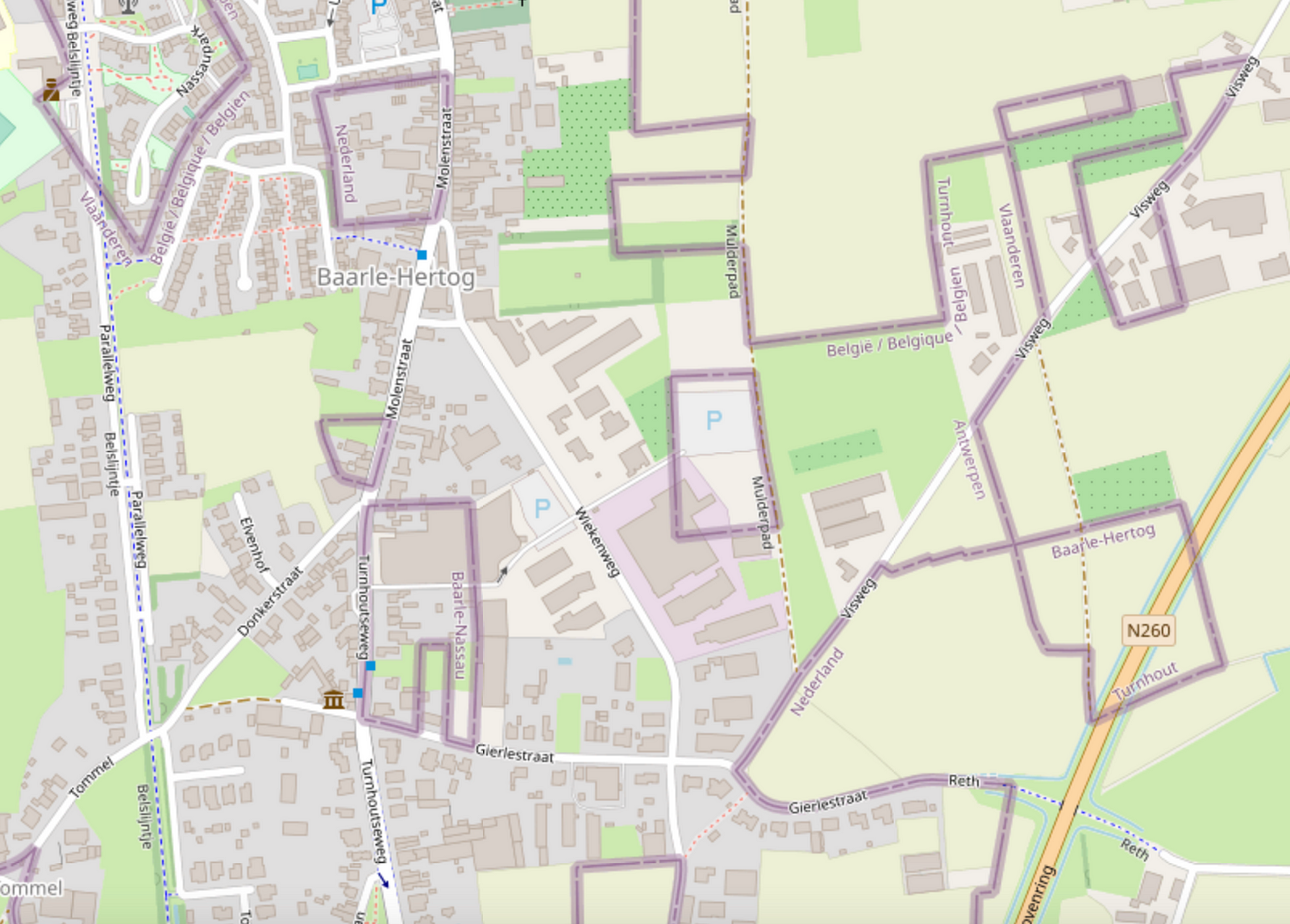
Wow, it looks complicated!
Legend depicts Baarle as a Kafkaesque theme park where buildings swap countries and laws are fluid. Sample anecdote:
There was a time when according to Dutch laws restaurants had to close earlier. For some restaurants on the border it meant that the clients simply had to change their tables to the Belgian side.
I likely learned about this town from the Google Sightseeing Blog a long time ago. As a maps nerd, I knew that I had to see it for myself one day.
Getting there
In April 2023, I took a train from Brussels to Antwerp, checked out the award-winning Port Authority Building, then another train onward to Turnhout, then a bus to Baarle-Hertog.
Posted by Giovanni Monni on 6 May 2023 in Italian (Italiano).
Last updated on 23 January 2025.

L’antico toponimo chiamato: “Sa Pedra de Vanda”nelle vicinanze di Arcu Procili de Monte Melas, nei pressi delle localita’ “Sa Scandula” “Baccu Eranu” “Baccu Eraneddu” “Monti Arbu” “Pedra Bianca” Baccu S’Acua Callenti” ecc. ecc. NB il suo vero nome è: “Sa Pedra de Vanda”. Attualmente viene conosciuta con il nome ( La Sfinge - La Mitra - o Su Cappeddu de su Papa o de Monzegniori). Ma tra noi che conosciamo questi luoghi da piu’ 60 anni continuiamo a chiamarla con l’antico toponimo “ SA PEDRA DE VANDA”. C’è da dire che anche noi ogni tanto usiamo questi toponimi per evitare di fare sbagliare l’itinerario alle nuove generazioni, e visitatori che frequentano questi luoghi. Dimostrazione pratica come la toponomastica è in continua evoluzione.

amenity=hitching_post
Short and easy, 214 uses.
tourism=trail_riding_rest
Well, it may contain one or more hitching posts. 1 use. That’ll be the person who wrote it up for the wiki and linked it about for good visibility. Ooh, and it’s rendered on the trail riding map. Perhaps it was made because other resting places are possible, so this becomes a unifying tag to look for if you are looking for a place to rest your horse? Much like a tourism=trail_riding_station seems to be a unifying tag to put on all the different things you can overnight your horse in? (1339 uses for that one, it’s doing a better job. Oh, except that I looked at how it was actually being used and some of it was for staging locations where overnighting would be illegal. So not all correct uses. And I can definitely see where the confusion comes from.) Although if these things are meant to be a unifying device, used in addition to the more specific tags, it probably ought to say that on the wiki page. Is that even how tags are meant to be used? I certainly see the utility.
amenity=animal_hitch
animal_hitch=ring/rail/post
horse=yes
er…
mule=yes
donkey=yes
llama=yes
Perhaps you should just be assuming your zebra/donkey cross or whatever other exotic bit of stock you’ve got =yes? Except if you’re in big horn sheep country, it very well might be that goat=no.
104 uses for all animals, but it isn’t popular enough to get combination details. For the type tag, there are 83 rings and 7 rails, but no posts at all. Nope, the people don’t want it for hitching posts. Well, except for the sorts who get particular about the post being horizontal between two other posts, AKA a rail. Or particular about there being a ring on the post, but the example dog_hitch (not kidding) is also a ring.
Oh, there’s also 2 uses of amenity=horse_hitch.
บ้านเลขที่99 หมู่มี่6 เทศบาลตำบลโพนทอง อำเภอเชียงยืน จังหวัดมหาสารคาม 44160