Users' Diaries

Recent diary entries

Local Community Building at OSM

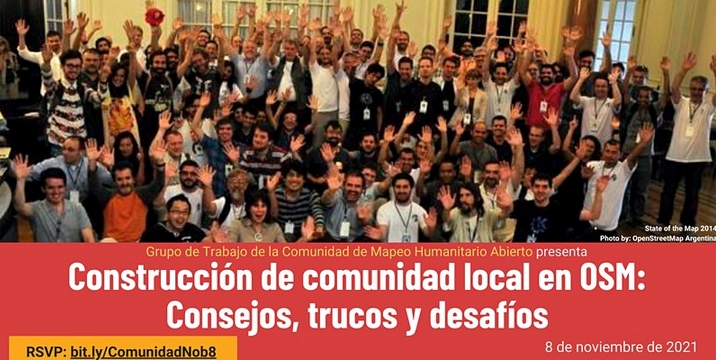
Yesterday, November 8, the event Local Community Building at OSM: Tips, Tricks and Challenges was held, organized by the Hotosm Community Working Group for Spanish-speaking OpenStreetMap communities.

As in any event worth its salt, there is a Document -in Spanish- with the notes on the presentations, conversations and chats, in addition to the video, of course (the video is -again- in Spanish).

I used the aforementioned document to make a live tweeting of the event from the @esopenstreetmap Twitter account, and then it occurred to me to make a thematic summary of the event based on the same notes, in order to facilitate the generation of future actions by the leaders of the communities. That summary is what I present in this post.

Topic Brief: Building Local Community in OSM

See full entry

Location: Unidad Vecinal del Rimac, Rímac, Lima, Province of Lima, Lima Metropolitan Area, Lima, 15025, Peru

Construcción de comunidad local en OSM

El día de ayer, 8 de noviembre, se llevó a cabo el evento Construcción de comunidad local en OSM: Consejos, trucos y desafíos, organizado por el Community Working Group de Hotosm para las comunidades hispanohablantes de OpenStreetMap.

Como en todo evento que se precie quedó un Documento con las notas sobre las presentaciones, las conversaciones y los chats, además del video por supuesto.

Usé el mencionado documento para hacer un live tweeting del evento desde la cuenta @esopenstreetmap, y luego se me ocurrió hacer un resumen temático del evento tomando como base las mismas notas, con el fin de facilitar la generación de futuras acciones por parte de los líderes de las comunidades. Ese resumen es lo que presento en esta publicación.

Resumen temático: Construcción de comunidad local en OSM

See full entry

Location: Rimac, Rímac, Lima, Lima Metropolitana, Lima, 15025, Perú
Posted by Nicxon Piaso on 8 November 2021 in English.

It’s great to see Users doing OSM editing for Humanitarian use. I live in a Highlands area prone to Frost, and droughts for longer period causing havoc to communities.

I hope to see Relief agencies using our OSM Maps for providing assistance during time odf disaster. Thankyou you OSM, if it hadn’t been your key role in providing open-sourced maps, I don’t think Government agencies will be willing to provide maps to its citizens during times of great need.

Government agencies and Departments don’t provide maps readily and would often come at cost which some can not really access it readily for their use.

I really appreciate the effort by the Developers of OSM and the selfless devotion in creating new features for all Mappers around the world to work on this vital platform for common good for humanity.

Thanks all and happy mapping form Papua New Guinea.

Location: Rungutenges, Kandep District, Enga, Highlands Region, 657, Papua New Guinea
Posted by O J on 6 November 2021 in English.

TrackExplorer

TrackExplorer is a solution based on the idea of RaceDirector. The difference is that with TrackExplorer you can use any GPX file - with or without timestamps. You can choose different activities and no matter where on earth you have recorded GPX data, the data can be displayed in an 3D environment.

TrackExplorer Quick Overview

Via the website TrackExplorer Upload you can easily upload any GPX file. If your GPX file does not have a timestamp, you can decide during the upload the speed your data should be displayed in TrackExplorer. This is necessary if you create the GPX file with a route planner – in most cases there are no timestamps available. TrackExplorer offers different activity categories. Depending on your selection, your uploaded GPX data will be displayed with your chosen activity.

TrackExplorer Activities

Bild

See full entry

Location: Katastralgemeinde Innere Stadt, Innere Stadt, Vienna, 1010, Austria

Задача

Внести переимование по сообщению Киевской Городской Администрации:

вулицю Цулукідзе на вулицю Наталі Забіли (видатної письменниці і поетеси);

Процесс

1. Проверяем внесено ли уже переименование

Нашлась только библиотека, значит ето наша задача.

Улицы не найдено

2. Находим улицу по старому названию

See full entry

Posted by Komadinovic Vanja on 4 November 2021 in English.

create new app ( osm.org/oauth2/applications/new )
set callback url ( must be https if not 127.0.0.1 )
client id and secret will be presented ( secret only once )

to obtain authorization code from browser go to
https://www.openstreetmap.org/oauth2/authorize?client_id=<Client ID>&response_type=code&redirect_uri=<Callback url encoded>&scope=write_api%20read_prefs%20write_notes

when user authorize access callback will be called like
https://localhost:7077/oauth2/callback?code=<Authorization Code>

exchange Authorization Code for access token, POST
curl -d "" 'https://www.openstreetmap.org/oauth2/token?grant_type=authorization_code&code=<Authorization Code>&client_id=<Client ID>&redirect_uri=<Callback url encoded>&client_secret=<Client Secret>'

access token will be returned as json, use it for API calls
curl -H "Authorization: Bearer <Access token>" 'https://api.openstreetmap.org/api/0.6/user/details'

resources to read:
https://aaronparecki.com/oauth-2-simplified/
osm.wiki/OAuth

Uzoefu wangu katika teknologia ya jeografia umeniwezeha kuchangia majengo mengi katika mji wa ifakara ulipo Morogoro, Tanzania.

watu wengi hawafahamu njia hii rahisi kusaidia jamii zao hususani kwenye jamii maskini ambazo mara nyingi hu athiriwa na majanga kama mafuriko.

openstreetmap ni moja wapo wa jukwaa ambazo humpa mtu uwezo wa kuchangia kwa kuchora ramani za maeneo tofauti kama nyumba na barabara. Kupitia jukwaa hili watu tofauti katika kila fani hutumia taarifa hizi kusaidia jamii hizi.

nitaendelea kutumia OSM kuwezesha faida hizi kwa jamii zetu, wewe je?

Location: -8.151, 36.687

Pesos Pesados

Caminho dos Grandes

Devido a relatos frequentes que ouço de motoristas de veículos pesados, tais como caminhões, ônibus (Double Decker / Low Driver), entre outros, sobre a incidência de acidentes ao passarem por pontes baixas, ou por ter um caminho inadequado apontado seja pelo OSRM ou outro qualquer, que desconsideram a altura do veículo. Decidi realizar algumas ajustes em um ponto específico “setando” as alturas das pontes, para tentar evitar tais incidentes.

No exemplo do link acima, caso um Ônibus Double Decker que possui 4,1m altura passar pela via de acesso à Ponte da Casa Verde que possui 4,3m, sobra apenas 20cm (pouco mais que a altura de um celular), medida esta, que se houver alguma ondulação de pista, infelizmente o teto do carro será danificado.

PS: Caso alguém se interessar pela ideia, e quiser ou puder testar, tamo junto!

Location: Imirim, Santana, São Paulo, Região Sudeste, 02467-120, Brasil
Posted by grin on 3 November 2021 in English.

Real Time Kinetics (RTK)

For half a year now I’m walking, biking and generally moving accompanied by an uBlock F9P unit, which is a precision multichannel GPS receiver board with an external antenna and bluetooth connection to my mobile phone. The phone receives correction stream (NTRIP) by mobile net and uploads it to the unit, which in turn uses the correctional data to fix up atmospheric noise in the GPS signal.

The result is a GPS position way more precise than a phone.

There are 3 usual states:

  • RTK - or “Real Time Kinetics”, when there is both satellite and internet data is available, and the base station of the stream is near. It means precision between 50 centimeters up to 5 centimeters! Imagine it like not only it’s visible when I go to the other side of the path but the track even show when I turn around, since my backpack makes a 30 cm circle around. :-)
  • FloatRTK - is when the precision “floats” from a known-good position, which in practice mean 1.5 meters up to about 90 cm (on average 1 m). When I am within 100-300 km of a base station and I’m moving in a forest this is the most usual state.
  • DGPS - when there is no RTK fix (usually due to no mobile network or blocked satellite receiving) the “normal” differential receiving mode is active, which means 3m - 1m precision, closer to 1.5 m on average, thanks to the external antenna and multichannel receiver.

When I am on FloatRTK or RTK it’s amazing: it can get back to the same position everytime, later on the day, or on a different day, which basically mean that the position is exact. I can draw a track with 50 cm precision and try not to draw that much detail on OSM (not to make anyone mad seeing fixes of centimeters along :-)).

See full entry