Posted by Juvair_Hossan on 11 August 2021 in English.
.jpg)
This event was an interaction with local youth contributors of various universities and organizations. Along with a three-day long Mapathon was held in this program.
 OpenStreetMap
This event was an interaction with local youth contributors of various universities and organizations. Along with a three-day long Mapathon was held in this program.
Dom
I have just updated some structures( as-builts) around National Capital District in Port Moresby in PNG. After seeing some street having awkward shapes(partially incomplete), I have deleted these and updated with correct tags. Most of the roads did not have correct tags( as most roads in PNG residential and rural areas have 6.0 m width as approved by Department of Works-PNG). I even updated the road surface based on the type of material the roads are built with( mostly asphalt, gravel and dirt/grass). Most Building do have Heights/Levels and using correct level tags, those Buildings not having the correct heights/Levels have been re-edited with correct tags. When also checking on Power transmission Pylons, the average Height is 30.0m, I have re-edited the pylon height again by setting the correct height. The type of landcover( whether grass, forest, concrete asphalt etc.) has also been updated of some streets that I was rechecking/verifying around National Capital District(NCD).
Thanks to the use of F4map.com, I was able to see the update in 3D after the edits were made 48Hrs later. Please do use correct tags in OSM to improve OSM maps.
Once again, thankyou and happy mapping to you all Mappers.
the person writing this piece of diary is by now a middle aged man, in his 50s, still passionate about all that he does, or he simply won’t do it. for reasons which might be clear to a psychologist, but not to a mathematician like the person in question, he assumes the same passion and intellectual correctness in his colleagues, even in the face of proof to the contrary.
since 1989 he left his home town, never settled for longer than 8 years, now since October 2016 living in Panamá, speaking the language as any native latin speaker, that is with a decent linguistic awareness, and with an accent making him sound a mix of French, Colombian and obviously Southern Italian. but language is not the whole story, and regardless his “permanent resident” status, he doubts how not to feel as an alien here in Panamá.
I’ll now switch to writing in first person.
when it had become clear I would stay here for a longer spell, that was around the end of 2018, I looked for ways to collect people around the common OSM interest, I found the very sleepy Panama forum and I founded a Telegram group, and started monitoring new mappers coming to contribute to the map, inviting them to come to the group, and form a local community.
My company Victory Ebikes is at
3136 W Balboa Blvd, in Newport Beach California and it was a Super cuts
How do I get that changed?
My Homes
mod_tile, consisting of libapache2-mod-tile and renderd, to instruct Mapnik to generate raster tile images and deliver them via a web server has reached version 0.6 through a broad and constructive collaboration among Free and Open Source Software contributors. And the installation packages have recently become part of Debian and Ubuntu.
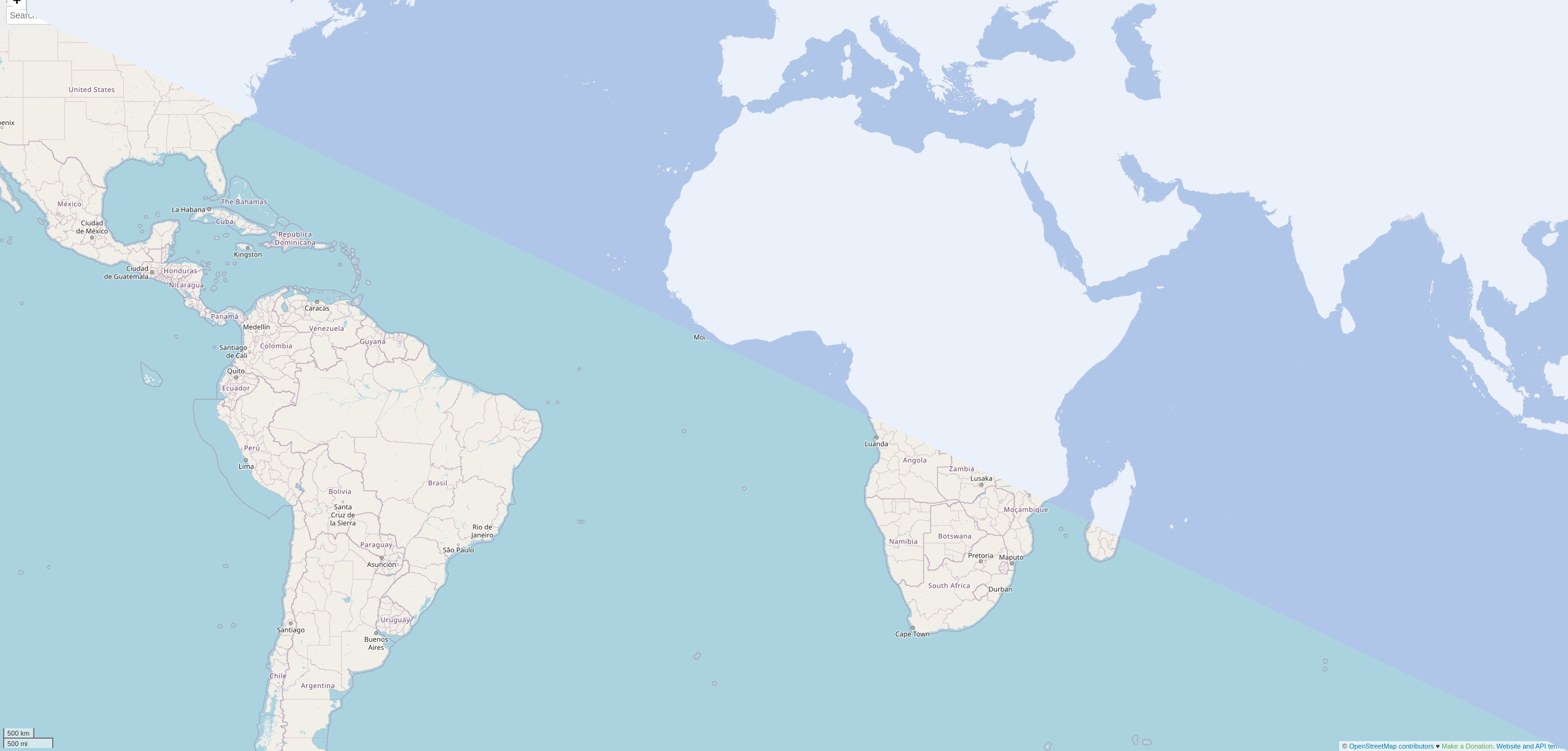
OpenStreetMap.org and many other web map tile servers are using mod_tile with Mapnik to generate and render raster tile images and with Apache2 to make them availabe serving on a webserver. For example for providing a slippy map on the web.
mod_tile has been been actively implemented between 2008 and 2014 by a core group of contributors. The last release was nine years ago when I assumed responsibility for maintenance, at the same there were also many good code suggestions waiting in the pipeline as pull requests on Github.
Vorige week begonnen met OSM. Ik werk aan een roadsafety project en daarvoor heb ik informatie nodig over de weg infrastructuur de snelheid, verkeersdrempels. Dan kan ik kaartjes maken met QGIS en analyses doen met Python
Запись
This is to extend my sincere gratitude an endless favorite thanks to project which was designed to fight against Gender based violence in Bushenyi district that is run by Nuwashaba Dativer and the team,it is our pleasure as the volunteers under center for life change and development to see community members living in a harmonious way.
test bereit zum kkkkkkk
As of a few weeks ago, it is now possible to add Mapbox Vector Tile (MVT) layers to JOSM. I have been playing around with these to learn how to apply basic styling to the layer. For this tutorial we will use a postcodes layer in Great Britain.
Styling requires us to first create a style.json file. Copy the contents below in to a plain text file (notepad) and save as style.json. If doing this on Windows you will want to make sure it doesn’t also have a .txt extension.
{
  "version": 8,
  "name": "Postcodes",
  "owner": "Postcodes",
  "id": "postcodes",
  "sources": {
    "postcodes-source": {
      "maxzoom": 13,
      "tiles": [
        "https://api.mapbox.com/v4/robjn.3uur23nz/{zoom}/{x}/{y}.mvt?access_token=pk.eyJ1Ijoicm9iam4iLCJhIjoid0dYNkY1QSJ9.A-0lzQOawGYICYPfURsjDA"
      ],
      "type": "vector"
    }
  },
  "layers": [
    {
      "id": "something",
      "type": "circle",
      "source": "postcodes-source",
      "source-layer": "results-4326-deduped",
      "minzoom": 13,
      "paint": {
        "circle-color": "#C70039",
        "circle-radius": 6
      }
    },
    {
      "id": "secondthing",
      "type": "symbol",
      "source": "postcodes-source",
      "source-layer": "results-4326-deduped",
      "minzoom": 13,
      "layout": {
        "text-field": "{postcode}",
        "text-size": 18,
        "text-allow-overlap": true,
        "text-ignore-placement": true
      },
      "paint": {
        "text-color": "#C70039",
        "text-halo-color": "#000000"
      }
    }
  ]
}
To all developers involved in an application which uses OSM data, either for smartphones (OsmAnd, MagicEarth, Maps.Me…) or online (Qwant maps…).
OpenStreetMap is a great database containing many type of information. All of the software I’m aware of seems to focus on explicit data (e.g. “There is a picnic table at this exact position” or “There is a rest area here”) to search for a POI, display a map or for navigation. Those explicit data come from tags directly on the POI or on a relation. But there is more to do whenever we think of what can be deduced from those explicit data to infer implicit data (e.g. “There are picnic tables in this rest area”). This would require to take into account tags on other POIs based on geometry.
Imagine a family on the road looking for a place to stop: Kids will want to go to the restrooms, the driver will need some coffee and it’s time to have lunch and wait a moment we also need to refill the car. Not all rest areas/service areas propose all those services. Looking for each of those POI on a map can be quickly cumbersome (cluttering, filtering…). Now imagine if one can, when selecting a service area or rest area, have in addition to the name and opening hours of the area, a list of services available there then the decision will probably be more efficient.
Another use case is if I’m looking for a park to bring my kids. I would love to know at a single glance if a given park has some sport fields, playgrounds, toilets, ice creams… depending of what I’m looking for without zooming and panning everywhere on my map.
最近在标注西安杭州等地铁的时候,好不容易编辑好的内容总是其他人员被改坏。这主要是地铁标志规范没有得到广泛认可的规范。我参考Metro_Mapping整理了地铁标志方法。

Note: This post has been translated and available in Spanish! Thanks to Cyberjuan! (Nota: Este post ha sido traducido y disponible en español! ¡Gracias a Cyberjuan!)
At State of the Map 2018, I was lucky to be selected as one of the conference scholars (my reflections here). This year, I took the chance to be part of the SotM 2021 WG to organize SotM 2021 online conference.
I mainly worked in the Communications team. I am sharing in this diary my experience and learnings as an organizer as this might help organizers in planning their online events, among others.
Long post ahead!
Because of the pandemic, SotM became online. Since there is no community bidding involved, SotM Chairperson invited OSM community members to join the SotM WG. She promoted this via the mailing list, and was shared by community members via social media and other community channels.
Takeaway: Clearly lay out structure of the WG (sub-wg/sub-teams), its functions and who’s leading the teams, and how to join (as simple as sending an email).
As seen in the invitation, there were small groups/sub-wg’s within the SotM WG for a more organized coordination.
Takeaways:
Coordination: Creation of sub-teams and sub-wgs, with a way to have asynchronous communication (no-meeting required coordination) for those who could not make it to the live meetings
Decision-making: We arrived at decisions by building a group consensus - this have encourage more active participation from the volunteers
SotM 2021 followed a 3day-format just like a physical event.
Cons: I don’t recommend the 3 consecutive days format as this is too exhaustive in the part of the organizing team (for an online event).
<EV=105;HR=20210805075923;LT=-19.825665;LG=-43.997825;NV=20490;VL=39;NL=490;DG=71;SV=1;DT=22078>
Estou trabalhando pela prefeitura de Iraquara-Ba, para atualizar nomes de ruas conforme legislações, para depois colocar as placas corretamente.
Estou inserindo e fazendo ajustes em diversos pontos na cidade de Santarém. No momento estou inserindo perímetros e informações nos bairros de Mapiri, Liberdade, Aldeia e Aparecida; em Universidades (Ufopa, Ulbra e Uepa), no Hospital Regional e na Orla.
Every week we get an alert from the very dedicated OSMBC group, that a new issue is ready on the site. I’m in a country where internet connectivity is expensive, and slow, and unreliable, all at the same time, so I wish to avoid opening the web site with all of its javascript and css files, and only get the information without the site software.
I’ve not been able to make the above situation considered, or understood, but I could use one of the hints I received, namely to check the RSS feed for the newsletter. This feed contains one item per week, and the latest item is the one I want to receive in my mailbox. I first simply added the feed to my Android RSS client, but since every item contains links to pictures, refreshing the feed would again clog my slow limited connection.
What I did was to write a bash one-liner which will run every Sunday on a server hosted in Europe, to which I have access. The script grabs the RSS feed, extracts the first item, and sends it to me by email. Which is what I wanted, so I’m fine now.
Should anybody want to be included in the mail, I have no problem sending them any of the OSMWeekly translations. the only limitation is I can’t send email to google.com.
the script is more or less this:
wget -qO- "https://weeklyosm.eu/feed" | sed -n -e '1,/^\]\]><\/content:encoded>/p' | sed -n -e '/<content:encoded>/,/^\]\]/p' | sed -e 's/.*CDATA.//' -e 's/^\]\]><\/content:encoded>//' | grep -v '^<p class="wp-caption-text"><img loading="lazy" src=".*alt="lead picture"' | grep -v '<p><!-- place picture here --></p>' | mail -a "Content-Type: text/html" -s "OSM Weekly" email@example.com
Digitizing individual building footprints down to smaller mapping units is a tiring task but it can be achieved if you have good cartographic/CAD skills. I am viewing all my 3D building models using F4map.com, which normally takes 48hours or so before the 3D visuals can be seen in the application. F4map performs well with OpenStreetMap(OSM) if you input the correct TAGS into appropriate fields. Colors to buildings can also bee seen if you use their correct tags as well. Thanks to all those Mappers who have been assisting in populating/digitizing maps around Papua New Guinea.
Thankyou all and lets keep improving our Maps for betterment.


