Users' Diaries

Recent diary entries

Ride sharing for “Mapillary Street Level Imagery” & “KartaView” in Shkoder County (Albania)!

Data Collection - Data Processing - Data Presentation

OpenStreetMap is a community project which requires so much time to invest in the mapping process from OpenStreetMap. Nowadays, with the rapid change of the cities, people are demanding more and more for digital information. Digital cartography plays an essential role in various areas of digital cities.

Even though many of us use directly and indirectly the data from OpenStreetMap, there are still people that do not know where the data come from. Without this community, OpenStreetMap cannot exist.

I chose Shkodra and the surrounding area of it as the first area to develop this project. Why Shkodra? Because Shkodra is my hometown and I still live there. Some years ago, I started editing a very detailed OpenStreetMap in Shkodra.

In attempting to provide different grant projects for OpenStreetMap and HotOSM and etc., I have not been successful. For a couple of months I have been trying to create mapillary imagery photos myself using mobile phones.

Data collecting by “Mapillary Street Level Imagery” & “KartaView” is a simple process that simplifies editing in OpenStreetMap with JOSM from anywhere. Here I am now. To the next step of data collection. “Mapillary Street Level Imagery” & “KartaView” is a service available to the community.

I am askin everyone in my area, in Albania / Kosovo and everyone who is on the road in Albania, if you want to contribute to using your mobile phones for mapillary/kartaview imagery, please send me a text message. Almost every weekend, I choose a route in and around Shkodra.

ps. OpenStreetCam is now KartaView!

Posted by landscapemapper on 16 March 2021 in English.

I pretty recently started to play table tennis, about weekly against my mate Roman. It is only then I noticed that table tennis tables TTT’s are a real ubiquity, especially on school-yards. Thus whenever you need a break, proceed to the nearby TTT and have fun. :-)

How to find? - I composed a umap containing all OSM mapped TTT’s in Switzerland. ( to date: 1081 TTTs)

See full screen

You can contribute to the collection mapping TTTs and tagging the nodes with leisure=pitch + sport=table_tennis. Here is the according OSM Wiki Page.

These tags are btw. the key to get your own data-set of TTTs over your region from overpass-turbo.eu.

Good spin!

Location: Escher Wyss, Industriequartier, Zurich, District Zurich, Zurich, 8010, Switzerland

I’ve never written a diary post, and for my first, why not write about a quick intro to my first experience of using the Mapillary app?

I’ve always been interested in contributing street-level imagery. I’ve always thought that you would need a lot of different and expensive equipment to do it. Little did I know that there was an app!

Using the app is super easy. I downloaded the app from the google store. I opened the app and chose the “Capture” option. Then, pressing record is all you’ll need to start capturing!

I use a magnetic phone mount on the windshield of my car, so all I had to do was point my phone’s camera towards the road. Now, before you start capturing, you have to make sure that the point of view with your phone’s camera free of obstruction like your dashboard or speedometer. I had to adjust my camera angle a bit to get the best view possible with my setup.

What’s great is that the app automatically pauses, capturing when you’re at a stop. I believe the capture frequency is dependent on GPS signals. You can also tap the stop capture button when you’re all done.

See full entry

Posted by DeBigC on 15 March 2021 in English.

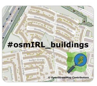
As a Director of OSM Ireland (osmIRL) chapter I occasionally get to do nice jobs for the community. Our chapter received a microgrant from the OpenStreetMap Foundation which we are using in conjunction with the agreed community task to map all 5+ million buildings on the island. With the support of this microgrant the chapter deployed the concept of rewarding mapping landmarks with a small token of appreciation for reaching the landmark of 10,000 buildings.

In this case we are giving our contributors a handy mouse mat, which is made with foam and nylon and carries a nifty design. Bias declaration: I designed it! mouse-matt.jpg

The background image is simply one part of suburban Dublin, showing the importance of adding buildings to the map. It also shows the campaign name #osmIRL_buildings. We have a task manager here to co-ordinate all this work.

See full entry

Location: Kilmore Big, Kilmore A Ward 1986, Dublin, County Dublin, Leinster, Ireland

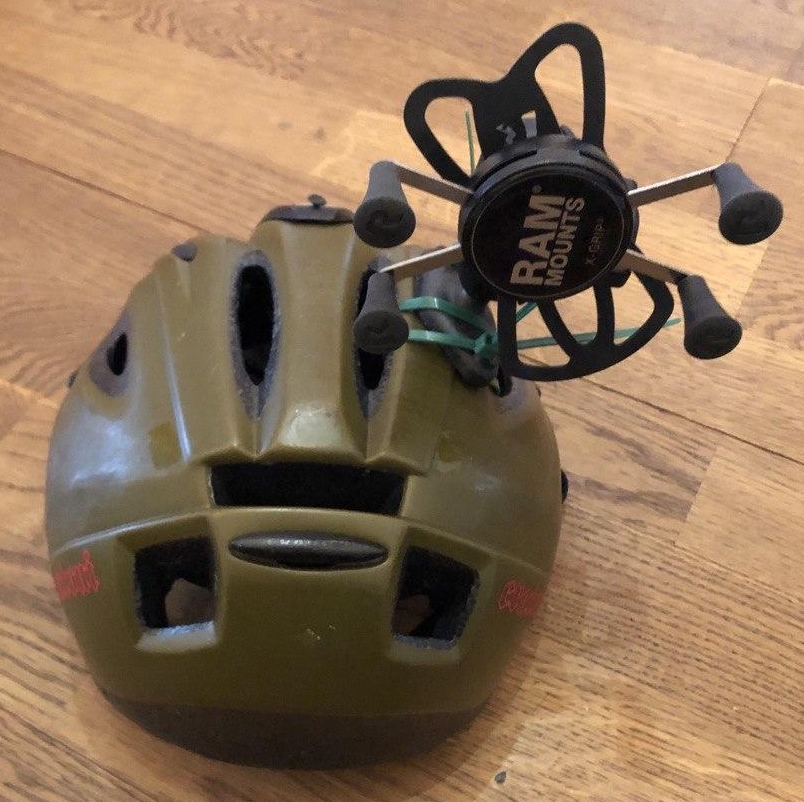
Da ich nicht mit ausgestrecktem Arm und das Handy in der Hand haltend herum Laufen/Radfahren wollte, hab ich mir mit der Zeit verschiedene Gedanken gemacht und einige ausprobiert.

Helm

helm_hinten.jpg

Idee

Da das Anbringen des Handys am Lenker nur für verwackelte Bilder sorgt, wollte ich mich selbst als Stoßdämpfer zwischen Rad und Handy bringen.


Das hat auch soweit funktioniert, auf den Bildern kann man scharf alles erkennen (naja mit Einschränkungen, so ganz Perfekt geht es halt nicht mit dem Handy). Das Problem ist, dass da ein relativ großes Gewicht obendrauf kommt. Außerdem kann ich mich nicht frei umsehen, ohne die Richtung der Bilder zu verändern (macht man ja mal auf dem Rad).

See full entry

🌟🌟🌟🌟🌟🌟🌟 خــــــرســــــــــــنـــــد شــــــــــــدیــــــم از ایــــــــنــــــکـــه امـــــــروز

رنــــــــــگــــــی دگــــــر اســــــتــ نــــــه رنــــــگــ دیـــــــروز

تــــــا شـــبـــ نــــشــــــده رنــــــگــ دگــــــر شــــد

گـــــــــفـــــتــنـد از ایــــــنــ نـــکـــتــه هـــزار نــــــکــــــتــــه بــــیــــامـــــــوز 🌟🌟🌟🌟🌟🌟🌟

Location: Таймырский Долгано-Ненецкий муниципальный округ, Красноярский край, Сибирский федеральный округ, روسیه

Saikono Collagen รายใหญ่ติดบริษัท รับตัวแทนจำหน่าย ปลีก-ส่ง สินค้าแท้ มีบัตรตัวแทนจำหน่าย แถมกระบอกชงสกรีนแบรนด์ มีกลุ่มตัวแทนสอนงานขายนะคะ

Location: Ban Bo Thong, อำเภอด่านช้าง, จังหวัดสุพรรณบุรี, 72180, ประเทศไทย

this is small village near Saleh Bhambro station 🚉 having about 20 houses and well educated people are living. https://goo.gl/maps/hmQZahYWKzLNXBJp6 this is the actual location of this village

Location: Village Bhagat Gajo Kolhi Parmar, Samaro Taluka, Umerkot District, Mirpur Khas Division, Sindh, Pakistan

A geoglyph of a man’s head appearing to be eating a snake (100m x 100m) on relatively sloped land. The man is in profile, facing west and seems to be swallowing what looks like a snake whole. It is unclear what kind object he appears to be swallowing. None the less, this image is rather disturbing.

In very close proximity to this geoglyph is near a flat plateau of what appears (hard to see at this current aerial resolution) of hundreds of images that look like a mosaic of geoglyphs ranging from 3m - 15m. Some look like faces while other looks like animals.

14°46′5″S, 75°11′4″W -14.7681516, -75.1844319 El Ingenio, Province of Nasca, Ica, Peru

Location: El Ingenio, Province of Nasca, Ica, 11350, Peru

As part of figuring out how to best process standard tile layer logs I had a chance to generate some charts for usage of the OpenStreetMap Standard tile layer on the day of 2021-03-14, UTC time. This was over a weekend, so there are probably differences on a weekday. I’m also only looking at tiles delivered and not including blocked tiles from scrapers and similar usage. All traffic is in tiles per second, averaged over the day.

Countries

I first looked at usage of the layer from users on openstreetmap.org and all users, by country.

See full entry

Posted by 马陵秋月 on 14 March 2021 in Chinese (China) (‪中文(中国大陆)‬). Last updated on 23 April 2022.

绘制OSM起源于一次课堂作业,商业地图过多关注一二线城市,对三四五线城市的地图绘制非常糟糕,所以只能自己动手,丰衣足食。在编辑的过程中逐渐体会到绘图的快乐,随着空白的区域被各种地理要素一点点填满,城市的样貌逐渐变得具体,变得鲜活起来。每个城市都有它的历史,有它的特色,每个城市都值得被更好地绘制。

Location: 三场, 项里街道, 宿城区, 宿迁市, 江苏省, 223865, 中国

هنگام نقشه‌کشی گاهی شرایطی پیش می‌آید که چندین عارضه قبلاً رسم شده و حالا می‌خواهیم با گذر از لابه‌لای این عارضه‌ها عارضهٔ دیگری را رسم کنیم. اینجاست که ممکن است بین عارضهٔ جدید و عارضه‌های موجود گره مشترک ایجاد کنیم. این موضوع شاید در وهلهٔ اول خیلی مهم به نظر نرسد، اما اگر مدتی بعد خودمان به همان جا برگردیم و بخواهیم ویرایش انجام بدهیم، می‌بینیم که این اتصالاتِ ناهدفمند بسیار دست‌وپاگیر هستند.

خوشبختانه در ویرایشگرها برای این مسئله راه‌حل‌های کارامدی وجود دارد که در این فِرِسته مختصراً اشاره می‌کنم.

۱. زوم کنید!

همهٔ کسانی که اندکی دقت چاشنی کارشان است، با این روش خیلی خوب آشنا هستند.

۲. کلید میانبُر

می‌توانیم هنگام کلیک‌کردن، کلیدهای میانبر مناسب را روی صفحه‌کلید نگه داریم تا خیالمان راحت شود و آزادانه‌تر کلیک کنیم، بدون آنکه بین عارضه‌ها گره مشترک ایجاد کنیم.

  • آی‌دی: اگر لازم شد جایی گره بگذارید که زیرش عارضهٔ دیگری قرار دارد، هنگام کلیک‌کردن کلید Alt را نگه دارید.
  • جاسم: کلید Ctrl را نگه دارید.

۳. پالایش عارضه‌ها

در این روش عارضه‌هایی را که نمی‌خواهیم اصطلاحاً تیکشان را برمی‌داریم تا در خروجی دیده نشوند.

  • آی‌دی: کلید میانبر F > عارضه‌های نقشه
  • جاسم: کلید میانبر Alt+Shift+F > پنجرک Filters
  • وسپوچی: منو > پالایهٔ تگ

مثلاً می‌توانیم در ویرایشگر آی‌دی تیک مرز را برداریم تا زیر دستمان با خطوط مرزی شلوغ نشود.

هشدار: در این روش یکسری از عارضه‌ها از دید ما پنهان می‌شود و بنابراین در کنار مزیتی که ایجاد می‌کند خطرات بالقوه‌ای هم وجود دارد.

نکتهٔ پایانی

نچسبیدن عارضه‌ها به هم یک قاعدهٔ بی‌چون‌وچرا نیست. گاهی شاید چسبیدنشان درست هم باشد.

هدف این مطلب توجه‌دادن خودمان به این نکته است که از شلختگی کار بکاهیم :)

Posted by c tito young on 13 March 2021 in English. Last updated on 14 March 2021.

Geoglyph of a man with a beard (50m wide x 75m long) is of what appears to be a man wearing a cape and poncho traveling east to west. He has and starkly appears to trudge forward. He is drawn from the waist up, but there is suggestions that he is sitting on an animal, but not confirmed.
In front of the man is some kind of etchings, which are evident but indistinguishable at the resolution from this aerial scans. He is drawn on moderately steep land, in a valley between two peaks. It is unclear what he is doing or where he is going.

14°44′58″S, 74°56′32″W -14.7495465, -74.9423362 Nazca, Province of Nasca, Ica, 11401, Peru

Location: Nazca, Nasca, Province of Nasca, Ica, 11401, Peru

Ein Interview von Tobias @tordans mit Alex @Supaplex030.

Tobias: Hallo Alex, du arbeitest gerade an einem spannenden Projekt an der Schnittstelle von OSM und der Verkehrswende in Berlin, nämlich einer Parkraumanalyse für den Ortsteil Neukölln. Das ist sehr vielfältig – heute wollen wir uns ein Detail anschauen, bei dem es um OpenData und OpenStreetMap und die Verbindung von verschiedenen Datenquellen geht.

Anzahl angemeldeter Autos pro Haus

Eine Zielsetzung dabei ist, herauszufinden wie viele Autos in einem Häuserblock angemeldet sind. Dafür gibt es keine direkten Daten, aber es gibt Daten über die man Näherungswerte schaffen kann mit Hilfe von anderen OpenData-Quellen und OSM. Und diese Daten hast du dann später in der Auswertung verwendet, über die wir auch noch mal an anderer Stelle sprechen: Eine Karte, in der visualisiert wird, wie viele Parkplätze pro Auto es im Umkreis eines Ortes gibt: https://supaplexosm.github.io/strassenraumkarte-neukoelln/?map=parkingmap

See full entry

Location: 52.474, 13.445