 OpenStreetMap
.jpg)
Today we have organised a training workshop on OpenStreetMap from Khulna University. Respected, Sawan Shariar ( Regional Ambassador, YouthMappers) conducted this training.
Users' Diaries
Recent diary entries
Posted by pedrito1414 on 20 November 2020 in English.

A group of HOT voting members, from across four continents) met on Tuesday evening as part of the HOT board’s strategy committee to discuss perspectives on community definitions and what we mean when we talk about community sustainability. These conversations are really pertinent at the moment as HOT begins to develop and implement the Audacious project, which provides a real opportunity to support local communities to power up as well as generate high quality OSM data in 94 countries.
The first question: What is HOT?
It was acknowledged that HOT is many different things to different people. It was thought to both be a network or community (including volunteers and contributors, staff, humanitarian data users) and a node in other networks (where it was felt that HOT sometimes plays an important facilitation role). It was also suggested to be a (niche) social network, used for finding and developing information, knowledge, tools and relationships.
It was also perceived as a sub-community of the OpenStreetMap and as an NGO.
Whilst there were many positive attributes associated with HOT (diverse, collaborative, oriented to social good), it was also felt that HOT was sometimes a label applied too easily to contributors and communities in its networks, without thought for how they might define themselves. For example, the use of the phrase ‘HOT community’ to encompass any group doing humanitarian work involving OSM (or ‘HOT edits’ for any OSM contributions through the Tasking Manager) can be perceived as HOT staking an undeserved claim over the work of others and not indicative of a collaborative node in a network.

Якби JOSM був би написаний не на джаві, а на плюсах… Тормозить, зараза

This afternoon I did front & left camera Mapillary capture around the block in Bandar Bukit TInggi near Healthlane Pharmacy. Unfortunately the usual afternoon rain intervened just after I started capturing. Don’t know whether the images are useable, but I’m uploading it first.

I m here
Current

Hoe kan ik zien dat een route is geblokkeerd als gevolg van verouderde data? In Middenmeer wordt ik een aantal malen zeer onlogisch weg geleid van logische route alsof de door mij gekozen straat is afgesloten of geblokkeerd. Het betreft hier de Wilgenlaan in Middenmeer tussen de Hoornseweg en de Plataanlaan. I.P.V. de route over te nemen over de Wilgenlaan wordt er een aantal malen heel krampachtig, via de Esdoornlaan en de Meidoornlaan gepoogd om te leiden naar de Dr. Hoogkamerlaan en dat is volstrekt onlogisch en maak de reistijd langer. De standaard begeleiding (gekozen eindpunt is Kokkel 1 Middenmeer) wil dat je via de prof. ter Veenweg en de Prof. Colijnstraat gaat. Als je een iets grotere wagen hebt (busjes e.d.) is dat in elk geval al een heel ongelukkige keuze maar je hebt op deze route via de Colijnstraat en dan de verlengde Breestraat en Plataanlaan veel obstakels en tegenliggers waarvoor je steeds moet stoppen of vertragen en als je via de Wilgenlaan zou gaan heb je dat helemaal niet dus is de reis sneller.

I had trouble using the existing libraries with OAuth. I first started Implementing the methods I directly needed. The size increased and I thought I would be easier to make that a separate Project. Now I’m done Implementing all of the OSM API 0.6 the you find the project at Github or on PyPi I would love to hear some Feedback from you, either here via PM or on github open an Issue.

You can now download a development version of Potlatch 3.0 to run on your desktop.
At https://www.systemed.net/potlatch/download/ , you can download a Mac native app, or an AIR file for use on Windows or (possibly) Linux.
Potlatch 3.0 includes desktop-editing features such as Remote Control support, overview zoom levels, and an OAuth login flow for saving. Rendering is faster and there’s now Overpass API support in the tasks palette.
Installation on Linux is likely to be complex and I’d welcome reports from anyone who has successfully achieved it.
There’s much more to come in future weeks so watch this space. You can report issues at http://github.com/systemed/potlatch2/issues pending the creation of a dedicated 3.0 repository.
https://weeklyosm.eu/ru/archives/13945
Все благодарности Влад a3563 Perm. Спасибо что делаешь переводы.
Вы можете предложить новость в ЕженедельникОСМ!
У вас уже есть логин OpenStreetMap осталось всего 3 шага:
-
Заметили ли какую-нибудь интересную новость? Откройте наш сайт
-
Вставьте ссылку в строку поиска и щёлкните “Поиск”. OSMBC проверит вдруг эту ссылку уже добавляли. Далее нужно выбрать категорию для новости и описать о чём статья. Если у вас есть ещё одна ссылка, которую нужно добавить, пожалуйста, добавьте её.
-
Вы можете предложить текст статьи или нажмите Сохранить.
Готово! В редакционной системе OSMBC есть ваша статья! Затем команда просматривает фильтрует, при необходимости выберет категорию, пишет (если не написано) и переводит статьи на другие языки. Также проведёт окончательную проверку для поддержания качества.
Posted by Kampar on 18 November 2020 in Indonesian (Bahasa Indonesia).

Couple of days ago, one of my fellow undergraduate student told me that Sumatera Island is missing …wew .. looking forward to investigate it …

Zaczynam wpisywać kasztanowce do mapy anińskich kasztanowców, żeby ratować je przed pasożytami.
Just tested and uploaded streetview of Persiaran Batu Nilam 16 to Mapillary. Looks great and should be able to get more streetviews for improving pedestrian paths mapping. ;-)

Every year during State of the Map, starting in 2016, there has been a Local Chapters Congress session where representatives and members of Local Chapters that have been recognised by the Foundation and other local mapping communities meet together to talk about experiences and challenges in starting, building up, and growing enthusiastic local communities of OSM mappers.
Due to the pandemic, we unfortunately could not hold the Local Chapters Congress this year during the virtual State of the Map 2020 last July. However, the Local Chapters and Communities Working Group, or LCCWG, has decided to push through with a separate virtual event at the end of this year’s OSM Geography Awareness Week! (Trivia: the LCCWG was in fact formed as a result of the Local Chapters Congress 2019.)
บ้านเล็บ ขนตา คาสเดย์สาย7
_
Posted by SomeoneElse on 15 November 2020 in English.
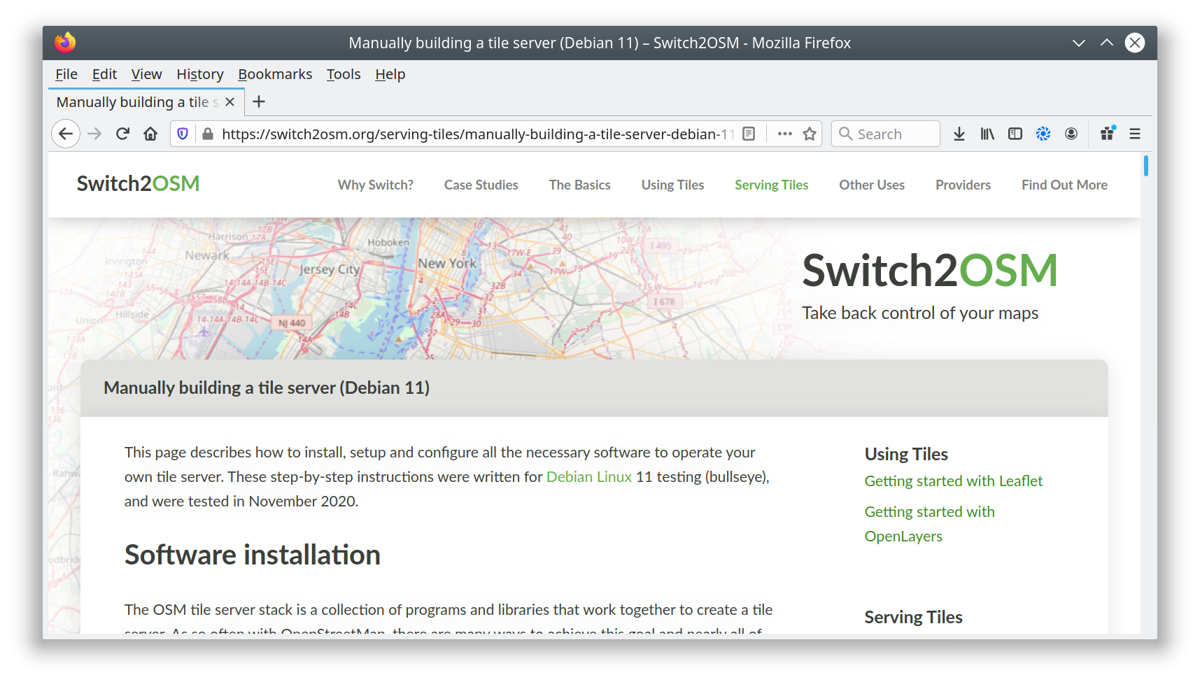
I’ve added a new page to the switch2osm guide: “Manually building a tile server (Debian 11)”. The Debian developers have worked to include the required software inside Debian 11, so there’s actually less setup work needed than in previous versions.
Debian 11 has not yet been released; it’s still “testing”, so there may be minor changes along the path to release. Also, there’s currently a temporary problem with the Natural Earth download site that requires a workaround, but that’s documented in the guide. When that is resolved I’ll update the notes.
I’ve not yet linked the new page into the menus because I want to give people a chance to test it and identify any problems first. Once that’s happened, I’ll add it to the “Serving Tiles” menu.

The difficult 3rd post is here with little to say. I am sitting in a little flat in Bellingen looking out at the hills and trees. I am on holiday. I am enjoying this moment.

Fossgis is sponsoring the CMS and Mattermost Server for the weeklyOSM Editorial team for several years now. Last week they sponsored a server update (a 4GB server).
As OSMBC is keeping history similar to OSM, the number of managed article has increased to nearly 24k articles. Currently 70 users are listed as editors and nearly 700 are guest users. With the update Fossgis supports the weeklyOSM team in their work.
But my main thanks goes to the weeklyOSM team, which now serves the their news in 14 languages.
Christoph
ho letto il lavoro fatto da Astrid Trento e ho iniziato ad aggiungere parcheggi in zona
Aggiunto parcheggio disabili #Astrid_Tn