 OpenStreetMap

I started this to try and find my f150 that was stolen from me
Users' Diaries
Recent diary entries

Since I started https://opencampingmap.org I do a lot of campsite-mapping.
Doing that I quickly realized, that just using capacity is ambiguous when used for campsites. Thus I just ignore it on my map and show it as a bug if used.
While there is often a limit on persons in backcountry campsites, tourist sites tend to have a limit regarding the number of tents or caravans!
So how to map? Well this is what I suggest to do:
- If the number of people allowed to use the site is limited tag capacity:persons appropriately.
- If the number of tents or caravans/RV is restricted use capacity:tents or capacity:caravans
- If the site has a fixed number of pitches and does not distinguish between using them with a tent or caravan/RV use capacity:pitches instead.
Posted by MapMapHooray on 14 August 2022 in English.
Open Camping Map (GitHub) is a useful little tool developed by @giggls that provides camp site information for when you want to travel.
We recently added integration with Mangrove Reviews. When selecting a camp site, the Mangrove API is queried to get reviews based on the geo: link. Checkout this pull request for a behind-the-scenes look on the code.
And here’s how it looks:
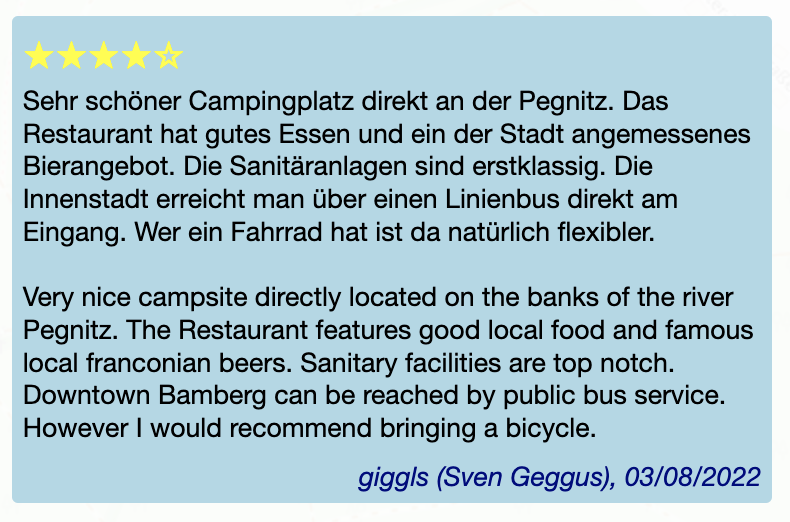
➡️ What do you think - is this useful? How do you feel about reviews in general? And: Which (FOSS) apps/websites do you use for camping?

I know, Florence is too far away, and tickets are worth a fortune. I hesitated for weeks before shelling out 800 € for a flight and a hotel. That’s too much even for me, so I totally understand if you could not make it this year.
Thank gods for the Internet though! We are continuing with an option of virtual participation in SotM. Traditionally that have meant watching talks online and occasionally making people at the venue read your questions out loud. Not too fun when you have to concentrate on events happening thousands of kilometers away.
BUUUT this year we trying something different as well. First, passive participation: few people at the conference (or just me, we’ll see how it goes) would post photos and announcements and general impressions on everything going at and around the conference. It’s a way to get a glimpse at the experience of actually being there. I have done it in Russian for every SotM and FOSS4G and FOSDEM since 2016, and now I thought it might fit well into the virtual attendee package.
Also, active participation: record a video introduction of yourself and put it into the library of introductions. That way you can listen to people who attend the conference, either physically or virtually, and start a conversation with any of them. It is a magic tool that helps learn something about a person before approaching them: might help when you have an introvert’s anxiety (I should know!). And generally it’s fun: it highlights that a conference is not so much about talks and dinners, but about people first and foremost.
So, do buy a Venueless ticket at https://pretix.eu/osmf/SotM2022/ and join us: yes, you won’t be able to shake any hands or split a beer, but with a very little effort you can be a part of the conference.

Pagina del diario di prova


Back in March I was amused to see Amanda tweet that the UK OpenStreetMap community ran a solar power mapping project “several years ago”. This was the theme of the [quarterly project(osm.wiki/UK_2019_Q3_Project:_Solar_Power) in Q3 2019, but the project keeps trucking on.
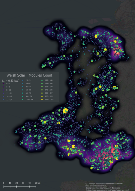
All small-scale Solar Power in Wales (i.e., excluding solar farms of more than 1MW capacity)
In the past few days we reached a milestone of having comprehensive solar cover for Wales, one of the constituent countries of the United Kingdom. I think this is the first country to have solar power mapped at such a fine level of detail either on OSM or anywhere else.
The rest of this post discusses aspects of the how & why of this work.
Solar Mapping in the UK
Thanks and please help

Dear all,
Today, v5.6.1 of the OpenStreetMap Carto stylesheet (the default stylesheet on the OSM website) has been released. Once changes are deployed on the openstreetmap.org it will take couple of days before all tiles show the new rendering.
Changes include
- Fixing rendering of water bodies on zooms 0 to 4
Thanks to all the contributors for this release.
For a full list of commits, see https://github.com/gravitystorm/openstreetmap-carto/compare/v5.6.0…v5.6.1
As always, we welcome any bug reports at https://github.com/gravitystorm/openstreetmap-carto/issues

I’m adding missing building with RapiD in Irvine, California:
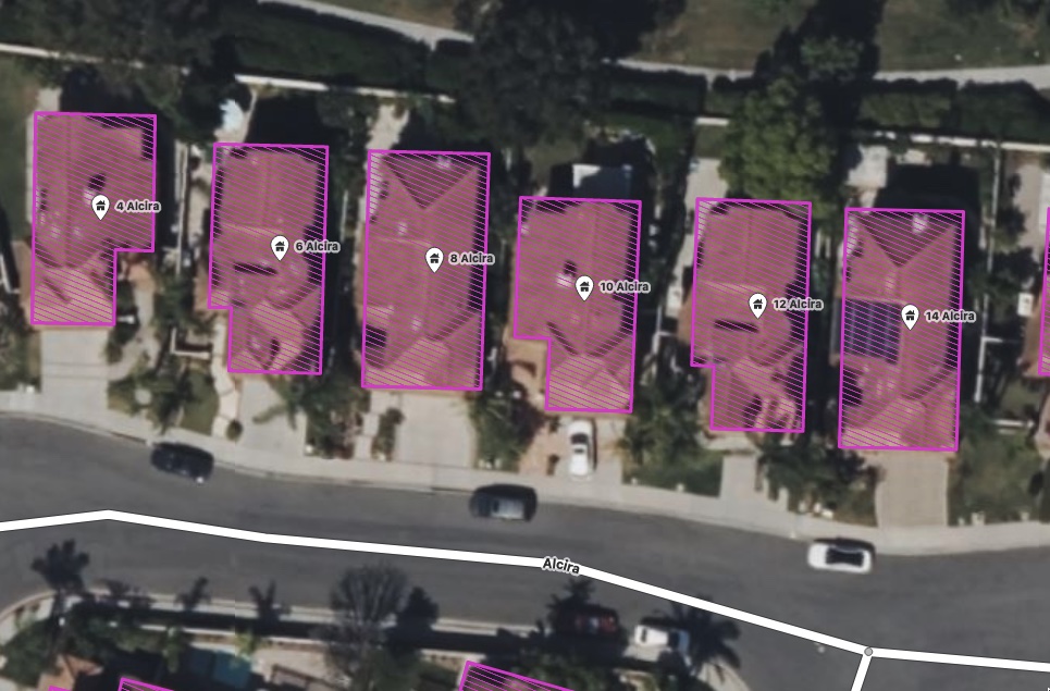
As you can see, there’s existing nodes tagged with building=yes and address info, imported at some point from city data it looks like:
Posted by pguillot on 11 August 2022 in French (Français).
Ma méthode pour mettre à jour le cadastre FR sous JOSM
Certainement pas la meilleure méthode, mais permet de mettre à jour efficacement un cadastre avec les derniers bâtiments.
Utilisation de JOSM.
Installer le coloriage “cadastre”
Télécharger le rendu CSS que j’utilise via cette URL : https://data.tedomum.net/s/GWcAyNHWjP3oSA9
Ce rendu CSS permet de colorier en rouge tous les polygones qui ont un attribut “source” contenant le texte “cadastre-dgi-fr source : Direction Générale des Finances Publiques - Cadastre. Mise à jour : XXXX”, où XXXX correspond à l’année (pour l’instant jusqu’en 2020). Pensez à le télécharger et le déposer dans son répertoire final avant de l’intégrer à JOSM.
Ouvez JOSM, puis rendez-vous dans le menu “Éditions / Préférences” puis cliquez sur la rubrique “Coloriage”, cliquez sur le “+” à gauche pour créer un nouveau coloriage :
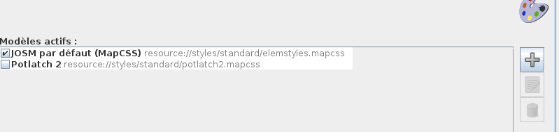
Allez chercher votre fichier puis donner un nom à ce coloriage :

.
Representing the federal government of traffic I would like to upload the 12 Routes of national cycling routes, representing the Cycle Network Germany. All data ist quality checked and free to use (Data licence Germany – attribution – version 2.0)
Looking for a contact to provide a boost for OpenCycleMap and OSM in general
Geodata is already published: https://www.radroutenplaner-deutschland.de/veraDaten_EN.asp

opened my map account on August 10, 2022.

40度

Wstęp
Podczas wizyty w Krynicy-Zdroju udałem się za drogowskazem znajdującym się na reklamie Ogrodów Żywiołów ponieważ zaciekawiła mnie ona wodnymi eksperymentami. Oczywiście strzałka na plakacie była mało precyzyjna a miejsce zupełnie nieoznaczone. Google mapsy nie potrafiły doprowadzić bezpośrednio do ogrodów. Na osm nawet nie było ich zaznaczonych. Pomocna okazała się opinia na google maps która sprecyzowała chociaż z której strony szukać wejścia. W lesie od strony ulicy Doktora Henryka Ebersa zauważyłem małe tabliczki z logiem parku które doprowadziły już na alejki ogrodów.
Jednym słowem o parku
Cóż. Pomysł na park fajny. Jednak z tego co przeczytałem w internecie został on otwarty wiosną 2022 roku a już niektóre eksperymenty są uszkodzone. Ludzi nie ma (pewnie poddają się szukając wejścia do parku).
Mapowanie
Zbieranie danych
Hello please help me i make three places and i need to delete them please help me please

Toronto Police Service has major, systemic problems. But they also have this one:
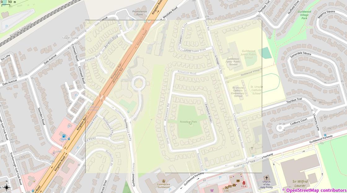
This is my hastily-georeferenced version of the image from this Toronto Police Operations tweet over OSM tiles in QGis. Note the extreme similarity between the streets and building detail. But also note the complete lack of OSM attribution on TPS’s map …

_
Posted by Troy Hartwig on 8 August 2022 in English.
