Users' Diaries

Recent diary entries

Posted by b-unicycling on 13 March 2022 in English.

When I was out do a bit of mapping (mostly house numbers and opening hours) in Clonmel with StreetComplete, I noticed an opening hours sign specifically for autism friendly opening hours. I had seen them before on supermarkets in Ireland, but this time, it led me to start a proposal for a new key to be able to map those, because I was at a loss there. It was a Vodafone shop, but I did some quick online research, and it is not uncommon in Ireland for shopping centres or supermarkets to have them. Some are referenced in the proposal.

The organization behind it is As I Am, a charity supporting people with autism and families with autistic family members.

It means that the lights are dimmed, there is no background music and announcements are kept at a minimum. I’m not diagnosed with autism, but I wish all this was done all the time and not just one or two hours per week.

The OpenStreetMap Foundation runs several services subject to usage policies.

If you violate the policies, you might be automatically or manually blocked, so I decided to write a post to help community members answering questions from people who got blocked. If you’re a blocked user, the best place to ask is in the IRC channel #osm-dev on irc.oftc.net. Stick around awhile to get an answer.

The most important question is which API is being used. For this, look at the URL you’re calling.

If the URL contains nominatim.openstreetmap.org, review the usage policy. The most common cause of being blocked is bulk geocoding exceeding 1 request per second. Going over this will trigger automatic IP blocks. These are automatically lifted after several hours, so stop your process, fix it, wait, and then you won’t be blocked.

If you’re using nominatim but not exceeding 1 request per second, to get help you should provide the URL you’re calling, the HTTP User-Agent or Referer you’re sending, the IP you’re requesting from, and the HTTP response code.

If you’re calling tile.openstreetmap.org or displaying a map, review the tile usage policy. The most common causes of being blocked is tile scraping or apps that don’t follow the usage policy.

To get help you should provide where the map is being viewed (e.g. an app, website, or something else), the HTTP User-Agent or Referer you’re sending, the IP you’re requesting from, and the HTTP response code. For a website, you can generally get this information through the browser’s developer tools. The tile.openstreetmap.org debug page will also show you you this information.

If you’re having problems with an app that you’re not the developer of, you’ll often need to contact them, as they are responsible for correctly calling the services.

2 Mapatona da UMBRAOSM em 2022 e será no dia 02 de Abril de 2022.

2 UMBRAOSM Mapathon in 2022 and will be on April 2, 2022.

BRASIL - DOM INOCÊNCIO - (PI) - EDIFÍCIOS, ESTRADAS, PONTOS DE INTERESSE E ÁREA VERDE. Brasil

O Mapeamento na Cidade de Dom Inocêncio - (PI) - Brasil será feito por Mapeadores Iniciantes e Avançados e tem como objetivo Incluir Edifícios, Estradas Rurais, Pontos de Interesses (Comercio em Geral. )

The Mapping in the City of Dom Inocêncio - (PI) - Brazil will be done by Beginners and Advanced Mappers and aims to include Buildings, Rural Roads, Points of Interest (Commerce in General. )

Link HOT: https://tasks.hotosm.org/projects/12274

Instruções para o Mapeamento na Cidade de Dom Inocêncio/PI.

Edificios: Muitos edifícios são muito próximos mas na verdade não se tocam. Tente mapeá-los o mais próximo possível, sem permitir que eles se conectem entre si ou com as ruas.

Estradas; Use as seguintes tags para mapear estradas no Editor iD:

See full entry

12290 | Union of Brazilian Mappers of OSM (UMBRAOSM

BRASIL - PRAIA ILHA DE ITAMARACÁ (PE) - EDIFÍCIOS Brasil

O Mapeamento na Praia de Ilha de Itamara´ca/PE - Brasil poderá ser feito por Mapeadores que tem conhecimento com o Editor Rapid.

The Mapping at Ilha de Itamara´ca Beach/PE - Brazil can be done by Mappers who are familiar with the Rapid Editor.

Link HOT https://tasks.hotosm.org/projects/12290/

Edifícios:

Muitos edifícios estão muito próximos, mas realmente não se tocam. Tente mapeá-los o mais próximo possível sem permitir que eles se conectem entre si ou com as ruas.

O mapeamento com o Editor Rapid e ideal usar a Imagem da Bing para uma melhor centralização dos Edifícios, outra camada vai desfocar os edifícios.

Buildings:

Many buildings are very close together, but they don’t really touch. Try to map them as closely as possible without allowing them to connect with each other or with the streets.

Mapping with Rapid Editor is ideal to use Bing Image for better centering of Buildings, another layer will blur buildings.

Comentário do changeset:#hotosm-project-12290 #Mapeamento de Edifícios #RapiD #microsoft-building-footprints #Cidade-Praia-Ilha-Itamaraca/PE #Brasil #UmbraOsm

Veja como usar o Gerenciador de Tarefas e o RapiD combinados no OpenStreetMap;(3:23)

Raphael de Assis UMBRAOSM

Телефонное наследие

Как-то раз я вводил очередную порцию данных POI. При том способе, которым я обычно действую, я выясняю, где находятся их входы. Далее, при вводе, я добавляю или изменяю данные так, чтобы было понятно, где находятся соответствующие POI входы. В простейшем случае для этого достаточно поставить точку POI рядом с тем местом, где находится вход в здание, через который можно пройти в редактируемое заведение. Подробнее об этом и о более продвинутых способах ввода можно прочитать в записи про геометрию POI. Большая продвинутось обычно включает в себя также отмечание самого входа как точки entrance=yes, входящей в контур здания. Нередко есть смысл это сделать, так как некоторые входы в здание уже отмечены, и тогда лучше доотметить их все.

Так вот, в тот раз именно доотмечанием входов я и занимался. То есть, мне понадобилось добавить POI в здание, где часть входов уже была отмечена, вместе с чем было лучше добавить в контур здания и неотмеченные входы. Но точки entrance это не единственное, что бывает в линии контура. Помимо задающих геометрию углов здания, там бывают и точки прочих объектов, находящихся в или на стене. Ими могут быть, например, почтовые ящики или мемориальные доски. Ясно, что было бы неплохо, чтобы все обозначения этих объектов шли в том порядке, в котором идут и сами объекты в реальности.

То есть, если в реальности есть входная дверь, и слева от неё находится почтовый ящик, а справа — мемориальная доска, мы захотим, чтобы и в осме было так же. А именно, в линии контура слева направо должны присутствовать точка ящика, затем точка входа, затем точка доски. Если точки входа ещё нет, её надо добавить между ящиком и доской, чтобы она располагалась относительно правильно. Но также точку входа надо добавить на то место, где вход собственно и находится, чтобы она располагалась и абсолютно правильно. А это сделать не удастся, если точки ящика и доски сами в достаточной степени расположены абсолютно неправильно.

See full entry

Posted by jmapb on 11 March 2022 in English. Last updated on 18 March 2022.

To celebrate NYC Open Data Week, a brief introduction to the NYC Department of Buildings Building Information Search tool.

I’ve spotted a new building in Brooklyn that’s missing in OSM. My goal is to add this building to the map, keeping parity with New York City’s established tagging practices for buildings.

NYC had a full import of building footprints in 2013-2014. In addition to building=yes, all buildings were tagged with height (in meters) and nycdoitt:bin (the city’s Building Identification Number, or BIN for short). Buildings with only a single address were also tagged with addr:housenumber, addr:street, and addr:postcode. For buildings with multiple addresses, a node for each address was placed inside the building perimeter.

The building I found has just one address: 1021 Bedford Avenue, 11205. I’ve added the addr: tags, but I’d also like to know the height and BIN so this building will be as well-tagged as those around it. So let’s look it up in the Department of Buildings Building Information Search (BIS for short), which can be found at the following arcane url:

https://a810-bisweb.nyc.gov/bisweb/bispi00.jsp

Here’s the initial search form:

See full entry

Location: Brooklyn, Kings County, New York, United States

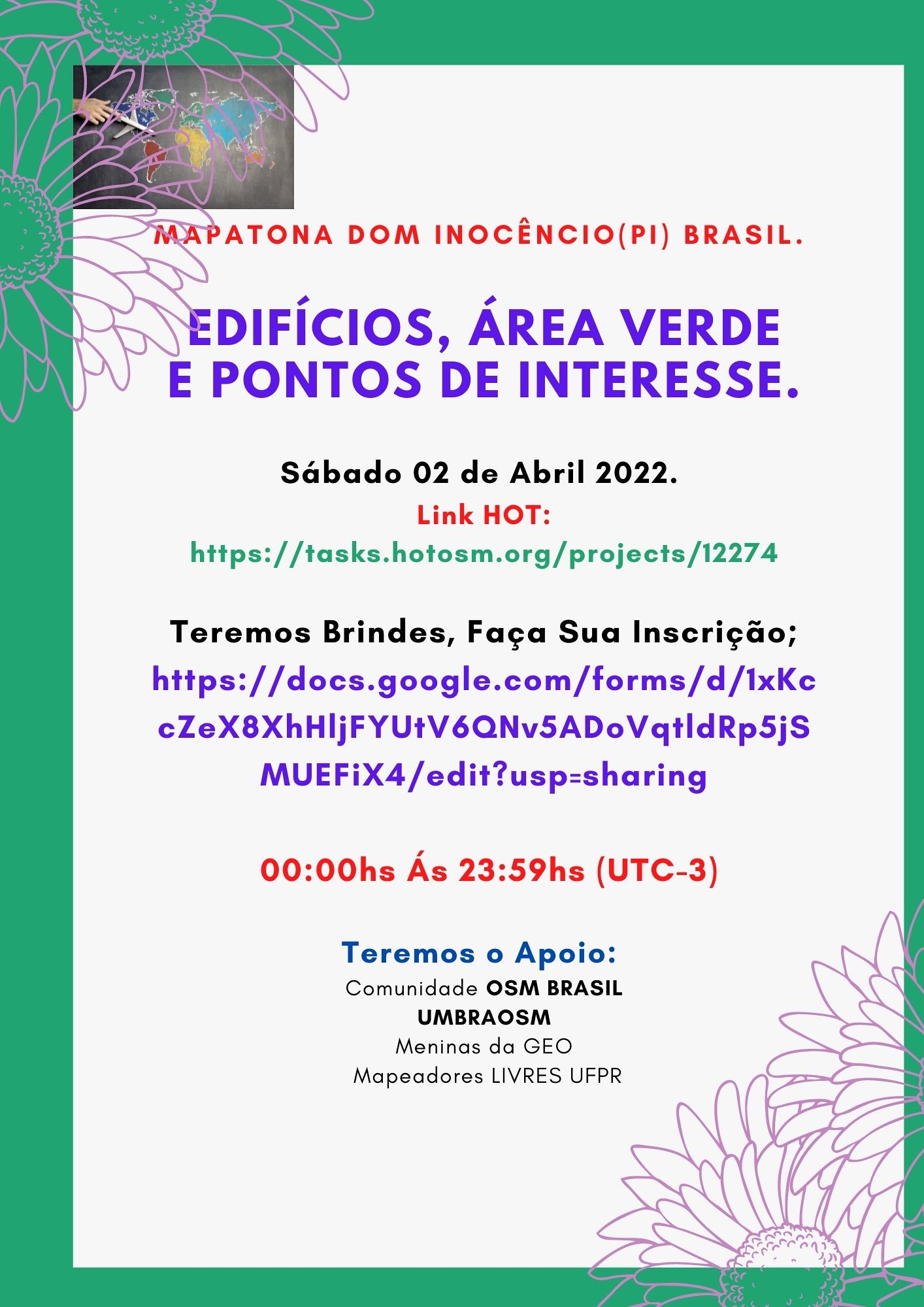
Mapatona-02

Novo Evento da UMBRAOSM - União dos Mapeadores Brasileiros do Openstreetmap

será realizado no Primeiro Sábado, dia 02 de Abril de 2022. das 00:00hs ás 23:59hs (UTC-3). Promovida pela UMBRAOSM, https://t.me/grupoumbraosm Meninas da GEO e Mapeadores Livres UFPR.

New UMBRAOSM Event - Union of Brazilian Openstreetmap Mappers will be held on the First Saturday, April 2, 2022, from 00:00h to 23:59h (UTC-3). Promoted by UMBRAOSM, https://t.me/grupoumbraosm GEO Girls and Free Mappers UFPR.

BRASIL - DOM INOCÊNCIO - (PI) - EDIFÍCIOS, ESTRADAS, PONTOS DE INTERESSE E ÁREA VERDE.

BRAZIL - DOM INOCÊNCIO - (PI) - BUILDINGS, ROADS, POINTS OF INTEREST AND GREEN AREA.

Link da HOT para a Mapatona HOT link to Mapathon https://tasks.hotosm.org/projects/12274

As inscrições podem ser feita atraves do link; https://docs.google.com/forms/d/e/1FAIpQLSc1uja8nBd360NtEVxzR2oPwtxuwJ_fuH8iRhCjcJRt3fFBLA/viewform

Nossos Parceiros:

Grupo Meninas da Geo; https://t.me/meninasdageo

See full entry

Location: Cohab, Recife, Pernambuco, Região Nordeste, Brasil
Posted by bo_hot on 11 March 2022 in English.

Happy end of Feb all! (yes, I realise it’s already mid March)

After 2 long grounded years, hot_tech is starting to take off again - both figuratively and literally. Our team is now turning our attention and efforts toward working alongside hubs, contributors and users to test and evolve existing and potential humanitarian OSM tools increase access, usage and contribution to OSM.

Full blog post here »

Tldr;

  • hot_tech are leaving the comfort of our home offices and engaging with hubs, contributors and users around existing and future humanitarian OSM tech.
  • We are building some experimental workflows for conflating AI generated data with OSM data, which we plan to share for all to see and scrutinise around May.
  • OpenAerialMap design research is underway in partnership with Kontour (of Disaster Ninja fame) - Look out for opportunities to get involved.
  • The Harvard Tech for Social Good team continues their work as they connect with users and community members interested in Galaxy.

# Announcements:

  • We have kicked off a redesign for OpenAerialMap (OAM). We will be working closely with users and communities who use and depend on OAM to discover needs, wants and wishes to be included in the next version of OAM. If you’d like to be involved, please reach out to Cristiano or DK.

  • Omran Najjar played a starring role on a webinar hosted by Omdena, where he talked though HOT’s evolving AI-assisted workflows. You can rewatch the event here »

  • We will be welcoming a new senior engineer to the team in March. They are a passionate, experienced and dedicated OSM contributor and we are really looking forward to officially welcoming them next week!

  • We are contributing to the improvement of OSMSeed in collaboration with Development seed. We will share more on this soon, but the short version is, together we hope to improve the flexibility, accessibility and usability of OSMSeed for other users in the ecosystem.

# Project updates:

See full entry

Location: Naz, Esserts-Salève, Monnetier-Mornex, Saint-Julien-en-Genevois, Upper Savoy, Auvergne-Rhône-Alpes, Metropolitan France, 74560, France
Posted by Becky Candy on 9 March 2022 in English.

Live Validation:

Live Validation involves real time data cleaning conducted during a mapathon. It aims to give feedback to mappers as soon as possible after they mark a task in the Tasking Manager as mapped.

How Live Validation is done:

1.A validator joins a mapathon (either remote or in-person) accompanying the mapathon trainer. Ideally the validator gets a chance to introduce themselves near the start of the session and explain their role.

2.Once mapping has started, the validator uses Tasking Manager to focus on most recently mapped tasks: Within a project in the Tasking Manager under the ‘Tasks’ section select tasks that are ready for validation and sort by ‘most recent’. Carry out validation using JOSM and give feedback in the Tasking Manager.

3.After main training elements are covered - validator gives verbal feedback while screen sharing during the mapathon. It tends to be more polite not to mention mapper names - participants typically recognize the task they have been working on when you share your screen.

Advantages:

1.Capture data quality issues very early to prevent further occurrences by giving mapper feedback to improve.

2.Live validation helps the trainer to identify recurring issues where the mappers might need more guidance during the mapathon. The trainer can then adapt quickly and focus their training on those issues.

3.Live validation gives the validator the chance to give verbal feedback while also sharing those issues visually on their screen - this is an impactful way to give feedback, particularly compared to the typical method which only involves text-based feedback.

4.A validator gets the chance to demonstrate feedback channels (Tasking Manager notifications) with mappers to make them aware of where they can find feedback after a mapathon - this improves communication between the mappers and validators.

See full entry

Привет Опенсоурс карты!

Однажды я взглянул на карту моего село и ахнул, на карте не было ничего кроме дорог и названия. Но сегодня ситуация лучше так как пользователи отметили стадион, а я хочу пометить дома и магазины!

Posted by DENelson83 on 7 March 2022 in English.

After just under five months of hard work, I have completed my project of giving every single body of seawater in Canada an area definition. I have experienced some pushback from other editors who had issues with this project, including my practice of only giving one point of seawater a single name, as well as questioned whether area definitions were even necessary and saying that point definitions would have sufficed, as well as how I was defining their extents. However, mapmaking is as much an art as it is a science, and my own preference is for area definitions over point definitions in this case. As well, my “one point, one name” rule had one intent and one positive effect: The intent was to minimize interference with coastline edits, and the positive effect was that I was able to minimize as much as I could the number of ways in each relation, not just for bodies of seawater in a sort of “divide and conquer” strategy, but also for islands as well as for the mainland coastline of Canada. Sure, there were some outliers with thousands of ways, such as the Gulf of St. Lawrence and the Labrador Sea, but there are very few of those, and I would estimate the average number of ways in each relation over this whole dataset is only about a few hundred.

A Mapatona na Cidade de XEXEU - (PE) BRASIL foi Concluída com Sucesso, vejam a estatística de mapeamento, 100% Concluído!

The Mapathon in the City of XEXEU - (PE) BRAZIL was Successfully Completed, see the mapping statistic, 100% Completed!

The Mapathon in the City of XEXEU - (PE) BRAZIL

was Successfully Completed, see the mapping statistic, 100% Completed!

Mapatona terminada com sucesso, agora e a hora daValidação!

See full entry

Location: Cohab, Recife, Pernambuco, Região Nordeste, Brasil

最近佇咧 OSM dialy 遐有人寫文章,認為 talk-tw 的討論變矣,傷排外用手段阻止編輯。我佇咧想你敢是佮我看仝款的 mailing list,這幾年大都是 weeklyOSM 的出版公告,猶閣有匯入佮大量編輯的通告,確定逐家無問題就動手來做,講實在是無啥物咧討論。

古早時代 talk-tw mailing list 有社群進行串聯熟似彼此,制定臺灣各級行政區的標籤方式,欲社群聚會的時間討論等等重要的議題。後來真濟討論走去較濟人的 Facebook 社團遐,mailing list 就無啥人用。

社群討論不論是佇咧佗位,毋就是欲出聲討論,逐家攏有無仝看法佮做法,提出來嘛會當修正,嘛無看著有其他人的意見 。社群機制親像臺灣原住民區域遐的部落會議,進前亞泥佮在地部落欲諮詢部落敢會當繼續開採礦場,欲開部落會議來投票,過程有好好討論就好,來爭取各方支持。

在地力量在地社群辛辛苦苦咧維護,揣𪜶討論,應該毋是傷過份的代志。進前嘛有外國公司,一个 Snap 想欲模仿 Google 按呢佇 OpenStreetMap 遐存各國認為的「國家」邊界,臺灣予𪜶認為是中國的,所以愛有一个中國認為的臺灣是𪜶的邊界,予社群認為無共識閣爭議傷濟予阻止。採取較激烈的手段是欲為著落尾的討論來起頭,因為好好佇咧編織討論留話,真濟擺是無人回的。

嘛有公司推捒無啥問題的物件,親像 Here 創臺灣的 Maprouttle Challenge 修正臺灣遮的地圖小問題,Apple 嘛有用 Maprouttle Challenge 希望社群有人會當鬥跤手來修正地圖的問題。

我遮有共 Talk-tw 當做愛發文來吸引人來回的目的,社群莫干焦一个所在討論,另外一方面是欲記錄,因為 Facebook 討論濟,毋過無好揣,寄批信到 mailing list 留記錄。

Location: 卡里布安村, 信義鄉, 南投縣, 臺灣