 OpenStreetMap

-
Users' Diaries
Recent diary entries
Posted by bkil on 30 December 2021 in Hungarian (Magyar).


I’m getting close to finishing all buildings south of Corbin Street, which would mark about 65% of the town’s buildings mapped, hopefully the suburbs in the north will be easier and I should hopefully finish all those buildings if I continue at my pace of work by February


2021 has been a challenging year in many ways, but Crowd2map’s amazing volunteers have kept on mapping, for which I am extremely grateful.
Over 1000 new mappers joined us, and added a further 15,700 km of roads, an additional 435,000 buildings and over 3,300 schools. This means almost 17,000 volunteers have added over 5.4 million buildings to date. We continue to give feedback and train new mappers via our Slack channel, which anyone interested is welcome to join.
As we approach the year end here are some of our highlights.
Although opportunities for face to face meetings were few, we continued our twice weekly training sessions via zoom and managed to speak at HOT summit and various other online conferences including SOTM Africa, where Herry Kasunga talked about our Health Centre mapping project
We were delighted that many of the groups we have trained were awarded microgrants from OMDTZ in June, and we are continuing to work with them in mapping areas such as child labour at informal mines, school gardens to improve nutrition, and gender based violence projects.
The Digital Champions programme we started in 2019 in Serengeti has now been extended to the neighbouring districts of Butiama and Tarime. There is a FGM cutting season in progress now in Mara and these activists have been vital in protecting the community and the maps necessary to find girls at risk quickly. Cutters continue to escape across the porous border into Kenya, highlighting the need for better mapping and cooperation.
In November we celebrated our 6th birthday, with an amazing range of speakers, as you can see here. The recording is here.
In December we celebrated the graduation of our first cohort of interns. Eight women from Tanzania and 3 other African countries joined us for a 12 week training session with HOTOSM interns, as part of the Everywhere She Maps Youthmapper project.
So thank you to everyone who has helped us in 2021 and Happy Mapping for 2022 and beyond!..
Posted by THE WAJATR LAHOO SEVEN on 29 December 2021 in Thai (ไทย).
The neverdie gay good boy:II bad some time Segni nella testa e spirali Hayri.
.jpg)
So this is the user diary. Intresting feature.
Menuisier pour obtenir des avivés
(Jaja, is Montag … macht aber nix ;))
Grad zufällig gesehen, ich hab die 20000 Changesets voll. (zum cs)
 (Hintergrund (c)ESRI)
Prost!

MY GEOGRAPHIC INFORMATION SYSTEM (GIS) JOURNEY
I am AKOR DANIEL ENECHOJO, an under graduate student of Geography Department, University of Nigeria Nsukka, a volunteer at humanitarian OpenStreetMap (HOTOSM), a member of the YouthMappers, Unique Mapper Network (UMN) and Lion Mappers Team(LMT) Nsukka Chapter. Due to my quest and passion for GIS and it application after my first and second semester GIS courses which I took at my undergraduate course modules, in the year 2020, I enrolled for a GIS training with Mr. Malachi Eze a GIS Expert and I also applied for GIS online courses which sharpen my knowledge of GIS and gave me an in-depth understanding of geospatial application into diverse field. June 2021, I came in contact with Mr. Anointing a GIS expert who introduce me to some tool of GIS, OSM and geospatial analysis during my Industrial Training (internship) at the Nigerian Meteorological Agency Yola –Airport, I undertook some visual training with him (Mr. Anointing) during the training he recommended a visual seminar which I attended, Theme “World Youth Day”, it was so amazing, an eye opening workshop that led me to know about “Unique Mapper Network”, at the cause of the workshop I introduce myself and my interest to join the Unique Mapper Network which I was guided by Mr. Victor N. Sunday ( Team Coordinator) on how to join the team. Due to my passion for OSM, after the workshop I opted for Unique Mapper Network, am happy to be part of the member of organization.

Flag??
Posted by Cristoffs on 26 December 2021 in Polish (Polski).

Projekt OpenStreetMapPolska mapowanie lokalizacji AED (Defibrylatorów)
OpenStreetMapPoland project mapping the location of AEDs (defibrillators)
Nagłe zatrzymanie krążenia (NZK) oznacza, że serce przestaje bić. Człowiek traci przytomność po upływie 10-20 sekund, po czym przestaje oddychać. W Polsce co dziewięć minut w ten umiera osoba z chorobą serca. Główny Urząd Statystyczny szacuje, że liczba chorych, którzy cierpią na schorzenia układu krążenia, może wynosić nawet 800 tysięcy osób, z czego spory odsetek nie wie o tym, że żyje z poważna chorobą. W Europie NZK jest główną przyczyną śmierci, rocznie około 700 000 osób umiera na skutek zatrzymania akcji serca.
Sudden cardiac arrest (SCA) means that the heart stops beating. A person loses consciousness after 10-20 seconds and then stops breathing. In Poland, a person with heart disease dies this way every nine minutes. The Central Statistical Office estimates that the number of people suffering from cardiovascular diseases could be as high as 800,000, a large proportion of whom are unaware that they are living with a serious disease. In Europe, SCA is the leading cause of death, with around 700,000 people dying each year from cardiac arrest.
Kluczowym czynnikiem dla ratowanej osoby jest czas, w jakim zostaje mu udzielona pomoc. Defibrylator AED znajdujący się w bliskim otoczeniu zwiększa szansę na przeżycie osoby z NZK z 2% aż do 75%. AED jest w pełni zautomatyzowanym urządzeniem, które może być używane przez osoby nieposiadające wiedzy o resuscytacji. Po uruchomieniu wydaje instrukcje głosowe, wskazując, jak należy postępować podczas wykonywania zabiegu pierwszej pomocy, podczas samej reanimacji sugeruje odpowiednie tempo wykonywania ucisków. Właśnie dlatego dostęp do defibrylatorów AED jest tak ważny. To właśnie te urządzenia często decydują, czy ktoś przeżyje, czy nie.
check
I am in the process of removing all fiber internet poles, listed as “converge”. A local internet company. All these are marked as “mail box”.
This is commercial use of the platform in an inappropriate manner.
Tienda departamental

Recently I have worked a bit on the web app “Latest Changes” (https://rene78.github.io/latest-changes/) in order to make it more mobile-friendly. Hope someone finds it useful.
Quick reminder to the ones of you, who don’t know the app yet. The purpose is to check recent OSM changes within a certain cartographic boundary, for example your home town. It is very simple and powerful:
- Open the Latest-Changes web app.
- Zoom to the area of interest
- Check and validate the changesets of the last 7 days (1 day, 3 days, 1 month).
- Bookmark the URL to regularly come back and monitor your area of interest.
The link on top leads to my version of the app. The original one can be found under https://tyrasd.github.io/latest-changes/

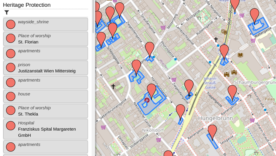
Recently, I added a new category, which shows all heritage protected items (at least those, which are tagged correctly in OpenStreetMap). Additionally, I created a web-application which helps tagging heritage protected items in Austria (and Berlin, Germany). I blogged about this here.

Hace poco instalé Grammarly en mi el computador en el que mapeo, y empecé a ver que no podía usar varios atajos del teclado - shortcuts, y me estaba volviendo loco. Desinstalé JOSM, borré todas las preferencias, cache y demás directorios, volví a descargarlo, cambié definitivamente a OpenWebStart, en fin hice mil cosas.
Había visto que cuando cambiaba de pantalla, sí podía usar la letra “s” de select en JOSM, pero me estaba molestando.
Fue cuando me acordé de este asistente gramatical en inglés, y lo desactivé permanentemente en JOSM (realmente en Java) y ahora todo volvió a la normalidad.

Hello world