Users' Diaries

Recent diary entries

HOT Tasking Manager (TM), SimpleTaskManager (STM), and Divide and map. Now. (damn) are tools for collaborative mapping, with different philosophies and different approaches. In this diary, I discuss some issues of the first two from the perspective of the third one.

DISCLAIMER: I’m the damn project developer.

Which issues to consider: I filter out bug reports and issues that oppose the damn project philosophy. Then, I pick up issues I think are interesting and categorize them, describe the category, and provide some comments how the particular issues are or would be solved.

About naming: TM’s and STM’s project corresponds to damn’s area. TM’s and STM’s task corresponds to damn’s square. Where TM uses validation, damn uses review.

Solved by design

There are many issues of both managers that wouldn’t be an issues for the damn project because of it’s design. Let’s quickly recap that design.

There are areas divided to squares. Any change to an area is stored as commit. So, creating new area leads to creating new squares as well as new commit with to map type for each square. During collaborative mapping, new commits of different types like locked or done are added with area and square identifiers, always updating particular square of the area. It’s not possible to delete something.

See full entry

One of OpenStreetMap’s greatest strengths is our worldwide platform backed by a worldwide community. As such we need to give our full support to our mappers around the world, including the ones in countries whose cultural and legal norms you may dislike and wish to work against. Supporting these mappers isn’t an endorsement of those norms; rather it is a commitment to worldwide mapping.

Any suggestion of ostracising countries would be a stand against inclusion of mappers, depriving them of the opportunity to talk about their specific issues both with each other and with the rest of the world.

StreetComplete is an application allowing to contribute to OSM by answering simple question. It makes possible to contribute without learning about tagging schemes and without learning how to handle interface of more general editor like JOSM, iD or Vespucci.

I contributed to StreetComplete in past. Recently I received a grant that will allow me to spend more time on improving it.

Grant is funded by a NLnet as part of NGI Zero grants. StretComplete grant is mentioned by NLnet at https://nlnet.nl/thema/NGIZeroDiscovery.html and https://nlnet.nl/project/StreetComplete/ pages. It will allow me to spend far more time on improving StreetComplete.

I will participate in project as usual, sending pull requests that will be reviewed and accepted (or rejected) by StreetComplete author, Tobias Zwick and minor changes commited directly (and still subject as review).

Note that I selected topics of work to be done (based mostly on open issues on the bug tracker) on my own, and it was accepted without any requested changes. I am sole beneficiary of the grant.

Total grant will depend on how much I will manage to do before deadline.

See osm.org/user/Mateusz%20Konieczny/diary/368849 for earlier, very similar entry.

I created osm.wiki/NLnet and submitted it OSM weekly as it seems to me that other OSM projects also may be funded.

Posted by Homosaur on 9 October 2021 in English.

A well.. appears I cant accurately add building to this map since the satellite images are old. The images available show the site before the foundations where put so it is hard (or maybe impossible) to add buildings without any reference point (plus I’m new to this so I know nothing).

Anyway, I’ll just keep studying the site and hopefully, I may figure out a way to add the buildings.

Location: Boera, Kairuku-Hiri District, Central, Southern Region, Papua New Guinea
Posted by DUGA on 9 October 2021 in English. Last updated on 10 October 2021.

People should be wary of the imagery offset especially using high resolution products. In OpenStreetMap, Mapbox often provides high resolution images in densely populated areas within the US. However, just because Mapbox provides high resolution imagery does not mean the offset is not a thing. In fact, Mapbox has created a lot trouble as it pretends to be accurate but actually not.

Keep in mind that whenever your local municipality has its own orthoimagery published, always use it to draw features (of course it has to be compatible with OpenStreetMap, if it is missing in iD, maybe you can bring it in). The imagery could be dated, but it is accurate. Your local municipality will spend more time to process with the data. These “commercial” providers, like Mapbox or ESRI or Bing, do not have a lot of time to carefully examine everything in a specific area especially when it is not that popular.

I’m going to post an example here. The orange area is OSM data fetched by QuickOSM in QGIS, drawn by a random person who has not noticed the offset for years.

See full entry

Location: Roland Place, Bel Air, Harford County, Maryland, 21014, United States
Posted by cquest on 8 October 2021 in French (Français). Last updated on 9 October 2021.

L’association OpenStreetMap France a été créée le 8 octobre 2011, il y a 10 ans.

Nous fêterons cet anniversaire lundi 11 octobre dans plusieurs endroits en France, ainsi qu’en ligne.

C’est l’occasion de revenir sur cette première décennie et pour commencer sur la génèse de l’association.

La première trace de discussion sur le principal canal de communication (talk-fr) date du 16 novembre 2009:

https://lists.openstreetmap.org/pipermail/talk-fr/2009-November/016188.html

Robin Prest pose la question “Voulez vous créer une association OSM France ?” après que Pieren et Etienne Chové mentionnent “une association française qui mettrait en place des serveurs (avec peut-être un soutien pour l’administration) et qui a surtout besoin d’un porte-parole”. Le sujet des serveurs est en effet important à l’époque, pour mettre en place des services (comme osmose) et les dons ne sont envisageables qu’avec une structure officielle. L’Université de Nantes fera ainsi le “mirroir” pour le don d’un lot de serveurs venant de chez free (voir: https://lists.openstreetmap.org/pipermail/talk-fr/2009-November/016284.html).

Un vote est lancé sur un Doodle… une cinquantaine de “OUI” se dégage en quelques jours.

Le mode de fonctionnement proposé par Robin est le suivant:

D'ailleurs, je suggère que les statuts prévoient de "soutenir" le projet
plutôt que de le "diriger" - référence au message de **sly** sur la république
bananière - ce qui permet une certaine souplesse dans le fonctionnement
général. D'ailleurs, on peut avoir OSM tel quel avec sa communauté de plein
de gens anonymes qui participent sans se prendre la tête avec le côté
administratif  et une assoc OSM france dont un des buts est de soutenir le
projet d'une façon ou d'une autre (par l'hébergement via des serveurs, par
la collecte de dons, par les communiqué de presse, par ses relations, etc),
l'un n'empêche pas l'autre.

See full entry

Location: Quartier Vivienne, Paris 2e Arrondissement, Paris, Île-de-France, France métropolitaine, 75002, France

Just realized that I didn’t notice that on Tuesday (the 5th) I sent out the 10’000ths welcome message to a contributor.

I’ve been doing this for SOSM since December 2013, nearly 8 years ago, averaging a bit over 100 messages per month.

I’ve discussed our expectations (or rather the absence of them) before see osm.org/user/SimonPoole/diary/40071

PS: The happy “winner” was osm.org/user/JFischli

Dear HOT Voting members, HOT staff, HOT volunteers and people interested in HOT, Humanitarian and Open Mapping,

I hope this message finds you and your loved ones well and healthy. I would like to present to you my end of term report as President of the Board. On 10 February 2021 I shared a detailed annual report for 2020. In this new report I would like to focus on challenges, ongoing efforts, key learnings and achievements.

Challenges

Of all the anticipated challenges while participating as a Board Member, a global pandemic was not on our list. It was a difficult and challenging time for Voting members and staff and the Board members were not an exception. Board members, like many other people, were facing difficult situations with loved ones getting infected, trying to find a balance between working from home and taking care of their families, among many other difficult situations.

This could be one of the reasons why not every Board member was contributing equally. Being part of a Board requires certain commitments such as time and asynchronous participation to be able to be part of the decision making process, often outside of Board meetings. Some Board members were not responsive or slow on providing feedback in discussions, this caused delays in progress and decision making.

My suggestion to future Board participants is to review in advance the Board Procedures and other relevant documentation to make sure you can commit to this two year period.

See full entry

Hi all,

I hope you are all well and safe.

As many of you know, we have been working on a new model to ensure Tasking Manager (TM) continues to get the love and attention it well deserves. As we unpacked the value of the project, we started to realise just how much we value the inputs and contributions of a large collective of contributors lodging issues, PRs, code, resources etc. I went through every single issue on TM’s Repo and was really blown away by just how much support the project gets both in front of and behind the screens.

Moving forward, we really want to return TM to its former community-lead glory and as such have put together this proposal for what TM’s Tomorrow could look like.

https://docs.google.com/document/d/1tTT4oKUN34FThzbNFZKfj0lhQOMRB4uTF1n2rO1iHrc/edit?usp=sharing

I invite everyone to comment in the doc on things they like or don’t like or questions they have so we can reenergise our love for the TM and it’s sustainability and evolution. There is a long list of Frequently Asked Questions (FAQ’s) at the end of the doc, but I also invite you to add your questions as a comment to the FAQs so we can endeavour to answer them as well.

I really look forward to your feedback.

Kindness,

bo

p.s. we are also now on the hunt for a possible community representative product owner for TM, so if this sounds like something you could be interested in, please get in touch.

Location: Naz, Esserts-Salève, Monnetier-Mornex, Saint-Julien-en-Genevois, Upper Savoy, Auvergne-Rhône-Alpes, Metropolitan France, 74560, France
Posted by dcapillae on 6 October 2021 in Spanish (Español). Last updated on 4 July 2024.

Bibliobús municipal de Málaga Bibliobús municipal de Málaga junto al colegio María Zambrano. Fuente: trabajo propio (CC BY-SA 4.0) disponible en Wikimedia Commons.
Hace algún tiempo me propuse mejorar la información geográfica disponible en OpenStreetMap relativa a bibliotecas y librerías. Otras ocupaciones me han distraído de este empeño, aunque continúo trabajando en ello. Recientemente se han incorporado al mapa los datos abiertos del Ayuntamiento de Málaga relativos al equipamiento municipal de bibliotecas.

See full entry

Location: Centro Histórico, Centro, Málaga, Málaga-Costa del Sol, Málaga, Andalucía, España
Posted by SebastianHelm on 6 October 2021 in English.

Now it is one week since I started working with OSM. Sadly, my initial enthusiasm has waned. While there were many nice experiences, above all encountering some helpful fellow mappers, a feeling of meaningful connection with the purpose of the project did not develop.

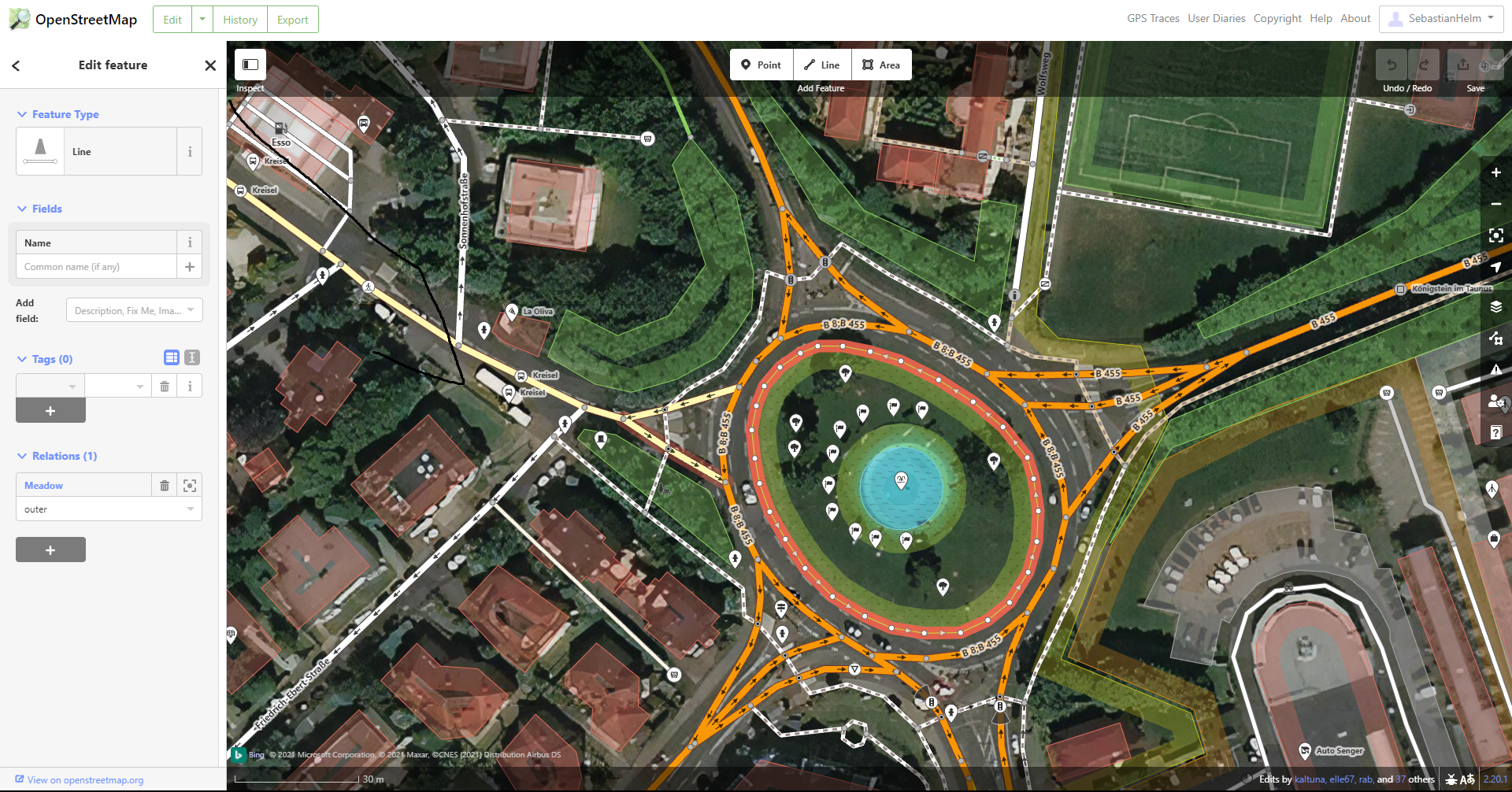
The apps I used show little consideration for what’s meaningful to the average mapper or end user. The below example from iD may serve as an illustration for how haphazardly it has been decided what gets displayed and what gets hidden. This matters because the UI displays no settings button to override that decision. iD visibility example

See full entry

Hi everyone,

A new version of MapComplete has been deployed. It has a lot of exciting new themes and features, which I’d like to highlight in this diary entry.

New themes

The Flemish touristical agency (Toerisme Vlaanderen) has asked me to create a tool to help them to map charging stations, restaurants, café’s, …

This has resulted in quite some fun new themes:

At last, the theme I’ve quickly made as demo with hackerspaces and makerspaces is online as well.

Other improvements

At the same time, I’ve been doing lots of work on improving performance. A lot has changed under the hood, resulting in a way more robust and fast experience. On high zoom levels, the OSM-API is used directly, bypassing overpass all together. If overpass-api.de is down, failover to other instances is now builtin. At last, caching is a bit more aggressive and if the data on your machine is recent, no new data is loaded at all.

Earlier releases had some important features to, which I’d like to highlight as they can be important for theme builders:

  • A layer can configure filters
  • A layer can demand to have ‘precise input’, showing an extra draggable map (with e.g. aerial photography) when a new point is added to the map.
  • A new point can be snapped to an already existing road, e.g. when adding a bollard
  • A layer can define that a point can be (soft) deleted
  • The new Mapillary-API has been integrated
  • Some themes have a download-button enabled to download as GeoJson or as CSV

I need your help!

See full entry

Posted by LySioS on 5 October 2021 in English. Last updated on 6 October 2021.

Disclaimer #1 I’m not used to speak english anymore, I apologize if some sentences sound clunky.

Disclaimer #2 Last time I added pictures in the diary post, they would not always show up. Click on the link if it happens.

Introduction

So now, I’d like to start with a provocative joke :

Marck Zuck. comes into his office and asks his colleagues :

– Hey, do you know why there’s a magnifying glass on the OpenStreetMap logo ?

– Well, it means that OpenStreetMap helps you find places and amenities on the map.

– Not a all ! It’s because you won’t notice the credits without one.

Text Vs Logo

My point is that OpenStreetMap lacks a strong visual identity. I believe I started to notice it when I read some Facebook employee saying that a logo would be easier to credit on a map than the (c) openstreetmap contributors. 🤨

Dishonesty aside, he makes a point. The (not so) new OSM logo is gorgeous and deserve more consideration and would help OSM maps being more recognizable and popular. In times where we are constantly facing pictures, logos, visuals, a brand/company/project/whatever need a clear visual identity to exist in our digital world. The actual text only credit looks like good oldies websites.

Besides, sometimes, OSM credit is in competition with some other logo. I was thinking of Mapbox but I couldn’t find an example with an OpenStreetMap map.

See full entry

You may have heard people talk about ‘priority countries’ in relation to HOT’s work and the regional Open Mapping Hubs (the Asia Pacific hub for example).

HOT has committed to furthering its longer-term vision across 94 countries through 2025. Initial priority countries were selected based primarily on disaster risk and acute deprivations needs (measured through the multidimensional poverty index).

I just wanted to flag that if you ever need to know which countries they are or the process for updating the list, there is now a page on the OSM wiki at https://wiki.openstreetmap.org/wiki/Humanitarian_OSM_Team/Priority_countries.

Please let me know if there is any information missing that you think should be there…

Posted by HeiligerHein112 on 4 October 2021 in German (Deutsch).

Ich arbeite in einer Leitstelle und wir greifen auf die Daten von OSM zurück. Manchmal ist es schwer ersichtlich, sofort und schnell eine Adresse zu erkennen, wenn Adress-Punkte teilweise neben Gebäuden versorgt werden. (Ich weiß nicht, wie das Ganze mit den Layern funktioniert, aber die Adress-Punkte “verrutschen” häufig und sind dann neben den Gebäuden.) Laßt doch bitte die Hausnummern in den Gebäuden und setzt nur Adress-Punkte auf Grundstücke, auf denen (noch) kein Gebäude steht. Danke.