Users' Diaries

Recent diary entries

I have been checking all Danish motorway,trunk,primary,secondary, and tertiary roads without a maxspeed tag using geotagged photos (Mapillary, Kartaview, Bing). The maxspeed status now is (distances in km):

Maxspeed stats

  • motorway :: missing maxspeed: 0 , total: 2586 , pct with maxspeed: 100.0
  • trunk :: missing maxspeed: 0 , total: 502 , pct with maxspeed: 100.0
  • primary :: missing maxspeed: 0 , total: 2771 , pct with maxspeed: 100.0
  • secondary :: missing maxspeed: 10 , total: 6531 , pct with maxspeed: 99.85
  • tertiary :: missing maxspeed: 5421 , total: 23739 , pct with maxspeed: 77.16
  • unclassified :: missing maxspeed: 24821 , total: 32060 , pct with maxspeed: 22.58
  • residential :: missing maxspeed: 20866 , total: 27987 , pct with maxspeed: 25.45

I believe this is really good. Most routing decision will have almost optimal data. Even if the first or last part of potential routes are short residential or unclassified ways with unknown maxspeeds, it will in most cases not affect the result because there are no alternatives.

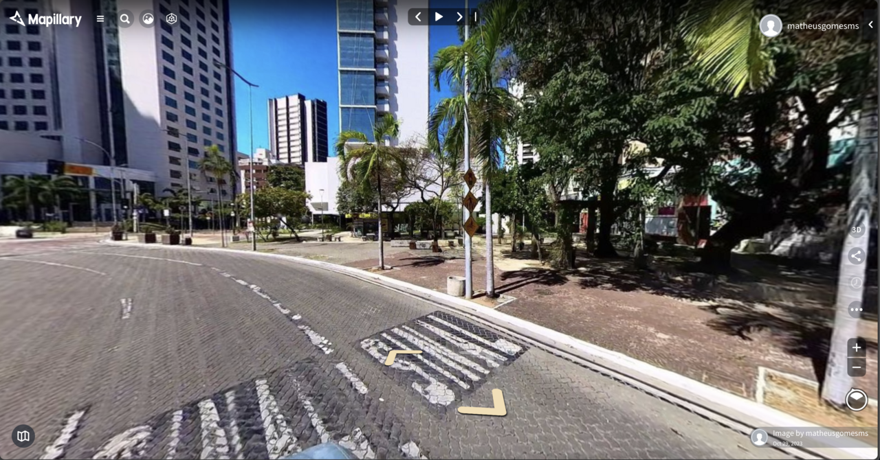
Motor-vehicle users of OpenStreetMap apps will most of the time be on roads with known max-speeds. I know this because it is getting quite difficult for me to get to ways without maxspeed to produce geotagged photos. I download a GPX file with ways without maxspeed to OsmAnd so that I can try to photograph them if it not too much out of the way.

Quality

Of course having maxspeed tagged on many roads is only valuable if the tagging is correct. I did find some incorrectly tagged max-speeds. This was mainly due to:

See full entry

Location: Brageland, Daugstrup, Nordfyn Municipality, Region of Southern Denmark, Denmark
Posted by AngocA on 4 November 2023 in Spanish (Español).

Después de haber participado en el evento de Wikimedia Colombia, me interesé aún más en apoyar la integración de estos proyectos, sabiendo que ya hay varias formas, pero no son muy conocidas. Por eso, aquí voy a listar las cosas que conozco, y actualizaré la entrada cuando encuentre más.

Etiquetas en OpenStreetMap

  • Etiqueta wikipedia - Key:wikipedia
    • Aquí se puede ver que en muchos casos no se debe usar solo esa etiqueta, sino acompañada de:
      • artist:wikipedia
      • architect:wikipedia
      • brand:wikipedia
      • subject:wikipedia - Probablemente la más común.
      • operator:wikipedia
      • network:wikipedia
      • species:wikipedia
      • taxon:wikipedia
      • name:etymology:wikipedia
  • Etiqueta wikidata - Key:wikidata
    • Para asociar ese concepto de wikidata en OSM.
    • Tiene muchas etiquetas secundarias:
      • architect:wikidata
      • brand:wikidata
      • buried:wikidata
      • flag:wikidata
      • genus:wikidata
      • manufacturer:wikidata
      • model:wikidata
      • name:etymology:wikidata
      • network:wikidata
      • operator:wikidata
      • owner:wikidata
      • royal_cypher:wikidata
      • species:wikidata
      • subject:wikidata
      • taxon:wikidata

Atributos de Wikidata

  • coordinate location - P625
    • Al abrir el wikidata, se verá un mapa de OpenStreetMap con la ubicación.
  • headquarters location - P159
    • Muestra el lugar de la casa matriz en un mapa.
  • OpenStreetMap relation Id - P402
    • Es el identificador de OSM de una relación, sin embargo no es muy recomendada, ya que puede cambiar de Id.
    • Caso similar para los nodos P11693 y ways P402

Herramientas de edición

See full entry

Location: UPZs Localidad Teusaquillo, Localidad Teusaquillo, Bogotá, Bogotá, Distrito Capital, RAP (Especial) Central, Colombia

Memoria descriptiva del mapeo de señales y carteles, usados por los trenes en la sección eléctrica de la Línea Sarmiento (Once-Moreno).

No encontré manual de señales para ésta línea, no soy experto ferroviario, no tenía idea de señales ferroviarias hasta que empecé a investigar para mapearlas en ésta línea, que es la que uso habitualmente, todo lo descripto aquí es en base a investigación en manuales de otras líneas y cosas que encontré por ahí, no estoy seguro de algunas cosas, funciones y sus nombres, por lo que por favor: corrígeme! Se dejan anotados los tags que se usan en ésta línea, pero se mencionan otros por si te sirve para mapear en otro lugar, revisar la wiki para más etiquetas.

Las señales son del tipo “semáforo” o de aspectos lumínicos, entre Once y Liniers las señales principales tienen 4 aspectos, entre Liniers y Moreno tienen 3.

Es común ver en un mismo poste varias señales, cada señal tiene su propio código de referencia, por lo que tuve que generar un nuevo tag para esto, railway:signal:main:ref=*, railway:signal:route:ref=*, railway:signal:shunting:ref=*, si hay una única señal se usa ref=*.

See full entry

Posted by RaphmanG on 2 November 2023 in English.

Hey! Just testing out this diary feature.

I’m making a diary entry as I’ve just seen this feature, I assume this will be shown on my profile. I see we can also include a location to it! Should a diary entry be tied to a specific location? Writing this, I start to wonder…

  1. Do people use this feature at all? If so, for what?
  2. How do people find this? I’d assume it is not every mapper’s pastime to casually stalk other mappers’ profiles! Am I wrong?
  3. Are there mechanisms that allow you to discover local users?
  4. Do some people use the platform as a mean to meaningfully connect and perhaps extend connections to other projects or platforms?
  5. Are relations rather equal between users, as in Facebook, where friends are friends with each other and where exchanges are expected to be mutual or is there power distance between users, like on Instagram, with followers and the followed?

Perhaps I’ll make a new diary entry when I’ve found out! :p

Location: Dornach-Auhof, Linz, Upper Austria, Austria

mapping workshop for beginners on Openstreetmap

Oficina de mapeamento para iniciantes no Openstreetmap

Inscrições Abertas! Inscrição na Oficina de Mapeamento

Inscrições Abertas!

Inscrição na Oficina de Mapeamento

The Mapping of the Marco Neighborhood, Belém - Pará - Brazil will be done by Beginners and Advanced Mappers and aims to Include Buildings, Points of Interest (General Commerce, Schools, Health Centers and Squares) thus improving data from the City of Belém.

https://tasks.hotosm.org/projects/15707

Workshop created by umbraosm

UMBRAOSM - Union of Brazilian Openstreetmap mappers www.umbraosm.com.br

Location: Fazenda Lagoa Seca, Ibitiruna, Piracicaba, São Paulo, Southeast Region, 13404-755, Brazil

project activated by UMBRAOSM 2023/2024 edition

##01/11/2023 - project activated by UMBRAOSM Union of Brazilian Openstreetmap mappers

BRASIL - BAIRRO MARCO - BELÉM- (PA) - EDIFÍCIOS, PONTOS DE INTERESSE E ÁREA VERDE.

https://tasks.hotosm.org/projects/15707

O Mapeamento do Bairro Marco, Belém - Pará - Brasil será feito por Mapeadores Iniciantes e Avançados e tem como objetivo Incluir Edifícios, Pontos de Interesse (Comercio em Geral, Escolas, Postos de Saúde e Praças) melhorando assim os dados da Cidade de Belém.

The Mapping of the Marco Neighborhood, Belém - Pará - Brazil will be done by Beginners and Advanced Mappers and aims to Include Buildings, Points of Interest (General Commerce, Schools, Health Centers and Squares) thus improving data from the City of Belém.

BRASIL - BAIRRO MARCO - BELÉM- (PA) - EDIFÍCIOS, PONTOS DE INTERESSE E ÁREA VERDE.

https://tasks.hotosm.org/projects/15707

Link do Projeto: https://www.umbraosm.com.br/mapeia-belem.html

See full entry

Posted by Tomas Straupis on 1 November 2023 in English.

Attack

In the sinister depths of a fellowship of the underground cartographers, known for its dark secrets, two veteran system administrators, Hat-trick and Springbok, had laboured tirelessly to maintain a cursed digital infrastructure for years. Their expertise was revered, their work likened to the dark heart of the company’s success.

On a moonless night, a group of overconfident, so-called dunkrugers challenged Hat-trick and Springbok. These individuals were unaware of the malevolent forces that dwelled within the servers, but their arrogance led them to believe they could control the sinister systems.

Ignoring the administrators’ chilling warnings, they recklessly invaded the server room, meddling with cables and initiating occult-like configurations. Their actions unleashed a torrent of unholy chaos as servers crashed, forbidden data was consumed, maps started to lie, and the very essence of the system unravelled.

See full entry

In May 2023, I discovered the existence of two websites : “The Skyscraper Center” and “Skyscraper Page”, presenting skyscrapers from all over the world and especially… skyscrapers from Pyongyang!

I took this opportunity to enrich several free projects on which I’m active: Wikidata with the creation of the elements in the first instance, combined with images from Wikimedia Commons in the second instance, to place them and link them with the OpenStreetMap data in the final instance!

Creating the skyscrapers in Wikidata

Wikidata is a database that can be very useful for the OSM project. In my case, it was very useful for tracking each skyscraper.

And it’s very well suited to adding all the skyscrapers that existed in The Skyscraper Center and Skyscraper Page for Pyongyang city.

Wikidata has a number of “properties” (PXXX) which can be used to provide a whole range of information:

  • where each building is located (P625)
  • when they were built (P571)
  • their height (P2048)
  • the number of floors (P1101), etc…

See full entry

Location: 39.023, 125.761

TLDR: No.

Very long version: Maybe

I was inspired by Feye Andal recent post, so I’m telling my experience and providing a workflow to those who face the same problem.

Background

Recently I was looking to buy an affordable 360 camera to capture street-level imagery and obtain the processed elements that Mapillary provides (traffic signs and other points, via AI). I wanted it to use on my PhD research and of course, contribute to the OSM community and map data. The main recommendation is the now a bit old GoPro Max 360. The product is solid, and very easy to connect to Mapillary.

See full entry

Location: Sabiaguaba, Fortaleza, Ceará, Northeast Region, Brazil
Posted by Ride3400 on 31 October 2023 in English.

This is my first OSM contribution: THPRD in cooperation with Arbor Lakes HOA, LLC and Finley Woods/Noyes Development have created a new Waterhouse Trail segment with easement over Finley Woods and Arbor Lakes property. I added the new trail segment to the map after recording a GPX on my phone walking the trail. I hope I did it right!

Location: North Bethany, Bethany, Washington County, Oregon, 97229, United States

Personal notes about potential mapping of the Palenque archeological site from archeological GIS data.

Source

Edwin L. Barnhart. 2001. The Palenque Mapping Project, 1998 - 2000 Final Report

Questions

  • Permission to use the data, no licence specified -> get in touch with author
  • What to map in OSM? Only visitable areas? Major buildings (ie. Templo Escondido)? Waterways? All site (lots of buildings, does it belong to OSM)? A staged approach is necessary
  • Is there any local community / interest groups to get in touch with?
  • The data looks like it’s of good quality but dates from 2001. Any updated dataset?
  • 3D mapping of certain buildings?
  • Source for naming? Limited on-the-ground names, multiple naming schemes (the source paper claims to be overcoming this in a sensible way, is it still up to date, accepted by the archeology community?) English translation for certain objects
  • Any prior work in OSM for this site or similar archeological site?

Problems

  • Data in DWF format, how to import in JOSM

TODO

Location: Palenque, Chiapas, 29960, Mexico
Posted by aaei924 on 29 October 2023 in Korean (한국어). Last updated on 31 October 2023.

공공 데이터를 이용하여 정류소 태그를 생성해 주는 도구입니다. 현재 경기도, 서울특별시 소재 정류소에만 사용 가능합니다.

https://prws.kr/osmtags/busstops


사용 방법

정류소번호나 명칭을 검색한 후 복사하고자 하는 태그 유형이 적힌 버튼을 클릭하면 텍스트 형식으로 클립보드에 복사됩니다.

태그 정보

  • 정류소: highway=bus_stop
  • 승강장: public_transport=platform
  • 정차위치: public_transport=stop_position

위의 기본 태그 이외에 국문 및 영문 명칭(일부 지원)과 정류소ID, 네트워크 정보(경기도만)가 포함되어 있습니다.

유의 사항

지역별로 제공되는 데이터의 차이로 인해 일부 지역에서 생성되지 않는 태그가 존재할 수 있습니다.


업데이트 내역

  • 11월 1일: 서울특별시 정류소 지원 추가

Maplibre and Protomaps are a match made in heaven! Together they are democratizing vector maps! There’s no better time to get involved than now; let me set the scene first.

Maplibre SDK with Protomaps vector tiles, map at an angle with a video source playing drone footage video overlayed; data attribution (c) OpenStreetMaps and contributors

Maplibre is the open source map SDK forked from mapbox-gl-js when Mapbox changed their license and moved away from open source in 2020. Maplibre packages up around seven years of state of the art map renderer development and is best in class in terms of map rendering and styling vector tiles.

Protomaps is a relatively new project and it’s fundamentally changing how vector maps are distributed. Protomaps can package up the whole world into a single .pmtiles files of around 100 GB. Static hosting this single file gets us global vector tiles! Magic!

See full entry

Arquivos das apresentações realizadas no SotM Brasil 2023, que foram gentilmente disponibilizadas pelos(as) autores(as).

Para acessar as publicações (volume de anais e pôsteres,) clique aqui

Apresentações (por ordem alfabética)

AUTOMATIZAÇÃO DO PROCESSO DE IMPORTAÇÃO E CONFLAÇÃO MASSIVA NO OPENSTREETMAP

Matheus Gomes Correia, Kauê de Moraes Vestena, Gustavo Soares, Silvana Phillipi Camboim e Adelino Ferreira

See full entry

Location: Jardim Botânico, Curitiba, Paraná, South Region, Brazil
Posted by DeLouredo on 29 October 2023 in Galician (Galego).

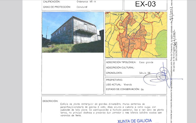
O Baceliño, con preciosas vistas do outro lado do pobo, parte do barrio do Coutiño (ollo a estes nomes e ó cerca que están, como sinalei na foto anterior, e canto diminutivo utilizado). Nesta zona situou o PXOM do concello de Cortegada unha “casa grande”. Por desgraza, denomínana como “do Cazapedo”, cando tan topónimo inda se atopa a uns cantos metros de distancia. Mal menor sería dicirlle “do Coutiño”.

Así queda descrita na ficha patrimonial: “Edificio de planta rectangular de grandes dimensións, muros portantes de perpiaños/cachotería de granito á vista, dúas alturas e cuberta a catro augas con cubrición de tella plana. En contraposición a fachada posterior, lisa e sen vans na planta terrea, na principal destaca a presenza dun corredor e nas laterais balcóns voados con varandas de ferro”.

O código do elemento é o 6-15, a localización en plano é EX-03 e a clasificación do solo denomínase Solo de Núcleo Rural Histórico.

Captura da ficha patrimonial

See full entry

Location: Casa Grande da Canliña, Louredo, Cortegada, O Ribeiro, Ourense, Galicia, 32200, España