 OpenStreetMap
Users' Diaries
Recent diary entries


Before I started mapping I didn’t think much about walkability. There are parts of the city that are hard to get to without a car.
Some streets don’t even have a sidewalk. Theres a chance that curbs have no ramp for wheelchair users. I will say though that the city is making things better.
A couple new walking paths were built along the two main roads. Near my house there was also work done to the roads and sidewalks. We now have ramps on the curbs!

5/8/2023: Salí de vacaciones a la playa de Cayo Bariay, aproveché la ocasión para mapear la zona. Pude recolectar datos de las instalaciones de la playa, las calles y los poblados por donde tuve que viajar. Me sorprende mucho como hubieron una cantidad de edificios como bodegas y clínicas que no habían sido indicados anteriormente en OSM, por lo tanto también me sorprende la poca colaboración de esta zona. Los datos recopilados lo iré añadiendo poco a poco.

Cool

It’s a long weekend this weekend in Ireland so I found some time today to catch up on some OpenStreetMap tasks.
Primary objective: Send welcome messages to new contributors in Ireland.
Objective status: Completed. \o/
Other observations:
- new contributors add lots of good information. some mistakes but we also did that at the start.
- lots of buildings still to add in Ireland.
- impressed by the amount of organisations trying to contribute updates. Saw new contributions from libraries, public transport organisations, business improvement organisations.
- A new contributor with a username that may signify they work in the waste industry has been adding information for new estates. Love it!
- Terracing tool rocks! Added a whole estate in Blarney, Co. Cork in about an hour using it today.
- Map Roulette (see maproulette.org ) is cool.
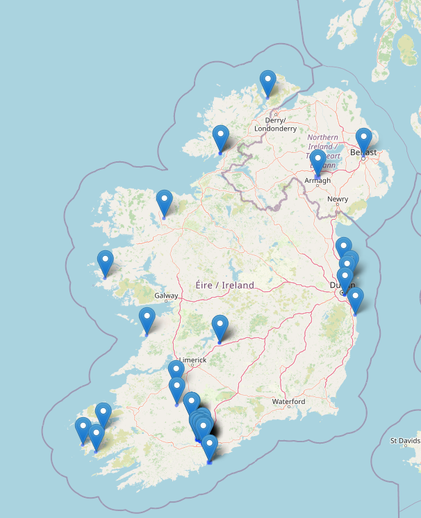
Map of recent edits for dónal

Le titre du texte
Un sous-titre
Texte pour le test… Blablabla !

Lots of criminal going on here


Everyone knows that StreetComplete is a simple editor. But did you know that it has more features than it seems at first glance?
On osm.org does not support video, so the article will be on telegra.ph https://telegra.ph/Advanced-StreetComplete-08-04
На русском языке: https://telegra.ph/Prodvinutyj-StreetComplete-08-05

Немного поразбирался с тегами, участвующими в 3D-рендеринге и отредактировал пока в черновом варианте собор в Болграде. Но вот увидел такую красоту (собор Святого Петра в Ватикане): https://demo.f4map.com/#lat=41.9025964&lon=12.4542521&zoom=19&camera.phi=-39.534

Стало интересно, как там задают скульптуры. Они, похоже, указаны как векторные изображения, отбрасывают правильные тени:

Yesterday which was the 5th of August, 2023 we ha our weekly mapathon. This holds every Saturday of every week. I trained our newbie from last week on how to use Maproulette and how to map road. Then I also opened a new account and trained a newbie yesterday on how to map. We had two newbies yesterday but I could only open an account for the other because our time was up. We all also had refreshments and had fun mapping. We were a total of 6.
I attended the monthly coordination meeting that took place on the 5th August from 9:45am-11am. The Agenda for the meeting 1. Map Nigeria Mapathon Project -progress and concerns 2. Other community Activities- 3. Reports from Mapathon centers/State Chapters/Campus Team 4. SotM Nigeria 2023-updates and Actions required
I also invited 2 persons to attend the meeting. It was quite nice.
There’s lots of software around to work with OpenStreetMap data - querying it, creating maps from it, using it for navigation. One area that there has historically been less support is analysing OSM changeset data. As an example, here is one of mine.
However, many years ago Toby Murray wrote ChangesetMD. That can be used to maintain a database of changeset information (tags, discussions, etc.). Martijn van Exel updated that to a recent version of Python and I made a couple more changes to support very recent Python versions and made the replication more scriptable.
Downloading changeset data
Over on the planet.osm.org site, there’s a download for all the changeets generated at the same time as the weekly “planet” file is created, and also one for all the changeets and discussions as well. The changesets-only one is just over 6GB (bzipped), and the one with discussions as well is only about 250MB more, because most changesets don’t have discussions.
If you’re not interested in changeset data dating back to 2012 you don’t need to download this file; you can just start replicating from whatever point in the past you are intereted in starting from.
Installing the software
If you’re on Debian or Ubuntu, you’ll likely want to follow these instructions from a non-root user account of your choice (substitute that account for “youruseraccount” in the instructions).
Running it for the first time
From the virtual account created by the installation, which you can reenter by running
cd /home/${youruseraccount}/src/ChangesetMD
source .venv/bin/activate
Run something like this
python changesetmd.py -d changesets -c -g
The “-g” is optional and initialises the database to store geometric data. “changesets” in the line above is just the database name.
Loading a changeset dump file
To load the database with changesets and discussions:
python changesetmd.py -d changesets -g -f ~/data/discussions-latest.osm.bz2
Added lots of building in SA between anderson loop-huebner and I10-NW Military HWY. Will continue adding in sections until SA buildings are filled in completely.
ฟิวแฟคอฟฟี่

I participated in the coordination of the conference state of The Map Nigeria in preparation for the Conference
Magic Earth is an Android App that used OpenStreetmap as it’s mapping source. Unfortunately many streets i travel either had no speed limit or a value that was in ERROR. So tonight I joined OSM and learned how to edit Speed Limits on streets. To my surprise I racked up 27 changes to post.
Editied OSM again this week.
I’ve spent time at Sargent Park (Winnipeg, Canada), and noticed a lot of missing pathways, which I can use on a bike or walking. I’ve made several updates to paths, roads, parking, fences, building names, facility names, etc.
I’m quite happy with the changes.
I haven’t found a good android app for OSM, either. Someone must know something decent– a kind of google maps competitor.
Today I came to think again about on-demand bus service areas. There is one mention on the OSM wiki: this explanation from Belgium, but I’m not sure if it really refers to a service area rather than a line with on-demand stops. The idea of the on-demand bus service area is that from one central stop a small bus will take you wherever you want to go, almost like a taxi, but only at certain times, and together with other passengers (if there are any). The concept has been quite common for some time in rural areas all over Europe. In my opinion, we could just draw the area, give it some tag so it is put down in the data that this rural area is generally accessible by public transport.
Mapper BroccoliB did so here, and his attempt was also what made me think about it again.
The reason I came across his edit was that my wife and I had a day off and used it for a bike ride through the sparsely-populated area north-east of Wolfsburg, just across the former border between West and East Germany. It was nice cycling along the Mittellandkanal - but I have to say that we are quite used to gravel tracks and have equipped our bikes with appropriate puncture-safe tyres. Some excellent pear trees along the road here. No traffic at all because of a road closure further south. When we came to the nearest larger village, we had to decide if we wanted to continue on the road in heavier traffic now or use a track running parallel. To our surprise (it wasn’t mapped as such yet), it had excellently smooth asphalt. For the way back we had opted for a bus line that also carries up to five bicycles (for free!). It’s really amazing what the land of Saxony-Anhalt with its limited resources and sparse population does for an attractive public transport. Lower Saxony could take a page from its book!
Posted by NorthCrab on 3 August 2023 in Polish (Polski).
Last updated on 11 August 2023.

🗺️🦀 Witajcie, społeczność OpenStreetMap,
Dziś dzielę się z Wami moim najnowszym projektem, osm-yolo-crossings — nowym narzędziem wykorzystującym zaawansowaną technologię AI do samodzielnej detekcji i mapowania przejść dla pieszych (zebry) w OpenStreetMap. Po udanym imporcie budynków w Polsce za pomocą AI, przyszedł czas na poprawę bezpieczeństwa pieszych!

Dzięki mocy detekcji obiektów YOLOv8, to narzędzie automatyzuje mapowanie brakujących przejść dla pieszych na naszych mapach. Z imponującą precyzją wynoszącą ponad 99,7%, jest w stanie zaimportować około 88% wszystkich wykrytych przejść. Pozostałe 12% jest odrzucane z powodu niskiego poziomu pewności. Dzięki inteligentnemu filtrowaniu, system ten jest niesamowicie wydajny. Na przykład, jest w stanie zmapować całą Polskę w ciągu zaledwie dwóch miesięcy, używając pojedynczego serwera bez karty graficznej. To AI pracuje mądrze, a nie ciężko!
🗺️🦀 Hello OpenStreetMap community,
I am excited to share with you my latest invention, osm-yolo-crossings — a new tool that harnesses cutting-edge AI technology to autonomously detect and map pedestrian crossings (zebras) in OpenStreetMap. After the successful AI building import in Poland, it’s now time to expand and improve pedestrian safety!
Leveraging the power of YOLOv8 object detection, this tool is designed to ensure that we no longer miss pedestrian crossings on our maps. With an impressive >99.7% precision rate, it’s able to import around 88% of all detected crossings. The tool discards the remaining 12% due to low confidence levels. Thanks to smart filtering, this system is incredibly efficient. For instance, it can map the entirety of Poland in just about two months using a single server without GPU. This is AI working smart, not hard!