OpenStreetMap logo OpenStreetMap

Users' Diaries

Recent diary entries

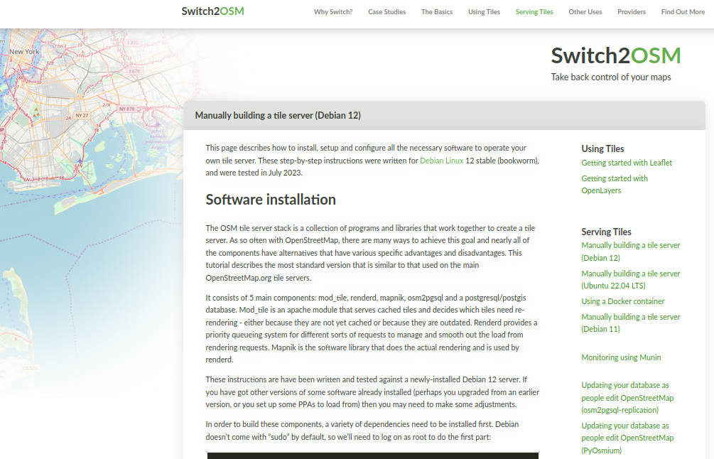
Screenshot of switch2osm page

I’ve added a new page to the switch2osm guide: “Manually building a tile server (Debian 12)”.

Mostly it’s minor changes only from Debian 11 and Ubuntu 22.04 - new versions of software, that sort of thing. Where new manual steps have to be carried out, the guide describes them. Debian 12 itself does have some differences - “syslog” is no longer created by default, so debugging changes slightly.

I’ve also updated a couple of other pages such as the replication ones to reflect that Debian 12 is now a supported operating system.

Separately to that, I’ve moved map.atownsend.org.uk (which uses a related may style) from an Ubuntu 22.04 server to a Debian 12 one. There was nothing wrong with the old one, but the hosting provider I use was offering higher spec ARM servers for essentially the same price as the old AMD one I was using, so it made sense to move.

See full entry

Location: Thurles Townparks, Thurles Urban, The Municipal District of Thurles, County Tipperary, Munster, Ireland
Posted by richlv on 14 July 2023 in English.

There’s this absolutely marvelous tool that offers Overpass tutorial with a storytelling approach. You get hints at how queries should be modified, and can try them out against real data, progressing as you find new bits of information from OSM data.

Learn Overpass

Unfortunately, it’s a bit out of date compared to the current live data in the OSM database, and breaks somewhere around step 6.

Still, even if you haven’t used Overpass before, the first five steps can be useful - and maybe the project gets revived :)

Posted by Infinite_Bed on 13 July 2023 in English.

For some reason, I have decided to re-engulf myself within OSM. I have found almost an entire city in south Colorado, devoid of houses mapped, and have thusly made it my mission to map them. After 3 days of mapping, I would deduce that I am about 10% done with all of these houses. Progress is certainly being made.

Location: East Cañon, Cañon City, Fremont County, Colorado, 81215, United States
Posted by miku0 on 13 July 2023 in English. Last updated on 17 July 2023.

Hi everyone!

This is a blog post providing an update on the progress of my project, which aims to improve the search experience in Japan. My project is 12 weeks long, and we are currently in the 7th week.

How did we approach it?

Based on our research, we identified two key areas for enhancing the search experience. These two aspects are interconnected, and we are working on resolving them simultaneously.

Searching for addresses: Currently, Nominatim focuses on the addr:street and addr:place tags when searching for addresses. However, in Japan, addresses are primarily based on block addresses, and the street component is less significant. Therefore, we need to ensure that Nominatim can appropriately assign the correct parent when conducting searches.

Importing data: Nominatim generates a database from an OSM planet file. To accommodate the block address system in Japan, we are adding a new sanitization function to adjust Japanese addresses. This will ensure that the data generated from the OSM planet file aligns with the block address structure, similar to the changes made on the searching side.

Progress Update

See full entry

Posted by PierZen on 12 July 2023 in English. Last updated on 14 July 2023.

pnorman and stereo analysis of Changesets

Following the temporary interruption of Maxar Imagery Access for OSM edits, pnorman and stereo published in the last few days analysis by changesets of Maxar usage. They used OSM Changesets Data for the last 12 months to make partial analysis from of Imagery usage by country showing a concentration in some countries from Asia and Africa.

Synthetic view of changesets and by Objects edited, 2022

I wanted to react rapidly and present a synthetic view. My excuses if any inconsistancy in resuls. The data I have on hand was extracted from the OSM Planet changeset file ending in 2022 using my own version of changesetMD. Analysis for 2022 is grouped by Continent / Sub-Continent where I divide Asia and America for North and South (South-Asia + Oceania).

The tags variable in the file provides the source and imagery_used keys, both with references to imagery used as source. And you can have sometimes simultaneous references to many images (example: Maxar, Bing, Esri). This can come from JOSM which presents us with a list of all the imageries opened in our session or is simply the fact that the contributor indicates that he used more then one image provider.

What I present is also a brief analysis where I classiy sources as :

  1. Maxar
  2. Other Major Imageries (Bing, Esri, MapBox)
  3. Others (all other sources - hard to classify rapidly)
  4. Noref (no source indicated).

Previous analysis were based on the comparison of the number of Changesets by country. I do present results for both Changesets and Objects Edited (ie. no of Nodes, ways, relations edited). The variable num_changes (no. of Objects Edited) better represents the intensity of mapping. A changeset can contain only one building (5 objects edited) or thousand of objects edited.

Analysis by changesets

See full entry

Location: 0.000, 0.000

Hello everyone, I am here again with the 4th Blog of my journey as an Outreachy intern. For those who don’t know me , I am Neelima Mohanty , selected as an Outreachy intern at Humanitarian OpenStreetMap Team (HOTOSM) for the May to August Cohort. If you are new to my blog then make sure you read my previous Outreachy Blogs before going through this blog post.

This blog post will help you to know me better and offer me job or internship opportunity according to my skills after I complete my Outreachy internship.

My skills and experience

Being a Computer Science and Engineering Student , I have learned a list of technical skills and am still learning more. As I believe that learning without implementation is worthless thus I have had experience of each skill that I have learned in the form of internships in various organisations. I welcome everyone here to have a look into my Resume to know about my experiences and skills in detail.

Opportunities I am looking for

I am looking for developer roles as well as technical writer roles . I will be interested to work and assist on job or internship related to any of the following domains : web development , app development , AI/ML , Cloud Computing or technical writing. I am eager to contribute my skills and assist in any capacity within these areas.

What makes me Unique for your organisation?

Below are some of my interpersonal skills which I consider as my strengths for an job/internship opportunity:

See full entry

Posted by b-unicycling on 11 July 2023 in English.

Last month, a friend and I started an Irish mappers’ “Stammtisch” called the Kilkenny History Mappers. It was his idea to have a regular in-person meeting mapping history, and I organized it.

I had sent a press release about the next meeting to our local paper (this is what they made of it, image not provided by me), and because everyone is connected here, the local community radio station contacted me and asked for an interview. I was hoping it was going to be a recorded one rather than live, because I’ve never done a live radio interview before, but alas…it was live. But it was fine.

His questions were good, I thought. It was lucky that I had mapped the area around his house. Well, maybe not so lucky, since I’ve mapped a lot, but it helped and made it relatable.

If anyone is interested, here’s the link. There are a lot of ads, because the radio is financed through them.

The audience of the radio station is probably 50+, to say the least, so I’m not expecting to recruit any new mappers, but it was nice of them to give us air time.

Location: Leggetsrath West, Kilkenny, County Kilkenny, Leinster, Ireland
Posted by courtiney on 11 July 2023 in English. Last updated on 24 September 2023.

Last month, at SotMUS in Richmond, Virginia, I, along with Marjan Van de Kauter and Keara Dennehy, presented on “How to Use OSM Channel Data for Effective Communications”

Background:

The genesis of the project comes from Marjan Van de Kauter’s and my work piloting an OSM community engagement program for TomTom. To make sure we were communicating about TT’s organised editing correctly, we began tracking and organizing communications channels. As the list grew, we realized we needed a better tool, so we worked with a TomTom developer to build a webscraper that could show us in which channels the community was active.

Later, we brought Keara on board as a business analyst who could build a more robust tool to manage all of the data. By this time, we had realized that this information was something that the community could use at the global, regional and local level.

Then, when I left TomTom, but kept volunteering for the CWG and the OSM/F board on fundraising and communications, we saw additional applications for the data. So, we decided to create a proof of concept for a communication channel data store and present our first efforts and findings at the 2023 SOTM US in Richmond.

The Context:

As background, Marjan and I shared some of the results from the Communications Survey we conducted in May. I wrote about it here. Some of the findings were skewed, but we identified some interesting trends, including:

  • Some respondents reported that they felt the forums have a hostile tone (35%)
  • Many respondents said they were able to keep up with the conversations, both locally (60%) and globally (49%). Nearly 70% said that they got at least one useful response if they posted a question
  • Respondents were more likely to read than post: 379 said they read daily or weekly and 152 said they posted daily or weekly
  • Older respondents were more likely to use the Listservs or Community Forum, whereas younger respondents were more likely to use Discord or Reddit

See full entry

The Lilongwe University of Agriculture and Natural Resources Youthmapper was privileged to be among the YouthMapper chapters that attended the Malawi and South Africa Youth Mapper workshop that was scheduled between September 2 and 4th, 2022 at University of Malawi. The training attracted five youth mapper’s chapters from Malawian universities namely, Malawi University of Science and Technology, Malawi University of Business and Applied Sciences, Mzuzu University, University of Malawi and Lilongwe University of Agriculture and Natural Resources itself. The South African Counter Parts comprised of University of LImpompo as well as University of Pretoria.

The training was organized by Youth Mappers and USAID Washington and comprised of the delegation of Brent Mccuster, Zola Manyungwa, Ndapile Nkuwu, Adele Birkenes and Christine Urbanowicz.

It was aimed at imparting knowledge and sharing mapping experiences on ID editor, Java Open Street Mapping, QGIS and Kobo collect Toolbox, in facilitating improved contributions and utilization to the open source community activities. Chapter members that attended the knowledge exchange platform were tasked with training their fellow chapter members in their respective colleges, as a post training activity.

LUANAR YOUTH MAPPERS DELEGATION The three member delegation for LUANAR YouthMappers were Tarcizio Kalaundi, Susan Chibophe and Martha Chirwa. They share their experiences for the Youth mapper’s workshop.

‘It was an inspiration to network with chapter members across the universities, learning from the potentials of Youthmapper’s organization and our role as chapter members to keep the dreams of the founders alive and perhaps develop new motivations and aspirations from the limitless mapping world. My take home assignment was to inspire fellow youths to explore opportunities with Youthmappers.’Tarcizio Kalaundi, chapter president.

See full entry

Location: Lilongwe, Central Region, Malawi, Malawi

Планирую актуализировать информацию по Парку Горького:

  • добавить все новые дорожки
  • нанести полигоны детских площадок,
  • нанести лабиринт. Там из кустов сделан и кубик Рубика по центру. Надо подумать какими тегами это лучше сделать. Идеи принимаются. Как минимум сам прямоугольник нанести.
  • добавить все кафе (полигоны)
  • добавить скамейки (если не надоест)

Буду рад если кто-то ещё подключится.

Location: Хаджибейский район, Одесса, Одеська міська громада, Одесский район, Одесская область, Украина

YouthMappers A Bank of Sustainable Skills for students.

What I learned in YouthMappers when I was a student.

I have never forgotten what happened when I was a student that day in the afternoon. I can’t unveil the whole incident without highlighting what caused it and in this case, YouthMappers started it. In fact, that was in the 2nd year, when YouthMappers continued to give students an equal opportunity to thrive and find their path in their career side. In my case, I don’t regret that I chose YouthMappers as a student over many other organizations. Career-wise, I wanted to be a computer or Data scientist but the University never gave me the chance to choose what I wanted, therefore I was pushed into Records and Archivist management and I graduated as an information specialist.

In YouthMappers as a student, I learned different skills in both academics and leadership. I have never learned any course related to mapping or GIS in my profession, but I freely acquired these skills from YouthMappers. Further, among the most important things YouthMappers value is inclusive and equal access to opportunity. I came from a background that has nothing to do with geospatial and geography but I was allowed to join YouthMappers and gained a lot of skills which I have also taught to many communities. As a student, I acquired skills from theories and practical points of view without learning them in class but through YouthMappers, open source, and mapathons.

See full entry

Location: Chaisa, Lusaka, Lusaka District, Lusaka Province, Zambia
Posted by pnorman on 8 July 2023 in English. Last updated on 9 July 2023.

I was curious about the usage of Maxar over the last year, so did some quick work to see where it was used. To start, I used a Python 3 version of ChangesetMD to load the latest changesets into PostgreSQL, using the -g option to create geometries.

I then, with a bit of manual work, identified the changesets of the last year are those between 122852000 and 137769483. Using this, and knowledge of tags normally used with maxar, I created a materialized view with just the Maxar changesets

CREATE MATERALIZED VIEW maxar AS
SELECT id,
    num_changes,
    st_centroid(geom)
FROM osm_changeset
WHERE id BETWEEN 122852000 and 137769483
    AND (tags->'source' ILIKE '%maxar%' AND tags->'imagery_used' ILIKE '%maxar%');

This created a table of 2713316 changesets, which is too many to directly view, so I needed to get it by country.

I did this with the border data from country-coder

curl -OL 'https://raw.githubusercontent.com/rapideditor/country-coder/main/src/data/borders.json'
ogr2ogr -f PostgreSQL PG:dbname=changesetmd borders.json

This loaded a quick and dirty method of determining the point a country is in into the DB, allowing me to join the tables together

SELECT COALESCE(iso1a2, country), COUNT(*)
FROM maxar JOIN borders ON ST_Within(maxar.st_centroid, borders.wkb_geometry)
GROUP BY COALESCE(iso1a2, country)
ORDER BY COUNT(*) DESC;

See full entry

In the past I made the mistake that I took pull requests of foreign language support I do not speak or am at least not good enough at.

Thus I now added more features using English language and I would like to have people translating this to French, Spanish and Russian accordingly.

Please contact me if you can help.

Sven