 OpenStreetMap

Maxijett olarak OpenStreetMap’teki Aydın’da yapılmış rota hatalarını düzenleyeceğiz. Gerekli çalışmalar sonucunda Aydın’ın bütün mahalle, sokak, cadde, bağlantı yolu vb. yanlışlıkları bularak OpenStreetMap’e yollayacağız.
Users' Diaries
Recent diary entries
Maxijett olarak OpenStreetMap’teki İzmir’de yapılmış rota hatalarını düzenleyeceğiz. Gerekli çalışmalar sonucunda İzmir’in bütün mahalle, sokak, cadde, bağlantı yolu vb. yanlışlıkları bularak OpenStreetMap’e yollayacağız.

Seit einigen Monaten mappe ich wieder 3D Gebäude, hier einige meiner Werke:
Rathaus Schneeberg
https://demo.f4map.com/#lat=50.5955008&lon=12.6409130&zoom=19&camera.theta=52.785&camera.phi=7.162
Haus der Wirtschaft, Selm:
https://demo.f4map.com/#lat=51.6951653&lon=7.4658714&zoom=20&camera.theta=63.352&camera.phi=142.094
Maggi Werk, LH:
https://demo.f4map.com/#lat=51.7703899&lon=7.4232912&zoom=18&camera.theta=76.849&camera.phi=33.35
Ascheberg Kirche und HIT Markt:
https://demo.f4map.com/#lat=51.7896585&lon=7.6180370&zoom=18&camera.theta=65.913&camera.phi=-96.83
Kreuzkirche Oelde-Stromberg:
https://demo.f4map.com/#lat=51.7997369&lon=8.2031816&zoom=19&camera.theta=52.212&camera.phi=-44.404
Vereinsheim SC Capelle (Gebäude wird im 3D-Druck Verfahren errichtet):
https://demo.f4map.com/#lat=51.7276&lon=7.590764&zoom=20&camera.theta=45&camera.phi=-71
St. Felizitas, LH
https://demo.f4map.com/#lat=51.7700841&lon=7.4449855&zoom=19&camera.theta=50.493&camera.phi=-37.489

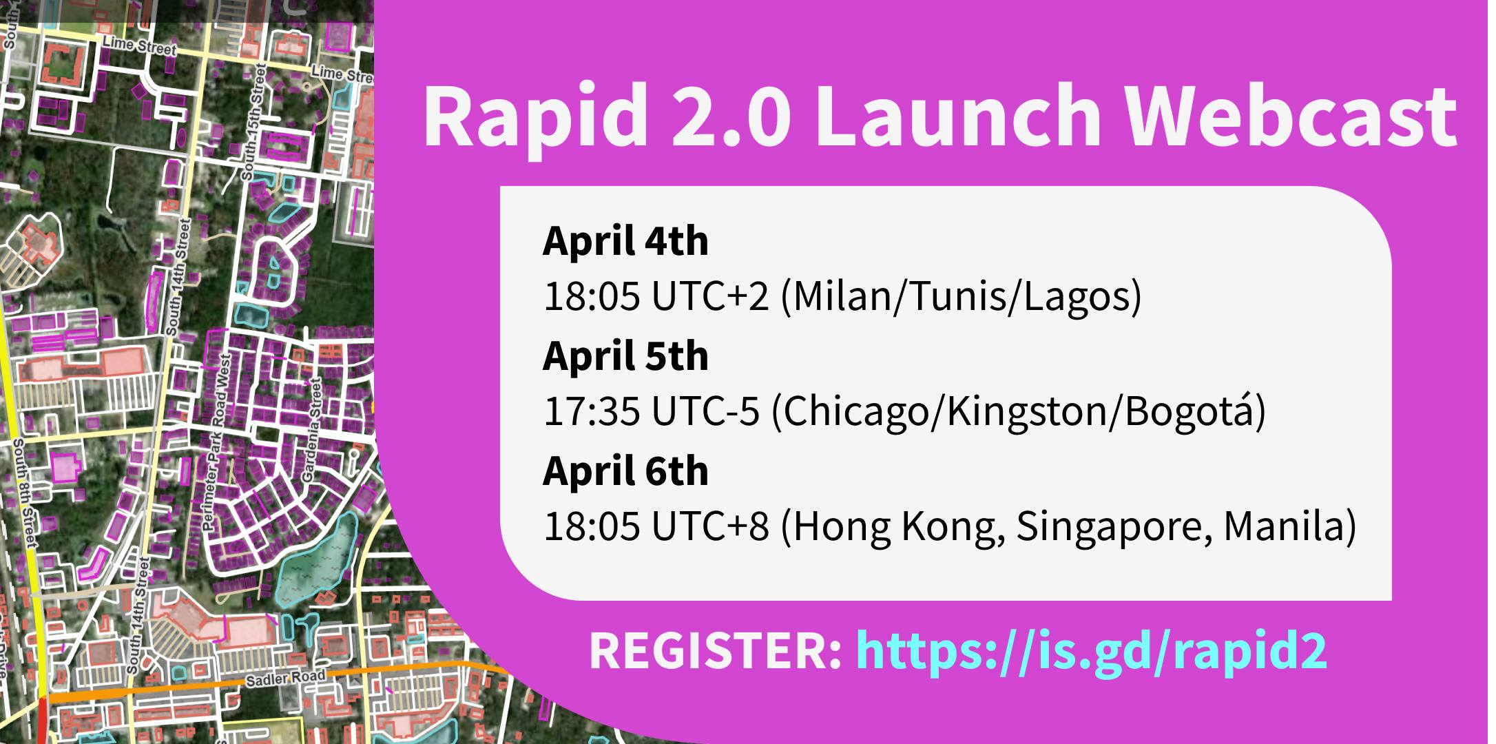
Rapid 2.0 launches this week. The Rapid team will host webcasts on April 4 (tomorrow at the time of writing), April 5, and April 6 for Europe / Africa, the Americas, and Asia / Pacific timezones respectively. You can sign up here. You can expect an overview of what’s new, and a live demo. You will also be able to ask the Rapid team questions.
What’s new
I wrote about the public beta of Rapid 2.0 before, and covered what’s new there.
One additional thing I wanted to call out is the ever-growing amount of external datasets available to mappers for efficient mapping of addresses, buildings and other features available as open data. There is a page on the OSM wiki that lists them all, and Esri has an interactive map with all the data sources available and considered as Rapid layers.
Posted by chris_debian on 3 April 2023 in English.
Last updated on 4 April 2023.

Ok, following on from my earlier writing, I can confirm that I have installed and tried capturing data with both the SmartRoadSense and Roadroid Android applications, on my Pixel 6. Both apps had good points, and ‘areas for development’. I was only able to capture data, submit it, and see it on a map, with Roadroid. My understanding is that I can’t do this with SmartRoadSense, because the app infrastructure is currently dormant, due to EU funding coming to an end, but I understand from the devs, that they are about to reinvigorate the project.
Lars Forslof (Roadroid) is doing some excellent work with his propriety solution, but I think the nature of his objectives, are business oriented, and enables a ‘customer’ to request survey coverage for a defined area, which is then coordinated, at a financial cost.
My main questions/ thoughts now, are:
- Is road surface data useful to anyone? I would suggest it is useful for deciding on routing, and can be used under open source terms, to enable interested bodies, such as highway/ local authorities to have an initial understanding of where surfaces don’t meet a required standard.
- Is OSM the right place to record the values?
- Can the open source community encourage the good people at SmartRoadSense to work with us, or do we need to create a new app, with infrastructure? The algorithm used to process the data is currently closed source. My preference would be to work with SmartRoadSense, and have a backlog of potential improvements, hosted on GitHub https://github.com/SmartRoadSense
- Encourage interested users to install the SmartRoadSense APK, and to give feedback at the GitHub address. The app didn’t appear in Play Store, in the UK on a Pixel 6, so I’ve used APK https://m.apkpure.com/smartroadsense/it.uniurb.smartroadsense
- I will write to the SmartRoadSense devs, to highlight these thoughts.
What is needed (Requirements capture)? (MoSCoW)
M= Must Have S= Should Have C= Could Have W= Won’t Have

OSM supports really complex opening times, apparently.
This node, a roof-top bar in Stratford, London is opening on the 20th of April. The following are the opening times per their website:
- April 20th to April 30th : Thursdays to Fridays 5pm- 11pm, Saturdays-Sundays 12-11pm
- May 1st- May 14th: Wednesdays to Fridays 5pm- 11pm, Saturdays-Sundays 12-11pm, Bank Holidays 12-11pm
- May 15th- end of September: Tuesdays to Fridays 5pm- 11pm, Saturdays-Sundays 12-11pm, Bank Holidays 12-11pm
The opening_time value I came up with is this:
Apr 20-30 Sa-Su 12:00-23:00; May-Sep Sa-Su 12:00-23:00; Apr 20-30 Th-Fr 17:00-23:00; May 01-14 We-Fr 17:00-23:00; May 15-31 Tu-Fr 17:00-23:00; Jun-Sep Tu-Fr 17:00-23:00; Oct-Dec off; Apr 20-30 PH 12:00-23:00; May-Sep PH 12:00-23:00
It also helped that there exists a handy tool that can visualise complex opening_time values.
I am looking forward to seeing how OSMAnd handles this when it eventually gets the updated node.

Hi all! I’m writing this new post to show a recent mapping that I’ve done on an industrial facility. In this case, I worked on a crucial headquarters of Petronas International, located near Turin (between the municipality of Santena and Villastellone).
The facility has been in that place for a long time but in the recent year the company built here the new global research centre so, under the pretext to add the new building, I mapped with care the facility.
That the result of my work:
Before

After
Posted by ngumenawesamson on 2 April 2023 in English.

To support organizations that use OpenStreetMap data for disaster response, the HOT Data Team is strengthening our data quality and fitness measures.
Several teams at HOT, including the Data Team, Technology & Innovation Team, and the Regional Hubs, are collaborating to develop resources, tools, skill sharing, and community feedback mechanisms that will be avenues for data creators and data users to collaborate to improve OpenStreetMap data quality.
Data Team:
The HOT Data Team presented the top 10 data quality issues in a lightning talk at State of the Map 2022 in Florence. We categorize these data quality issues into three main categories:
Semantic Accuracy
- Tagging
- Tasking Manager project consistencies
Positional Accuracy
- Spatial offsets
- Feature tracing inconsistencies
- Logical consistencies of map features
Completeness
- Temporal inconsistencies
- Road network inconsistencies
- Completeness of health facilities
- Completeness of public service data for sustainable communities
- Administrative boundaries
The Data Team is also defining use cases and data quality metrics. Measuring data quality starts with identifying core datasets for each of our impact areas. Examples include highways and health facilities for Public Health, water & sanitation, transportation, and education for Sustainable Cities & Communities, and waterways, buildings, and highways for Disasters & Climate Resilience.
We then evaluated the use cases and the metrics for assessing the quality of each dataset, enabling us to identify ways of improving data quality.
Technology & Innovation Team:
Technology & Innovation Team is implementing automated tools for measuring OpenStreetMap data quality.
Posted by frozenrabi on 2 April 2023 in English.

Lately I’ve been going for field survey day in day out. These day I spend most of my time on field survey using maps for field verification, collection of Point of interest (POI) data, land use zoning and obviously for public participatory mapping. Since 2018, there is no day that I had not worked or engaged with map. After I was introduced to this beautiful and addictive OpenStreetMap (OSM), I became a consistent OSM Mapper and a volunteer. While looking back, I felt I made right choice engaging in the field of OSM. From beginner curious mapper to Humanitarian OpenStreetMap Team (HOTOSM) Global Validator & being HOTOSM & OpenStreetMap Foundation(OSMF) Voting member, I’ve came a long way.
.jpeg)
Upon attempting to upload a new changeset, I received an error on iD. I don’t know what it means but it has an error code of 400 so it should be a server issue. Does anyone know what to do here? Will I have to start over?
I tried looking through the Help page but it’s hard to find what I’m looking for.

Sistemas para hospedar fotos a nivel de calle
OpenStreetMap no ofrece un sistema de hospedaje de fotos, ya que el propósito del proyecto es ofrecer una base de datos geográfica. Sin embargo, OSM etiquetas para referenciar imágenes en publicadas en algún servicio externo. Por ejemplo, existe la propuesta de etiqueta image - osm.wiki/Key:image que es genérica y sirve para cualquier imagen hospedada externamente. Otras etiquetas hacen referencia directa al sistema que las hospeda, y es lo que se llama foto enlazado – photo linking osm.wiki/Photo_linking:
- Mapillary - osm.wiki/Key:mapillary
- Wikimedia Commons - osm.wiki/Key:wikimedia_commons
- Flickr - osm.wiki/Key:flickr
De manera general, hay varias formas de asociar imágenes con un punto de interés (POI). Esto se debe al interés por las imágenes a nivel de calle – Street level photos, donde el más popular es Goole StreetView, pero este no es libre. Entonces, aquí es cuando descubrimos una variedad de opciones y licencias, de los que desconozco sus detalles, pero quiero listar.
Google StreetView
Son fotos a nivel de calle, principalmente tomadas por Google con sus autos y maletas son cámaras. En algunos casos se puede pedir prestadas estas mochilas para tomar fotos de algún de interés. Las fotos quedan propiedad de Google, y se pueden visualizar por la página de Google Maps con unos términos de uso. No se pueden usar estas fotos para hacer obras derivadas, por lo que no se pueden usar para mapear en OSM.
Mapillary
Posted by bkil on 1 April 2023 in Hungarian (Magyar).

Részletek: wiki.osm.org/Hungary/20230513

Posted by Jan Olieslagers on 1 April 2023 in English.
Last updated on 10 April 2023.

I think I am not the only one to find this matter confusing. The one clear and authoritative source of information is a pdf, in Russian language and Cyrillic alphabet only: http://www.caiga.ru/DocAni/manual_of_4_letter_indexes/Indexes_of_Airports.pdf ; it is regularly updated.
There are three columns of codes:
-
local “civilian” code, usually beginning with ‘У’, which transcribes to U
-
local code for “state” airfield, which includes military terrains, codes usually begin with a ‘Ь’ character, which transcribes to ‘X’
-
“international” code, given in Latin alphabet, corresponds to ICAO
Aerodromes of mixed military/civilian use will have the first and second columns filled out; or, if they have international status, all three. UHSS Yuzhno-Sakhalinsk is an example.
Thanks to mapper Mazda05 for patiently explaining!
PS local_ref beginning with Z or H are not official, they seem to be empirically assigned by maps.aopa.ru (which I often consult, though its information is not always perfect). Better an unofficial ref than none at all, in my opinion.

Nyt osui tielleni sen verran kiehtova ja kimurantti kartoitustapaus, että totesin että tätä olisi hyvä avata tällaisessa päiväkirjaformaatissa tarkemmin jo senkin vuoksi että OSM:in tageissa voidaan vaikka viitata tänne lisätietojen osalta. Tämä tarina on samalla osoitus siitä ettei se kohteen oikean nimen löytäminen meille OSM-kartoittajille aina suinkaan niin helppoa ole. Se on mielestäni myös opettavainen tarina siitä miten ei ehkä kannattaisi menetellä kohteiden nimeämispolitiikan osalta, jos haluaa sen olevan selkeä ja johdonmukainen.
No, asiaan. Minulle tämä tapaus lähti purkautumaan siitä kun silmiini osui tämä karttailmoitus Helsingin Länsi-Pasilassa “This park is called “Susannanpuisto”; Sannanpuisto is north of Maistraatinkatu 2.” Huomasin tämän ilmoituksen olevan kytköksissä toiseen pari sataa metriä pohjoisempana olevaan karttailmoitukseen.
Jo pikaisen perehtymisen jälkeen totesin että tässä on nyt jotain hyvinkin erikoista ja niin totisesti olikin. Kaikkia vaiheita ja oivaltamisia en ala tässä järjestyksessä käymään läpi. Tarkempi tapahtumaketju muiden kommentteineen on kyllä luettavissa tuossa ensin mainitussa karttailmoituksessa.
Tässä kuitenkin lyhyt yhteenveto ns. lopullisista havainnoista …
Tämä pohjoisempi puistoalue on merkitty asemakaavaan puistona, jonka virallinen nimi on “Susannanpuisto”. Tuon puiston sisällä sijaitsee “leikkipuisto Sanna”. Tämä on puolestaan kilvitetty mastossa muotoon “Asukaspuisto Sanna” ja paikallisen asukin mukaan yleisesti tunnettu käyttäjiensä toimesta Sannanpuistona. 100 metriä etelämpänä olevalla puistikolla ei ole virallista nimeä, mutta sen sisällä sijaitsee “leikkipaikka Sannanpuisto” ja sen vieressä “Päiväkoti Susanna”, jonka asukkaat tiedän ko. leikkipaikkaa hyvinkin ahkerasti hyödyntävän, sillä olen itsekin tuosta kulkenut työmatkallani usein ohi - onnelisen tietämättömänä tästä monitahoisesta nimivyyhdistä.

I’ve released a new version of tilemaker, the command-line utility that takes OpenStreetMap data in .osm.pbf format and makes vector tiles out of it.
It’s now between 45% and 85% faster - you’ll notice the difference particularly in places with complex multipolygon geometries. Memory usage is reduced, particularly in the polar regions. Plus it’s compatible with Geofabrik’s new CC0 “Shortbread” schema for vector tiles.

Yes, I am..i love Geography and Locations.. I churned whole Globe and used GPS from Day1
Posted by Kai Johnson on 30 March 2023 in English.
Last updated on 30 April 2026.
The GNIS matching project I’ve been working on uses a lot of Overpass queries to find things in OSM. At some point during the project, I needed a faster, more reliable Overpass server than the public servers. So I built a local Overpass server as cheaply as I could. It’s working well. This is how you can build one for yourself.
Update
Things have changed a lot in the last couple of years. If you’re just arriving at this diary entry, you might check out the newer container build for Overpass. Otherwise, keep reading …
Why Would I Build My Own Overpass Server?
If you’re using the Overpass API for software development, you’re going to be running a lot of queries. You could use a public Overpass instance, but it’s more polite and a lot more efficient to run one locally. Also, public overpass servers have query limits that you may not like. And sometimes they go down or flake out, and then there’s nothing you can do but wait until the operators fix them. If you run your own server, your fate is in your own hands!
For most use cases, a cheap local Overpass server can be significantly faster than using one of the public Overpass servers. The setup described here is a lot smaller with a lot less computing power than those big public servers. But it doesn’t have the entire world hammering on it constantly. Also, Overpass queries can return huge amounts of data. The network latency and throughput is a lot better on your own local network segment than if you’re downloading results from halfway across the world.
I’d like to give a special thanks to Kumi Systems for hosting the public Overpass server that I abused until I set up my own server. They’re providing a great service for the OSM community!
Do I Really Want to Do This?
Posted by umbraosmbr on 30 March 2023 in English.

Projetos disponiveis no maproulette.
DESAFIOS Procurar
Correção de CEP na Região Nordeste do Brasil para o Padrão Brasileiro = XXXXX-XXX / Correction of CEP in the Northeast Region of Brazil for the Brazilian Standard = XXXXX-XXX umbraosmbr’s Project
Correção de Nomes de Rua que foi mapeado de forma errada em todo Brasil. / Correction of Street Names that were mapped wrongly throughout Brazil. Raphaelkaart’s Project
Correção de CEP para o Formato usado no Brasil - Estado de Pernambuco. / Correction of ZIP Code for the Format used in Brazil - State of Pernambuco. Raphaelkaart’s Project
Correção de CEP para o Formato usado no Brasil - Estado da Paraiba. / Correction of ZIP Code for the Format used in Brazil - State of Paraiba. Raphaelkaart’s Project
Correção de CEP para o Formato usado no Brasil - Estado da Bahia. / Correction of ZIP Code for the Format used in Brazil - State of Bahia. Raphaelkaart’s Project
Inclusão de Nomes de Rua em Vilarejo Ponte Branca no estado de Goías - Brasil / Inclusion of Street Names in Vilarejo Ponte Branca in the state of Goias - Brazil. Raphaelkaart’s Project
Correção de Nomes de Rua em todo Brasil / Correction of Street Names throughout Brazil Brasil - Projetos da UMBRAOSM - União dos Mapeadores Brasileiros do Openstreetmap
Correção de Nomes de Rua em todo Brasil - Part1. / Correction of Street Names throughout Brazil - Part.1 Brasil - Projetos da UMBRAOSM - União dos Mapeadores Brasileiros do Openstreetmap
Correção de Nomes de Rua em todo Brasil - Part2. / Correction of Street Names throughout Brazil - Part.2 Brasil - Projetos da UMBRAOSM - União dos Mapeadores Brasileiros do Openstreetmap
Posted by Jéssica Macedo on 29 March 2023 in Brazilian Portuguese (Português do Brasil).

Por quem é utilizado?
Faço essa pergunta porque conheci a plataforma recentemente como uma recomendação para resolver conflitos de localização dentro do Instagram. E me veio a dúvida de como, por que, por quem e pra quem é feito esse mapa.
Claro, são usuários comuns utilizando. Mas estas grandes corporações se baseiam nestas informações? Alguém saberia me dizer?
Hasta hace poco me enteré de la aplicación OpenStop, que se parece bastante a StreetComplete y es para mejorar el mapeo de la infraestructura del transporte público. La aplicación está para iOS y Android y su página web es https://openstop.app/
La situación actual de la aplicación es que solo está en alemán, por lo que las preguntas salen solo en ese idioma. Por tal motivo he traducido todas las preguntas para que cualquier hispanohablante pueda responderla.
La traducción está aquí: https://github.com/MaptimeBogota/Varios/tree/main/OpenStop-app