Users' Diaries

Recent diary entries

Néha levelezgetünk arról, hogy a területfunkciók (lakott terület, erdő, ipari terület,…) vonala fusson-e külön a közutak vonalától.

Íme egy újabb indok, amiért én a különválasztást preferálom. Egyetlen pont arrébb mozgatásával és egy másik törlésével kibővítettem az ipari területet az erdő rovására.
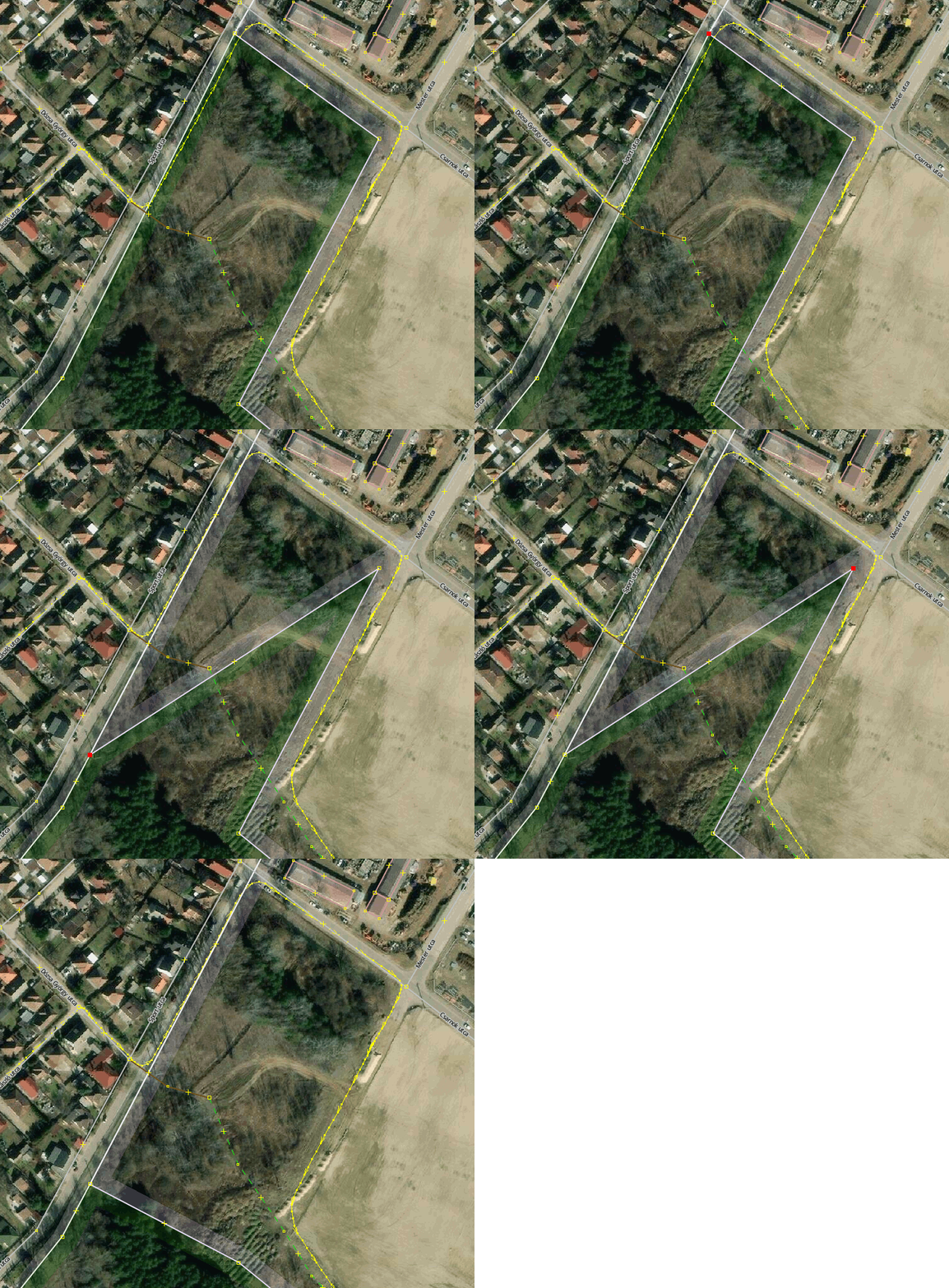
Gif anim amin 3 egyszerű mozdulattal kibővítek egy ipari területet az erdő rovására

(Ha utakkal futott volna, akkor “unglue” szétválasztgatás stb.)

Location: Laposok, Veresegyház, Gödöllői járás, Pest vármegye, Közép-Magyarország, 2112, Magyarország

Uma Iniciativa da UMBRAOSM - União dos Mapeadores Brasileiros do Openstreetmap

An Initiative by UMBRAOSM - Union of Brazilian Openstreetmap Mappers

PROJETO PEGADAS DE CONSTRUÇÃO NO BRASIL COM DADOS DA MICROSOFT

CONSTRUCTION FOOTPRINTS PROJECT IN BRAZIL WITH MICROSOFT DATA:

Esse projeto consiste em Mapear Edifícios ou Casas com os dados da microsoft-building-footprints - Disponível em https://github.com/microsoft/SouthAmericaBuildingFootprintspara

Mapeamento N.01

BRASIL - PRAIA LUCENA - JOÃO PESSOA (PB) - EDIFÍCIOS.

O Mapeamento na Praia Lucena - João Pessoa -(PB) - Brasil poderá ser feito por Mapeadores que tem conhecimento com o Editor Rapid.

Mapping in Praia Lucena - João Pessoa -(PB) - Brazil can be done by Mappers who are familiar with the Rapid Editor. https://tasks.hotosm.org/projects/12292

See full entry

Location: Cohab, Recife, Pernambuco, Região Nordeste, Brasil

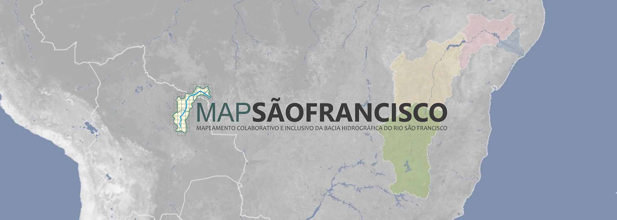
O MapSãoFrancisco é uma iniciativa da Canoa de Tolda e do InfoSãoFrancisco que se propõe a desenvolver projetos de mapeamento colaborativo em toda a bacia hidrográfica do rio São Francisco.

MapSãoFrancisco is an initiative of Canoa de Tolda and InfoSãoFrancisco that aims to develop collaborative mapping projects throughout the São Francisco river basin.

https://canoadetolda.org.br/iniciativas/projetos-permanentes/mapsaofrancisco/

A cartografia pública disponibilizada pelo MapSãoFrancisco na plataforma OpenStreetMap buscará preencher a desatualização da cartografia oficial, uma vez que esta não representa de forma adequada a evolução do panorama socioambiental verificada ao longo do território do Velho Chico ao longo de várias décadas.

A BACIA HIDROGRÁFICA DO RIO SÃO FRANCISCO E SUAS REGIÕES FISIOGRÁFICAS

COMO SURGIU

See full entry

Location: Cohab, Recife, Pernambuco, Região Nordeste, Brasil

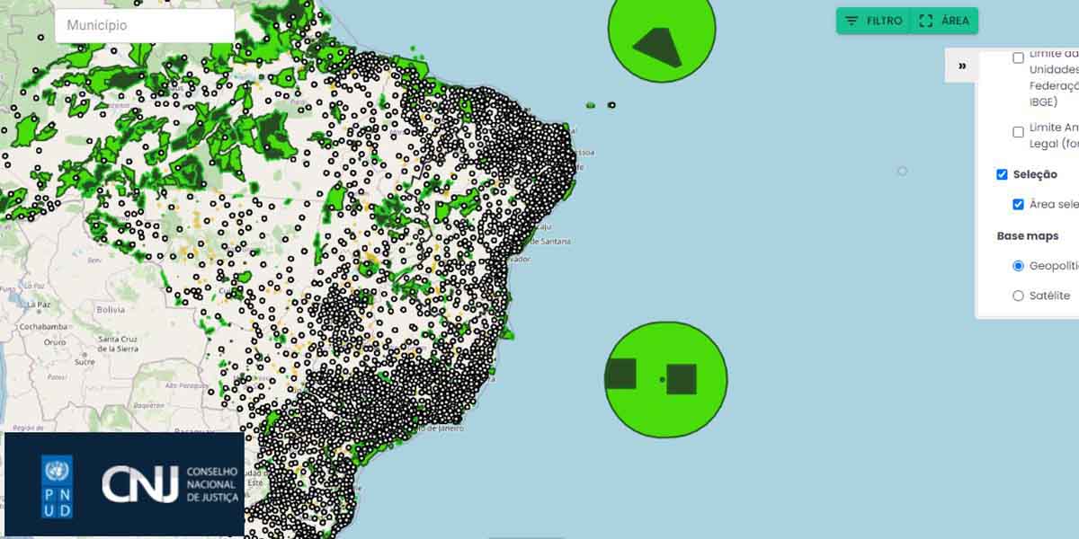
Mapa interativo permite visualizar dados sobre violações ambientais no Brasil

Interactive map allows viewing data on environmental violations in Brazil.

O CNJ – Conselho Nacional de Justiça e o PNUD – Programa das Nações Unidas para o Desenvolvimento lançam, através de cooperação, mapa/painel interativo público com geolocalização de ações ambientais, cíveis e criminais em todo o Brasil.

O mapeamento das áreas ameaçadas por crimes e danos ambientais acaba de se tornar realidade para o Judiciário e toda a população. O painel interativo SireneJud tem o objetivo de ampliar a transparência dos dados do Poder Judiciário sobre ações ambientais, cíveis e criminais. A ferramenta foi desenvolvida no âmbito da parceria firmada entre o Conselho Nacional de Justiça (CNJ) e o PNUD, que visa consolidar Laboratórios de Inovação e ODS no âmbito do Poder Judiciário e fortalecer as capacidades do CNJ para a produção de pesquisas em temas relacionados à Agenda 2030.

See full entry

Location: Cohab, Recife, Pernambuco, Região Nordeste, Brasil

Last week, we launched a new OpenStreetMap-based website: “Pin je Punt”.

This application -based on mapComplete- was commissioned by the flemish touristical agency Visit Flanders. The application is a map viewer and map editor, which requests information about charging stations for ebikes, bicycle rental, benches, playgrounds and a few more POIs.

Why?

This project was started for two reasons:

  • No one in Belgium does know where all the charging stations for bikes are
  • There are five different, provincial touristical offices. They all keep their own database of POI as benches and bicycle rental. ‘Visit Flanders’ (which is responsible for the five smaller ones) wants to unify and integrate these databases. And where better to store all the data then on the biggest geodata repository?

This project builds upon MapComplete, which aims to be an easy-to-use map viewer and editor.

The launch

The project is live since the 7th of march, the (dutch only) project page can be found here

A former radio presentator made an advertisment video as well, which can be seen on youtube (dutch only). As far as I know, this is the first professionaly made commercial which asks to contribute to OpenStreetMap!

There has been quite a few edits done by now too:

See full entry

Location: Bever, Strombeek-Bever, Grimbergen, Halle-Vilvoorde, Flemish Brabant, Flanders, 1853, Belgium

Vídeo Aula de mapeamento com OpenstreetMap

Video Mapping Lesson with OpenstreetMap

https://www.youtube.com/watch?v=Jm5l8M989j4&t=26s

Mapeamento para resiliência com OpenStreetMap - aula introdutória com Prof João Porto -12/05/2020

Mapping for resilience with OpenStreetMap - introductory class with Prof João Porto -12/05/2020 https://www.youtube.com/watch?v=mjTOZevgmyk

Mapeamento para resiliência com OpenStreetMap (Pt) - Webinar - 17/04/2020

Mapping for resilience with OpenStreetMap (Pt) - Webinar - 17/04/2020 https://www.youtube.com/watch?v=gSBBNTBwLTU

Canal Youtube Openstreetmap

Openstreetmap Youtube Channel https://www.youtube.com/channel/UCzKJ-y53Zu4dEISCRmPrcWg/videos

Raphael de Assis

UMBRAOSM - União dos Mapeadores Brasileiros do Openstreetmap

Union of Brazilian Openstreetmap Mappers

WWW.UMBRAOSM.COM.BR

Posted by seii166 on 13 March 2022 in Arabic (العربية).

I have a problem to report to you. The problem is concerning the feature “Our Story”. Whenever I try to upload something on “Our Story”, Snapchat does not upload it, and no one can see it. Keep in mind that the snaps I try to upload on “Our Story” are mostly tourism snaps, therefore they aren’t violating any guidelines. Previously, I was able to upload snaps on “Our Story” normally. Only recently has this problem happened to me. Please help me in this problem of mine so that I can upload snaps on “Our Story” like I used to.

Thanks and regards,

Posted by b-unicycling on 13 March 2022 in English.

When I was out do a bit of mapping (mostly house numbers and opening hours) in Clonmel with StreetComplete, I noticed an opening hours sign specifically for autism friendly opening hours. I had seen them before on supermarkets in Ireland, but this time, it led me to start a proposal for a new key to be able to map those, because I was at a loss there. It was a Vodafone shop, but I did some quick online research, and it is not uncommon in Ireland for shopping centres or supermarkets to have them. Some are referenced in the proposal.

The organization behind it is As I Am, a charity supporting people with autism and families with autistic family members.

It means that the lights are dimmed, there is no background music and announcements are kept at a minimum. I’m not diagnosed with autism, but I wish all this was done all the time and not just one or two hours per week.

The OpenStreetMap Foundation runs several services subject to usage policies.

If you violate the policies, you might be automatically or manually blocked, so I decided to write a post to help community members answering questions from people who got blocked. If you’re a blocked user, the best place to ask is in the IRC channel #osm-dev on irc.oftc.net. Stick around awhile to get an answer.

The most important question is which API is being used. For this, look at the URL you’re calling.

If the URL contains nominatim.openstreetmap.org, review the usage policy. The most common cause of being blocked is bulk geocoding exceeding 1 request per second. Going over this will trigger automatic IP blocks. These are automatically lifted after several hours, so stop your process, fix it, wait, and then you won’t be blocked.

If you’re using nominatim but not exceeding 1 request per second, to get help you should provide the URL you’re calling, the HTTP User-Agent or Referer you’re sending, the IP you’re requesting from, and the HTTP response code.

If you’re calling tile.openstreetmap.org or displaying a map, review the tile usage policy. The most common causes of being blocked is tile scraping or apps that don’t follow the usage policy.

To get help you should provide where the map is being viewed (e.g. an app, website, or something else), the HTTP User-Agent or Referer you’re sending, the IP you’re requesting from, and the HTTP response code. For a website, you can generally get this information through the browser’s developer tools. The tile.openstreetmap.org debug page will also show you you this information.

If you’re having problems with an app that you’re not the developer of, you’ll often need to contact them, as they are responsible for correctly calling the services.

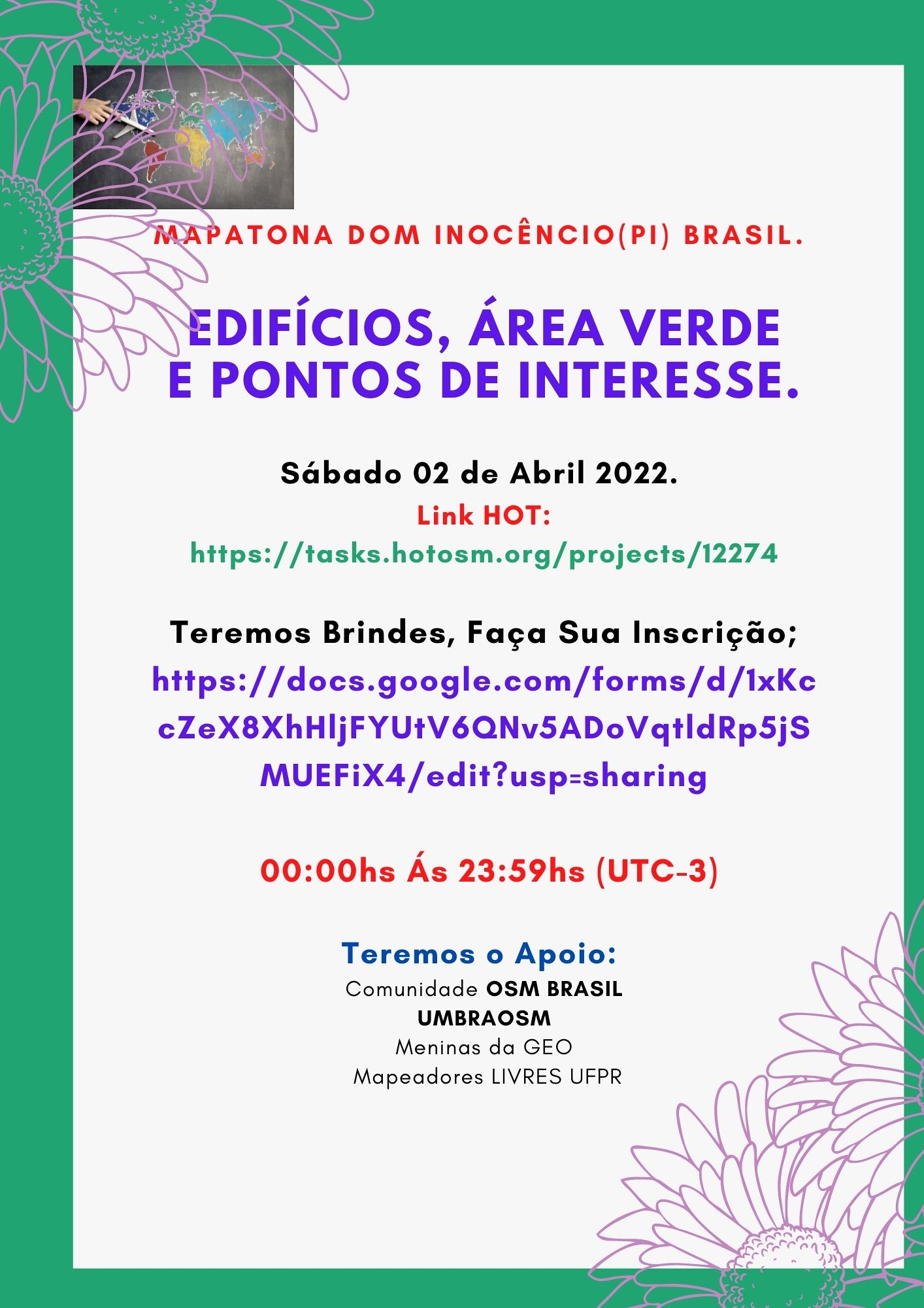
2 Mapatona da UMBRAOSM em 2022 e será no dia 02 de Abril de 2022.

2 UMBRAOSM Mapathon in 2022 and will be on April 2, 2022.

BRASIL - DOM INOCÊNCIO - (PI) - EDIFÍCIOS, ESTRADAS, PONTOS DE INTERESSE E ÁREA VERDE. Brasil

O Mapeamento na Cidade de Dom Inocêncio - (PI) - Brasil será feito por Mapeadores Iniciantes e Avançados e tem como objetivo Incluir Edifícios, Estradas Rurais, Pontos de Interesses (Comercio em Geral. )

The Mapping in the City of Dom Inocêncio - (PI) - Brazil will be done by Beginners and Advanced Mappers and aims to include Buildings, Rural Roads, Points of Interest (Commerce in General. )

Link HOT: https://tasks.hotosm.org/projects/12274

Instruções para o Mapeamento na Cidade de Dom Inocêncio/PI.

Edificios: Muitos edifícios são muito próximos mas na verdade não se tocam. Tente mapeá-los o mais próximo possível, sem permitir que eles se conectem entre si ou com as ruas.

Estradas; Use as seguintes tags para mapear estradas no Editor iD:

See full entry

12290 | Union of Brazilian Mappers of OSM (UMBRAOSM

BRASIL - PRAIA ILHA DE ITAMARACÁ (PE) - EDIFÍCIOS Brasil

O Mapeamento na Praia de Ilha de Itamara´ca/PE - Brasil poderá ser feito por Mapeadores que tem conhecimento com o Editor Rapid.

The Mapping at Ilha de Itamara´ca Beach/PE - Brazil can be done by Mappers who are familiar with the Rapid Editor.

Link HOT https://tasks.hotosm.org/projects/12290/

Edifícios:

Muitos edifícios estão muito próximos, mas realmente não se tocam. Tente mapeá-los o mais próximo possível sem permitir que eles se conectem entre si ou com as ruas.

O mapeamento com o Editor Rapid e ideal usar a Imagem da Bing para uma melhor centralização dos Edifícios, outra camada vai desfocar os edifícios.

Buildings:

Many buildings are very close together, but they don’t really touch. Try to map them as closely as possible without allowing them to connect with each other or with the streets.

Mapping with Rapid Editor is ideal to use Bing Image for better centering of Buildings, another layer will blur buildings.

Comentário do changeset:#hotosm-project-12290 #Mapeamento de Edifícios #RapiD #microsoft-building-footprints #Cidade-Praia-Ilha-Itamaraca/PE #Brasil #UmbraOsm

Veja como usar o Gerenciador de Tarefas e o RapiD combinados no OpenStreetMap;(3:23)

Raphael de Assis UMBRAOSM

Телефонное наследие

Как-то раз я вводил очередную порцию данных POI. При том способе, которым я обычно действую, я выясняю, где находятся их входы. Далее, при вводе, я добавляю или изменяю данные так, чтобы было понятно, где находятся соответствующие POI входы. В простейшем случае для этого достаточно поставить точку POI рядом с тем местом, где находится вход в здание, через который можно пройти в редактируемое заведение. Подробнее об этом и о более продвинутых способах ввода можно прочитать в записи про геометрию POI. Большая продвинутось обычно включает в себя также отмечание самого входа как точки entrance=yes, входящей в контур здания. Нередко есть смысл это сделать, так как некоторые входы в здание уже отмечены, и тогда лучше доотметить их все.

Так вот, в тот раз именно доотмечанием входов я и занимался. То есть, мне понадобилось добавить POI в здание, где часть входов уже была отмечена, вместе с чем было лучше добавить в контур здания и неотмеченные входы. Но точки entrance это не единственное, что бывает в линии контура. Помимо задающих геометрию углов здания, там бывают и точки прочих объектов, находящихся в или на стене. Ими могут быть, например, почтовые ящики или мемориальные доски. Ясно, что было бы неплохо, чтобы все обозначения этих объектов шли в том порядке, в котором идут и сами объекты в реальности.

То есть, если в реальности есть входная дверь, и слева от неё находится почтовый ящик, а справа — мемориальная доска, мы захотим, чтобы и в осме было так же. А именно, в линии контура слева направо должны присутствовать точка ящика, затем точка входа, затем точка доски. Если точки входа ещё нет, её надо добавить между ящиком и доской, чтобы она располагалась относительно правильно. Но также точку входа надо добавить на то место, где вход собственно и находится, чтобы она располагалась и абсолютно правильно. А это сделать не удастся, если точки ящика и доски сами в достаточной степени расположены абсолютно неправильно.

See full entry

Posted by jmapb on 11 March 2022 in English. Last updated on 18 March 2022.

To celebrate NYC Open Data Week, a brief introduction to the NYC Department of Buildings Building Information Search tool.

I’ve spotted a new building in Brooklyn that’s missing in OSM. My goal is to add this building to the map, keeping parity with New York City’s established tagging practices for buildings.

NYC had a full import of building footprints in 2013-2014. In addition to building=yes, all buildings were tagged with height (in meters) and nycdoitt:bin (the city’s Building Identification Number, or BIN for short). Buildings with only a single address were also tagged with addr:housenumber, addr:street, and addr:postcode. For buildings with multiple addresses, a node for each address was placed inside the building perimeter.

The building I found has just one address: 1021 Bedford Avenue, 11205. I’ve added the addr: tags, but I’d also like to know the height and BIN so this building will be as well-tagged as those around it. So let’s look it up in the Department of Buildings Building Information Search (BIS for short), which can be found at the following arcane url:

https://a810-bisweb.nyc.gov/bisweb/bispi00.jsp

Here’s the initial search form:

See full entry

Location: Brooklyn, Kings County, New York, United States

Mapatona-02

Novo Evento da UMBRAOSM - União dos Mapeadores Brasileiros do Openstreetmap

será realizado no Primeiro Sábado, dia 02 de Abril de 2022. das 00:00hs ás 23:59hs (UTC-3). Promovida pela UMBRAOSM, https://t.me/grupoumbraosm Meninas da GEO e Mapeadores Livres UFPR.

New UMBRAOSM Event - Union of Brazilian Openstreetmap Mappers will be held on the First Saturday, April 2, 2022, from 00:00h to 23:59h (UTC-3). Promoted by UMBRAOSM, https://t.me/grupoumbraosm GEO Girls and Free Mappers UFPR.

BRASIL - DOM INOCÊNCIO - (PI) - EDIFÍCIOS, ESTRADAS, PONTOS DE INTERESSE E ÁREA VERDE.

BRAZIL - DOM INOCÊNCIO - (PI) - BUILDINGS, ROADS, POINTS OF INTEREST AND GREEN AREA.

Link da HOT para a Mapatona HOT link to Mapathon https://tasks.hotosm.org/projects/12274

As inscrições podem ser feita atraves do link; https://docs.google.com/forms/d/e/1FAIpQLSc1uja8nBd360NtEVxzR2oPwtxuwJ_fuH8iRhCjcJRt3fFBLA/viewform

Nossos Parceiros:

Grupo Meninas da Geo; https://t.me/meninasdageo

See full entry

Location: Cohab, Recife, Pernambuco, Região Nordeste, Brasil
Posted by bo_hot on 11 March 2022 in English.

Happy end of Feb all! (yes, I realise it’s already mid March)

After 2 long grounded years, hot_tech is starting to take off again - both figuratively and literally. Our team is now turning our attention and efforts toward working alongside hubs, contributors and users to test and evolve existing and potential humanitarian OSM tools increase access, usage and contribution to OSM.

Full blog post here »

Tldr;

  • hot_tech are leaving the comfort of our home offices and engaging with hubs, contributors and users around existing and future humanitarian OSM tech.
  • We are building some experimental workflows for conflating AI generated data with OSM data, which we plan to share for all to see and scrutinise around May.
  • OpenAerialMap design research is underway in partnership with Kontour (of Disaster Ninja fame) - Look out for opportunities to get involved.
  • The Harvard Tech for Social Good team continues their work as they connect with users and community members interested in Galaxy.

# Announcements:

  • We have kicked off a redesign for OpenAerialMap (OAM). We will be working closely with users and communities who use and depend on OAM to discover needs, wants and wishes to be included in the next version of OAM. If you’d like to be involved, please reach out to Cristiano or DK.

  • Omran Najjar played a starring role on a webinar hosted by Omdena, where he talked though HOT’s evolving AI-assisted workflows. You can rewatch the event here »

  • We will be welcoming a new senior engineer to the team in March. They are a passionate, experienced and dedicated OSM contributor and we are really looking forward to officially welcoming them next week!

  • We are contributing to the improvement of OSMSeed in collaboration with Development seed. We will share more on this soon, but the short version is, together we hope to improve the flexibility, accessibility and usability of OSMSeed for other users in the ecosystem.

# Project updates:

See full entry

Location: Naz, Esserts-Salève, Monnetier-Mornex, Saint-Julien-en-Genevois, Upper Savoy, Auvergne-Rhône-Alpes, Metropolitan France, 74560, France