Users' Diaries

Recent diary entries

If you’ve ever wondered how accurate road surface tags are in OpenStreetMap, I’ve compiled a review of the accuracy of surface tags (sealed vs unsealed) in Victoria, Australia.

https://littlemaps692810600.wordpress.com/2021/12/03/openstreetmap-on-australian-roads-how-accurate-are-road-surface-tags-in-victoria/

There’s lots of colorful maps and tables. Spoiler alert – Thanks to amazing work by hundreds of enthusiastic mappers, OpenStreetMap’s road surface tags in Victoria are extremely accurate, and provide an invaluable resource for users who want to select routes that stick to sealed or unsealed roads and tracks.

This year I had an amazing opportunity to participate in the HOT Data Quality Intership, being chosen to participate in these twelve weeks was the best thing that happened to me this year, I felt as if all my work on OpenStreetMap was recognized at that moment. I would like to thank everyone who shared their knowledge in the trainings and also to the project coordinators Sam and Becky thank you very much!

Without a doubt it was an experience that I will take for life, I met incredible people from many different countries…

No doubt it is a unique program for OpenStreetMap mappers and helps the community to grow, giving this opportunity to inspire and support young people like me to learn more about OSM and the ecosystem around us is priceless, I imagine that like me my colleagues continued to contribute to OSM in their local communities…

Here I must emphasize the importance of programs like Data Quality Intership in being able to fund and impact local communities around the world, perhaps it would be interesting to expand the program to the mapping hubs.

The future of OSM is not in closed teams maintained by companies that often do not know the reality of what they are mapping, the future of OSM is in funding the work of young volunteers and their communities giving them the opportunity to learn and improve their skills, well structured local communities know what is missing on the map and what they want to map, they know the region better.

For the future I intend to continue to apply what I learned during these 12 weeks and help the Brazilian community, I intend to continue mapping with the projects in TaskManager, I am still planning to have a more solid base for 2022 but I intend to continue with my work mapping cities in my state.

Translated with www.DeepL.com/Translator (free version)

Esse ano tive uma oportunidade incrível de poder participar do HOT Data Quality Intership, ter sido escolhido para poder participar dessas doze semanas foi a melhor coisa que me aconteceu esse ano, eu senti como se todo meu trabalho no OpenStreetMap tivesse sido reconhecido naquele momento. Gostaria de agradecer a todos que compartilharam seus conhecimentos nos treinamentos e também para os coordenadores do projeto Sam e Becky muito obrigado!!

Sem duvida foi uma experiencia que levarei para a vida, conheci pessoas incríveis e de vários países diferentes…

Sem duvida é um programa único para mapeadores do OpenStreetMap e ajuda a comunidade a crescer, ao dar essa oportunidade de inspirar e dar suporte para que jovens como eu possam aprender mais sobre o OSM e o ecossistema em volta não tem preço, imagino que assim como eu meus colegas continuaram a contribuir para o OSM em suas comunidades locais…

Aqui devo ressaltar a importância de programas como Data Quality Intership em poder financiar e impactar as comunidades locais ao redor do mundo, talvez seria interessante expandir o programa para os hub de mapeamento. O futuro do OSM não está em equipes fechadas e mantidas por empresas que muitas vezes não conhecem a realidade do que estão mapeando, o futuro do OSM passa por financiamos o trabalho dos jovens voluntários e suas comunidades dando oportunidade de aprender e aperfeiçoar suas habilidades, comunidades locais bem estruturadas sabem o que falta no mapa e o que querem mapear, conhecem melhor a região.

Para o futuro pretendo continuar a aplicar o que eu aprendi durante essas 12 semanas e ajudar a comunidade brasileira, pretendo continuar a mapear com os projetos no TaskManager, ainda estou me planejando para ter uma base mais solida para 2022 mas pretendo continuar com meu trabalho mapeando cidades do meu estado.

Posted by Michaelleo939 on 2 December 2021 in Swahili (Kiswahili). Last updated on 6 December 2021.

My name is Michael Leo from Tanzania. As a Crowd2Map Volunteer I had the opportunity to attend the conference #StateOfMap2021, it was a unique experience where for the first time I could see many experts from various areas related to data in one place, I did not know that the mapping area was too large. I saw even Tanzanians in the conference thus made me eager to actively participate so as to see what are they doing in mapping.

Well, many sessions marked me but in particular those involving development of solutions using programming language, I hardly knew that with the knowledge I have in coding and database could do a lot of things with data, for me it was a wake-up call. It was from this awakening that I decided to explore further this area of development of solutions using data, research more about what I can do with the mapping data here in Tanzania specifically in Mwanza to help in the development. With regard to networking it was possible to create networking, for an exchange of experience in the area, where it was possible to have a view also of what I can do mapping.

Congratulations to the whole team, for the beautiful organization, was all very well organized from the sessions until the presentations made, it was very good to know that there are so many people or a united group in the area of mapping and for the development of solutions for society.

See full entry

Location: Chemba, Mkoa wa Dodoma, Central Zone, Tanzania

Ich hab letztens schon mein neues Tool vorgestellt, welches dabei hilft, OGD Datensätze mit Wikidata, Wikipedia Listen, Wikimedia Commons und OpenStreetMap abzugleichen.

In einem neuen Screencast hab ich beschrieben, wie man das Tool selber installiert und dann eigene Datensätze hinzufügen kann: https://www.youtube.com/watch?v=4PKUCjS2HL8

Außerdem gibt es einen neuen Datensatz: die öffentlichen Toilettenanlagen in Wien!

Posted by Puxan on 2 December 2021 in Spanish (Español).

Estoy validando en el proyecto 8942 y por casualidad descubro que hay otros dos proyectos activos que actúan sobre una parte de la misma zona. No es la primera vez que veo que hay proyectos que cubren zonas ya mapeadas en otros proyectos. Creo que debería existir algún tipo de coordinación o al menos de conocimiento del mapeo de una zona en la que se planea un nuevo proyecto. Quizá también debería existir alguna forma de ver el historial de mapeo en una zona.

Son ideas para aprovechar mejor el esfuerzo de mapeadores y validadores.

Posted by DSRathore on 2 December 2021 in English.

To gain first- hand experience of OSM, mapping was done in Mhow subdivision of Indore district in Madhya Pradesh, India. There are 10 subdivisions in the district. Total area of the district is nearly 3900 sq. km with total and rural population of nearly 3.28 and 0.8 million respectively. Nearly 679 sq. km area is under forest cover. Indore city is commercial capital of Madhya Pradesh and has a population of nearly 2 million and has been ranked the cleanest city in India for five consecutive cleanliness surveys from 2017 to 2021. Dr Ambedkar Nagar (Mhow), the headquarter of the subdivision is an important cantonment town. The town is located 23 km south-west of Indore city and has a population of nearly 85 thousand. Four training institutes of Indian Army and Border Security Force and two premier educational institutes namely Indian Institute of Management (IIM) and Indian Institute of Technology (IIT) are also located in the subdivision. National Highways NH52, NH347BG and State Highways SH38, SH38A and SH40, IIM Road and Main District Road pass through the subdivision. Important tourist locations are Choral dam, Patal Pani waterfall, Mhow Fort and Bhim Janmbhumi (birthplace of Dr Bhimrao Ambedkar). Other nearby attractions are Ralamandal Wildlife Sanctuary, Jam Dwar (Jam Gate) etc.

See full entry

Location: Apollo DB City, Nipanya, Indore, Juni Indore Tahsil, Indore, Madhya Pradesh, 452001, India

Twitter » Website » Facebook

Introduction 

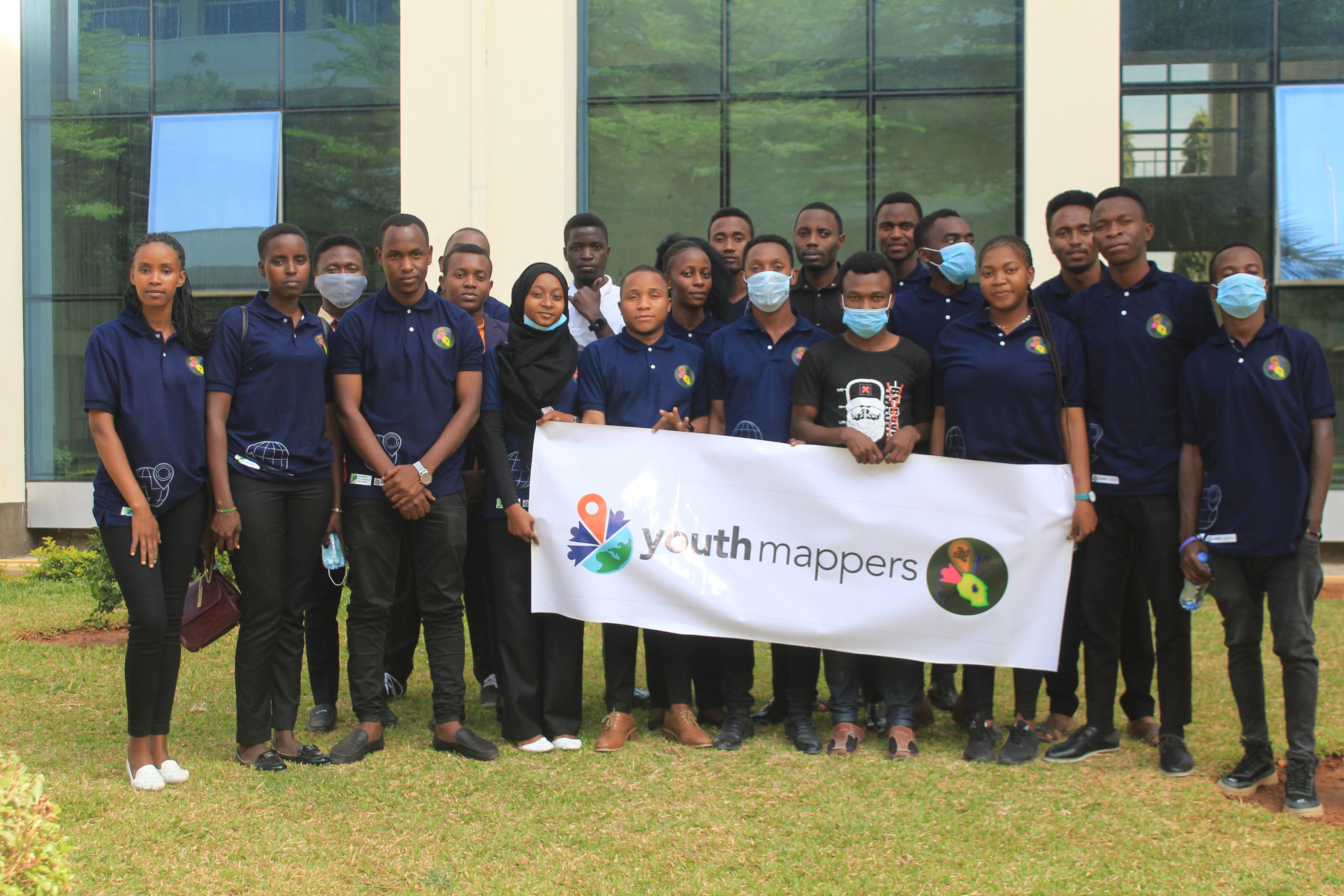
IRDP YouthMappers is the group of students from the Institute of Rural Development Planning engaging in the provision of information related to the Geographical Information System (GIS).

This chapter was established in 2017 at IRDP. It is engaging in exploring various skills and technology which are related to their field and in one way or another can be helpful to their community.

Mnadani Community Mapping Project

IRDP YouthMappers Team formulate and conduct this project so as to reveal and identify various social, physical and environmental problems faced by the people from Mnadani Ward. With Micro Grant from OMDTZ, help IRDP YouthMappers Team to perform the following:

  • Track and address challenges faced by the Mnadani Community.
  • Capacity building to Students and Community Mappers.
  • Community Awareness and Participation.

See full entry

Location: -6.122, 35.745
Posted by Da5id on 30 November 2021 in German (Deutsch).

Es ist schon einige Zeit vergangen seit ich mit OSM und Mapping angefangen habe. Landnutzung war damals noch kein Thema, sehr viel von der Karte war einfach nur weiß. Ich zog los mit einem GPS-Empfänger und einer digitalen Kompaktkamera, um Straßenschilder zu fotografieren und habe Straßengerippe eingezeichnet, heute nennt man das Craftmapper. Fotos per timestamp zu korrelieren war in JOSM noch nicht eingebaut, dafür hat’s noch ein Plugin gebraucht.

Später war dann schon eine Menge da und ich hab nur noch sehr wenig gemacht, weil es sich gefühlt nicht mehr lohnte, ein paar Notizen mit nach Hause zu nehmen und mit JOSM zu pinseln.

Es ist noch nicht so lange her, dass ich im Fediverse einen Kurzeintrag las, der grob sagte, auf dem Bild seien mindestens 20 Punkte in StreetComplete enthalten. Dann hab ich mir das angeschaut und spiele es tatsächlich gelegentlich, weil man damit echt viel ergänzen kann, wenn man nebenan steht. Mehr oder minder gleichzeitig kam dann noch Vespucci mit aufs Telefon, denn damit kann man die ganzen Sitzbänke, Mülleimer, Hydranten, Bäume etc. einzeichnen, die noch nicht da sind, und all die Telefonzellen löschen, die die Betreiber mittlerweile abgebaut haben.

Die Auflösung der GPS-Empfänger ist im Kleinen eher so mittel, vor allem, wenn eine Zeile Häuser da rumsteht, die alle so unter 10 Meter breit sind und in den OSM-Daten oft nichtmal richtig eingeteilt sind, weil die Dächer zu ähnlich waren von oben. Für solche Dinge habe ich noch keine rechte Lösung.

Für den Schluss bleibt noch die Frage der Fragen: Wenn ich einen Mülleimer einzeichne, wo keiner ist, kommt dann die Stadt und stellt einen auf?

Я полностью прочитал ветку обсуждений над дворовыми проездами. Эта тема все еще имеет проблемы: она плохо объяснена на соответсвующей странице в вики, она плохо объяснена на других страницах, которые упоминают дороги. Как я понял: Жилые территории, обозначенные и не обозначенные знаком 5.21, то что мы называем дворовыми проездами и прилегающими территориями мы обозначаем так:

highway=service living_street=yes

Если во дворе есть более “главная” дорога (ее могут называть “стволовой”), то можно применить такую схему:

highway=unclassified living_street=yes и добавлять для второстепенных дорог во дворах (дороги, которые называют “нестволовыми” проездами): highway=service living_street=yes

В дурацком случае, когда жилая зона имеет название: highway=residential living_street=yes

Сейчас хочу изучить обозначение парковок вдоль дорог. Эта тема достаточно неочевидно рассказана, чтобы с поверхностного просмотра страницы в вики я не смог сразу взять и начать картографировать.

Posted by Sovushka on 30 November 2021 in Russian (Русский). Last updated on 5 January 2022.

Пару месяцев назад мне пришла идея поместить в пост координаты того, что хочу пофиксить. Мне указали на ошибку и теперь все мои координаты - у меня в профиле.

Posted by Sovushka on 30 November 2021 in Russian (Русский). Last updated on 5 January 2022.

Пару месяцев назад мне пришла идея поместить в пост координаты того, что хочу пофиксить. Мне указали на ошибку и теперь все мои координаты - у меня в профиле.

My 214 Mapping Days of 2021

At the beginning of the year 2021, one of my targets was to upload a changeset at least every day until the end of the year. However, I have not managed to hit my target. Nevertheless, this year still emerges the year with my highest number of contribution days. OSM Contributions

See full entry

Location: Owen Road, Kampala, Central Region, Uganda
Posted by Romeo Ronald on 29 November 2021 in English.

The OpenStreetMap Community of South Sudan, was launched on 26th.Nov.2021, in an event that brought together Government agencies like the National communication Authority, Companies like East Africa GoGreen, Academia like The University of Juba and among other individuals, this launch event was the commence point of the upcoming programs of OSM South Sudan and it strives to achieve its goal of facilitating the creation, and use on OpenStreetMap data, this shall be made possible by the couple of partnerships OSM South Sudan is looking with the Government and other entities who shall either be data users or contributors, though the collaboration with other HOT and the Open Mapping hub, East and Southern Africa has come handy in building and pushing for success of the community. OSM South Sudan is now in the process of collaborating with the NCA to map and solve address issues in Juba.

Posted by Sheila Job on 29 November 2021 in English.

As a Crowd2Map intern I had the opportunity to attend the conference #StateOfMap2021, it was a unique experience where for the first time I could see many experts from various areas related to data in one place, I did not know that the mapping area was too large.

Well, many sessions marked me but in particular those involving development of solutions using programming language, I hardly knew that with the knowledge I have in Python and database could do a lot of things with data, for me it was a wake-up call. It was from this awakening that I decided to explore further this area of development of solutions using data, research more about what I can do with the mapping data here in Mozambique to help in the development. With regard to networking it was possible to create networking, for an exchange of experience in the area, where it was possible to have a view also of what I can do mapping.

Congratulations to the whole team, for the beautiful organization, was all very well organized from the sessions until the presentations made, it was very good to know that there are so many people or a united group in the area of mapping and for the development of solutions for society. One of the recommendations that maybe could leave is that next time presentations are made all in English so that we can all watch all the sessions, or to the sessions in a language other than English could be put subtitles do not know if is possible or the slide could be translated into English and then sent to the participants.