 OpenStreetMap

I mostly just map footpaths and pedestrian amenities because often these get overlooked. Usually just stay around Christchurch.
Users' Diaries
Recent diary entries

Aside from imports, about 99% of the features mapped in Fortuna were mapped by me. It’s an interesting feeling.
It feels like the local map is a personal creative project. Like building a model train…that, uh, helps other people navigate and travel.
The most difficult part is deciding what’s important – what counts as “progress.” One of the big problems I’ve fixed is mapping errors that make Osmand spaz out when you’re traveling along the 101 or Main Street.
I’m gravitating toward focusing on having correct lanes, turn lanes, nearby buildings, and nearby driveways along the most important roads. Then slowly focusing on less important roads as I make progress.
And osmose error hunting. That’s always fun!

New Users in Washington State
2020 saw 746 new users in Washington State make their first edit. Down just slightly from the previous two years. Anecdotally it appears that we had fewer SEO edits than in past years.
Welcome Message
Welcome messages were sent to 696 of those new mappers, up from last year. Only 26 people replied at least once to the welcome message. I should note that the welcome message doesn’t ask for a reply. Of the new users, 84 replied to changeset comments. A total of 1784 changeset comments were made on the new users edits. Not all of these changeset comments required a reply. Tips were left on 351 changesets.
Edit Quality
I tried to review all of their edits before I send out the Welcome message. Some days when I had other more pressing chores the reviews were just a quick check. In some cases I left a Tip: in the changeset comment on better mapping practices. If the edit was harmful I either reverted or fixed their edit. Harmful could mean that the new mapper unintentionally dragged a node or disconnect a road. There were eight cases of vandalism which were all reverted.
TIPS
As mentioned above, I left 351 tips. Below are the most common tips left.
Posted by EnumMapper on 31 January 2021 in Chinese (China) (中文(中国大陆)).
Last updated on 3 June 2022.
deleted
Posted by EnumMapper on 31 January 2021 in Chinese (China) (中文(中国大陆)).
Last updated on 30 July 2021.
deleted

My November 2020 in OSM
Here’s some of the things I’ve been doing in OpenStreetMap in November 2020. (Yes I know I’m posting this in late January, I’m sorry for being late. Hence some parts of this document will appear out of date)
Heavyshop
Administrador de https://www.trasteralia.com y geógrafo de formación
I have noticed an issue with the OSM map that it is a little blurry on all tiles, no matter what longtitude or latitude. Please help, I want it to be sharp again 😫
I’m excited about the idea of getting Fortuna’s roads and trails entirely covered with Mapillary. It makes editing OSM much easier for me, being able to look back on any bit of road I’ve driven on. I hope that the machine learning Mapillary does can one day make OSM mapping much, much quicker.
My main frustration with Mapillary (Android app) is that it has a poor sense for where the camera is pointing. I tell it my camera points forward, but 1/5 of the pictures are like, “are you sure you weren’t pointing 150 degrees backward.”
No. Normalize sequence.
Posted by c tito young on 29 January 2021 in English.
Last updated on 11 March 2021.

The Geoglyph Meeting Circle 18m in diameter within a series of complex geometry of lines, connecting points, and unexpected alignments. The meeting circle shape also becomes repeated in a location 900m to the northeast. Located in an area of relatively low amounts of slope, the vast distances are difficult to fathom when you think of the primitive tools used to make them. The use of meeting circle is unclear as an overview with these maps. It is also difficult to say if the geoglyphs relate to each other or for that matter the layers of geoglyphs covered by time.

The Free and Open Source Software (FOSS) Policy Special Committee of the OpenStreetMap Foundation has been asked by the Board of Directors to assess the degree to which Free and/or Open Source Software or Services are being used within the OpenStreetMap Foundation (OSMF), the board itself, the different working groups, and committees. This analysis focuses on collaborative services to be used over the Internet. The FOSS Policy Special Committee was explicitly excluding the software used by the community at large, local chapters, or systems running on personal computers.
Indicators
The committee has defined two indicators that cover the most important aspects of freedom and openness of software. These are:
1. Programs or Services released under a Free and/or Open Source Software license: Are the programs or services used released under licenses that have been officially approved by either the Free Software Foundation or the Open Source Initiative. Only these licenses are following the standards to be considered free and/or open.
2. Control over data stored at hosted services: The key aspect of hosted services is the ability of the OSMF and the community to fully control the data hosted and to prevent this data from being used for other purposes by a third party. Some of such services are based on open-source software and can be self-hosted by the OSMF, then offering full control and ownership of the data. Non-open services usually do not offer this ability and the full control of the data is at least questionable if not completely impossible.
Inventory

If you use the iD editor you are possibly familiar with the MapBox locator layer which appears as one zooms out. There’s a fairly recent post from MapBox about this layer (on Medium).
This transparent layer is also used in other MapBox products and therein lies a problem.
I noticed a tweet complaining about the position of a motorway (or planned motorway) on a local active travel portal for Newport, South Wales. Someone pointed out that the map is credited to OpenStreetMap & MapBox, which caused someone else to say:
“Well now I know why I don’t rely on open source maps …. it’s frustrating as ‘that’ m4 has been the source of plenty of political debate and has been widely regarded as the only way to solve Newport’s congestion”
It took me a while to work out what had happened (with help from russss & trigpoint). There have long been highly controversial proposals for a new route for the M4 motorway around Newport because the current route is prone to congestion. At some stage in Summer 2018 someone mapped one of the proposed routes on OSM (as highway=construction). This incorrect tag was not changed to proposed for several months, but the ways were then removed from OSM when the proposals were dropped in 2019.
Incidentally, it’s not the first tweet complaining about OSM from a cycle campaigner this week.

The one who solved the mystery of Taiwan Power Company grid, Dan Jacobson noticed that the dataset of Taiwan Power Company’s power pole is added with an additional field of coordinates. He announced his findings in OpenStreetMap Taiwan Facebook Group and Talk-TW mailing list.
But the data is released with TWD67 coordinates with special parameters, could not transform directly into WGS84. Thanks typebook for the help to transform the dataset into WGS84. It will make further works much easier.
Jacobson asked Taiwan Power company about the coordinates. He said that Taiwan Power Company will add the dataset with TWD96 coordinates. But we don’t know the exactly update date.
There are many dataset with coordinates released on Taiwan governments’ open data portals. These dataset includes police station, freeway ETC toll gates location, YouBike station is imported into OpenStreetMap. But for foundational dataset like address, there are only Tainan and Taichung address available. We Taiwanese Mappers want the whole country’s address dataset is released in the future.
Posted by luiseme on 29 January 2021 in Spanish (Español).

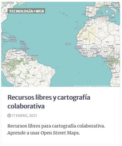
Recientemente, desde una revista digital, me solicitaron un artículo introductorio a la cartografía colaborativa y recursos libres disponibles para tal efecto. Dejo el enlace al mismo:
Recursos libres y cartografía colaborativa (cc by-sa 4.0)

Dear all,
Today, v5.3.0 of the OpenStreetMap Carto stylesheet (the default stylesheet on the OSM website) has been released. Once changes are deployed on the openstreetmap.org it will take a few days before all tiles show the new rendering. It may take longer than normal because there are significant deployment-related changes.
-
External shapefiles for coastline and other data are now loaded into the database with a provided script.
-
The recommended indexes are now required. Attempting to render without them will result in abysmal performance.
-
amenity=embassy is no longer rendered, and office=diplomatic with diplomatic=embassy or diplomatic=consulate is instead.
-
Mini-roundabouts are rendered like a turning circle.
-
There is a new partial index for waterways
Anyone running their own install must run scripts/get-external-data.py
and create the new indexes. People who are running with minutely diffs
may be interested in https://github.com/openstreetmap/chef/issues/386.
Thanks to all the contributors for this release, including hiddewie, crimsondusk, pitdicker, and terminaldweller, new contributors.
For a full list of commits, see https://github.com/gravitystorm/openstreetmap-carto/compare/v5.2.0…v5.3.0
As always, we welcome any bug reports at https://github.com/gravitystorm/openstreetmap-carto/issues
Posted by c tito young on 29 January 2021 in English.
Last updated on 15 April 2021.
This geoglyph appears to be a 50m wide x 75m long shrimp with a rounded tail. with a stinger. It is sideview orientation has its head northerly and its tail southerly with its feet’s orientation facing east. It has a set of dark round eyes on its head.. The object is etched on a moderately sloped terrain and nearby, to its south is a geoglyph of a puffer fish.
The look of this object is difficult to decipher and still in progress.
Posted by Sowa1980 on 29 January 2021 in Russian (Русский).
Вся правда о данные Росррестра её можно и нужно использовать в OSM на это сейчас нет ограничений ни каких, сам Росреестр это поясняет так.
Наборы открытых данных Росреестра
https://rosreestr.gov.ru/wps/portal/cc_ib_opendata
Других данных, открытых нет, увы, остальное это - Электронные услуги и сервисы.
В соответствии с подпунктом 1 пункта 3 статьи 6 Федерального закона от 27 июля 2006 г. № 149-ФЗ «Об информации, информационных технологиях и о защите информации» (далее – Федеральный закон № 149-ФЗ) обладатель информации вправе определять порядок и условия доступа к информации, а также разрешать осуществление иных действий с информацией. Информация, размещаемая в форме открытых данных, является общедоступной (пункт 4 статьи 7 Федерального закона № 149-ФЗ), что означает отсутствие ограничений по ее использованию (пункт 1 статьи 7 Федерального закона № 149-ФЗ). https://data.gov.ru/information-usage
Но сам Росреестр дает право использовать его сайт и его информацию без ограничения любому кругу лиц при условии указания гиперсылки как на источник информации. Так что данные из Росреестра Вы можете использовать в OSM, на это нет ни каких ограничений. Со стороны Росреестра. На вполне законных основаниях!!!
https://rosreestr.gov.ru/site/legals/
Правила и условия использования информации, размещенной на официальном сайте Росреестра
Posted by SomeoneElse on 28 January 2021 in English.
Last updated on 1 February 2021.
As you will no doubt have heard, browser support for flash went away at the end of last year. As you can read here, Potlatch 3 has been released and downloads for Windows and Mac are available. Linux users are asked to “Use Wine to run the Windows installer”. You may be wondering “why?” - there’s a section at the end of this diary entry that covers that. First, the “how”:
What do I need to do?
There are lots of different Linux distributions out there. Most have some sort of package manager and in most of those “wine” will be available as a package. Here is what I needed to do on a couple of desktop Ubuntu systems (both using KDE) - one running 18.04 LTS, the other 20.04 LTS.
Firstly, install Wine itself:
sudo apt install wine64
Next, you’ll probably need to install some fonts that software that normally runs on Windows needs. You can do this via a helpful script Winetricks. First, install cabextract, which is needed by the script:
sudo apt install cabextract
Next, decide where to install the “winetricks” script. I’ll put it in an existing user “bin” directory, so:
cd ~/bin
wget https://raw.githubusercontent.com/Winetricks/winetricks/master/src/winetricks
chmod +x winetricks
Next, install the fonts:
winetricks corefonts
Finally download Potlatch 3 (choose the “Windows application” option, which is a zip file) from the download page, unzip it, and run it:
wine64 Potlatch.exe
Follow the instructions that are presented and accept the defaults to “just install” it.
Running Potlatch 3
When Potlatch runs, you’ll initially see the whole world zoomed out. Rather than zooming in manually you can then “edit with remote control” from the openstreetmap.org site to go to wherever you are currently looking at there, and you can also search for any sort of OpenStreetMap URL to jump straight to it. “GPS / My tracks / load” loads GPS traces.
Posted by Supaplex on 28 January 2021 in Chinese (Taiwan) (中文(台灣)).
Last updated on 29 January 2021.
先前破解台電電力座標之迷的積丹尼,注意到台電的電桿資料加上座標了,並且在 Facebook 社團與 Talk-TW 郵件論壇談這件情。不過台電他們釋出的資料採用的 TWD67 套用特別的參數,導致無法直接轉為 WGS84。還好有 typebook 協助轉成 WGS84 格式,要進行後續匯入方便許多。
積丹尼也詢問台電那邊,會在之後資料集釋出時,附上 TWD97 的座標,只是就不知道何時會進行。
台灣的開放資料當中,有不少有座標的資料集,先前就有派出所、高速公路 ETC 收費桿、YouBike 站匯入 OpenStreetMap。不過比較偏基礎圖資的地址,還只有台南市與台中市釋出來,希望有一天全台灣的地址能夠釋出來。