Diary Entries in English

Recent diary entries

Posted by SharpSharp on 8 September 2020 in English. Last updated on 9 September 2020.

I joined OSM 11 years ago. My area was poorly mapped. I thought I’d get cracking on the streets, but didn’t.

eventually I returned and got into mapping of buildings and other features. I started on adding addresses to all the properties in Copmanthorpe. This entailed redrawing the vast majority of buildings, many of which had been draw as one building when in fact they were many.

I concentrated in the areas I was most familiar with. And when I was canvassing before elections, I’d return to the map and add the address of the streets I’d cover.

I’d complete halfish of the suburb.

Then I came across 3D buildings. Intrigued, I set about learning how to “draw” houses. Mainly woking on properties I’d previously mapped, I built-up skills and faster techniques.

I decided to map the all the main block of Copmanthorpe. Over 1500 properties. Improved the drawing off all, complete all the addresses and make the all 3D.

Today, 10 days later I completed it. It’s here on OSM Buildings

I also added a ton of other features along the way. Not being buildings, they don’t feature on OSM Buildings. They do appear on F4map

However, f4map doesn’t seem so keen on using the latest updates, so I get a random selection of old and new mapping. I guess that will improve with time.

The next stage is to revisit the area. There are a lot of garages that could still be added, and over 1000 gardens, if I can be bothered. I also want to improve my building with multi part buildings. I haven’t got my head around that yet. Working with small buildings appears to be the problem.

Posted by b-unicycling on 7 September 2020 in English.

While I was collecting fieldnames in my area, my landlord gave me the name of one of his family’s fields as “Mile Bush”. Apart from thinking that it must be a mile from Kilkenny, I didn’t think much of it. Some weeks later, I got fieldnames from a different friend a bit to the east and my friend gave me locations named “Mile Bush”, both being bends in the road, and both being a mile from Kilkenny (1 and 2). It doesn’t actually matter whether it’s an Irish mile or a statute mile, both will bring you into Kilkenny. So I posted on Facebook, if anyone knew any other ones, and another one at the border between Kilkenny and Carlow was pointed out. That one is a mile to Old Leighlinbridge. I consulted O’Kelly’s “Placenames of County Kilkenny” and found another one near Rosbercon, which I had the fortune of visiting today (I don’t drive, but a friend drove me to New Ross to look for benchmarks and we took the scenic route back). This one does actually have a bush or rather a tree growing there with a sign saying “Mile Bush”, so I added that to the map today. There is a townsland in Clare (?) according to logainm.ie with Milebush in its name. These are the only ones I have found so far, but I’m convinced there must be more. People 200 and more years ago surely asked “Are we nearly there yet” as well. ;-)

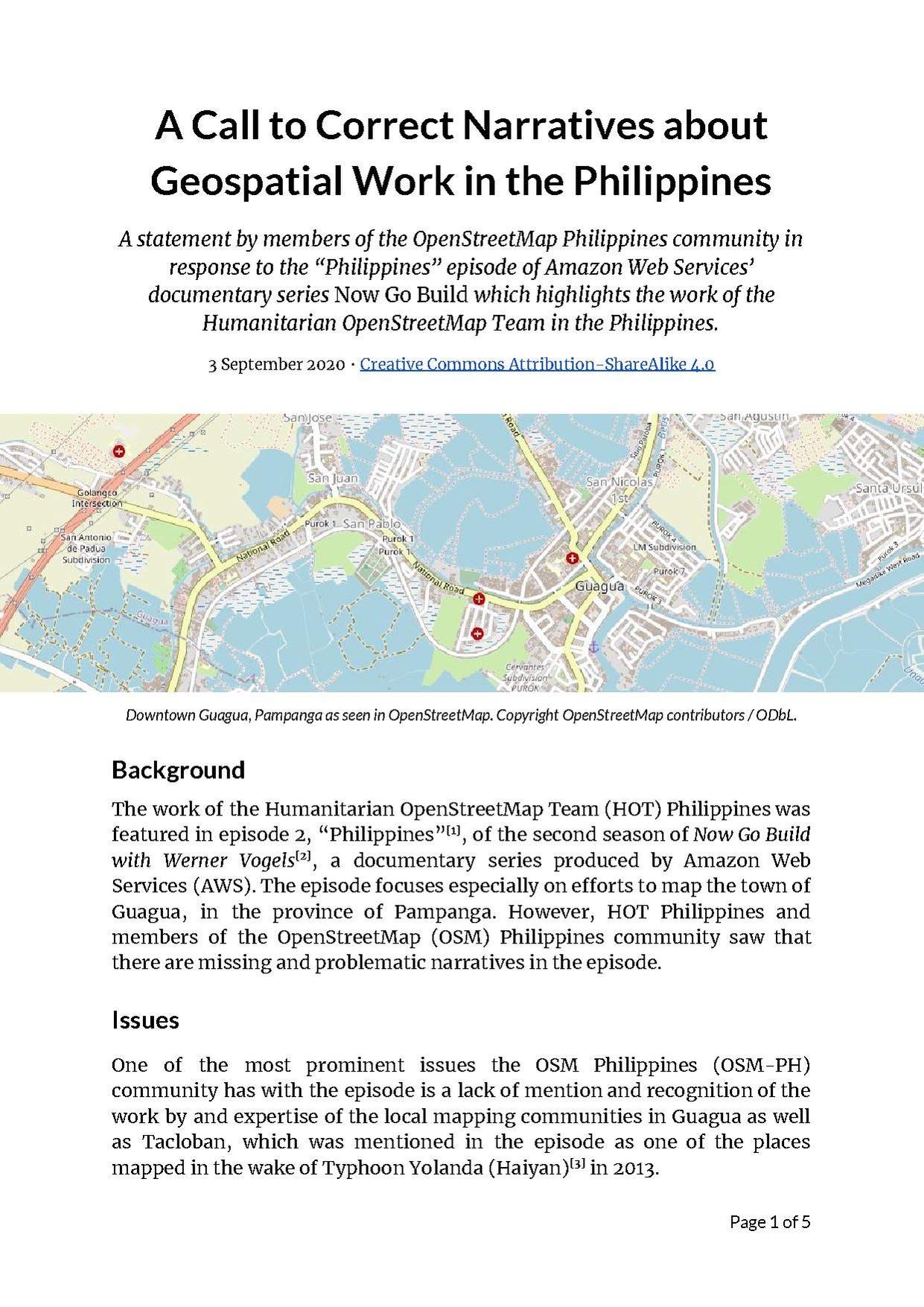
Cover image of the statement

Last September 1, Amazon Web Services (AWS) released an episode of their documentary series Now Go Build which highlighted the work done by the Humanitarian OpenStreetMap Team in the Philippines, especially in mapping the town of Guagua, Pampanga.

Several members of the OSM-PH community however have observed that there are missing and problematic narratives in the video related to the story it tells of geospatial and humanitarian workers in the country.

Therefore, some of us have prepared and released the following statement: osm.wiki/w/images/a/aa/A_Call_to_Correct_Narratives_about_Geospatial_Work.pdf

Posted by SharpSharp on 4 September 2020 in English.

I recently came across Simple 3D Buildings and thought I’d have a go with some of housing on my street.

The documentation is thin so the learning curve is steep. I’ve installed the Kendzi3d plugin to JOSM which is helpful. Getting a view of what you have mapped is difficult because the data refreshes of OSM Buildings and F4map are few and far between. The Kendzi3d viewer enables confirmation of details on a single building, but I’ve not used it for whole streets or housing estates.

Working with parts of buildings in difficult. I’m not sure how to override the default settings for buildings. One suggestion was to leave all 3D data out of the main building and only include that in the Building Part. Working this way the rendering engine still draws the default white block for the building type and can completely hind the Building Parts. I’m working though some ideas on how best to get round this issue.

Facebook is releasing a third update to Daylight, our complete, downloadable preview of OpenStreetMap data.

📥 Download Daylight Map Distribution right now in OpenStreetMap PBF format: 📦 planet-v0.3.osm.pbf (57GB).

Earlier this year, Facebook released Daylight as part of our work with OpenStreetMap. We use maps to let our users find friends, businesses, groups and much more. OpenStreetMap (OSM), the open source wiki map, has a substantial global footprint of map data built and maintained by a dedicated community of global mappers making OSM a natural choice for Facebook.

Every day, our mapping teams work to confirm OSM’s millions of community contributions for consistency and quality by excluding intentional and unintentional edits that are incompatible with our use cases. Daylight is the result of that process.

Daylight Map Distribution

See full entry

Location: Downtown, Downtown Oakland, Oakland, Alameda County, California, 94612, United States
Posted by L Freil on 4 September 2020 in English. Last updated on 11 September 2020.

The MS Building Footprint dataset is now available to use with Daylight. I am part of the Microsoft Open Maps team, and I work with the team that produces the MS Buildings OSC. Seeing some questions and feedback from the OSM community regarding how to use the dataset, my goal is to make it an option for users to easily import the building footprints.

The goal of the MS Buildings OSC effort is to make sure that the building footprint IDs did not collide with current or future OSM Ids. Negative IDs were used in the ms-ml-buildings-v0.3.osc.bz2 and prior versions as it is discussed as a useful approach in the OSM wiki https://wiki.openstreetmap.org/wiki/OsmChange. Unfortunately, some of the tools used to work directly with planet files and changesets do not fully support working with negative IDs so here are some approaches using the existing tools for community members to use the MS building OSC. I investigated some workflows that use a changeset with negative IDs ms-ml-buildings-v0.3.osc.bz2, and for this release there is also a second changeset that uses positive IDs ms-ml-buildings-v0.3-positive.osc.bz2.

There are two different workflows that were tested that work with the Daylight Distribution and MS Building Footprints to create map tiles using only open source tools.

Workflow 1:

Use Osmium to apply .osc to the Daylight pbf and fix negative IDs before importing them to PostgreSQL database. Steps:

  1. Use Osmium to apply the changes to the planet file. Example: “osmium apply-changes planet-v0.3.osm.pbf ms-ml-buildings-v0.3.osc.bz2 -o daylight-and-ms-ml-buildings-v0.3.pbf”

  2. Use Osmium to reorder IDs. Example: “osmium renumber daylight-and-ms-ml-buildings-v0.3.pbf -o ordered-daylight-and-ms-ml-buildings-v0.3.pbf”

  3. Use osm2pgsql to import the output PBF from previous steps

Workflow 2:

Import Daylight pbf then import MS Buildings

See full entry

One of the biggest internment camps near the region capital city Ürümqi was removed the prison tag several months ago by China mapper which claimed it is just a re-education facility for the Uyghurs , that was claimed by the China Authorities .

Now a report by Buzzfeednews findout that there are more internment camps and most of the camps are expand, which could assumed that there are more people send to these places. And some OSM mappers re-examine the previous found internment camps, and findout just west of the previous found one near Ürümq, there is a new infrastructure was built, which means no sight close down.

Some mappers who saw the news and want to map the area, wish to have a list of these camps. If someone remove camps, then we have a list and can re-add the camp back on map.

Some Chinese mappers are defending their government claims of these facility are re-education center for Uyghurs. But for OSM mappers, if a removed happened, it should have strong evidence to support their claims and then remove these named facility. If no these facility should keep what is tagged. And I have to say sorry keep commenting on one of a Chinese mappers changeset, hope the alert mail won’t make him in trouble.

I hope they could record something on Mapillary, we could see the image of re-education facility as real educational institute, and see some happy Uyghurs learning useful stuff for life, earning their livings after they finished their training program.

Location: 达坂村, Ürümqi, Xinjiang, China
Posted by maning on 3 September 2020 in English.

This is OSM way/445712235. It was edited twice and has 9 nodes and 2 tags.

Screen Shot 2020-08-25 at 11 32 33

way/445712235 was created together with fisherfolks, its local government unit, a social action arm of a university, researchers and diving enthusiasts in Lian, Batangas. It was a culmination of years of grassroots organizing, research and community-based participatory mapping I was part of as a volunteer.

COSCA as the social action arm of the De La Salle University is working with the local fishing community in Kay Reyna (Lian, Batangas) through its community-based resource management program. Part of the community’s aspiration is to establish a community managed marine protected area (MPA) to protect and rehabilitate their marine ecosystem. During the summer of 2012, I was asked by friends to help in mapping Kay Reyna’s community-managed MPA.

My task is “simple”, grab a GPS and mark the location on the boundaries of the proposed MPA.

Community process for establishing the MPA

See full entry

Location: 13.989, 120.623
Posted by krahulreddy on 31 August 2020 in English.

Code

Diary entries

Hosted Server

About the project

This is a GSoC project, which has been developed over the Summer of 2020 by K Rahul Reddy (krahulreddy). This project is mentored by Sarah Hoffmann (lonvia) and Marc Tobias (mtmail).

What are we doing: The problem statement

OSM’s main search engine Nominatim does not support search suggestions. A separate database, which should be derived from the Nominatim database, should be set up for search suggestions. This DB should support regular updates from Nominatim DB. This must handle various languages. It must be small enough to run alongside Nominatim.

This project aims at setting up such a search suggester by comparing various alternative implementations like Elasticsearch, Solr. These suggesters set up indexing to facilitate quick suggestions to the users. The finalized stack will be integrated with the Nominatim search API. Complete installation and setup documentation along with a test suite will be created as a part of this project.

Why is it required?

Suggestions during search help a lot in terms of finding the right place. Adding suggestions to the Nominatim search will help the users of Nominatim and OpenStreetMap to easily find the right place without performing a Nominatim DB search.

What are the approaches taken?

The following steps were taken to provide suggestions:

See full entry

Posted by DWeaver on 30 August 2020 in English.

Over the past 3 months I have been working on OSM2World for Google Summer of Code. The aim of my project was to add support for indoor tagging, meaning rendering indoor data in 3D. This includes basic features such as rooms and corridors, windows and doors as well as objects that may span levels such as stairs and barriers.

The code that I have produced can be seen in these 3 pull requests:

https://github.com/tordanik/OSM2World/pull/166

https://github.com/tordanik/OSM2World/pull/168

https://github.com/tordanik/OSM2World/pull/169

text

And the results of my work are as follows.

Basic Indoor Features

See full entry

Posted by jkirk on 30 August 2020 in English. Last updated on 22 August 2021.

It seems that we have no concept for the parking zones in Graz, see: https://www.graz.at/cms/beitrag/10072106/7922687/Parken_in_Graz_Blaue_Zone_%7C.html

I made a proof-of-concept where I tried to map a street here:

I will have to discuss this with the OpenStreetMap Graz community.

Location: Katastralgemeinde Innere Stadt, Innere Stadt, Graz, Styria, Austria
Posted by jkirk on 30 August 2020 in English.

Today I noticed some ways which are tagged with “railway:lanes” in Graz, but no Wiki-Page exists for such a key: osm.wiki/Key:railway:lanes

I assume this key is wrong and I will start to remove them. (If I am wrong please correct me).

The overpass-turbo link to all ways with a key “railway:lanes”: https://overpass-turbo.eu/s/Xxo

Location: Katastralgemeinde Innere Stadt, Innere Stadt, Graz, Styria, Austria
Posted by apm-wa on 30 August 2020 in English.

Today as the remnants of Hurricane Laura dumped rain on my house, I chose to stay indoors and resume reading “Land of the Turkomans”, an anthology of reports delivered in the 1800s to the Royal Geographic Society of expeditions and explorations of what is today Turkmenistan. As I delved into the reports, I realized that I had been in many of the places described, and if not, at least knew where they were. Out came the Soviet military maps, and I began trying to plot the routes of the explorers.

One noted the names of water wells as he crossed the Karakum Desert led by a local guide. It struck me. Of course, a semi-nomadic people like the 19th-century Turkmen tended not to reside in villages out in the middle of the desert, but to move their flocks of sheep and herds of camels from pasture to pasture, always bearing in mind the locations of wells for watering themselves as well as their animals. Thus the wells have names! A review of the Soviet military maps revealed that some of those wells existed at least as late as the 1980s (and probably still do). I’d never thought of that…where there are few to no villages, names are assigned to water wells.

A trip from Gokdepe to Khiva, which today might take perhaps 10- to 12 hours by automobile (including up to two hours to clear Customs at the border), back then involved a minimum of two weeks’ “march” across the desert, including one five-day stretch without water, and was only possible in practice during spring and fall, when temperate weather was somewhat assured.

Location: Ak bugday District, Ahal Region, Turkmenistan
Posted by mvexel on 29 August 2020 in English.

A couple of years ago, I released the Meet Your Mappers tool that helps you find active mappers in your area based on live and historic OpenStreetMap data. It is different from other tools that let you locate nearby mappers in that it analyzes actual OSM data instead of changeset metadata, giving a more accurate result. It also categorizes mappers so you can see only ‘power’ mappers, or filter out mappers who are no longer active. I wrote about this tool on my blog before.

I didn’t advertise the tool very much since, and few people were using it. In a server switch it even went offline for a while. Now it’s resurrected, and I also published a video explaining how to use it.

video screenshot

I hope it’s useful, let me know if you have questions! Here’s a direct link to the tool.