 OpenStreetMap

Unmapped Places of the OpenStreetMap World - 2024
Posted by pitscheplatsch on 25 December 2024 in English.In 2010, I first conducted a study which identified regions (places) in the OpenStreetMap (OSM) project in Germany that still had potential for more detailed mapping. Later, in 2016, this analysis was repeated and extended to the entire world. I have since regularly carried out these studies and published the results. The algorithm and some more details are documented in an earlier blog post of mine.
For the year 2024, I have recalculated this analysis and published the results on my website: “Unmapped Places of OpenStreetMap”. For the study, the OSM Planet File in PBF format from Dec. 7th was used. It can be downloaded here.
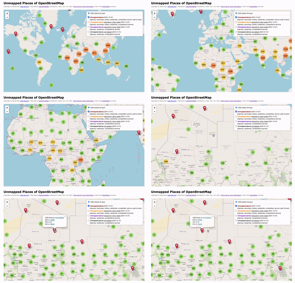
Currently, there are about 8.6 million elements in the OpenStreetMap project that use the place-key, representing either the center or the outline of a named place. Approximately 1.5 million place nodes are registered as villages, defined as “A village/town with up to 10,000 inhabitants.”. More details about the place-keys can be found in the OSM wiki. Depending on which type of street is used as a filter in my search, there are currently at least 170,000 places (villages) in OSM that are unmapped.
How is the number distributed across continents? Currently, 67% of the unmapped places are in Asia, followed by 30% in Africa. The remaining approx. 3 percent are distributed across the rest of the world. The detailed figures:
- Asia: 113,895 (67%)
- Africa: 51,443 (30%)
- South America: 2,282
- Oceania: 804
- Europe: 637
- North America: 484
- Antarctica: 3
In the past the data from my studies have been used for MapRoulette, HOTOSM, MissingMaps, or similar mapathons or challenges. If anyone is interested in the individual layers of the visualization, they can be downloaded here directly as a JS file (track, minor, major). I would appreciate appropriate attribution if my data is used.
Discussion
Comment from Wynndale on 29 December 2024 at 10:12
Would a place like osm.org/go/zgvcK64ol- in India where the imagery in the editor shows a village but there is no place named in OSM remain unflagged by this?
Comment from trial on 29 December 2024 at 13:24
Here it was not unmapped, but wrongly mapped. Corrected yesterday. An educated guess of the root cause of the correction ? ;-)
Thanks for that.
Comment from pitscheplatsch on 30 December 2024 at 07:43
@Wynndale Yes, my analysis only uses OSM data and no aerial images or similar. So if no OSM place node is available, no hint or marker is created.
Comment from pitscheplatsch on 30 December 2024 at 07:47
@trail Based on the user’s changeset comment in italian, it probably has nothing directly to do with this analysis here :)
Comment from jayaddison on 27 May 2026 at 20:28
Hello - for this resultmap and similar place-related reports: please could you consider filtering out places with abandoned=yes tagged on them, if you are not already?
(I found one place that is abandoned while browsing it – so this is not yet a suggestion based on statistics, purely anecdata so far)
Comment from pitscheplatsch on 31 May 2026 at 14:54
Thanks @jayaddison.
Do you have an example Node ID you could share with me?
Comment from jayaddison on 31 May 2026 at 15:02
@pitscheplatsch yep, can do; here is one: osm.org/node/13034667246
Comment from pitscheplatsch on 31 May 2026 at 16:33
@jayaddison Thanks.
Comment from pitscheplatsch on 1 June 2026 at 06:00
@jayaddison I have just added abandoned and disused to my filter. This means that whenever a place node contains one of these keys, it will be excluded from the unmapped analysis. I have also started a new preprocessing run. The results should be ready within the next few days.
Comment from jayaddison on 1 June 2026 at 09:19
@pitscheplatsch Thank you!
Comment from pitscheplatsch on 1 June 2026 at 14:23
Data has been updated and published, see https://resultmaps.neis-one.org/unmapped#5/47.145/9.800
HappyMapping