
The Hub, Edinburgh building tagging
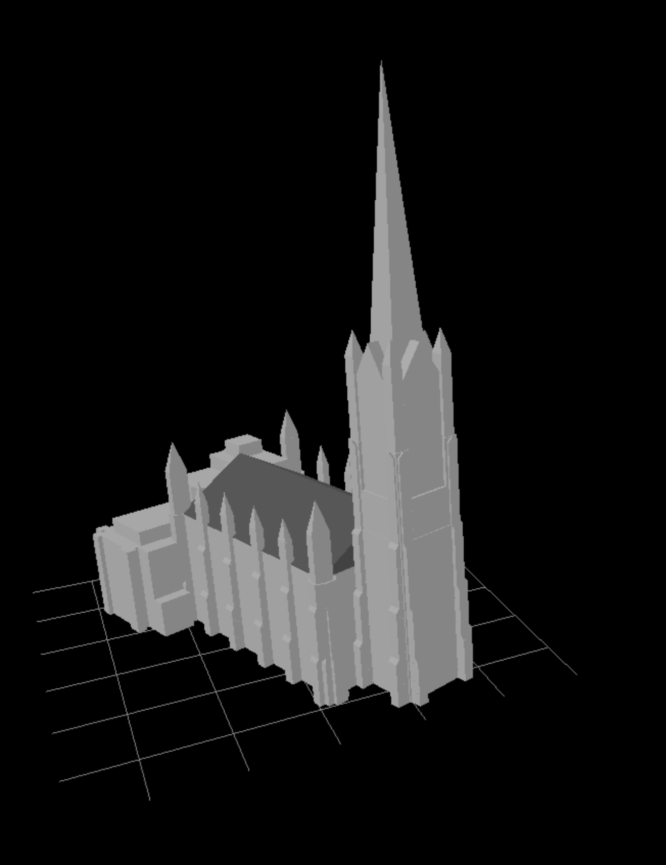
Posted by jwheare on 31 March 2026 in English. Last updated on 1 April 2026.The Hub, Edinburgh rendered with Beakerboy’s OSM Building Viewer https://beakerboy.github.io/OSMBuilding/index.html?id=42997989
I’m working on a project using OSM building data so I thought I’d familiarise myself with the building:part and roof tags and see what the editing process is like.
The Hub only had height data and a basic outline tagged for the spire, so as the highest man made point in Edinburgh, it made for a good candidate to get stuck in.
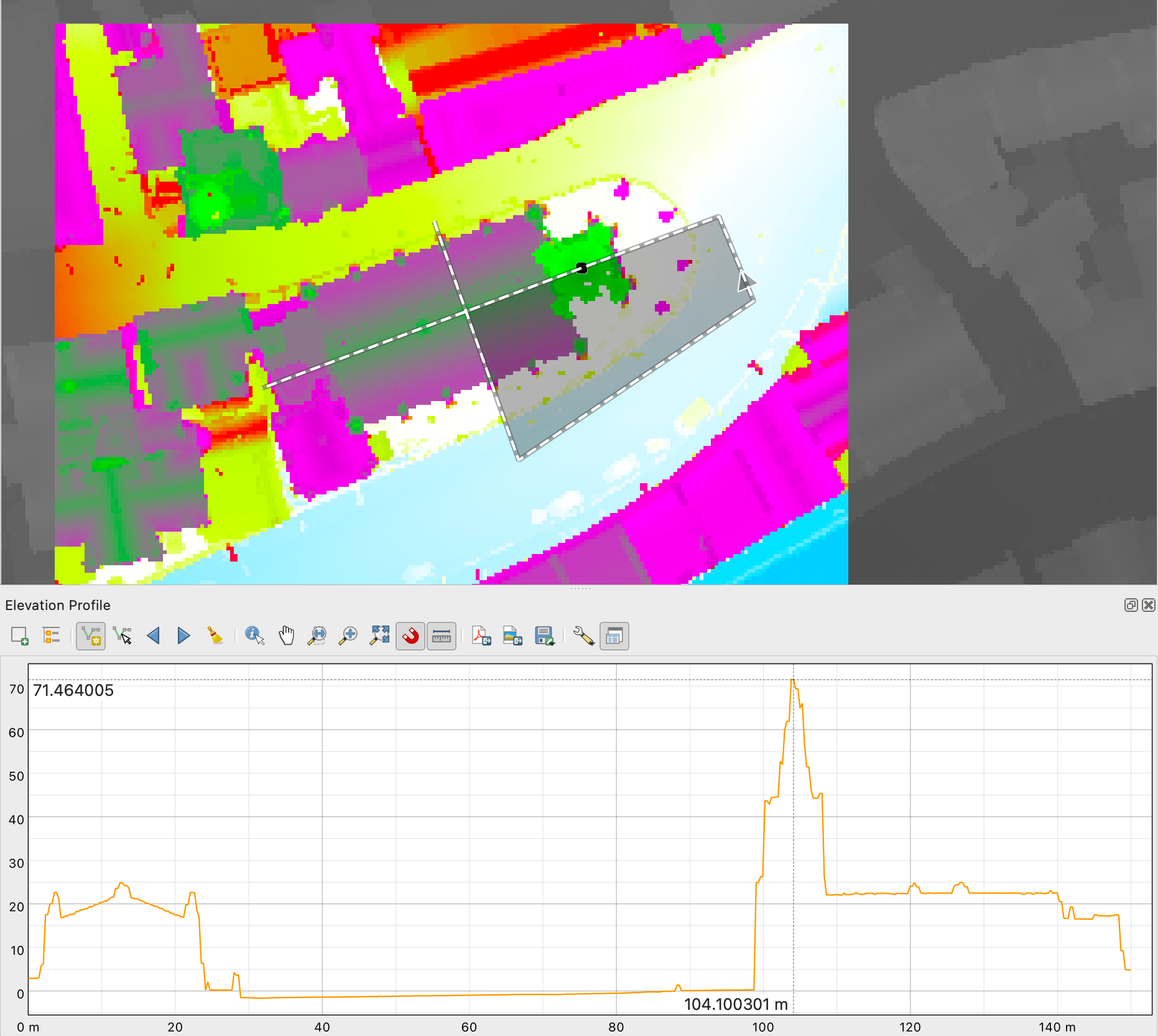
I used height data from the OGL licensed Scottish LiDAR Phase 5 DSM that covers Edinburgh, and photos of the building from Wikimedia Commons
The elevation profile tool in QGIS proved useful for exploring the LiDAR data (after I worked out how to right-click to confirm the path). I normalised the elevation to zero with the raster calculator and set a custom colour ramp to aid visualisation:
Definitely fiddly to get right but interesting to see the level of 3D detail achievable with just a handful of tags and open data. There are more details to sort out, but I think I made a decent start.
Visualised changeset: https://resultmaps.neis-one.org/osm-change-viz?c=180674112#20/55.94878/-3.19521
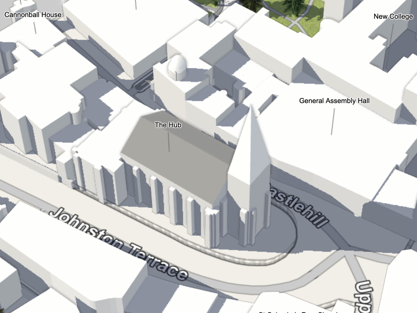
Here’s what it looked like in F4Map before my edits:
https://demo.f4map.com/#lat=55.9489462&lon=-3.1951278&zoom=19&camera.phi=56.15
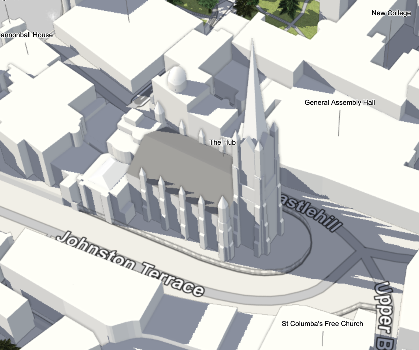
And after:
Discussion
Comment from LordGarySugar on 1 April 2026 at 04:03
Looks amazing! Great work! Now it’s time for building:colour? ;) Fyi: Streets.gl will never update, it’s currently an abandoned project and requires map data to be refreshed manually.
Comment from jwheare on 1 April 2026 at 08:29
Thank you. Good to know about streets.gl. And yes I’ll likely explore adding some colours and materials soon. Not sure if I’ll aim for the level of detail in some of your 3D Showcase masterpieces tho… inspiring work!
Comment from spiregrain on 1 April 2026 at 11:17
Great work! I occasionally add 3d info too. I’ve found the new JOSM plugin - Urban Eye 3d - is an absolute game-changer.
https://community.openstreetmap.org/t/urban-eye-3d-josm-3d-viewer-plugin/133674
Comment from jwheare on 1 April 2026 at 12:06
Thanks for the heads up, looks really useful, I’ll check it out. I was using the trick described here for previewing https://community.openstreetmap.org/t/showing-off-my-3d-building-renderer/112810/25
Comment from spiregrain on 1 April 2026 at 15:43
Very nice - I’ll add it (https://beakerboy.github.io) to the list of ways to check I’ve done it right.