OpenStreetMap
Pawcio's Comments
| Changeset | When | Comment |
|---|---|---|
| 115927194 | Znaczenie drogi zależy od możliwości technicznych i transport nie składa się tylko z tranzytu krajowego czy wojewódzkiego, tego nie ma np. w angielskich regułach, im większe miasto, tym bardziej jest ono celem i generatorem transportu. |
|
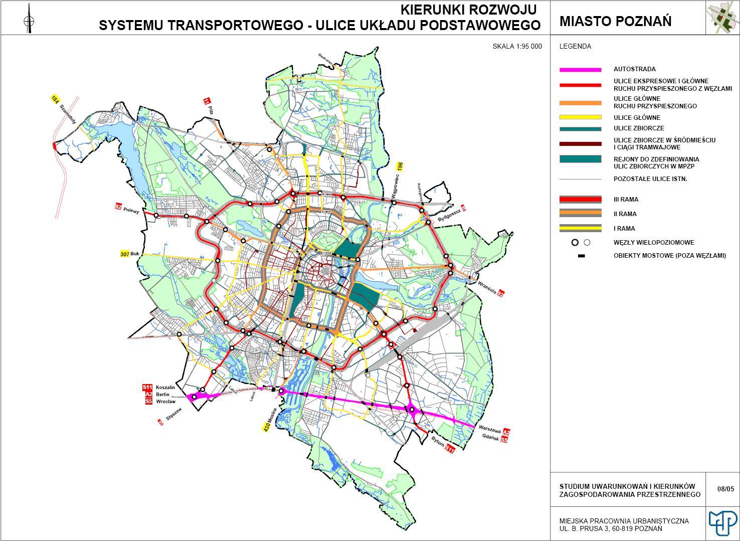
| 115785614 | Tak, tak zwłaszcza między Polską i Przybyszewskiego Bukowska jest ważniejsza niż Królowej Jadwigi. Chodzi mi o kategoryzację, czyli o grupowanie podobnych w tej samej kategorii. Na OSM ruchu nie widać, ale można chociaż spojrzeć na mapę komunikacji publicznej, żeby porównać ważność relacji. Poznań kwalifikuje i inwestuje w wylotową Bukowską i Królowej Jadwigi w tej samej kategorii technicznej https://upload.wikimedia.org/wikipedia/commons/7/7e/Uk%C5%82ad_komunikacji_drogowej_Pozna%C5%84.jpg nie bo tak, tylko z powodu roli w transporcie. |
|
| 115785614 | Super, super! Aleje Solidarności, Królowej Jadwigi i Roosevelta w końcu, po kilkunastu latach, są w tej samej kategorii co Mostowa i Szczawnicka, Kraszewskiego. Gdzież im w znaczeniu dla użytkowników do chociażby Bukowskiej? |
|
| 115776179 | Nie rozumiem skąd pomysł, żeby główna droga w kraju musiała być tranzytowa, a droga o klasie wyższej niż większość dróg krajowych, łączącą krajową sieć drogową z jednym głównych celów transportowych w kraju była secondary. |
|
| 115927194 | Bardzo ogólna dyskusja była po edycji, bez wzmiankowania tych dróg i chyba byłeś jedyną osobą wyraźnie opowiadającą się za ignorowaniem kategorii technicznej. |
|
| 115927194 | Brawo, brawo! Aleje Solidarności, Królowej Jadwigi i Roosevelta w końcu, po kilkunastu latach, są w tej samej kategorii co Mostowa i Szczawnicka, Kraszewskiego. Gdzież im w znaczeniu dla użytkowników do chociażby Bukowskiej? |
|
| 109486116 | 1) Because there is ,,Tagging for the renderer" it doesn't mean editors should ignore how data are rendered (useful), quite opposite. 2) From the wiki ,,In any case the phrase is often misunderstood. The meaning of it is closer to the following:
|
|
| 109486116 | Replacing a name tag with a ref tag makes that platform number is not rendered. Please, restore the previous usefulness. |
|
| 109195369 | No, not only on the core network: https://www.outdooraccess-scotland.scot/practical-guide-all/cycling |
|
| 109195369 | If there were signs that this for cycling, I'd revert these useless (useability subtracting values) edits and restore the designated tag. There is no evidence that cycling is not allowed here. |
|
| 99928652 | Good point about cornices, I haven't thought about this, although I was there on 27.06 and there was no snow at this viewpoint when there was a big patch on the main path and some below cliff edges.
|
|
| 99928652 | Getting there requires boulder hopping so people with balance problems or in precarious conditions like ice or iced snow should find out fast it would be a bad idea to get there. Edges are not more precarious than at the main path, although I'm surprised that there are no railings at so popular mountain. I would put them at a few viewpoints to encourage people. Looking at the Walk Highland rating Ben Navis is highly undervalued I guess by people sticking only to the main path. I found quite good correlations between the rating and the steepness of the steepest slopes of the mountain and approximations of its size and the Ben Navis is the biggest outlier - it is the black dot at right: https://drive.google.com/file/d/1lXp_ZUSuLMExsSQNmctlaSiLQVkUX8lG/view from my unfinished page https://sites.google.com/site/europeanpeaks/home . For me, it was the best part of the whole hike - one of the best hikes while the top was only good. |
|
| 99928652 | here it was changeset/99928652#map=19/56.79766/-4.99957 |
|
| 99928652 | Hi
|
|
| 106607628 | I believe you. Cycling from E I couldn't see it and it is visible only at low grass. I would prefer to cycle on the N carriageway than on this sidewalk. Two years being deleted shows how it is maintained and useful. |
|
| 106607628 | Please use route=bicycle only to signed trails route=bicycle , not for one's fantasy trails. As real trails are more useful for less experienced tourists mapping fantasy trails is misleading and potentially harmful. There are a number of alternatives where the green bicycle trail could go, Palackeho, N sidewalk (it has at least a barrier) or Alvinczyho street http://brouter.de/brouter-web/#map=16/48.7234/21.2674/standard&lonlats=21.276805,48.717901;21.25847,48.720634&nogos=21.270567,48.719135,48 But it doesn't matter - nobody maps planned motorways as finished because there is no other alternative route. |
|
| 92715265 | 1) It is wide enough, like the signed cycleway on SE. At crossings kerbs are low.
|
|
| 92715265 | It is not just a normal pavement for pedestrians, because of its remoteness it is shared with cyclists and it is also designed for cyclists. Pity you ignore the question whether such tagging adds any value for the path users. |
|
| 91596857 | Why? There is no sign it is not a shared use path. What value would add such tagging for the path users? |
|
| 91596857 | Do you mean sidewalk? I don't remember any big difference with the cycleway 76 on SE, beside the number |