Users' Diaries

Recent diary entries

Hello Community,

Recently, I embarked on a quest to explore second-hand stores and made an intriguing discovery—not only about the variety of hidden treasures but also about the limitations of the existing data in OpenStreetMap.

At the beginning of my search i obviously used OSM to look for second hand shops. I used https://openstreetbrowser.org/ and created a custom category with the code

query: 13: nwr[shop=second_hand]

and discovered that there are just few second-hand stores mapped in my area. I was sure that this is not possible and so i searched the internet to create my own list while cross-referencing various websites, blogs and platforms.

To optimize my exploration, I looked to create an efficient route—the classic Traveling Salesman Problem. There are various tools and APIs that can be utilized for this purpose. After some deliberation, I opted for Routexl, which best suited my needs as its possible to use it for free if you don’t have more than 20 points.

Armed with the list and the route, I got out with my bicycle on two separate days to visit most of the second-hand stores and map them. But my journey didn’t end there. I checked again with the OpenStreetBrowser and and shared it the first time within a local community. The community then showed me another second-hand store specializing in computers—an aspect I had not previously considered, as my focus was on clothing stores.

Now there are two already mapped stores where its not clear if they are still in operation. More research and exploration is required to keep everything recent.

It was interesting to discover how these store did not get mapped previously or did not get any attention even after they got added to OSM. It was a nice experience to find something that might be needed locally.

Lets fill the map with new discoveries!

Open street mapping training was started at. 09:00, it was located at Kacyiru in Gift house where headquarter of OpenStreetMap Rwanda located. it was started by Jeannette as coordinator of Eco mappers, she starts with welcoming all newcomers (the trainee of the day) with good greeting and asked them to feel at home. as continuing she asked Jack to explain for us what OpenStreetMapping mean? what Eco mapper do? he told us where Eco mapper comes from, their vision and missions etc. jeanette continue as the newcomer to present itself and then she shows us her team one by one in his/her name and what he/she responsible for in Eco mappers group. continuing with receiving speakers, our special guest etc. also, we taking tea break together, then we follow another speaker. as we continuing to be celebrating women day, we play game together, and then we start to study how can we contribute to mapping process, Liliane helper us and another ecomappers member then we start to map, where the first mapper of the day mapped 170 buildings, he is a boy, finally, we took photos and sharing food together.

Posted by ENGELBERT MODO on 12 March 2024 in French (Français).

Bienvenue à la campagne d’adhésion 2024 à la Fondation OpenStreetMap ! Aujourd’hui, les membres du conseil d’administration de la Fondation OpenStreetmap (OSMF) et plusieurs groupes de travail de l’OSMF lancent une campagne mondiale d’adhésion à l’OSMF dans le but d’augmenter et de diversifier les adhésions à l’OSMF dans les régions où il n’y a pas ou très peu de membres de l’OSMF.

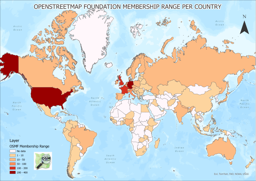
Comme vous pouvez le voir sur cette carte, ces régions sont nombreuses.

Visualisation des membres de l’OSMF par pays, dans le monde entier OSM est connu pour avoir été construit par une vaste communauté mondiale de cartographes, de professionnels des SIG, de créateurs de communautés, de développeurs, d’ingénieurs, de formateurs, etc. au cours des vingt dernières années d’existence du projet, qui toutes et tous apportent leurs connaissances locales et maintiennent des données géospatiales ouvertes et gratuites.

La Fondation OSM administre et soutient la création d’OSM en supervisant les infrastructures techniques et les données d’OSM. Elle contribue également à orienter la stratégie à long terme et le bien-être du projet.

Il est donc très important que les membres de la Fondation OSM reflètent la grande diversité de sa communauté.

Pourquoi avons-nous besoin d’une campagne d’adhésion à l’OSMF ? OSMFMembershipCampaign Comme le souligne le site web de l’OSMF, la fondation OpenStreetMap a pour mission d’encourager la croissance, le développement et la distribution de données géospatiales libres et de fournir des données géospatiales que tout le monde peut utiliser et partager..

Il est important de noter qu’il n’est pas nécessaire d’être membre de la Fondation OSM pour créer un profil sur OSM.org et commencer à modifier OpenStreetMap. Il n’est même pas nécessaire d’être membre pour se porter volontaire auprès d’une communauté locale ou d’un groupe de travail, pour assister à une conférence State of the Map ou pour participer à une fête de la cartographie.

See full entry

This is directly translated from Arnalie’s Blog.

২০২৪ সালের OpenStreetMap ফাউন্ডেশন মেম্বারশিপ ক্যাম্পেইনে স্বাগতম!

আজ, ওপেনস্ট্রিটম্যাপ ফাউন্ডেশন (ওএসএমএফ) বোর্ডের সদস্যরা এবং বেশ কয়েকটি ওএসএমএফ ওয়ার্কিং গ্রুপের সদস্যরা একটি বিশ্বব্যাপী ওএসএমএফ সদস্যতা প্রচারাভিযান শুরু করছে। যেখানে ওএসএমএফ সদস্য নেই বা খুব কম এমন অঞ্চলে ওএসএমএফ সদস্যতা বৃদ্ধি এবং বৈচিত্র্যময় করার লক্ষ্যে।

আপনি এই মানচিত্র থেকে দেখতে পাচ্ছেন, এরকম অনেক অঞ্চল রয়েছেঃ A visualization of OSMF membership by country, worldwide ওএসএম একটি বিশাল, বিশ্বব্যাপী ম্যাপার, পেশাদার জিআইএস, কমিউনিটি বিল্ডার, ডেভেলপার, ইঞ্জিনিয়ার, প্রশিক্ষক ইত্যাদি দ্বারা নির্মিত হওয়ার জন্য পরিচিত, যা ম্যাপের অস্তিত্বের বিগত বিশ বছরে তাদের স্থানীয় জ্ঞানে অবদান রাখে এবং উন্মুক্ত এবং বিনামূল্যে ভূ-স্থানিক ডেটা বজায় রাখে।

OSM ফাউন্ডেশন, OSM এর প্রযুক্তিগত সিস্টেম এবং ডেটা তত্ত্বাবধান করে OSM তৈরির পরিচালনা এবং সমর্থন করে। এটি দীর্ঘমেয়াদী কৌশল এবং মানচিত্রের মঙ্গল পরিচালনা করতে সহায়তা করে।

সুতরাং, OSM ফাউন্ডেশনের সদস্যপদ তার সম্প্রদায়ের বিশাল বৈচিত্র্যের প্রতিফলন হওয়া খুবই গুরুত্বপূর্ণ।

See full entry

Posted by Vali-44-49 on 11 March 2024 in French (Français).

Bonjour,

Une petite information : Doué-en-Anjou (sud du Maine-et-Loire) possède maintenant une petite communauté OSM! Elle s’organise en utilisant le réseau social Communecter.

On se retrouve normalement l’après-midi du deuxième samedi du mois. Si vous n’êtes pas trop loin, vous serez les bienvenus!

Au plaisir! Valentin

Location: Hemon Chollet, Le Fief Limousin, Doué-la-Fontaine, Doué-en-Anjou, Saumur, Maine-et-Loire, Pays de la Loire, France métropolitaine, 49700, France
Posted by arnalielsewhere on 11 March 2024 in English. Last updated on 7 October 2024.

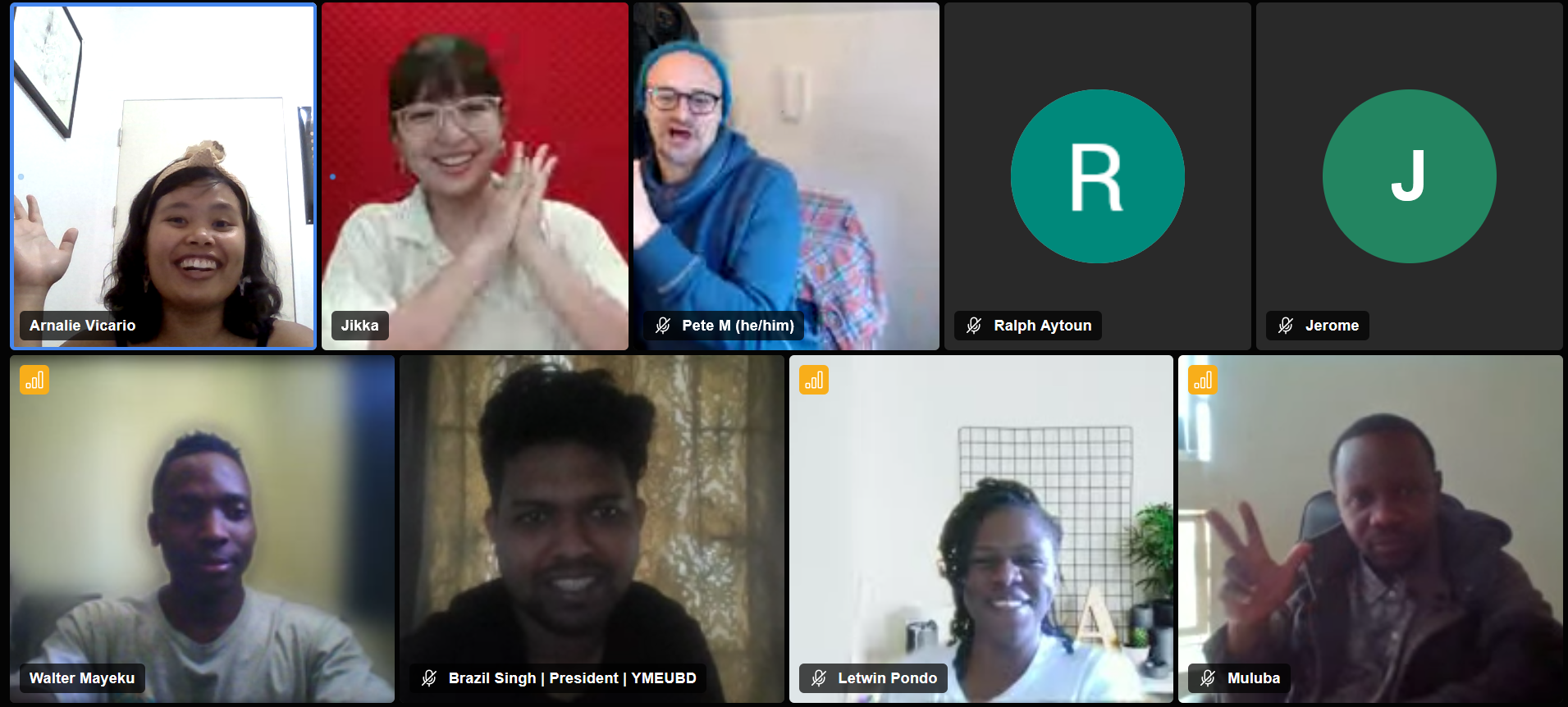
In 2 March 2024, various OSM contributors and community members/leaders gathered together for the Local Chapters and Communities Congress! It was my pleasure to share a short update about HOT where I work as an Online Community Engagement Lead.

My slide presentation is here. Recordings are now uploaded in Youtube :)

Just a point to make that I shared about the HOT and its community, and not the HOT as an org. HOT Annual reports are available here.

HOT CommunityWG

How to get involved in HOT?

There are three general ways to get involved with HOT:

  1. mapping in your own time,
  2. participate in a HOT Working Group/s, and
  3. contribute to tech.

So how do we engage with the community / contributors at HOT?

Since lots of different community members and leaders were there in the Congress, I took the opportunity to share and highlight how we foster a collaborative and inclusive space in HOT and channels

See full entry

Posted by Bogomil Shopov - Бого on 11 March 2024 in English.

After FOSDEM I was hooked again to contributing to OSM. I started slowly by using StreetComplete and did more than 700 suggestions and edits for a months. Now I am looking into using the editor to be able to add missing spots, especially pubs and toilets.

If there any any other Englis speaking enthusiasts in Prague, I am always open for doing a map walk combined with a pub visit.

Location: Košíře, Praha 5, obvod Praha 5, Prague, Czechia
Posted by GOwin on 11 March 2024 in English. Last updated on 18 March 2024.

Yesterday morning, our OSM community in Metro Manila, conducted an AlayData event for the quarter. We gathered to celebrate Open Data Day, focusing on open geopsatial data from OpenStreetMap, and give ourselves opportunities to socialize and get to know other contributors, sharing stories and experiences, and a chance for hands-on learning with new tools.

Among the things that our community learned from a “getting to know you” survey we did last quarter, is the high interest in other aspects of the OSM movement: like field mapping, photo-mapping, and getting familiar with other tools available from the OSM ecoysystem, and to more casual opportunities to contribute other than arm-chair mapping.

The volunteer group was sub-divided into three teams of their choice:

  • Galúgad - folks also on foot, using FieldPapers, for a no-tech mapping approach. In Filipino, “Galúgad” means travelling to explore, or search for something.
  • Tahák - folks on foot, using StreetComplete_EE (SCEE). “Tahák” in Filipino means to pass through a new or unusual path.
  • Padyák - folks on HPVs (in our case, just bikes), to collect ground-level photos, to support or augment map editing. “Padyák” in Filipino means to stomp, and by extension, to pedal or push with your foot.

Initial results

Here’s the latest heatmap of recent edits made in the area:

See full entry

Location: Barangay 654, Intramuros, Fifth District, Manila, Capital District, Metro Manila, 1002, Philippines
Posted by kwiatek_123 on 10 March 2024 in English.

I have created a web-based tool to easily and intuitively obtain the access token needed to make most requests to the OpenStreetMap api.

It is hosted courtesy of Interactive Maps.

The tool walks you through the process of obtaining such a token. It is useful for those writing server-side software that communicates with the api.

I created this tool because there is no other simpler way to authorise server applications. Current ways require running code locally.

It is available here: https://tools.interactivemaps.xyz/token

Posted by DENelson83 on 10 March 2024 in English.

In case you might have not yet noticed, my current project on OSM is to cover the entire remainder of Vancouver Island with woodland data. I started with my home area of the Comox Valley and am radiating out from there in all directions, eventually finishing up with the area around Cape Scott. Every patch of forest I find in aerial imagery, no matter how expansive, even if the trees are small, will be added.

../

Posted by Raquel Dezidério Souto on 9 March 2024 in English.
Posted by Raquel Dezidério Souto on 9 March 2024 in English. Last updated on 30 April 2024.

✽✽ Women’s participation is recognized


Leia em Português

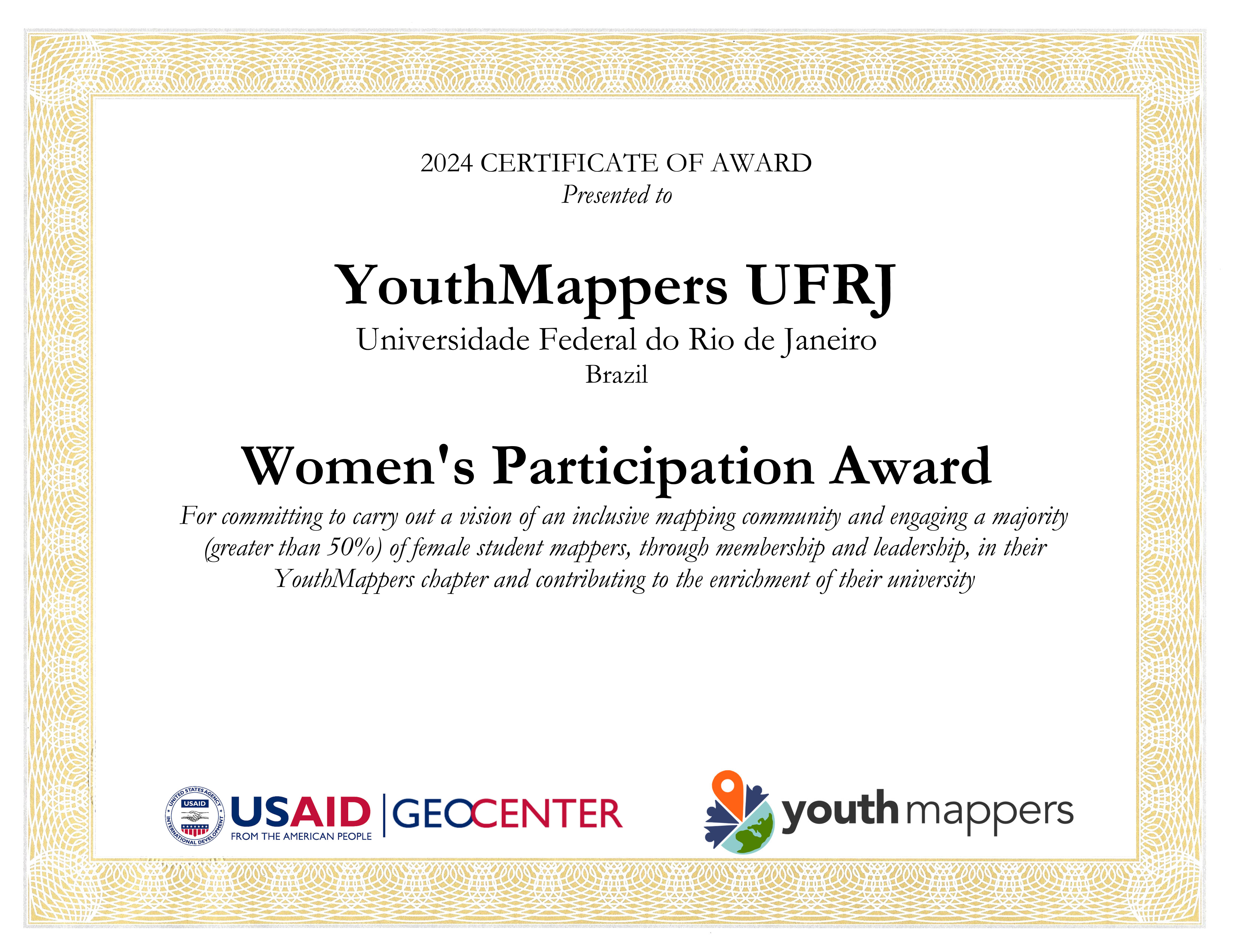
The international project YouthMappers awarded the YouthMappers UFRJ Chapter (Rio de Janeiro, Brazil) for promoting women’s participation in its activities and organization, corresponding to more than 50% of its membership.

The YouthMappers UFRJ Chapter is an initiative of open collaborative mapping, that results of a partnership between the Virtual Institute for Sustainable Development - IVIDES.org and the Laboratory of Cartography - GeoCart-UFRJ, chaired by Dr. Raquel Dezidério Souto.

On this International Women’s Day, we dedicate this award to all girls and women, hoping that they can achieve their goals!

youthmappers-ufrj-award

See full entry

✽ ✽ Representatividade feminina é reconhecida


Read in English

O projeto internacional YouthMappers premiou o capítulo YouthMappers UFRJ (Rio de Janeiro, Brasil), pela promoção da participação feminina em suas atividades e organização, correspondendo a mais de 50% de sua membresia.

O capítulo YouthMappers UFRJ é uma iniciativa de mapeamento colaborativo aberto, fruto da parceria entre o Instituto Virtual para o Desenvolvimento Sustentável - IVIDES.org e o Laboratório de Cartografia - GeoCart-UFRJ, sendo presidido pela Dra. Raquel Dezidério Souto.

Neste Dia Internacional das Mulheres, dedicamos este prêmio a todas as meninas e mulheres, que consigam sempre realizar os seus objetivos!

youthmappers-ufrj-award

See full entry

../

Posted by Raquel Dezidério Souto on 8 March 2024 in English.
Posted by Raquel Dezidério Souto on 8 March 2024 in English. Last updated on 9 March 2024.

An event to strengthen alliances between mappers from Brazil and Africa


Read in Portuguese

Between March 2nd and 5th, 2024, the event OPEN DATA DAY - Communities mapping communities: Brazil-Africa connection was held in Salvador (Bahia, Brazil), with the participation of Brazilians and Africans, who presented special keynotes and case studies on collaborative mapping, on the themes of sustainable development, gender equity, adequate housing, humanitarian mapping, disaster risk reduction and urban planning.

The YouthMappers at UFBA, producer of the event, also held mapathons, or mapping marathons, in the format of hybrid workshops, where participants mapped collaboratively on-line, using the editor iD for OpenStreetMap.

The YouthMappers UFRJ participated of the event, with the special keynote Collaborative mapping for disaster risk reduction - Case study: Municipality of Maricá (Rio de Janeiro, Brazil), given by its president, Dr. Raquel Dezidério Souto (IVIDES.org).

WATCH the RECORED VIDEO (in Portuguese and English), clicking here.

READ The PDF PRESENTATION FILE (in Portuguese and English), available here.

KNOW about this case study of collaborative mapping here.

See full entry

Um evento para aproximar mapeadores do Brasil e da África


Read in English

Entre os dias 02 e 05 de março de 2024, foi realizado em Salvador (Bahia, Brasil), o evento DIA DOS DADOS ABERTOS YouthMappers UFBA - Comunidades mapeando comunidades: Conexão Brasil-África, com a participação de brasileiros(as) e africanos(as), que apresentaram palestras e estudos de caso sobre mapeamento colaborativo, nas temáticas do desenvolvimento sustentável, equidade de gênero, direito à moradia digna, mapeamento humanitário, redução de riscos de desastres e planejamento urbano.

O capítulo YouthMappers at UFBA, produtor do evento, realizou ainda, as mapatonas, ou maratonas de mapeamento, no formato de oficinas híbridas, ministradas ao-vivo pela web, onde os(as) participantes mapearam colaborativamente e utilizando o editor iD para OpenStreetMap.

O YouthMappers UFRJ participou do evento, com a palestra Mapeamento colaborativo para redução de riscos e desastres - Estudo de caso: Município de Maricá (Rio de Janeiro, Brasil), ministrada pela sua presidenta, Dra. Raquel Dezidério Souto (IVIDES.org).

ASSISTA à PALESTRA GRAVADA (em português e inglês), clicando aqui.

LEIA o arquivo PDF da APRESENTAÇÃO (em português e inglês) está disponível neste link.

CONHEÇA mais sobre o MAPEAMENTO, clicando aqui.

See full entry

Posted by radiotrefoil on 8 March 2024 in English. Last updated on 4 April 2024.

Introduction

I am writing this tutorial because adding wireless connectivity to the cheapest hobbyist RTK module (Ardusimple simpleRTK2B) is very useful but not trivial for those inexperienced with electronics, and Ardusimple closed down their forums for… some reason. Hopefully this is something anyone can follow to make RTK more accessible to the general hobbyist mapper.

This entry is building on from my previous diary entry “Affordable, High Quality 360 Street Level Imagery using GoPro Fusion and Ardusimple”, I have now been using the rig for a couple years and it is holding up very nicely.

A quick summary is that I used the simpleRTK2B with my phone and GoPro Fusion 360 to make a very cheap and ultra portable street level imagery rig, for Mapillary or Kartaview. It can be used handheld or mounted to a car or bicycle.

The last survey I went on, whilst mostly fine, did bring up some issues regarding the reliability of the USB OTG data connection. This has always been a weak point of the rig in other ways because;

  • the USB connection would drain my phone’s battery and make it difficult to charge the phone simultaneously whilst surveying, unless using wireless charger
  • the phone always needed to be in close proximity to the simpleRTK2B
  • too easy to accidentally disconnect
  • The OTG adapter is wobbly in the type-c port

As my Android app of choice “SW Maps” permits a bluetooth connection for the NTRIP corrections, it was the obvious way to go.

Bluetooth module choice

Ardusimple sells the Bluetooth XBEE module for the simpleRTK2B for €34 which is quite expensive. I know you’re reading this Ardusimple! Third party Bluetooth XBEE modules are somewhat cheaper (around $20 AUD), however I had a generic bluetooth UART module laying around so I decided to just solder it in. Similar ones are quite cheap to buy new, for example the arduino HC-06 module goes for around $10 AUD.

Connecting it up

See full entry

Location: Bentley, Western Australia, 6102, Australia