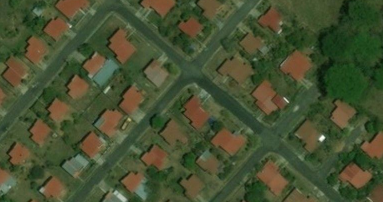
원주혁신도시를 여기저기 손을 보며 가장 ‘중간’에 맞는 편집을 저는 그렇게 하고있습니다 하지만 아직도 어딘가 모자르며 제가 잘못만진 부분이 분명히 있습니다..~~ 이를 찾아서 앞으로 손볼 예정입니다.
2022년 현재 가능한 도로를 전부 최신화 하였습니다. 의견의 있는 내용은 저와 관련이 없음을 적습니다
원주혁신도시를 여기저기 손을 보며 가장 ‘중간’에 맞는 편집을 저는 그렇게 하고있습니다 하지만 아직도 어딘가 모자르며 제가 잘못만진 부분이 분명히 있습니다..~~ 이를 찾아서 앞으로 손볼 예정입니다.
2022년 현재 가능한 도로를 전부 최신화 하였습니다. 의견의 있는 내용은 저와 관련이 없음을 적습니다
원주기업도시는 현재 사실상 커다란 변화는 없다고 개인적 판단되어 이제는 건물이나 주변 태그들을 넣을 예정입니다.
‘기업도시 숲길’ 은 만들 생각은 없습니다…! 숲길은 더 뚜렷한 위성이나 개인 드론등으로 봐야 정확하고 위성으론 숲에 가려져 도로의 모습이 모호하기때문에 괜한 편집으로 생각됩니다.
2020년 3월29일
고속버스 및 샘마루초등학교 건물 정보를 수집하고있습니다.
2022년 현재 지도 최신화를 진행했습니다
앞으로 업데이트가 없을 예정입니다 기업도시에서 다시 시내로 이동하였고, 기업도시의 뚜렷한 변화점이 없기때문입니다
섬강과 남한강 주변을 초기 2018~19년도에는 위성자료가 부족하고 강둑 주변을 어떻게 표현하는지 확실한 방법을 몰라 초원등으로 표현했습니다 또한 여주보 근처 최초 편집시에도 자료는 제가 직접본 경험말곤 없어서 대충 표현했는데 지금은 잘 보이는 부분은 초원등으로 표현하고 비어있는 부분은 직접 보거나 주변을 자연스럽게 마무리할 예정입니다.
![]()
De moins en moins utilisé de nos jours le courrier est encore parfois indispensable. Connaitre les emplacements des boites aux lettres jaune de La Poste peut être bien pratique. Dans cet article nous allons analyser l’état d’avancement du référencement des boites aux lettres (que nous nommerons désormais BAL) dans OSM et que nous comparerons aux données mises à disposition par La Poste.
Une BAL est identifiée par l’attribut amenity=post_box auquel on peut y ajouter les horaires de relevé (collection_times : ), l’exploitant (operator : ) en France il ne doit y avoir que La Poste à ma connaissance. Et la référence de la BAL (ref : ) car on le verra plus bas, toutes ces gentilles BAL ont un petit nom unique.
Here in San José, we’ve begun importing tens of thousands of businesses from an official registry of South Bay businesses and other points of interest that are open during the COVID-19 pandemic. When we’re done, our POI coverage will look similar to this visualization:
As i’m figuring out how to use this site, i’m hoping the be a really good mapper as years go by, I want to help the area of Northwest Pennsylvania since there isn’t many people from that area on this website anymore, only a couple are actually still pretty active, I also hope to improve more of Lake Erie & Crawford County since most buildings were drawn years ago on old satelites imagery and I hope to fix and reshape the buildings to fit better with the more modern satelite map imagery thats used today.
Modification du lieu-dit “Les Monçeaux” en “Les Monceaux”.
In Panamá there’s a YouthMappers chapter, at the Universidad de Panamá. This YMUP Chapter started quite late working at its visibility here on OSM, so their first activities went mostly unnoticed. They do produce quite a bit of action and boast a remarkable access to various types of resources.
My goal in this diary page is to document the groups initial organized activities, and I’m writing in English because I hope this will help reach a wider public.
Member composition is dynamic, but a few members are sort of “resident”, definitely the two mentors María Adames de Newbill and Humberto Smith, professors at the University of Panamá. The support by Esri is also a constant, through Manuel Quintero and Jean Felix Guevara. fanny16 is possibly also part of the Chapter through Esri, I don’t know. Two other mappers closely tied to the YMUP are Karen Martínez and Martitza Rodríguez, who have been president of the chapter respectively from October 2018 to October 2019 and from October 2019 to October 2020, confirmed for one more year.
Further membership can only be inferred based on early participation to the mapathons and HOT projects. Given the logs, few of their mappers participated to mapathons in more than one calendar year. As of January 2021, according to their mentor, it’s 12 people in the group. Here an incomplete and possibly incorrect list: fanny16, Marianne_pty, Tinago, Yarilpa, Nwalachosky18, Brenda Soto, Mafe96, Angel Ortega…
The YouthMappers International web portal has a blog link, and I’ve collected the entries related to YMUP:
It’s mostly buildings that they map, and I’m focusing on that only.
This was project 4917 on HOT, and this is JOSM with the buildings edited 2018-07-01/2018-07-31:
يسود قرية نجرو مناخ مداري ممطر وحارّ صيفاً، حيث ترتفع درجات الحرارة بشكلٍ كبير فيها في الشهور التالية أبريل وتموز مايو وحزيران يونيو ويصل أعلى معدل لها 46 درجة مئوية بينما تنخفض درجات الحرارة إلى أدنى مستوى لتصل إلى 14 درجة مئوية في كلّ من شهر يناير وشهر كانون ألثاني وكذلك تسقط الأمطار على القرية في الموسم المطير والذي يمتد من شهر مايو إلى شهر أكتوبر المقولة الشهيرة (المطر قابل نجرو )
تضم قرية نجرو شأنها في ذلك شأن بقية قرى و مدن ومناطق ولاية الجزيرة مجموعات سكانية من مختلف قبائل إثنيات السودان من بينها مجموعات واشهرها الخوالدة والجعلين وبهاء الكواهله والرفاعيين والمسلمية والعركيين والكنانة والكواهلة و البديرية الدهمشية والفونج إلى جانب أعداد كبيرة من الانثيات الأخرى بالسودان والتي توافدت إليها بعد تأسيس مشروع الجزيرة لسد الحاجة لليد العاملة بالمشروع البرقو الفلاتة والهوسا في غرب وجنوب غرب القرية وغيرهم . ويقدر عدد السكان بحوالي 2845 نسمة حسب تعداد 2008 تقريبا
تقدر مساحة قرية نجــــرو بحوالي 338,206.97 متر مربع
سميت قرية نجرو بهذا الاسم نسبة لما ورد إلينا من أسلافنا انة اول شي فكر فيه الناس هو إيجاد مصدر لمياه الشرب وبدو في حفر البئر حتى وصلوا إلى مستوى معين واع طرد سير عملية الحفر في هذا البئر حجرا و اجتهد الجميع في ازالة الحجر فبدأ جادين في حفر البئر وتكسير الحجر الذي اع طردهم وتم ازالته عن طريق الحفر والتكسير حتى إزالته كله وكان الناس في القرى المجاورة يسألون عن ماذا فعل اهل هذا القرية في موضوع ذلك الحجر فقيل لهم أنهم قد نجرو وبعد ذلك سميت القرية بهذا الاسم نسبة لاجتهاد الكل من أهل القرية في نجر ذلك الحجر من هنا سميت بهذا الاسم قرية نجرو. والله أعلم
I Just had a brief orientation with Oluwatosin and Ijeoma on OSM and how Unique Mappers contribute to OSM project . I look forward they will pick it up from there… How brief can you make an orientation about OSM? just to get newbies excited and get on board as active Local OSM Mappers?
Over the past years, the OpenStreetMap Foundation has worked hard to expand the membership. On the one hand, we want the core of the project to be run by people from all backgrounds. On the other hand, a larger membership makes it harder to buy your way into power.
Over the past year, MWG and Board worked on the implementation of the Active Contributor Membership (ACM). You no longer need to pay, or say you cannot pay to join. We now welcome anyone who is contributing significantly to the project by mapping or in other ways. The project was launched by the end of August 2020, and has already had a significant impact. A previous iteration of this was “the fee waiver program”. It was only available for people for whom the subscription cost of 15 pound is very high, or for whom making the payment is difficult (because of international banking issues). This program was launched around new years 2018.
We compare the status at the end of the year 2018, with the membership right before the launch of the ACM and a few months later - mid November. Note that with the 90 day membership requirement for voting in the AGM/Board election, no snapshot exactly represents the voting population.
According to my count, membership rose from 1503 to 1939 in the period since the introduction of ACM. That’s over 400 new members or a growth of almost 30%. In this short time, the membership has grown more than in the almost two years before.
A lot of the motivation behind ACM is increasing geographic diversity. There has in fact been a significant shift. Where Africa was virtually unrepresented back in 2018, it is now at 5,2% of the total membership. Asia shows a steady growth. South America did not profit much from the fee waiver program, but has seen a significant rise recently.
I had been working on trails in Westwoods for years, but in 2011 we moved to Guilford adjacent to Westwoods so since then I have been doing extensive editing in Guilford Land Conservation Trust properties and also some adjoining towns.
As part of working with the Westwoods Trail Committee, I have created a display that relies on OSM maps and in particular on waymarkedtrails.org layer. In that app (based on a Leaflet map using OSM data) I have been displaying an inventory of bridges in GLCT properties. I also use it to display trail issues that need to be addressed and points of interest relevant to GLCT.
I have been paying much more attention to hiking route relations because of how well waymarkedtrails.org uses that data in its displays. In particular, I’m getting better at recording osmc symbols so that they will appear accurately on the waymarkedtrails.org map.
Apart from taking part in the OSM Ireland project to map all buildings on the island, most of my constributions are of historical features. I’m also always trying to convince other historically interested people of the merits of OSM. So when a friend and fellow member of the Kilkenny Archaeological Society asked me whether jostle stones (Wiki link) could be mapped on OSM, I said “sure”. Only slight problem being that there is no key for them - yet. So I started a proposal on the OSM wiki. Please join the discussion and the vote, once it starts.
While I was preparing the proposal, I asked around in my family if someone could send me pictures. I was 90% sure my aunt in Leipzig, Germany lives in a house with guard stones, because it used to be a printing house in the 19th century and has a huge gateway. She didn’t think so, but she checked, and there are. I just thought it was funny that I remembered them being there (I haven’t seen that house in about two years) and she has been living there for at least five years and never noticed them.
It took us a while to find out the name for them in German - there are actually a few. I put all my hopes unto my grandmother who used to work for the Heritage Council, and she did deliver. She didn’t know right away, but she knew where to look it up. It’s curious, that very few people know the name for them, even though they are omnipresent in historic town and city centres. At least that is the situation in Ireland and Germany. But raising awareness might keep the word(s) in the collective vocabulary a bit longer.
I think it would make for a nice Heritage Week project to map jostle stones (that seems to be the Hiberno-English word for it) in Kilkenny or even the whole of Ireland. It could be a way to get new mappers with a local history background. Or people who map for visually impaired map users.
🚘 أرجو أن تكون مده حفظ المسار أكثر من يوم واحد على الأقل أن تكون مده حفظ المسار شهر وبالتالى تكون ممتازة جدا جدا جدا وهذا للضروره القصوى وهذه الميزة كذالك تفيد فى أشياء كثيرة جدا لمستخدمى الخرايط وموظف المندوب الذي يتجول فى الشارع وعلى المحلات🙏🙏🙏
(work in progress)
he escrito estas notas pensando en las cosas que pasan, cuando un mapero principiante se encuentra con unas fotos aéreas y no tiene la preparación o el apoyo para interpretarla correctamente. los ejemplos que siguen son reales, y las soluciones son lo que haría yo. todo está basado en JOSM. espero que les sirva, o que me dejen algún comentario.
hay áreas con edificaciones recientes, donde las calles son ortogonales, las casas todas paralelas a las calles, los árboles están poco desarrollados o quedan lejos de las casas, y todo es bien visible, como en Villa Belén al sur de Santiago de Veraguas, en Panamá:

pero las casas no son todas iguales, así que seguramente es más rápido dibuarlas una por una. sólo debes seleccionar dos puntos en la calles con que alinearse, activar el plugin “buildings_toos”, dibujar los elementos rectángulares, y unificarlos.
It is a privilege to address 2020’s humanitarian OpenStreetMap Summit today. This year marks HOT’s 10th anniversary, and my own 5th anniversary with HOT starting from 2015. Today’s theme is the past, present and future of humanitarian OpenStreetMap and we have been thinking a lot about the future.
I wanted to share my Summit address (which you can watch here) on an OSM diary simultaneously, so that people can engage in the comments if they want to.
This is something of a statement of intent for HOT within the humanitarian and OpenStreetMap ecosystems and, while it has been shaped by many conversations with community groups, collaborators and contributors in the universe in which HOT exists, it only seeks to represent my own perspective and some of the recent thinking within HOT the NGO. Please think of it as an early draft and a contribution to a conversation.
I also acknowledge that HOT’s presentation of itself has increasingly highlighted our successes while smoothing over or not acknowledging challenges and failures. Today’s Summit features “failfest” sessions for the first time where friends and colleagues are sharing learnings from where they didn’t necessarily get it right. This statement is not about what we’ve gotten right, but about how we’d like to embrace a stronger culture of feedback and learning and hope that, by doing so, we can achieve great things, with all of you.