

Spending countless hours terracing thousands of buildings yet didn’t even bother to correct the errors caused by it?
 OpenStreetMap
Spending countless hours terracing thousands of buildings yet didn’t even bother to correct the errors caused by it?
Hello OSM community,
We (myself and the MapSwipe community!) want to hear from you!
My name is Nicole Siggins and I’m currently on the governance team at MapSwipe a humanitarian mobile phone app and web app where volunteers can contribute to geospatial data projects.
I presented a talk, “MapSwipe Today and its Future in OSM” along with Benjamin Herfort from HeiGIT at State of the Map Europe 2025 in Dundee, Scotland. (recording coming soon…)
The talk has two main purposes:
Let people know more about MapSwipe, its history, and what one can do with it today!
Begin a discussion within the OSM community about what it might mean for MapSwipe to become its own OSM editor, especially if AI or machine learning models are involved.
The MapSwipe community wants to ensure that if we are going to move forward with any ideas and planning around becoming an OSM editor, and maybe even one that has AI in the mix, that we also make sure the OSM community is present in our discussions.
Some concrete items we’d like to discuss with the OSM community are:
The talk at State of the Map Europe was an extension of the same talk I gave at State of the Map US 2025 in June in Boston, Massachusetts.
You can view that talk on YouTube.
Looking forward to the discussion!
Nicolelaine
This week I’ve been mapping rural communities in Honduras, focusing on areas within the Tegucigalpa Health Region. My work has included adding paths, correcting road alignments, and identifying visible structures such as houses and community centers.
Today we at Unique Mappers did our weekly presentation were I made a presentation on Humanitarian Use of OpenStreetMap where i talked about OSM what it is why it is crucial in Humanitarian context how it provides critical data in poorly mapped or un mapped areas. I still talked about the basics( getting started with OSM), the intermediate OSM data use(Analysis and virtualization) and advanced used of OSM. I still talked about the tools and resources( software) used with OSM and example is the HOT tasking manager, QGIS [qgis.org], Umap and many other software, site, organisation using OpenStreetMap
Hi :) I am mapping Eritrea these days and found some objects I am not able to identify. Can you help me with your wisdom?
I suspect those are some living buildings, but I might be wrong.

As I write in my profile, I was really peeved off, that dozens of “Camino Apps” (apps used to track users along the Ways of St. James, the Caminos de Santiago) did ask their users for updates to opening hours or bed counts in albergues, but never contributed back to OSM what they’d discovered.
I launched a “test balloon” in 2023, renaming an accommodation to reflect its real name, and lo and behold, of the 23 apps I checked, 22 had suddenly also changed the name, meaning they used OSM data, but didn’t ever give back to the community.
So I changed it, wrote a Camino App that did contribute back. We don’t expect our users to have OSM accounts. Instead, we recruited a bunch of volunteers, who are served the changes, check them personally, and then contribute them back to OSM.
First step: fountain potability. Along the Caminos are thousands of fountains providing drinking water to the 500k pilgrims walking the Way every year. Spain is excellent, when it comes to drinking water quality, but sometimes fountains dry out, become undrinkable, or become drinkable again. Nothing sucks more than going 1000m out of your way to find out that fountain has been closed.
I’ll semi-manually start updating fountain “drinking_water=” tags over the next 30 days along the most famous route, the Camino Francés. Once that’s stable and enough volunteers have been trained and shown that they can do this without harming the dataset, we’ll expand to hostel data.
This blog was originally posted on my personal site:
I’m not much of an armchair mapper. Partly because ground surveying with Everydoor and StreetComplete is what got me started mapping in OSM. But I think it’s also because I hate having to decipher blurry aerial imagery. I still do it from time to time, but ever since I discovered how to use the Strava heatmap, I’m hooked.
To hopefully sell others on the dataset and walk you through some ways I’ve found it helpful, I’ve collected some examples below of ways you can use the Strava heatmap data.
For those of you who don’t know, Strava is used around the world to record all kinds of workouts. Strava has moved to using OSM data in their apps and to give back they’ve allowed use of their GPS traces as a source when contributing to OSM!
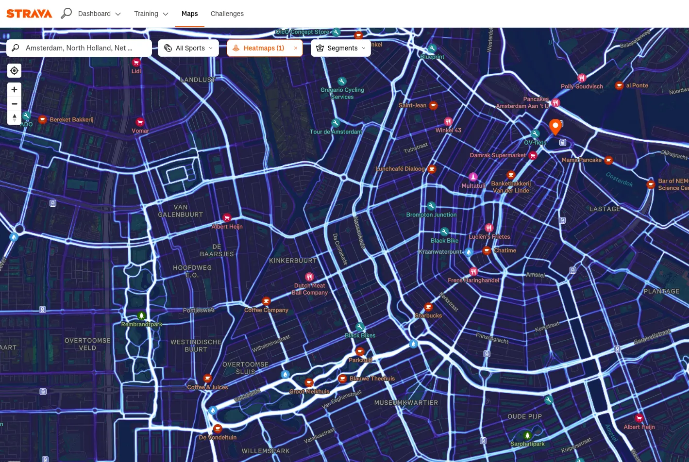
To get it set up you can reference the OSM wikipage for Strava.
This content was hidden by the user and will be available in the not-so-near future.
Just a quick blog post on some coastline work I was doing.
For the OSMF Shortbread vector tiles I had to identify when coastlines has changed. The solution I came up isn’t specific to Shortbread, but is useful for anyone using the tiled ocean shapefiles.
I’m going to start by assuming that the old ocean data is in water_polygons and the new data is in loading.water_polygons. Other parts of my code already handle this. The shapefiles are loaded into tables that have the columns x int, y int, way geometry.
To start I want to find any geometries that have changed. For geometries in the new data that aren’t in the old data, I can get this with a LEFT JOIN. I want a set of geometries that includes any geometries from the new data that aren’t in the old. This set can be made by excluding any geometries in the old data that have identical x, y, and binary identical geometry to a new geometry. It’s possible this set includes extra geometries, but that’s okay.
A RIGHT JOIN would find geometries in the old data that aren’t in the new. Combining these gives a FULL OUTER JOIN. If I then collect the geometries in each shapefile tile I can compare them to find the geometries
SELECT ST_SymDifference(ST_Collect(old.way), ST_Collect(new.way)) AS dgeom
    FROM water_polygons AS old
    FULL OUTER JOIN loading.water_polygons AS new
        ON old.way = new.way and old.x = new.x and old.y = new.y
    WHERE new.way IS NULL OR old.way IS NULL
    GROUP BY COALESCE(old.x, new.x), COALESCE(old.y, new.y)
This gets me the difference in geometries for the entire world in about two minutes. But I need tiles, which is it’s own complication.
One person is sanding down a rusty gate,
Another is painting over the rust,
Yet another is attaching a new handle to the corroded gate,
Some are even building an entirely new gate to replace the old, rusted one…
And a few are wondering, “Why are they doing all this? The gate still works just fine…“
Everyone is doing what they want to do and what they can do,
but since no one is coordinating or adjusting things,
it’s a situation where people are working inconsistently and in a disorganized manner.
어떤 사람은 녹슨 대문을 사포질하고 있고
또 다른 사람은 녹이 슬어 있는 대문에 페인트칠을 하고 있고
또다른 사람은 녹이 슨 대문에 새로운 손잡이를 달고 있고
또 어떤 사람들은 녹이 슬어 낡은 대문을 교체하려고 새 대문을 만들고 있고…
그리고 몇몇 사람은 대문이 아직도 쓸만 한데 왜들 저러고 있나 의아해 하고 있고……
각자 제 하고픈 일을 하고 할 수 있는 일을 하지만,
누구도 조정해 주거나 조율해 주지 않아서
서로 일관성 없고 뒤죽박죽으로 일하고 있는 형국.

EN translation below
PT abaixo
En 2025, il existe encore plein d’endroits dans OSM où les villes sont encore peu cartographiées dans le détail – malheureusement pour l’exhaustivité de la base, mais heureusement pour la motivation des cartographes OSM. Il est possible de changer radicalement la cartographie d’une petite ville en y consacrant quelques heures lors d’un séjour de quelques jours.
Par le passé, lors d’une formation en ligne, j’avais montré comment j’avais cartographié peu à peu quelques centaines de POI sur un quartier très vivant de ma ville de résidence, et cela avait motivé un étudiant pour faire la même chose chez lui (voir ce billet).
À nouveau, je relate mon expérience pour inciter d’autres à l’adapter à leur manière. Mais j’irai cette fois au-delà des aspects techniques et logistiques. En effet, cartographier des POI, c’est bien sûr utile à toutes celles et ceux qui réutiliseront la donnée, c’est un bon moment à passer seul ou à plusieurs, mais cela permet également de découvrir le lieu autrement, de mieux le connaître et le comprendre.
Au-delà des POI, en portant un œil de géographe, on se rend compte comment la localité s’organise et comment elle évolue. Je rajoute donc quelques petites pastilles sur ce que les POI m’ont appris sur le territoire cartographié.
J’ai passé trois jours dans les environs de Mucugê, petite ville de la Chapada Diamantina dans l’intérieure de l’État de Bahia au Brésil, dont l’histoire est justement marquée par la période de ruée vers le diamant, avec avant tout un agenda touristique, mais aussi en tête la possibilité de cartographier en fin de journée, au retour de visites ou de randonnée, ou au contraire tôt le matin. Mais dans les deux cas, seulement si j’avais suffisamment d’énergie pour le faire et sans que cela n’interfère avec les activités prévues ou improvisées avec les personnes qui m’accompagnaient.
It sometimes feels like OSM is of the West, by the West, for the West.

Over the past 20 years, OpenStreetMap has become one of the world’s largest and most impactful crowdsourcing projects. Thousands of communities have formed around collaborative mapping, connecting people and fostering the sharing of geographic knowledge.
Today, OpenStreetMap is an essential source of geographic data, powering a wide range of map services used by thousands of people daily and serving as a vital tool in managing climate and humanitarian crises. Although the main site, OSM.org, is not designed as a direct navigation tool, the experience of new users plays a crucial role in attracting new mappers. Improving usability for the public, therefore, benefits the entire community, alongside the millions of organizations that use OSM data.
In recent years, the OpenStreetMap ecosystem has grown significantly, expanding to every corner of the world and yet, the user interface of OSM.org is much the same as it was when OSM was founded in 2004. Among other challenges, it is not optimized for mobile devices, nor does it meet modern accessibility standards. We believe this is the time to prioritize a more cohesive, intuitive, and enjoyable user experience while making it easier for developers and contributors to create solutions.
To achieve this goal, we are developing a design system, a set of reusable guidelines and components that unify the design and functionality of digital interfaces. This system has been designed to meet the community’s needs, promoting consistency, accessibility, and scalability. It will ensure that interfaces are inclusive, modern, and capable of addressing the needs of a diverse global community.
After one more year of French administration funding (thank you!), we are so proud to have released versions 3.X of uMap since last April. Since then, we made a couple of adjustments to ease the deployment of that new version.
The main feature of that version is the long awaited real-time collaboration! Thanks to Alexis for the development and NLnet for the funding 👏
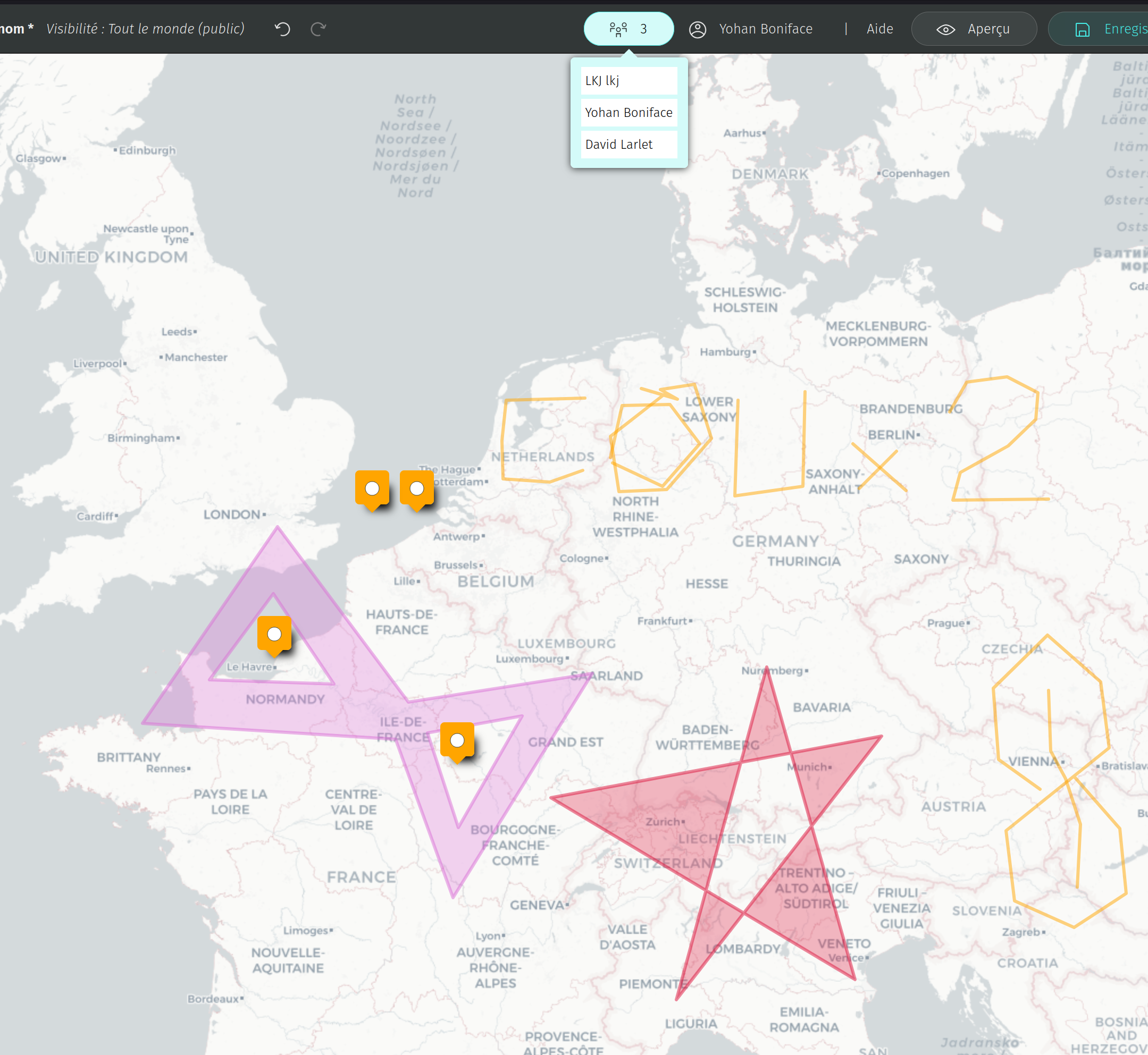
We decided for now not to activate the real-time collaboration on the French server of OpenStreetMap for two reasons:
It’s activated on these instances:
We also introduced the template feature which allows to avoid copy-pasting maps to reproduce similar styles and (optionally) data. It also allows to share templates with others (useful for friends, workshops and so on).
Cet article de blog a été publié à l’origine sur ce site web et a déjà été mentionné par WeeklyOSM.
EN translation below
Dans le billet précédent consacré à la cartographie des dommages du bâti à Mayotte, j’annonçais vouloir comparer ces dommages évalués dans OSM à partir d’imageries Pléiades post-désastre avec d’autres jeux de données et de promouvoir la réplication de l’exercice cartographique, ce qui implique de présenter la démarche et ses résultats.
Dans cette double perspective, je me suis rendu compte qu’il serait utile de disposer de statistiques plus détaillées que celles montrées dans le tableau de bord produit jusqu’à présent en intégrant à la fois un nouvel indicateur, un rapprochement méthodologique et une autre échelle territoriale. Dans la base PostgreSQL de l’IFL consacrée à Mayotte, j’ai ainsi décidé de :
Today is a special day—my birthday. I woke up feeling grateful and hopeful. Another year of life is not something to take for granted. I feel happy, not just because it’s a celebration, but because I’ve come a long way, and I’m ready for more. Birthdays are not just about cake, candles, or greetings. They are about reflection, growth, and new beginnings.
As I look ahead, I’m deeply motivated to grow—not just in age, but in wisdom, character, and capacity. I want to build myself professionally and personally. My journey so far has been full of lessons, and I know there is much more to learn. I believe in continuous improvement, and that belief fuels my ambition to keep pushing forward.
This year, my focus is on professional development—gaining new skills, strengthening what I already know, and becoming more confident in my work. I plan to seek opportunities for learning, whether through training, mentorship, or real-life experience. I want to become more capable, resourceful, and impactful in everything I do.
At the same time, I also want to grow emotionally and mentally. Maturity isn’t just about work—it’s also about how we treat people, how we handle challenges, and how we understand ourselves.
So, on this birthday, I’m not just celebrating the past—I’m preparing for the future. I feel proud of the person I am becoming. I will keep dreaming, working hard, and building the life I envision.
Here’s to a new year of growth, purpose, and becoming the best version of myself.
This is something I encountered mapping bike infrastructure in the Austrian town of Neuhofen an der Krems: what one might assume is a continuation of a shared bike/pedestrian path over a pretty unimportant side road is actually a legal trap for cyclists and people walking. View it on Mapillary and look closely: a sign indicates that the cycling/walking path ends, only for it to continue right after the crossing. This means that pedestrians and cyclists no longer have right of way and have to yield to cars coming out of the residential road.
It is unfortunately a bit hard to make out using imagery, but the sight lines at this crossing are horrible. Not only is it basically impossible for cars from the south to see anyone cycling by before it’s too late, it’s also pretty much impossible to see any cars coming as a cyclist, even when slowing down. This is exactly the sort of situation one should avoid as a planner, but it is strikingly obvious that the bike path here was just an afterthought.
Intersections like this are common all over (Upper) Austria and often “solved” by applying this “interrupted cycle path” treatment. This means that if a cyclist and car were to collide here, the cyclist (person far more likely to die) would have to be the one explaining why they didn’t yield, and not the car driver (person driving a multiple-ton death machine) - just adding insult to (literal) injury. This is especially bitter because the bike path connects a fairly sizeable (by Austrian standards) part of town with the town center, while the side road only serves a handful of houses.
My journey as an OpenStreetMap contributor began in 2022, with a humble yet impactful project: mapping roads in Mugu, Humla, and Jumla—three of Nepal’s most remote and mountainous districts. Since then, I’ve grown into an active mapper, dedicated validator, and proud member of the global OSM community. In 2023, I was recognized as an OSM Guru and listed among the top contributors, a reflection of my deep passion and consistency in open geodata contribution.
Areas of Focus My primary interest lies in mapping buildings and roadways, especially in critical and under-mapped areas. I’ve also actively contributed to tools like MapRoulette and MapSwipe, which help bring micro-edits and mobile contributions to the mapping ecosystem.
Highlighted Contributions “Map Roads, Make Your Way” Project Recognized as a top-quality mapper, I contributed significantly to this project—led by HOT, Open Asia Pacific Hub, KIRDARC, and OSM Nepal—focusing on mapping roads in Humla, Jumla, and Dolpa. This initiative was a pivotal moment for me, helping improve accessibility in some of the most remote regions of Nepal.
Digital and Spatial Technologies for Anticipatory Action Volunteered in this 5-day event organized by NAXA Nepal, where we mapped roads, waterways, buildings, and land use across six municipalities. Using ESRI imagery on the HOT Tasking Manager, we enhanced maps to support community resilience and disaster preparedness. We focused on: Mapping open spaces critical for evacuation and aid Digitizing health posts, schools, power lines Improving road networks and land use classifications
Global Solidarity Through Mapping Solidarity Mapathon for Myanmar (HOT) Climate Change Challenge with HOT, TOMTOM, Open Asia Hub Participated in multiple Kathmandu University mapathons—both as a mapper and organizer, including events under NEPGEOM


