Diary Entries in English

Recent diary entries

Hello everyone!

I’m Ayush Dhar Dubey, a 2nd-year undergraduate student at Indian Institute of Technology Roorkee, pursuing my major in Civil Engineering. While my academic roots lie mostly in reinforced concrete and structural design…software development and open-source have become equally foundational to how I think about solving real-world problems.

I’m thrilled to share that I’ve been selected for Google Summer of Code 2025 as a student developer with OpenStreetMap (OSM). My project, under the mentorship of Lonvia and Tordanik, is titled “Modernize the 3D Model Repository (3DMR)”.

alt text


What is 3DMR and Why Does it Matter?

The 3D Model Repository (3DMR) is an online platform that allows contributors to upload openly licensed 3D models and link them to OpenStreetMap features. Tools like OSM2World can then render realistic 3D views of real-world locations using this data.

See full entry

Location: Sahijna, Tenar, Garhwa, Jharkhand, 822114, India
Posted by Raquel Dezidério Souto on 19 May 2025 in English. Last updated on 19 June 2025.

Want to learn how to map buildings after a disaster? Learn about the BAR/HHI Methodology, applied to mapping with OpenStreetMap and JOSM


On May 19, 2025, we successfully held the workshop Post-disaster mapping with OpenStreetMap and JOSM, in Brazilian Portuguese, promoted by the company IVIDES DATA and the group of young Brazilian mappers, YouthMappers UFRJ, and given by Séverin Ménard, from Les Libres Géographes.

Leia em Português

IMG VIDEO 1


Recommendations and demonstration videos are also available in the guidelines section of the Mayotte’s projects on the HOTOSM-TM.

See full entry

Today, Monday 19th May 2025, Made me one week at my IT, And so far i can say it has been great for me, Topping the chart, mapping over Thousands of building just in one week. Yes i sign up for this, that’s why I’m here to lead and take the topflight. Saying about today, I got the opportunity to teach and lecture one of my new IT College on what OpenStreetMap Is, His name is Alex though, And it was fun throughout the whole process. For fact, i know a lot is gonna come my way through this program, which I’m waiting for it and ready for success!!!

Location: Rumuosi, Obio/Akpor, Rivers State, 500004, Nigeria
Posted by OG Alex on 19 May 2025 in English.

So today i learned what is mapping and how to map and i mapped some building. it was a beautiful experience and i really enjoyed it. i met a guy called fortune he taught me almost everything i learned about mapping he is and easygoing guy, i still met a lot of fun people that will make learning easy. When i started i first learned what is mapping the site used for mapping which was later introduced as OSM US tasking manager. after that i created my account did my first mapping under the supervision of fortune and when he checked what i did and approved it i continued with some project he gave me and i finished 2 mapped task.

An open, cross cutting feature request for streetcomplete, everydoor, organicmaps and anyone else who targets mobile data capture.

  • Ask for location detection (yup), device activity sensors (maybe not already asked for)
  • If I am detected in the same place and that place has a shop=* or amenity=* for 5-15 minutes
  • Activity detected is “still” or similar (I put my phone down, or walked around a shop)
  • Can I please get a nuanced prompt at some point either then or within a few hours?
  • And limit current notifications to 1

Particularly for cafes, restaurants, pubs, etc.

Why: Google maps does this for reviews, to great effect. Ask me, while I am at a restaurant, with a physical menu “Is the cuisine vegetarian?” Or “what’s the website?” (Often printed on menus) Ask me, while I am a cafe, “is there outdoor seating?”

The problem this solves is often I don’t know when a favourite place is missing data. I go there all of the time, why wouldn’t it be mapped?

Give me a “no thanks” option so if I don’t want the intrusion I can opt out easily. But if I hit “yes please, nudge me”…

Following various discussions and requests over the previous years, I’ve adapted parsing of the machine-readable osmc:symbol tag in waymarkedtrails for route symbols to cover more use cases. The new implementation comes a bit closer to what is specified on the wiki website, most notably now supporting a second foreground, but also extending the list of supported backgrounds. This posts gives a bit of background on the changes.

Supported syntax

The official specification of the osmc:symbol tag always had the issue that it largely relies on guessing the function of its parts from their content. A part called red_bar? Must be a foreground description because there is no “bar” background and the content looks to be too long to be a text description, too. This is a viable way of describing something but not very robust against typos and it makes it very hard to extend the value set. waymarkedtrails has therefore implemented a subset of the specification that could be parsed in a way that the function is determined from the position of the parts. This subset was essentially: waycolor[:background[:foreground[:text[:textcolor]]]] Unfortunately this approach made it impossible to support the second foreground when it popped up on the wiki page and that has left users confused ever since.

User mueschel has recently re-analised the format and came to the conclusion that we can still keep the positional approach when sticking to the following combinations of part descriptions:

waycolor:background waycolor:background:foreground waycolor:background:foreground:foreground2 waycolor:background:foreground:text:textcolor waycolor:background:foreground:foreground2:text:textcolor

The one officially allowed variant that isn’t covered is waycolor:background:text:textcolor. Luckily this variant isn’t really used in practice with very minor exceptions. And it can easily be made compliant by adding an empty foreground: waycolor:background::text:textcolor.

See full entry

Hello fellow mappers, I’m Ezekiel Kiariro, a passionate GIS and remote sensing expert based in Tanzania, and I’m truly honored to be nominated as a 2025 Voting Member of the Humanitarian OpenStreetMap Team (HOT). I’ve been mapping since 2020, and what began as curiosity quickly turned into a calling. Today, I serve as the GIS & Open Mapping Manager at GeoTE Tanzania, where I lead and support various community-based mapping initiatives across the country. I’m excited to share a bit more about myself, what HOT means to me, and how I hope to contribute as a voting member.

What Does HOT Mean to Me?

To me, HOT is a movement that embodies equity, collaboration, and action. It’s about creating open, accessible geospatial data to solve real-life problems, especially in vulnerable and underserved areas. HOT represents a community where people from different backgrounds use open mapping as a tool for change, resilience, and empowerment.

How I Got Involved in HOT and Mapping

My journey started through Youth Mappers and university training sessions in Tanzania. Inspired by the potential of OpenStreetMap to support humanitarian response and planning, I became an active mapper, trainer, and later a national organizer. Since then, I’ve:

  • Organized local and national mapathons and Open Data Day events
  • Supported field data collection using OSM-based tools
  • Co-led the GeoTE-Tanzania Field Training Program, a five-week initiative to integrate OSM into university curricula
  • Mentored young mappers and helped local communities map their own spaces, such as informal settlements and health risks From mapping roads and buildings in disaster-prone areas to leading sessions on NDVI and land cover classification using OSM-integrated datasets, I’ve seen how open mapping directly contributes to decision-making, planning, and community resilience.

Why I Want to Be a Voting Member

Being a voting member gives me the chance to:

See full entry

Location: Madizini, Morogoro Municipal, Morogoro Region, Coastal Zone, 67104, Tanzania
Posted by rphyrin on 18 May 2025 in English.

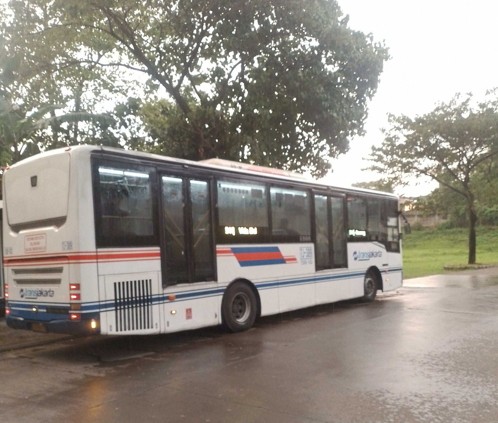
Although I read the newspaper (almost) every day, lately I’ve been getting news faster through my social circle. It usually starts as a rumor from an online friend, popping up on my timeline :

“There’s a new bus route coming to town!”

“Look at this photo I took— they’re testing the route!”

“I tried the trial run. Here’s a draft of the route I recorded myself.”

That’s what I’d been hearing for the past few weeks.

And then, finally, that rumors showed up in the daily newspaper I read.

See full entry

I am honored and humbled to introduce myself as one of the nominees for the 2025 Humanitarian OpenStreetMap Team (HOT) Voting Membership.

My name is Adamu Muhammad Adamu, a geographer, mapping advocate, and dedicated leader from Gombe State, Nigeria. I currently serve as the President of the National Association of Geography Students (NAGS) at Gombe State University, where I also lead our active YouthMappers chapter—a platform that has significantly shaped my journey into open mapping, humanitarian work, and global collaboration.

  • What HOT Means to Me

HOT represents more than an organization—it is a movement that embodies inclusion, empowerment, and action.

To me, HOT stands at the intersection of technology and humanity, where data becomes a tool to respond to crises, build resilience, and bring visibility to marginalized communities. It is through HOT that young people like myself have found a purpose in contributing to real-world solutions, bridging the gap between global challenges and local realities.

  • My Journey into Mapping and HOT

My engagement with HOT began in 2020 through YouthMappers. What started as curiosity evolved into a passion and a responsibility to serve. I joined mapping campaigns, led training sessions, and participated in field data collection. In time, I became a mentor and mobilizer, encouraging others to see maps not just as tools, but as voices for the voiceless.

In 2024, I was proudly selected as a Leadership Fellow to represent my country in Bangkok, Thailand, and now selected as a Volunteer Regional Ambassador for YouthMappers in Nigeria, a role through which I support chapters across the country, encourage inter-campus collaboration, and promote open mapping as a vehicle for humanitarian and sustainable development.

  • Selected Projects and Community Impact
  1. Kwakwambe Village Mapathon – Adamawa State.

See full entry

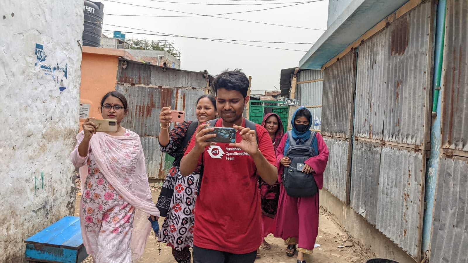
Brazil Singh on a Field Mapping, Supporting HOT & Open Mapping Hub's Dhaka Thrive Project in Bangladesh

Hello OpenStreetMap and HOT Community,

I’m Brazil Singh, from Bangladesh, and I’m honored to be nominated as a 2025 Voting Member of the Humanitarian OpenStreetMap Team (HOT). I want to take this opportunity to share my story, what HOT means to me, and how I hope to contribute as a voting member.

I currently serve as an Open Mapping Guru at the Asia Pacific Hub and as a Regional Ambassador of YouthMappers. Through these roles, I’ve been able to support my community and contribute to open mapping efforts across the region. I’m also actively involved with the OpenStreetMap Foundation’s Communications Working Group, where I help strengthen global community engagement and communications.


What HOT means to me

See full entry

Location: Elenbari, Tejgaon, Dhaka, Dhaka Metropolitan, Dhaka District, Dhaka Division, 1215, Bangladesh
Posted by cybermapper on 18 May 2025 in English.

I will stop editing here after more than year of contribution because of various reasons, mainly political reasons.

I feel like continuing to support the project which is politically involved in mapping scope is not my moral thing to do anymore.

OSM’s ridiculous policy about who controls the ground, those determine the border is far more ridiculous than occupation itself. I am not surprised that these people do not understand what is international recognition means. The policy of “who controls the ground” is simply supporting any “invasion / annexation / or whatever term here” and running away from the reality of internationally recognized borders. If OSM is run by Europeans or Americans or Russians (who support their invasions and military presence in Moldova, Ukraine and Georgia) I am not remotely shocked. Because if they understood, world would not have been this trash since WW2.

I have seen it first time when I was removing fake Armenian names from the Karabakh area (was under occupation in between 1992 and 2024), DWG contacted me about not removing them because they have talked to Armenians who felt nostalgically bad about those. I was in utter shock for an American in DWG who did not think about occupation a second, but being fully biased on occupiers side asking how they would feel.

The same goes to Russo-Ukrainian war, for some reason they show Donbas as Ukraine area while it is under occupation, but showing Crimea not as a part of Ukraine while it is under annexation and occupation.

Same situation is with Georgian occupied areas.

I am familiar with double standards of Europeans, so no surprise here at all. You guys can enjoy mapping with disputed areas and changing borders every day.

Good luck to you all!

Posted by MugerwaHukasha on 17 May 2025 in English.

I’m a skilled cartographer and GIS professional with expertise in mapping, spatial analysis, and information visualization using various software, including ArcGIS, QGIS, AutoCAD, ACAD, and OpenStreetMap. I create informative maps, conduct network analysis, and perform connectivity studies to drive insights and inform decision-making, leveraging my skills in GIS mapping, spatial analysis, and cartography to deliver high-quality solutions and contribute to projects that require spatial analysis, mapping, and data visualization.

Location: Kisenyi, Kampala, Central Region, Uganda

Gis

Posted by MugerwaHukasha on 17 May 2025 in English.

Cartographers in Uganda’s National Water and Sewerage Corporation would play a vital role in water resource management by creating maps of water infrastructure, such as pipes and treatment plants, and mapping water sources like rivers and lakes. They would also identify areas prone to flooding, monitor water quality, and inform infrastructure planning using geospatial data. By providing accurate spatial data, cartographers would enhance planning, efficiency, and decision-making, working closely with engineers, hydrologists, and environmental scientists to ensure effective water resource management and infrastructure development.

Posted by rphyrin on 17 May 2025 in English.

May 16, 2025 (22.46 PM) : “Before starting validation on Project 18915, would you mind assisting with validation on another project first? It would be helpful for practice on a few tasks/grids beforehand.”


Since this is my very first validation project, I thought it would be best to train myself beforehand.

To start, I needed to choose a project to validate. I preferred a recent and active one, so I decided on Project #20468, which was created in response to the recent earthquake in Myanmar. The objective of this mapping project is to identify clusters of residential areas to support better disaster mitigation efforts in the future. Individual buildings do not need to be mapped—only clusters of houses (more than five) using landuse=residential.


The first issue I encountered after clicking the “Validate” button was that JOSM needed to be open with “Remote Control” enabled.

So, I opened JOSM, navigated to Edit → Preferences → Remote Control, and enabled the option. Once that was done, the task loaded successfully from my browser into JOSM. That was a pleasant surprise—I hadn’t known JOSM had this feature.


Next issue: my favorite keyboard shortcuts from the iD editor didn’t work in JOSM. I figured the keys might be different, and wondered whether someone had already created a shortcut conversion table between iD and JOSM.

Eventually, I found the relevant information.

At the moment, I don’t need many shortcuts—just a few essentials. The wireframe toggle is particularly important since it helps me cross-check OSM data against the underlying satellite imagery. Additionally, I often want to inspect specific OSM objects; I’ve already prepared several Violentmonkey scripts (such as BetterOSM and OSMHelper) to satisfy my curiosity. For that, I need to open the original URL of an OSM object in the browser.

See full entry

A particular goal of mine will be to map Jackson Mississippi’s highest poverty areas. Source: Poverty Rate by Open Data for the City of Jackson, MS

There are many more neighborhoods with high poverty rates in the city of Jackson, MS but these below will be my primary focus. Once these areas are mapped, the scope will expand.

Focus

  1. The neighborhood block Northeast of Boling Street and Bullard Street.

    Includes: Hoover Street, Daniels Street, McAdoo Street, Broadview Street, Ford Avenue, Englewood Street, Hermitage Street, Garden Circle, Sagamore Street, Sagamore Street, Lynda Street, Breazeale Street, Dutchman Row, Palo Alto Street, Richmond Circle, and Ford Avenue.

  2. Immediate area around Hawkins Field Airport.

    The area Northeast of Sunset Drive, Coleman Avenue, and Elraine Boulevard up to Medgar Evers Boulevard.

  3. The area between West Silas Brown Street, West Pascagoula Street, and South Gallatin Street.

Location: Jackson, Hinds County, Mississippi, United States

Joining the Unique Mappers Network Nigeria has been a turning point for me. As a passionate student of Surveying and Geoinformatics, stepping into the world of OpenStreetMap was like unlocking a new level in my career and community impact journey.

My OSM Goals Contribute high-quality spatial data that makes real-life impact Master advanced mapping tools like JOSM, iD Editor, and HOT Tasking Manager Inspire fellow students and young professionals in Nigeria to embrace open mapping Support humanitarian mapping, disaster response, and climate resilience efforts.

To Everyone in the OSMFight Arena… This is more than a competition – it’s a movement. A call to action. A chance to leave our digital footprints across the globe. So whether you’re mapping buildings in Port Harcourt, roads in Kano, or health facilities in Bauchi – know that YOU are making a difference.

Let’s light up the map, one building at a time! Let’s bring the crown home 🏆🗺️ Let’s make Unique Mappers Network Nigeria proud 🙌🏾💚

It works !! OSMfight as a gamification for community engagement of OSM contribution -This week we are engaging paired mappers for OSMfight for the next one week - we need to get our project task running,engaging and fun to map https://tasks.openstreetmap.us/projects/815#description

OSMfight this week engages volunteers from our 1. Unique Mappers Abuja Mapathon Center 2. Unique Mappers Enugu Mapathon Center 3. Unique Mappers Port Harcourt Mapathon Center 4. Unique Mappers Kaduna Mapathon Center and others

Our challenge remains breaking the barrier of high cost of internet data subscription in Nigeria

Sustaining our mapathon centers with basic volunteering motivations

Engaging data users stakeholders workshop and lost more

We look forward to our partners and supporters !!!!!

You can support us here https://uniquemappers.org/donate/

Location: Alakahia, Obio/Akpor, Rivers State, 500004, Nigeria
Posted by ColbyTheWorldTraveler on 13 May 2025 in English.

Little did I know when I first started my job in Antarctica that I’d become obsessed with editing OpenStreetMap during my empty hours at work. While I made an account back in 2019, that was simply to add a missing sidewalk from my mission in India that bothered me. Last month, I was playing around with some maps, seeing how different engines would interpret a cycle route I frequently took back home, and I noticed the trail was laid out with a bit of jank. I decided I had an account and the fix would be easy, so I went ahead and did it. I then saw the sidewalk options, and started playing with infilling the sidewalks around the route.

That was a mistake.

I have since spent hours adding sidewalks everywhere I’ve been. As I learned the tools and improved my methods, I started looking at other options. Street lamps, lowered curbs with tactile paving, and power poles were next. I started looking into other ways to contribute and installed Street Complete on my phone. I saw my office trailer wasn’t listed on the map at McMurdo, so I used OSMTracker for Android to map it out (Turns out, my phones GPS combined with the poor signal so far south makes things a bit more challenging). I then started using it to map all the infrastructure I could reach. I spent 2 hours on one of my few 2-day weekends down here out in -10F weather mapping out the power poles and lines connecting them.

Needless to say, this has become a bit of an obsession, but I suppose if I’m going to have that, I can at least use it to do some good in the world, no matter how small. Now if you’ll excuse me, I’ve got some suburban sprawl to map out. Those sidewalks aren’t going to add themselves!

Location: -77.846, 166.672