
I wish an Irish wristwatch.
P.S. The wristwatch shall be wish-washed
 OpenStreetMap
I wish an Irish wristwatch.
P.S. The wristwatch shall be wish-washed
I am mapping every day, but i am unable to write a diary entry for every day i map. due to limited internet access and being on the move most of the time.
During the past 4 days, including today, i have mapped Villages Mesul, Cerjan, Bishqem and Papër and i have done a lot of mapping in Kosovo.
I have also gotten some private message these days to whom i have been unable to respond, so i ask you to bear with me. I will be back home in a week and will catch up with you all. Thanks a lot for contributing on mapping Albania! <3
“#100villagesin100days “
Hello, I am logus and I am from Vietnam. It would be amazing if all of us from South East Asia collaboratively map for OpenStreetMap’s 20th birthday at August 9th. Right now, I am currently mapping Hanoi’s center at here. If you are interested, do leave a comment below. Thank you!
Good morning!
This is my first diary entry. I am new to OSM and have a lot of learning and growth to do. I have to say I knew nothing about OSM and am absolutely blown away by how many companies use OSM in their mapping efforts. Truly awesome!
I am starting out building a interactive eruv map using OSM. I am getting lot of help and I am learning all the code words of the OSM community. Learning what for instance nods are points, I think they are called wazes or lines, and relations are a combinations of points and lines. Learning to Tag as well. I am also learning and trying to learn daily the LearnOSM website. Going through the tutorials are very good. I am enjoying doing it, yes it is frustrating at times but that is learning.
I am building this eruv map for my community and looking to embed it on the Synagogues website. Learning right now I am learning about the editor and how to place points and lines.
I will keep posting every so often my wins, loses, and how it worked for me.
by:
New OSMer
Jason
On May 24, 2024, I led an “Introduction to OpenStreetMap (OSM)” training session at the Geography Department of the University of Laos in Vientiane. The session was organized with the help of Professor Sonnasack Phaipasith, who provided translation support and organized the venue and invited his students. We had 15 participants, all students of Geography - eight women and seven men.
This training was part of my assignment with the Humanitarian OpenStreetMap Team’s (HOT’s) Open Mapping Hub - Asia Pacific (AP Hub) Guru Fellowship program. The Guru Fellowship program is a program aiming to engage with and upskill OSM mappers to fully utilize their knowledge and experience in advancing the Open Mapping movement in the region. Within this Open Mapping Guru Fellowship program, I also organized a Happy Hours OSM mapping meetup in Vientiane as well as 2 online trainings about “Mapping Relations” and “Good practices of Tagging Names in OSM”.

I love maps. Since I was a kid, I was fascinated by the old atlases and maps I found in my grandfather’s drawers. I could spend hours learning about countries’ borders, historic events, and the world through those thematic and topographic pieces of art and science.
Circumstances had it that eventually I ended up with a Masters Degree in Geography, unleashed onto the professional world, trying to make some positive contributions, some might say, “to change the world”, on the beautiful island of Lombok, Indonesia.
I still remember, when back in 2008, my colleague showed me an article about a crazy project to make a free map of the world, basically by using GPS tracks as the main data source – high resolution satellite imagery as we know it now, was not yet accessible. Crazy idea, impossible, overambitious, were a few thoughts that popped up. Though, “why not give it a try” and add a few roads and places in my neighborhood. I don’t think those few edits made a big difference to OSM – but it thought me of how to use and contribute to OSM.
The following year I ended up living and working in the town of Putussibau, Kapus Hulu District. Take a dart, throw it somewhere onto the middle of a map of Borneo, the biggest Island in Indonesia, and if you slightly missed the exact middle a little bit to the north-west - that’s where I found myself. Surrounded by amazing nature, amid local Dayak, Iban, Punan and Malayu as well as other Indonesians who had moved there more recently from other parts of the archipelago, I was teaching GIS and conservation, mapping forests, customary boundaries and the manifestations of an increasing human footprint there – road infrastructure, oil palm plantations, gold mining areas and the like.
These days i am very busy and i have not been able to write a diary entry as I do every day, but i have mapped some villages and improved some already mapped villages. Too tired, to remember the names or go back and look them up. Hopefully ill get some more free time in the next days to make a more detailed diary entry.
“#100villagesin100days #day41&42”
This week, I am attending State of the Map Europe 2024, where I’ll be a speaker on at least two occasions. Because of that, I have been working on material for the conference, and I would like to include it in my development diaries. However, to avoid spoilers, this must obviously be done after the conference :P. Please expect development diary #15 to be published shortly after SOTM EU, which ends on Sunday. I will also try to get the video recording of my talks in case you miss them. Cheers 🦀!
Are you familiar with the OpenStreetMap Statistics created by Piebro? It’s a handy tool that analyzes OSM changeset files and creates graphs from various perspectives.

The project’s README also indicates that analysis can be performed for individual countries or regions. I analysed the Japanese region in my local environment, so I’ll summarize the procedure.
a
I started contributing some edits to OSM using StreetComplete, it’s nice to be able to help!
Yesterday i received a message from perenniallylate notifying me that he had mapped village 99 on the list, Tremul, and asking me if it was okay for him to map some villages in the upcoming weeks.
I thanked him in private, but also want to thank him publicly for contributing to mapping Albania and putting Albanian villages on the map.
Anyone can map any village from the list, because I can always add more villages to it. It would be amazing if you could send me a message or leave a comment that you mapped it, but even if you do not, it is totally okay.
Today I continued mapping and mapped Kryemadh and the surrounding areas, including villages Kalimash and Shtanë.
“#100villagesin100days #day40 #+1contributor”
↓ Version française ci-dessous ↓
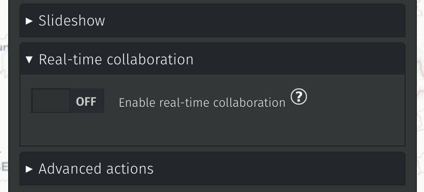
The latest 2.4.X release sets the path for two major requested features: real-time collaboration and one-click remote data importers.
Additionally, minor improvements and bugfixes have made the tool more stable and usable.
Thanks to our NLnet sponsorship, we have been able to make the first push in that direction. This is not yet activated in any (known) instance but the underlying code is deployed and we will be able to manage allocated resources and fine-tune how websockets are deployed. Details of the next steps are available on Alexis’ blog post.
Given the required server changes for that new feature, it will be part of a future 3.X version when the dust has settled.
We made 4 importers to begin with:
Today I mapped in Peshkopi. Tomin ain’t really a village of Peshkopi but a neighborhood, so after mapping it I proceeded to the villages closest to Peshkopi.
I mapped Pilafë which is a small village very close to the city. I have been in Pilafë in 2021,for a door-to-door campaign in support of a local miner who was representing the miners in the parliamentary elections. As soon as we entered the village, a 10-year-old boy saw us and wanted to show us the village, and he walked with us and showed every house in the village for two hours straight.
After Pilafë, i moved to Staravec and partially mapped it too.
“#100villagesin100days #day39”
Almost did not make it to contribute today but i found some time just before the days ends.
Today i mapped Saraqinisht and also the villages Krinë and Tranoshisht.
“#100villagesin100days #day38”
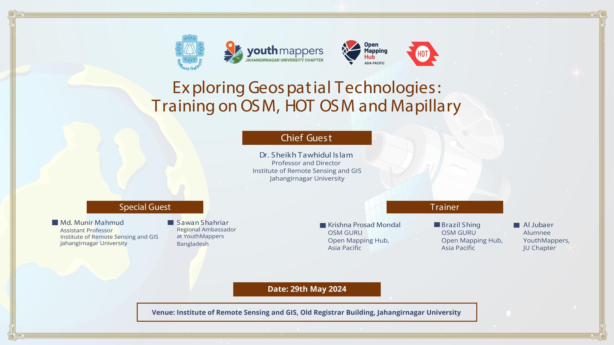
Hello, Openstreetmap community! I’m Brazil Singh, Open Mapping Guru, and I’m excited to share the highlights from my recent training session at Jahangirnagar University. As an Open Mapping Guru under the Open Mapping Hub - Asia Pacific, this experience was both enlightening and thrilling, filled with dynamic discussions, insightful training sessions, and endless fun. Here’s a summary of our amazing day together!
The session began at 2 PM with a vibrant atmosphere. We were honored to have several distinguished guests who contributed immensely to the event:
Chief Guest: Dr. Sheikh Tawhidul Islam, Professor at the Institute of Remote Sensing and GIS, Jahangirnagar University
Special Guests:
    Md. Munir Mahmud, Assistant Professor at the Institute of Remote Sensing and GIS, Jahangirnagar University
    Sawan Shariar, Regional Ambassador at YouthMappers and President of OSM Bangladesh
OpenStreetMap Training:
Dear diary, today I made my account. I hope this can count for CAS :skull:
Yesterday was a hectic day and I missed a day of mapping. I will try to make it up.
Today I mapped Duhanas which is a big village in Berat with a population of around 1500.
“#100villagesin100days #day37”
I’ve been using StreetComplete for the past few days now. It’s great fun, but I often run into questions where I’m thinking “Well… I don’t know that any of these options are right.” (Or “If Regina wasn’t a uniquely hot mess, then maybe one of these answers would actually work!” I’m looking at you Albert street rail crossing.) The tagging and questionable-edits channels on the osm-world discord have been massive helps.
It isn’t until you start tagging out in the wild that you start coming up with weird questions that you wouldn’t have thought up otherwise. Like:
My journey into mapping began in 2012 when I was a college student. I started by mapping my village and later expanded to mapping numerous banks as part of my work in 2016-17. This initial exposure sparked my interest in community mapping.
In 2018, I began contributing to OpenStreetMap (OSM) alongside my volunteer contributions on Wikipedia and Wikidata. This involvement allowed me to bridge the gap between platforms by linking Wikidata entries with OSM and vice versa, enhancing the data quality and interconnectivity between these valuable resources.
Joining the Open Mapping Guru Fellowship has been a transformative experience. The fellowship provided me with access to various tools that have significantly enhanced my mapping activities. The tasks during the program helped me learn and expand my knowledge about mapping in OSM. These tasks ranged from mapping amenities using mobile applications like Every Door and remote mapping using JOSM and mapping and validating using the Tasking Manager.
Through this fellowship, I have not only improved my technical abilities but also deepened my commitment to the OSM community. The Open Mapping Guru Fellowship has been a significant part of my journey, and I’m excited about what lies ahead.
I am grateful to HOT and APHub team for this opportunity to be part of such a dynamic and collaborative environment.
As I continue my mapping journey, I look forward to applying the skills and insights gained from the fellowship to make a meaningful impact on the mapping and open data ecosystems.


