 OpenStreetMap

Our OpenMapping iniative for #Wayaland Last few days Our #opendatakerala team with #OSMKerala OpenStreetMap working with officials and National Disaster Response Force for the mapping needs in their field needs. Just Noticed a news came few days back. Thanks The New Indian Express
Diary Entries in English
Recent diary entries

Started a discussion on difference between place_of_worship=mosque and place_of_worship=musalla

How is it going and what am I up to now?
Introduction
I know I put in a entry in the diary not to long ago but I want to let you know what I am up to now. I am putting the finishing touches on my eruv map with I hope looks good. I am getting help with it and thank you to the gentleman that is helping.
What’s next?
-
I am currently spending a lot of time on StreetComplete and MapComplete. They are really good for me. I am helping my local community by validating roads, building, hours of operation, what sidewalks are made of, if the road is asphalt or what ever. I am really having a lot of fun doing it and its a good feeling that hey I have no clue if this helps anyone but it helps knowing I am helping.
-
I am also interested in adding things to OSM. I am fascinated by what I have seen from others. It would be good to start with one thing like roads, building, etc. Still learning the types of things OSM maps. Then build from that point once I get relatively comfortable with whatever this is.
-
Eventually I would love to get down to one or two things and really get good mapping those. I do not know the full capabilities of OSM, its a lot I am sure. Just hope I can be more specific and get very comfortable doing that one or things.
-
I am super interested in sustainability and resiliency. I would love to start to map and get involved in this area at some point. I also want to find out if OSM has something like Esri Story Maps. I want to see if I can tell stories of people for resilience. Cultures and peoples have has a long history of successful resiliency initiatives. That is the Story Map type thing came from.
Conclusion
I am super happy I found OSM and you all are very kind and generous and always happy to answer question. Just want to say thank you!
OSM is a tremendously powerful tool that I would love to see how it is used day-to-day by different organizations.
Till next time!
Posted by SomeoneElse on 3 August 2024 in English.
My previous diary entry looked at the UK section of this OSM wiki page. A commenter there noticed that neither the wiki table nor my analysis covered highway=track (covered here) or highway=service (left for later).
We’ll use the same approach as before. Essentially, that’s this urban area (and this when looking at designation), and this rural area.
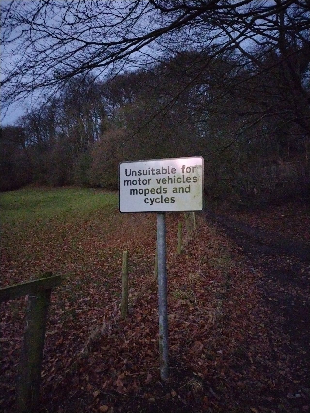
It’s useful to look at designation because that tells us what some of the access values should be, and also local authority data about public rights of way such such as visible in this overlay. We’ll therefore ignore ways in OSM with designation set but look to see if any of our examples “should” be designated as a public right of way.

Welcome to the sixteenth OpenStreetMap NextGen development diary.
This week, we continue focusing on feature parity and migration efforts.
🔖 You can read other development diaries here:
osm.org/user/NorthCrab/diary/
⭐ This project is open-source — join us today:
https://github.com/openstreetmap-ng/openstreetmap-ng
🛈 This initiative is not affiliated with the OpenStreetMap Foundation.
Project Keeps Growing
Before we get started with this week’s highlights, I want to highlight the continuous growth of the project in terms of popularity on GitHub. It’s amazing to see the community in action - thank you all! It keeps us all motivated! 🌠
Geolocation Icon Pt.2
Last week, we talked about the new geolocation icon design. This week, we have iterated on it and created a custom design that looks and feels just right. Check it out:

This is a diary about a recent drone mapping initiative that I participated in. I would like to give credits to the Open Mapping Hub - West and North Africa, OpenStreetMap Sierra Leone, Pete Masters and Ivan Gayton for all the support and knowledge given during the course of this initiative. I hope to learn more as we continue collaborating.
Purpose
The use of satellite imagery from multiple sources has been a pivotal aspect of open mapping campaigns across the world. However, satellite imageries have some limitations, such as low resolutions and delayed visitation time. This affects the quality of the digitization of physical features that are to be mapped. In order to address these limitations in open mapping campaigns, the use of Unmanned Aircraft Systems such as drones have been employed to capture images with high resolutions within desired timeframe.
Scope
With support from the West and North Africa Hub through the Mwalai microgrant, OpenStreetMap Sierra Leone embarked on the collection and processing of drone imageries in three slums across Freetown as part of the Know Your City initiative. The imageries would be used to map buildings and critical infrastructure, test the fAIr model and Field Mapping Tasking Manager.
Technical Specifications/Parameters
In order to have high resolution imagery, the team used a DJI Mavic 2 Zoom drone for the flights and Open Drone Map for the image processing. A smartphone-based flight planning and control application was used to conduct flights with specific elevation, overlap, and angle settings, allowing the operators to ensure consistent resolution, quality, and coverage across the areas of interest.
Flights were conducted above slums with dense buildings, therefore, flight settings with paths and gimbal angles that captured the top and sides of buildings and other infrastructure. The team used the following flight settings. 70% Frontal Overlap 80% Side Overlap -75 degrees Gimbal Angle
Processing
can’t find a suitable type of point for this - anyone have any advice please
many thanks, mark

Today I woke, cold and alone me. This day unlike any almost except I’m still alone, but today was different. Tonight I mean as 4 :55 ish in the morn , it was as if I had given birth to yesterdays sorrows and as if I’m lying in bed waiting for them to begin walking from a crawl as a toddler does when it first uses it’s feet to wind it’s legs up and run away. Today is now a new day as yesterdays sorrows have become real with their own love deform so it can take its sadness that makes it sorrow and simply , with its own life form simply walk away. Now the dark, like belt, place inside called sorrow simply became and ran away, so now only I have to face today and the sorrow is now lol Niger feeding of my light or life and today is Jacqueline still that it’s mine “just for today”.
Posted by liliane nishimirwe on 1 August 2024 in English.

INTRODUCTION
The fieldwork of Anticipatory action mapping was conducted on Wednesday, July 24th, 2024 in the Western province of Rwanda, Ngororero district by the ecoMappers of OpenStreetMap Rwanda with the collaborative partnership of the administration of Ngororero district, and the volunteers who reside in this district. The fieldwork mainly aimed to acquire information from the leaders and community about the hotspots that had rainfall-induced landslides, and flooding, onboarding new volunteer members, and verifying the digitization status.
Description of activities
This fieldwork was a great opportunity that resulted in the onboarding of new volunteer members by matching the experienced mapper with the new one so that they could exchange skills and be aware of different tools that they can use while mapping, they learned the other different map features and how to use tags identifying those features.
Spatial analysis Field work objectives
From the ability to show the hotspot in google Earth to extracting the elevation , slope analysis and downloading the OSM data digitized around a particular hotspot.
During the field visit, the digitization status was verified using the mobile application Vespucci. On the field, the volunteers were briefed on how to download, install, and use the application. This enabled them to confirm the status of the digitization within the buffer of the hotspot.
Posted by SomeoneElse on 1 August 2024 in English.
After reading this forum topic and commenting that the United Kingdom part wasn’t great because it didn’t consider the different rules in England and Wales, Scotland, and Northern Ireland, I wondered “what should the defaults actually be for England and Wales?”.
Of that table, I think that the rows down to living_street are correct, and of the remaining rows the columns across to moped are also correct. I decided to pick a couple of areas I’m familiar with (one urban, one rural) and look for examples in those areas without explicit access tagging. Based on that it should be possible to suggest some sensible defaults.
path
The default of no for everything through to moped is correct, which leaves horse, bicycle and foot.
path, horse, urban
https://overpass-turbo.eu/s/1P4E
https://overpass-turbo.eu/s/1P4G
Mostly these ways are foot=permissive, and there’s no horse signage. In some of the parks horses might be tolerated; elsewhere likely not. This suggests horse=no here.
path, horse, rural
https://overpass-turbo.eu/s/1P4I
https://overpass-turbo.eu/s/1P4H
Mostly these ways are foot=permissive or =yes, and there’s no horse signage. In some of the parks horse access might be =permissive; in most cases not. This suggests horse=no for these as well.
path, bicycle, urban
https://overpass-turbo.eu/s/1P4J
https://overpass-turbo.eu/s/1P4K
Mostly these ways are foot=permissive. In a large number bicycle access is explicitly disallowed.
path, bicycle, rural
https://overpass-turbo.eu/s/1P4L
https://overpass-turbo.eu/s/1P4M
Mostly these ways are foot=permissive or =yes, and on some (but not as many as the urban ones) bicycle access is explicitly disallowed. However there are also some designated “public bridleways” which should be tagged bicycle=yes but are not, perhaps because bicycle access is legal but implausible
path, foot, urban
https://overpass-turbo.eu/s/1P4O

I am struggling to write a diary entry every day, but I am making up for it by mapping more in the surrounding areas of every village I map. During the past 5 days i have mapped the villages:
1 - Bubq
2 - Mengël
3 - Gjokaj
4 - Nangë
5 - Bicaj
6 - Ngraçan
7 - Bishqethem
A big thank you to ibanez for mapping Bllatë e Poshtme.
“#100villagesin100days”

Hello OSM community,
I’m excited to share my experiences as a participant and trainer in the OM Guru Fellowship, 2024. My name is Kyaw Zayar Linn, and I’m from Myanmar. I work as a GIS officer at CDE Myanmar. I’ve mostly used GIS software like ArcGIS and QGIS but have limited experience with OSM. So, this program has been an incredible journey of learning, growth, and community engagement.
My Journey Before joining this fellowship program, my experience with OSM was primarily limited to downloading OSM data and using it in GIS software. While I knew that I could edit and contribute to OSM, I lacked the practical knowledge on how to effectively edit and contribute data. Also, thanks to the Person who encourage to do OSM contribution and explain opportunity of OpenStreetMap for Myanmar that Myanmar is lacking free vector map.
From the moment I joined the OM Guru Fellowship, I knew I was embarking on a unique adventure. The fellowship provided a structured platform for me to enhance my mapping, validating skills, collaborate with fellows and contribute to meaningful projects on HOT Tasking Manager. One of the highlights was working on HOT Tasking Manager Projects, where I learned the HOT Tasking Manager plays a crucial role in leveraging the collective efforts of a global community of volunteers to improve mapping data where it is most needed. It supports humanitarian organizations and local communities in making informed decisions based on accurate and up-to-date geographic information.

The problem
We are generating an increasing level of data as a society. An unstated goal of openstreetmap that many contributors subscribe to is “completeness” or “accuracy”, which works fine when you dataset is small, local and high level detail, but less so when scaled up to determining if every traffic light crossing in the world has tactile paving.
So naturally, automation and data imports are where people start to look; and very sensibly there’s a process to propose, review and ingest large datasets.
However, this relies on:
- Expertise and peer review
- Honesty and diligence of the importer to have and execute a QA plan
- A second level of QA tools and mappers to QA and maintain data
What could we do differently?
In the semantic web/linked data world, two big concepts emerged. The first is the semantic web layer cake, which talks about going from “machine readable” to “schemas” to “query” to “proof” to “trust”. In OSM terms these are poi, tags, overpass, a lot of tools like keep right or osmose, and at the moment, human boots on the ground survey.
The concept of 5 star open data is focused on the idea that we have a lot of data locked up in silos - and while it would be ideal to align it to every standard and have the highest quality possible data; 95% of the time it’s better to publish anything at all rather than wait until it’s perfect. So long as data consumers have an idea of the limitations, they can apply judgement when attempting to use it.
What is the current state?
A number of open data portals provide basic indicators of “5 star open data” quality.
In our wiki, we maintain documentation which describes the OSM community’s view on data quality of an external dataset.
We have tags for change sets describing the source.
What specifically would we change?
Even though I have not been able to write a diary entry every day, I have managed to map a village or more every day.
Now I am at the airport of Athens, waiting for the airplane to travel back home, and found the time to write this diary entry. In the past days I have mapped the villages Pac, Gjergjan, Kaçinar, Romës, Selckë, Bukmirë and many smaller villages surrounding the above-mentioned villages.
I would also like to publicly thank again perenniallylate for mapping other two villages in Albania, Rusinjë and Kuqar.
“#100villagesin100days “

Tasking Manager, an open-source project, recently undertook a significant migration: transitioning from Flask to FastAPI for our web framework and from psycopg to asyncpg for our database interactions. FastAPI offers substantial performance improvements by leveraging asynchronous programming and simplifying API development with automatic interactive documentation and modern Python features. asyncpg enhances database interaction throughput with its asynchronous design and high optimization. Despite challenges like the learning curve and extensive code refactoring, this transition promises enhanced performance and scalability, providing valuable insights for the community and encouraging the exploration of FastAPI and asyncpg for similar projects.
For a detailed account of our migration journey, read our full post here. We invite the community to get involved, share feedback, and contribute to Tasking Manager. Your insights and collaboration are invaluable as we continue to innovate and improve in the world of open-source software.
Welcome to the fifteenth OpenStreetMap NextGen development diary.
I am sorry for the delay in the development diary! Due to my participation in the recent State of the Map EU 2024, I had to dedicate some of my time to making the presentations and attending the event. Nonetheless, thanks to other project contributors, we have more highlights to show off! This is the beauty of an open community collaboration 🙂.
🔖 You can read other development diaries here:
osm.org/user/NorthCrab/diary/
⭐ This project is open-source — join us today:
https://github.com/openstreetmap-ng/openstreetmap-ng
🛈 This initiative is not affiliated with the OpenStreetMap Foundation.
Multiple Changeset Bounding Boxes
OpenStreetMap-NG is resolving one of the most common newbie issues on OpenStreetMap while making area monitoring more accurate. Changesets now support incremental and deterministic clustering of changes, enabling multiple bounding box support.
Posted by Sonam Tshewang on 24 July 2024 in English.

Collaborators
Department of Disaster Management (DDM) , Thimphu Municipality (TT) and BSc. Environment Management, Royal Thimphu College (RTC) and the Open Mapping Hub Asia Pacific (OMH-AP)
Initiative
Since OpenStreetMap (OSM) is the most accessible data for individuals and agencies for map visualization, geospatial analysis, research, and decision-making, the DDM and TM conducted a one-day session on using spatial data in urban planning and humanitarian efforts. During this session, students learned how to update or contribute point data or Point of interest (PoIs), such as shops, offices, and hotels, to OSM using a mobile app called Organic Map. A session was also included by Mr. Mikko from OMH-AP, the Philippines.

Who maps the most
Posted by Gregory Peony on 23 July 2024 in English.

Today I realised that it’s probably significantly more efficient (in terms of effort and time) to simply state the reason(s) for (in)validating a task in the task comments, and ask contributors to read the project comments where I can post some more detailed comments, explinations, pictures etc. related to common mistakes I find while validating the project.
This efficiently accomplishes at least four objectives;
- Contributors who read the comments recieve feedback regarding their contributions
- It is easier to get an overwiew of quality issues in the project.
- It saves time in comparison to giving feedback on each individual task.
- Contributors to the project who map areas yet to be mapped and read the project comments can get a heads up, before contributing increasing the likelihood that they will avoid making the same mistakes.
Farewell to giving feedback on every task, unless it is truly unique. 😌

My journey with mapping began during my undergraduate studies in geography at Eastern University, Sri Lanka. My fascination with maps and the potential of Geographic Information Systems (GIS) to solve real-world problems sparked a deep interest that would shape my career. In 2019, I joined OpenStreetMap (OSM), an open-source platform that allows users to create and share maps of their communities. This was the beginning of a transformative experience. Through OSM, I discovered a vibrant community and shared my passion for open data and community development. I quickly became an active contributor, dedicating countless hours to mapping underserved areas in Sri Lanka.
As my involvement with OSM grew, I became proficient in using various mapping tools and mobile applications, which allowed me to conduct efficient and accurate mapping projects. I got appointed as the YouthMappers Chapter Secretary at Eastern University, where I played a pivotal role in promoting open mapping practices among students and local communities. My commitment to mapping and community development led me to join Sarvodaya Fusion, an NGO dedicated to empowering communities through technology. At Sarvodaya Fusion, I organized workshops and training sessions to teach others how to use OSM and GIS tools. These initiatives not only enhanced the mapping capabilities of participants but also fostered a sense of community and shared purpose.

President Ferdinand R. Marcos Jr. on strengthening support for teachers and advancing education at #SONA2024 #Mapper