Diary Entries in English

Recent diary entries

In the second semester of the academic year 2022-2023, we took a course, GmE 203 Principles of GIS, under Prof. Macapinlac and Prof. Ang from the Department of Geodetic Engineering at the University of the Philippines Diliman, and we found ourselves fascinated by the world of Geographic Information Systems. Through the end of the semester, we absorbed interesting things about GIS concepts and technologies. Yet, the pinnacle of our journey in this course was the capstone paper project, wherein we were tasked to bring together all that we had learned and apply it to a real-world scenario.

Fueled by determination and a passion for open-source technologies in the geospatial field, I, together with Honeylyn Carpio collectively decided to embark on a project of significant ecological relevance. Thus, the project “WEB VISUALIZATION AND SPATIAL ANALYSIS OF TREE SPECIES DISTRIBUTION AT UNIVERSITY OF THE PHILIPPINES DILIMAN ACADEMIC OVAL” was conceptualized.

See full entry

Location: 14.655, 121.070
Posted by spwoodcock on 18 September 2023 in English.

Storing map tiles in a single file is a common way to load basemaps on a map client.

There are a few formats available to do this, with different use cases.

Offline

mbtiles

  • A format innovated by Mapbox, but is a fully open spec.
  • Essentially an SQLite database linking to embedded tiled images.
  • The client interfaces with the database and loads each tile as required by the basemap.

OSMAnd SQLite

  • Based on BigPlanet SQLite format.
  • Basically the same as mbtiles, but a slightly different database schema.

A small aside.

Sometimes it’s necessary to generate both mbtiles and OsmAnd format to view in different software, which is a pain.

There is an open issue in OsmAnd to support mbtiles format, but it’s not a priority for now.

Knowing that they are very similar file formats, I considered the possibility of accessing one SQLite database via another ‘wrapper’ SQLite database in a custom view. This view would map tables and fields from one database schema to the other, eliminating the need to store both tilesets for the same data.

Assuming you have an MBTiles table with the following schema: CREATE TABLE mbtiles_table ( zoom_level INTEGER, tile_column INTEGER, tile_row INTEGER, tile_data BLOB );

And you want to create a view for an OsmAnd SQLite table with a schema like: CREATE TABLE osmand_table ( _id INTEGER PRIMARY KEY AUTOINCREMENT, x INTEGER, y INTEGER, z INTEGER, tile_data BLOB );

You can create a view to convert between them like this: CREATE VIEW osmand_mbtiles_view AS SELECT NULL AS _id, -- Use NULL for auto-increment _id tile_column AS x, tile_row AS y, zoom_level AS z, tile_data FROM mbtiles_table;

I couldn’t get this to work when testing, however (it may warrant further investigation).

If you find a solution, please do let me know!

Online

PMTiles

See full entry

Location: 27.721, 85.319
Posted by Ponsyano on 18 September 2023 in English. Last updated on 19 September 2023.

Hello, fellow mapmaking enthusiasts! Today, we're excited to celebrate the remarkable success achieved in the past three months. This success story revolves around the passionate youth mappers of G-SIG Timor-Leste, who have embarked on an inspiring journey into the world of community mapping. Join us as we share our experiences and accomplishments, and together, let's continue to work towards mapping excellence in our beloved country Timor-Leste:).

Introduction

In the picturesque landscapes of Timor-Leste, the past three months have seen a flurry of mapping activities that are transforming the way we perceive and utilize geographical data. From empowering students and volunteers to conducting specialized disaster management training, our OpenStreetMap (OSM) community in Timor-Leste has been fervently engaged in expanding the horizons of open mapping. In this OSM Diary entry, I am delighted to share the details of our endeavors during the months of July to September 2023.

See full entry

Location: Politeknik, Cristo Rei, Dili, East Timor

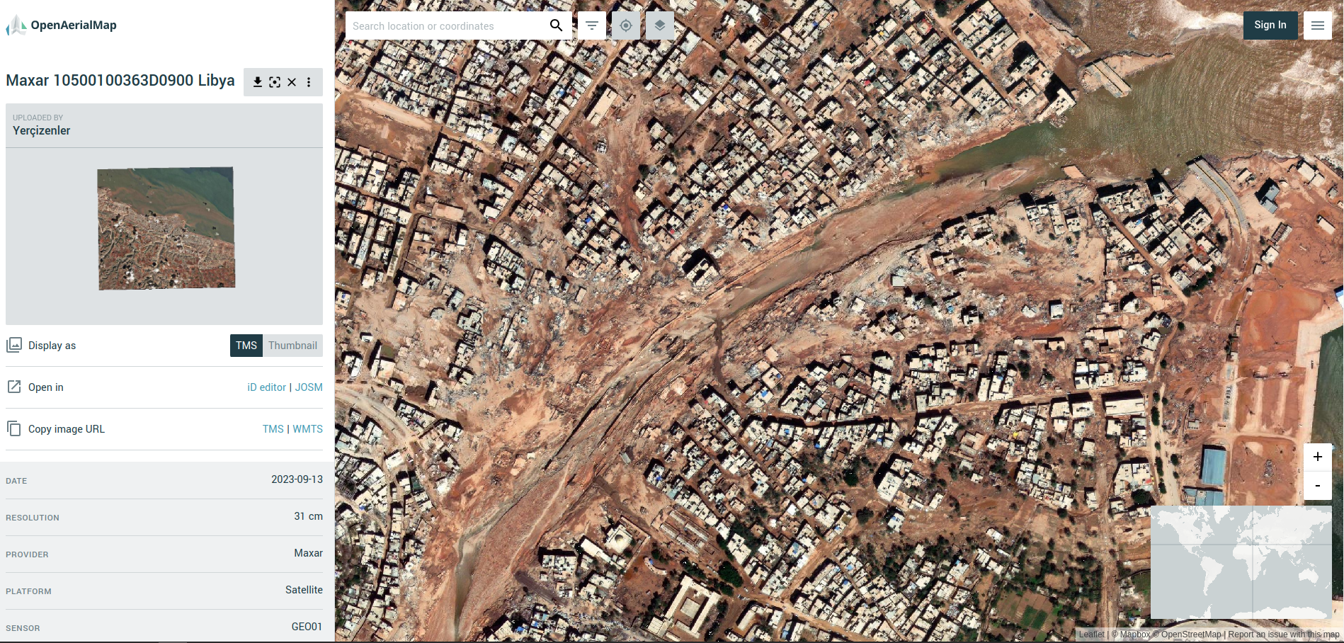
The devastating events in Morocco (earthquake) and Libya (floods) happened within two days of each other on the 08 & 10 September 2023. Both have meant large scale destruction of infrastructure and thousands of tragic deaths and injuries.

OSM communities in both countries (OSM Maroc and OSM Libya), alongside partners, have responded and with huge support from mappers from the OSM community across the world.

Screenshot from OpenAerialMap (Libya Floods)

A screenshot from OpenAerialMap showing the devastation to the city of Darnah in Libya (imagery courtesy of Maxar)


The latest…

The OSM community response

Approximately 1,600 mappers have so far contributed to both campaigns, creating ~220,000 buildings and ~5,000km of roads.

Validation teams at HOT and UN Mappers have been busy providing quality control and trying to keep up with the rapid pace of the mapping.

See full entry

Posted by jxpsert on 17 September 2023 in English.

Hi there! Today I’ve created a store via Etsy, where I’ll be selling OSM shirts, hoodies and perhaps other items. They’re priced at cost, and in doing so, follow OSM Trademark Policy.

Production

The items are made and shipped by a third party, Gelato, and are produced on-demand in both North America as well as Europe, depending on the product. All products with OSM trademarks are the ‘fairest’ option provided by Gelato. You can find more about that on their website, gelato.com

Why?

I wanted an OSM shirt, and there wasn’t one. So I made one. It’s the very same one available on the store right now. I had a meeting with the CWG about merchandise in June, but have since heard nothing from them. Hence, I went ahead and did it myself.

The store

The store contains other products as well, but the OSM products are neatly organised in a ‘OpenStreetMap’ category.

https://potatodonkeynl.etsy.com/

Posted by apm-wa on 17 September 2023 in English. Last updated on 14 May 2024.

I have figured out how to get mkgmap to produce fully customized, routable Garmin-compatible IMG files for my nüvi GPS navigator. Here’s the story, with the helpful hints so you can produce custom IMG files to your own specifications, too.

Background

I first got serious about mapping in OSM in 2014, during a diplomatic posting to New Delhi. I had a Garmin nüvi GPS navigator, but Garmin provided no maps for India. A search of the OSM wiki revealed Lambertus’ website that provided ready-to-use, downloadable IMG files, which proved a godsend. Fast forward to 2015 and my diplomatic posting to Turkmenistan. That story is told in a recording of my 2019 banquet speech to the North American Cartographic Society. People in Turkmenistan and elsewhere relied on Lambertus’ IMG files to navigate in countries for which Garmin provides no maps. Alas, a couple of years ago Lambertus’ website went defunct. I tried bbbike’s IMG downloads, but they leave out numerous POIs I know are either useful or necessary for both diplomats and local residents in Central Asia.

I decided to study mkgmap so as to generate custom IMG files. As an aside, when I mentioned this to a longtime OSMer friend, the response was, “Good luck with that.”

The documentation

The documentation on mkgmap is a bit sparse, and it is not really comprehensive. The base documentation found at https://www.mkgmap.org.uk/doc/index.html is enough to get you started, but is written by computer experts for other computer experts. It is inaccessible in places to those of us who majored in political science or economics.

Andy Townsend’s instructions at osm.org/user/SomeoneElse/diary/38613 proved very helpful in shedding light on how things work.

Then I stumbled across ligfietser’s style sheets at https://github.com/ligfietser/mkgmap-style-sheets. This shed even more light on how to get rendering to work the way I wanted it to.

Phase I - getting it to route

See full entry

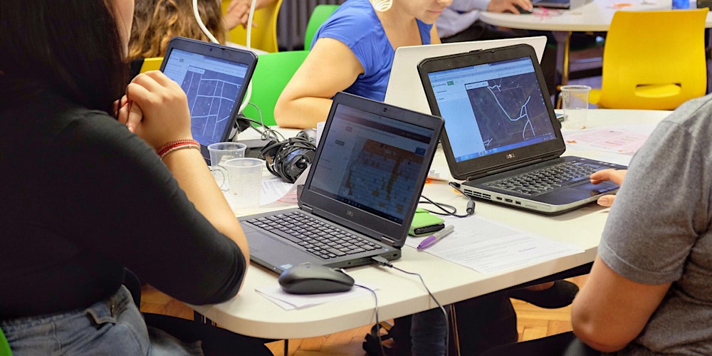
Hey there, fellow changemakers! Today, we're diving into an incredible story of young minds driving change in their community. It's all about the Southern Leyte State U (SLSU) Youthmappers and their journey into the world of community mapping. Grab a seat, and let's get inspired!

A Spark of Transformation

A group of students at SLSU, fueled by a burning desire to make a difference, decided to roll up their sleeves and take action. They had a secret weapon – geographic information systems (GIS) and mapping skills. These students saw that they could use these skills to bring about real change in their community. They knew technology was a game-changer, and they are ready to harness its power. With the use of their laptops and with the power of OpenStreetMap, they set a whole lot of enthusiasm to map their community.

an image

See full entry

Location: Rizal, Sogod, Southern Leyte, Eastern Visayas, 6606, Philippines
Posted by HBanu on 17 September 2023 in English. Last updated on 20 September 2023.

🌍The workshop event

A collaborative effort between Youthmappers at Sri Jayawardanapura University of Sri Lanka. The event organized by the Youthmappers chapter / EUSL On 15.09.2023. The session was engaging , and more than 55 students participated including many new attendees. Resource Person of the event is Sir. Anuradha Rajanayake. Booster grant Project Assistant Miss. Sinduja Sriram, Lecturer Doctor. MadanRaj, Assistance Lecturer Miss. Gayathri also joined with is event.

I am very glad to share my delightful movement as a Mapathon Trainer in this event. I am very thankful to our guider Sir. Suthakaran. He is very kind and best motivator. He helped a lot to come this path. Thank you sir. And, Thanks for our Department of Geography Eastern University to grant this valuable opportunity.

This event mainly focused ID Editor , JOSM and Hot Tasking Manager

Support by : open mapping Hub - Asia pacific

See full entry

Location: Batticaloa, Manmunai North DS Division, Batticaloa District, Eastern Province, 30100, Sri Lanka
Posted by spwoodcock on 16 September 2023 in English. Last updated on 18 September 2023.

Manual Mapping

Since the inception of the Missing Maps project in 2014, the global community has achieved remarkable progress in digitally mapping communities that were once poorly mapped or entirely unmapped.

Shout-out to the incredible volunteers that contribute to this during regular mapathons🙏

mapathon

AI-assisted Mapping

HOTOSM’s fAIr project is at the verge of making this a reality. With an emphasis on open-source (ethical, responsible) models, region-specific training data, and iterative feedback, the entire globe will be mapped at record speed.

Watch this space.

See full entry

Location: Phaya Thai Subdistrict, Phaya Thai District, Bangkok, 10400, Thailand
Posted by nabilersyad on 15 September 2023 in English.

Thought I’d write a quick diary entry to start things out. I’ve been mapping in OSM since 2020, almost 3 years now at this point and covered many places in Malaysia. I’ll talk about those in the future.

My I have 2 major focuses now.

  1. Mapping every street in Kuala Lumpur CBD
  2. Adding satellite visible data in all of Kuala Selangor District

Kuala Lumpur

I define Kuala Lumpur CBD as all the area surrounded by the MRR1 road network. My mapping plans here are comprehensive. I would visit every single street and add as much detail as possible. However I will prioritize buildings, pavements, housenumbers, POIs, locality names and landuses. The following link visualizes how much area I’ve covered so far.

https://felt.com/map/Everystreet-KL-B4AH7To6RaiuAaKUqJBY3D?loc=3.158563,101.694303,15.72z&share=1

Kuala Selangor

The mapping here is a bit simpler. I plan to add all buildings in Kuala Selangor. Wherever I can, I will also add landuses, highways and water features.

That’s all for now. I will update every major milestones when I can.

Posted by citrula on 15 September 2023 in English.

For a while now, I have used the QA Tool OSMCha in order to observe edits happening in my local area. The saved filters allow you to create feeds of edits based on criteria like changeset location and even some validator results. Recently, I have been trying to respond to changesets in Texas which are either from new users or requested for review by the community, so I made an OSMCha filter to find those changesets. While I was using this filter, I noticed that OSMCha supports RSS feeds for saved filters!

So, I’ve added some of my most used filters into my RSS reader of choice, which has made it significantly easier to keep up with the filters without having to try to remember where I left off since it keeps track of which changesets I have actually opened. Here’s what it looks like in my reader: A screenshot of an OSMCha filter feed open in FreshRSS) Some improvements can probably be made to OSMCha to make this easier to use at a glance (such as including a simple screenshot of the bbox), but this is already great for keeping track.

See full entry

Posted by Answerquest on 15 September 2023 in English. Last updated on 14 October 2023.

Assumptions: - You’re working with a district shapefile having village polygons, and you want to add the village boundaries to OSM. (Find+replace the terms as appropriate for your use case) - Instead of separate polygons, you want each shared boundary between say 2 villages to be loaded on JOSM as a LINE shape, so that you can add it as a Way and then include it in the respective Relations of each village - So this process will help you convert those polygons into these common boundary lines

See full entry

Location: Shaniwar Peth, Pune, Pune City Subdistrict, Pune District, Maharashtra, 411001, India
Posted by jonnymccullagh on 15 September 2023 in English.

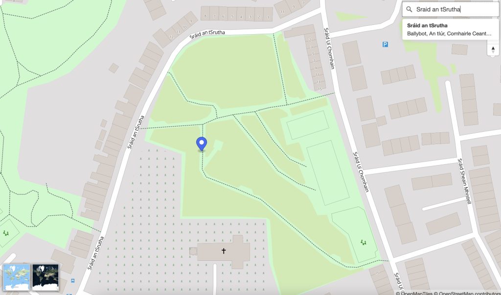
OpenStreetMap Ireland identified a need for a map of Ireland showing place names in the Irish language (Gaeilge) and to encourage more Irish language additions to OpenStreetMap (OSM). Some other mapping services show only town names in Irish when Irish is set as the preferred language in the web browser; however we wanted a map that would ‘by default’ show towns, streets and other places using the Irish place name.

We named this service ‘léarscáil’ which translates to English as ‘map’. The service is available at learscail.openstreetmap.ie Screenshot Any streets that do not have a tag for name:ga within OpenStreetMap are left blank on léarscáil – this is by-design – to encourage everyone to fill-in-the-blanks. We use official street name signs as the source for the translations.

Technical

We made use of several open technologies to solve the problem including:

See full entry

Location: Castlewilder, Agharra ED, Ballymahon Municipal District, County Longford, Leinster, Ireland

A few weeks ago, I wrote a plugin for PMTiles for JOSM. PMTiles is a web-first tile storage format which allows the provider to have a single file with all the tiles they want to share. Users can then make direct requests using HTTP Range Requests to get just the data they want. With this, other OSM users have discovered that they can run a tile server for <2 USD/month.

As of Aug 28, 2023, the JOSM MapWithAI plugin now supports PMTiles and Mapbox Vector Tiles as data sources. Please note that no tag transforms are occurring, so if you do use the data, please use the replacement tags feature of the plugin. With that said, it is theoretically possible for a pmtiles file to give us the mappings; the specification has a JSON metadata field which can have arbitrary key value mappings.

Anyway, here are some known datasets to test out this functionality (I only tested the overture-pois.pmtiles file):

As a reminder, there is a reason why the overture data has not been imported into OSM, mainly quality concerns. So if you do use it, ensure that whatever it is you are adding actually exists (for POIs) or is geometrically correct (for buildings/roads).

See full entry

Location: 39.067, -108.561
Posted by umbraosmbr on 12 September 2023 in English. Last updated on 13 September 2023.

The activation of Flood Mapping in the City of Muçum, RS has begun!

As a result of the rains that affected the state of Rio Grande do Sul, Brazil, UMBRAOSM, the Brazilian Chapters of YOUTHMAPPERS created an Activation project for mapping in the city of Muçum in the state of Rio Grande do Sul - Brazil for mapping the City! !

This project aims to map buildings, so if you want to use the MapWithAI tool (Rapid or JOSM), it is recommended to use this tool mainly in rural regions with low building density. This allows you to quickly add AI-predicted buildings and roads. However, human verification is necessary. Don’t just accept auto-detected buildings - ensure correct building alignment, geometry and road classification before saving your work.

If you want to use JOSM, you must download the [MapWithAI] plugin (https://github.com/KaartGroup/JOSM_MapWIthAI_plugin#readme). The plugin wiki page contains detailed usage instructions. You can also use the [building_tools] plugin (osm.wiki/JOSM/Plugins/BuildingsTools), which will make the geometry creation process easier. Once the building has been digitized, use the “q” key to adjust the geometry. For road mapping, remember that they must be connected to each other. Additionally, generate enough nodes to avoid sharp angles when changing road directions. In the case of intersecting roads, an intermediate node must be placed at the point where they intersect, unless there is a structure separating them, such as [bridges] (osm.wiki/Key :bridge) or [tunnels] (osm.wiki/Key:tunnel).

Powered by:

Umbraosm Brazilian chapters of youthmappers HOTHubLAC Brazilian Community of Openstreetmap

See full entry

Posted by GiftedIsha1 on 11 September 2023 in English.

I honestly don’t have the words to describe the overwhelming flow of emotions that I am experiencing regarding this project.

*This a whole new experience for me and I feel so blessed to be apart of this program and would honestly recommend anyone in joining and learning about the values and endless opportunities that exist with using (OPEN STREET MAP). From the first hand experiences in my community to mapping specified areas in my country it is such a remarkable experience for the young and young at heart to widen their horizons and try new things.

Location: Jamaica
Posted by aman_bagrecha on 10 September 2023 in English. Last updated on 11 September 2023.

On September 9, 2023 Let’s Talk Spatial and OSM Bengaluru organized a mapping party in Chamrajpet, Bengaluru, India. We had 367 contributions to OpenStreetMap with 6 first-time contributors. After we finished mapping, we were #1 in the world in terms of number of edits!

photo1

The idea of organizing an outdoor mapping activity originated on the day when OSM celebrated its 19th Birthday. My social media was flooded with mappers celebrating in various different ways to show their love towards OSM.

On the last day of FOSS4G I saw mappers mapping the streets of Prizren - noting down the opening hours, contact details and much more information onto OSM. Though I missed the opportunity to map with them, I saw this could be done in my city, with the help of expert mappers.

See full entry

Location: Sunkenahalli, Bengaluru Central City Corporation, Bengaluru, Bangalore North, Bengaluru Urban, Karnataka, India

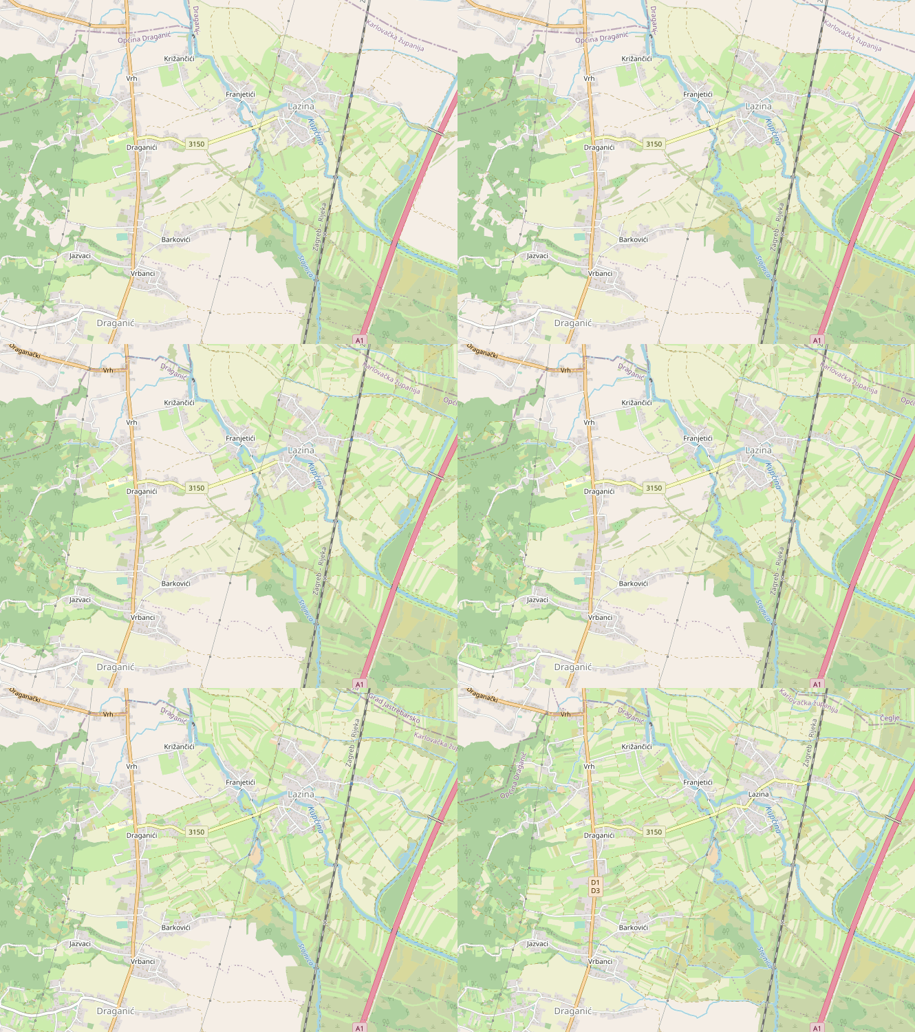
This week continued working on the barefootstache-mapping-croatia project to align with my upcoming trip to the area.

While mapping east of Vrbanci, I noticed that I was almost done with its boundary and completed it.

before and after animation of OpenStreetMap depicting land cover addition mainly farmland, meadow, heath, scrubs, wood, and many other land covers

Quick Overview

See full entry

Location: Lazina, Mjesni odbor Lazina - Franjetići, Draganić, Municipality of Draganić, Karlovac County, 47201, Croatia