 OpenStreetMap

I have contributed to open street map using mapswipe as a member of Oyo mappers team
Diary Entries in English
Recent diary entries
I have contributed using map swipe as a member of Oyo mappers team
I have mapped using mapswipe as a member of Oyo team
I have mapped using mapswipe as as a member of oyo member team
I have mapped using mapswipe as a member of oyo mappers team
I’m no stranger to GIS, so I jumped right in. Filled in BLM routes around Painted Gorge, Mica Gem, and Buck Canyon. Cleaned up some routes at Valley of the Moon and along Grapevine Canyon.
Still need to add a couple routes to Painted Gorge but I want GPS data first. There are discrepancies between BLM maps and aerial photos that can only be resolved by going there in person.
The Yuha Basin is also on my to do list, but I definitely want GPS data for that first. The BLM map isn’t that great and there are a lot of tracks on the ground that differ from the map.

After a summer break here we are. We just got over 5000 Table Tennis Tables in Switzerland. Here is the [TagInfo]{https://taginfo.osm.ch/tags/sport=table_tennis#chronology} We can expect another boost the next days because I have an agreement with my neighbour driving pingpongtische.ch, that we can use his database to find yet unmapped tables in OSM. We would not just import these, but scroll through them and check if we can verify their positions with the Swisstopos SwissIMAGE.
So for the next 1000… :-)
%20by%20Vince%20Emond.jpg)
Hi all,
Many people have been asking me over the last year what technology HOT is working on, what’s on the cards for the future and where we are headed. Given my role, all good questions I want to answer. The good news is, I have some of the answers and would like to share them with everyone for feedback, ideas or inputs as you feel compelled.
Sharing here for community comments hot_tech’s t21 basemap. This document outlines what underpins our future direction, decisions and deliverables.
For those that don’t want to read the whole thing, as the elevator pitch reads, the heart of our mission lies here:
By redirecting resources to augment and amplify the efforts of others, the future of hot_tech will no longer be focused on building technology for open mapping collectives, but instead building technology with them.
While I recognise this doc may not answer all questions and possibly raise even more, we see this as the starting point, our nodes and ways, our building=yes from which we can start to add more depth.
For those that just want the short version, I have summarised all the key changes in our ‘right turn document’, which clearly outlines not only what we plan to do, but also how we plan to do it.
Like it says at the end of the doc ’The closing of this document marks the opening of the conversation’, so I look forward to having this conversation with our entire collective of hot_tech supporters, stakeholders, contributors and users.
Kindness,
Bo

Dear all,
Today, v5.4.0 of the OpenStreetMap Carto stylesheet (the default stylesheet on the OSM website) has been released. Once changes are deployed on the openstreetmap.org it will take couple of days before all tiles show the new rendering.
Changes include
- Added a new
planet_osm_line_labelindex (#4381) - Updated Docker development setup to use offical PostGIS images (#4294)
- Fixed endline conversion issues with python setup scripts on Windows (#4330)
- Added detailed rendering of golf courses (#4381, #4467)
- De-emphasized street-side parking (#4301)
- Changed subway stations to start text rendering at z15 (#4392)
- Updated road shield generation scripts to Python 3 (#4453)
- Updated external data loading script to support pyscopg2 2.9.1 (#4451)
- Stopped displaying tourism=information with unknown information values
- Switched the Natural Earth URL to point at its new location (#4466)
- Added more logging to the external data loading script (#4472)
Thanks to all the contributors for this release including ZeLonewolf, kolgza, and map-per, new contributors
For a full list of commits, see https://github.com/gravitystorm/openstreetmap-carto/compare/v5.3.1…v5.4.0
As always, we welcome any bug reports at https://github.com/gravitystorm/openstreetmap-carto/issues
Introduction
Later today (September 22, 2021) OpenStreetMap US is hosting a discussion on trail tagging. There has been a lot of chatter recently about how to map these, and the following summarizes my current thoughts on the matter going into tonight’s meeting. I wrote these up mainly as a way to organize my own thoughts, and I’m sure that my opinions will change after further discussion.
Definitions
A path is any way not meant for wheeled motor vehicles. A trail is path or other way signposted or recommended by the landowner for use by those who are not in wheeled motor vehicles. Paths are mapped as ways, and trails are mapped as relations.
Paths that do not exist and never existed
These paths should be removed from OSM. If remote mappers keep restoring them, it may be worthwhile to leave the line tagged with only a note.
Paths that do not exist but recently used to exist
These paths should be tagged with abandoned:highway=path where found, but ideally they should not have been added in the first place. If these paths are deleted, from my experience, locals will inevitably add them back.
Paths that exist but should not exist according to the landowner
Tag as highway=path + access=no + informal=yes where found, but ideally they should not have been added in the first place. There are arguments to be made for using a different tag than path, but none exists as of yet. Deleting these from OSM is futile as locals or remote mappers will inevitably add them back.
Paths that exist and are only to be used by the landowner and guests
Tag as highway=path + access=private where found, but ideally they should not have been added in the first place.
Paths that exist and are tolerated
Tag as highway=path + access=permissive + informal=yes.
Paths that exist and are authorized
Tag as highway=path and include a surface tag
Paths that are part of trails
Tag as highway=path + surface=* and include in a type=route relation
Posted by googlenaut on 22 September 2021 in English.
Last updated on 27 September 2021.
how do you make those 3d-models, especially the more complex structures? .. here’s my reply.
Well, it’s an ambitious task to to it but it isn’t so superhard as it seems. The main difficulty is to get hi-res satellite imagery and some information on building levels and height. Another difficulty comes from the blind modelling approach in JOSM. You can get some help from the Kendzi3d Plugin, but I don’t make use of it. So it’s always a little surprise what the rendering engines does with the uploaded changeset. I’m not a big fan of commercial F4mapDemo with its animated objects. I prefer to see good results on OSMbuildings and OSMgo
I usually start with a floorplan, which could be found on wikipedia or other building related websites. You can resize it to match your favourite scale. When it comes to building parts i make use of the building symmetry. The roof shapes could be estimated from the hi-res satellite imagery. But there’s no height information apart from the shaddow length. So if there’s nothing on wikipedia, emporis, streetview or other, I use some photogrammetry tricks to get the information I need. I often combine some simple structures to achive a higher complexity. But I try to keep it as simple as possible. I also avoid to use multi-polygons, cause their roof will never be rendered the way I want it. Finally i check that all parts won’t overlap with the building outline and put everything in a single building relation. That’s it.
Editado San Carlos y Quillon usando fuentes de la INE

Hi all,
Here’s my response to the question listed on wiki page for the board election.
osm.wiki/Humanitarian_OSM_Team/Board_Elections_2021
Please feel free to comment or message/mail me, talk to you soon!
By Arnalie Vicario
Q1. What is/are the impact/s of the shift from global to regional structure of HOT on voting members?
A1. Strengthen the regional/local community is good in many ways including reducing the language barrier and harmonizing the open culture to local. Voting member is usually the opinion leader of local/regional community. As a result, about the impact of the shift from global to regional structure, it could be good to HOT.
Q2. Conversely, how do you think the voting members should interact (e.g. what is their role) with the Regional Hubs?
A2. Regional hubs can assist the voting members and the local communities to work more aligned to the vision/mission of HOT. The active voting members may talk with regional hubs more often for the harmonization of local/personal interests and HOT objectives.
By Matt Gibb
Q3. How can we support HOT volunteers who may experience burnout as we work towards HOT’s Audacious goals (including Voting Member and non-Voting Member volunteers), while the number of HOT paid staff grows?
A3. Burnout in community happens, so the responsibility of paid staff is getting heavier. We should facilitate more communications so we “speak out before burnout”. We also could take turns (flying geese paradigm) to be responsible for the tasks towards HOT’s audacious goals that potentially burnout community members.
By Heather Leson
Q4. What are the most important things the HOT board should be doing for the 1. membership 2. board 3. staff 4. global OSM community?
A4. (1) to facilitate the friendly (in many ways) environment for our community members. (2) be the plus to the operation of HOT. (3) share the experience and expertise. (4) be more influential in global community.

what is this about?
this entry describes a possible workflow for identifying missing road segments, thanks to the standard low-res Strava heat map. you may also use it to reclassify all those ‘highway=track’ that so many remote mappers keep creating for our ‘surface=unpaved’ unclassified and tertiary roads.
the mapping practice here described is totally manual, and quite obviously its speed will be inversely proportional to the precision you want to achieve.
preparation steps
- install JOSM
- in JOSM, activate the low resolution Strava heat layer
- do that by editing the Imagery Preferences settings,
- look for Strava among the available default entries,
- select the cycling and running heat map,
- activate it.
- you will need to restart JOSM after activating the new imagery layer source.
typical editing session
prepare for mapping
- add the OpenStreetMap (Carto) Standard layer,
- roughly choose an area of interest,
- add the Strava heatmap layer, but do change its transparency to 50%,
- add your favourite Aerial photography layer (here I will be using Bing because I will show screenshots and the Bing license allows didactic and instructional use. in mapping I tend to prefer Maxar.)
- order the layers so that:
3: is Strava, on top of both:
2: your favourite aerial photography layer,
1: the Carto standard map,
identify a missing road

Hey everyone, I would like to have a mapper meetup sometime. I am loving OpenStreetMap and would like to meet with other mappers in the region.
Posted by SomeoneElse on 18 September 2021 in English.
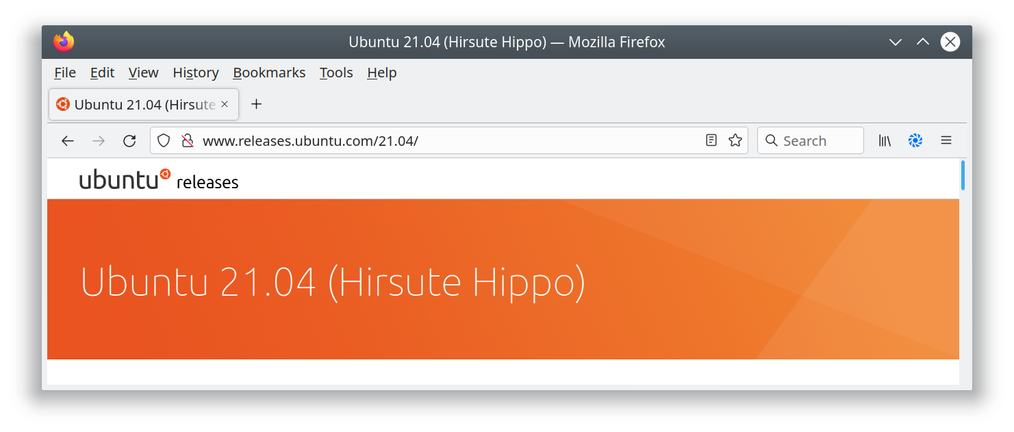
I’ve added a new page to the switch2osm guide: “Manually building a tile server (Ubuntu 21.04)”. The work that the Debian developers have done to include the required software inside Debian 11 is now in Ubuntu 21.04, so there’s actually less setup work needed than in previous Ubuntu versions.
Ubuntu 21.04 isn’t an LTS release, so Debian 11 or Ubuntu 20.04 are still the recommended options for servers that are expected to stay around for a while. One of the regular faux pas with the Natural Earth download site has just been and gone, but the guide includes a workaround in case problems reoccur there.

ROAD CLASSIFICATION DECISION MATRIX
Default Starting Ranks: [UK] [IRL] [DE] [FR] [IT]
INTERSTATE/MOTORWAY motorway [US:I] [UK:M] [IE:M] [DE:A] [FR:A] [IT:A]
NHS (DIV) trunk [UK:A(T)] [IE:N] [DE:B] [FR:N] [IT:SS]
US (ALL) / NHS (UNDIV) primary [UK:A] [IE:N] [DE:L] [FR:D] [IT:SS]
STATE PRIMARY secondary [UK:B] [IE:R] [DE:K] [IT:SP]
STATE SEC/COUNTY tertiary [UK:C]
TOWNSHIP residential
other things to think about for status changes: for Primary to Trunk: NHS mainline/some Strahnet (exc intermodal connnectors) +1 controlled access (limited intersections) +1 divided highway +1 interchanges at intervals +1 super-2 in places +1 or upgrade to motorway super-2 with widened centerline, rumble strips, mandatory headlight usage. Trunk means “watch out”; dangerous roads serving the role of a motorway one with design/safety compromises.
Secondary to Primary: high relative traffic +1 wide shoulders +1 Interstate Business Route +1 (not automatically in NHS!)
Tertiary to Secondary: 4 or 6-lane divided +1 through route +1 retail strip +1 interchanges with an Interstate (case-by-case)
Residential to Tertiary Divided, serving major retail centers and industrial parks +1 MD: Has yellow center line and is through/collector route VA: Numbered Secondary 600-999, selected routes above 1000 (VA numbers almost every road, but these lower numbers are usually important) PA: Numbered SR 1xxx-4xxx WV: County Routes (whole & fractionals)
for drops in status: numerous traffic signals in quick succession (drop from trunk) -1 retail strip (usually cause for above): drop from trunk to primary, but up from tertiary to secondary if divided. -1/+1 low speed limit -1 city environment -1 narrow shoulders -1 twists/turns/grades -1 (in relation to nearby straighter roads serving the same general direction)

Here we see that most of today’s cellphones’ GPS traces are “all over the parking lot,” thus will degrade the quality of OSM when making a map from them, https://medium.com/@importanttech/we-tested-mobile-gps-gnss-accuracy-and-found-some-surprising-results-b9ec35873e2e
But yes, you could say having a path on the map is better than no path.
See also https://www.sciencedirect.com/science/article/pii/S0263224121001858 .

The idea to map radars and mirrors of the Czech highways was raised in the mailing list of the Czech community. One of the comments is questioning about how to track the work done–and that’s exactly the problem to be solved by the damn project. (Note that the idea to map radars and mirrors of the Czech highways is still just an idea and there are no further steps done yet I’m aware of.)
I already wrote two Get inspired by … diaries. These were the potential HOT tasking manager improvements and the Tanga Building Footprints Import. This diary discuss the use of the damn project for tracking the work done on highways.
Create area
The damn project helps mappers by dividing some big area into smaller squares that a human can map. How this applies to highways?
It’s possible to upload two kinds of GeoJSON boundary files to the damn
manager. If the FeatureCollection has member ‘name’ then divide to squares
function is NOT used. Moreover, I’ve updated the damn project to understand
what to do with a feature containing a LineString geometry: create a
“square” with the border around the LineString. (“Square” here means a square
of an area of the damn project.)
So… when you download some highway=motorways within some interesting
bounding box (I mean from overpass API in JOSM,) save as GeoJSON, and add name
member, you are able to upload that as GeoJSON boundary file to the damn
manager.
Note that I experimented with joining ways to make larger squares of an area. The JOSM damn plugin then refused to automatically download the OSM data of a square because the square was too large, and the data had to be downloaded manually.
Mapping
The mappy client may help to visualize the area. An example is area 2352 and it looks way better with background image switched off. The JOSM damn plugin, light client, or panel using map random square/map nearest square are better options, though.
Posted by Nicxon Piaso on 14 September 2021 in English.

Today as of this week, I started editing the missing map details around the Gordons( esp the National Stadium), Rita Flynn Netbal Centre, Sir John Guise Stadium as well as commercial Buildings around Waigani area. It took me almost 3 days before the 3-D model of these Stadium(Sporting facilities) appeared in F4map.com. I hope to see these models also reflected in 3DBuildings.com.
Although these are LOD 2 models( in my context), I may hope to try pulling those models into Blender-OSM to further enhance these Buildings, in the future( to take 3D modeling a further step up). I hope to still edit areas that aren’t not mapped out around Port Moresby areas, such as Gerehu Suburbs which are still missing details. Alot still needs to be done around our National Capital city which is still lacking map elements in OSM.
I have done all my BEST and its almost a year that I have actively been editing maps around Port Moresby area esp. the Metropolitan area where high-rise Buildings and densely-packed detached buidings are.
One fundamental function that anyone can use is the Building tags; as I am using only the ID Editor as I don’t have access to use JOSM to verify if my tags are valid. Thanks goes to the OSM moderators who are providing me helpful tips&insights on how I can edit the maps with any error. I am still pressing and pulling myself up-to-date with OSM HELP menu and correcting myself to re-edit feature entries which are erroneous.
Thankyou all and once again happy mapping to all the Mappers around Papua New Guniea and to the Moderators who are taking their time to correct us.
BOLA! and happy Mapping.