Diary Entries in English

Recent diary entries

Its being quite a while on OSM diary and lots have been taking place in Nigeria OSM Community as Unique Mappers,the NGO community for OpenSTreetMap in Nigeria continues to grow and expand the OSM project in Nigeria even in the lock down of #COVID19.

We have had series of COVID19 Community empowerment and Mappers Wanted Training from March though April-the global Citizen Science Month and then into May. The moments include the MapWithAI Webinar traninng ,Mappilary training and the GODAN-Unique Mappers Webinar “Empowering Women in Agriculture with Open Data Mapping :Implications for Land Rights and SDGS. https://landportal.org/blog-post/2020/05/empowering-women-open-data-mapping-agriculture-implications-land-rights-and-sdgs

However,today ,I am so excited having my mentor and one of the corporate supporter of OSM in Nigeria sign up to OSM to add name a road in his village..We made use of google meet for the training and it was fun!! .Prof.Eze who is the managing Consultant of Transparent Earth Nigeria Ltd,-Corporate partner of Unique Mappers Nigeria sponsored as a community service the #Ogrute Ugwue Eru Mapathon for SDG-2 Food Security Project in Nigeria carried out by Unique Mappers . He also sponsors the Unique mappers best Mappers Annual Prize award.

Meanwhile,Victor Ezugwu(Victor1234)one of the state coordinator of Unique mappers Nigeria and HOT Voting member also closed up today succeeding in starting a new Chapter of Unique Mappers by mobilizing 12 newbies using social media . Surprisingly,with his passion ,Unique Mappers Ibadan has just begun…with the creation of a whatsaap group for the coordination and mentoring of these OSM newbies. Amidst,the #COVID19, locakdown,the youths and veveryone staying at home wants to do something new and get off the boring moments and here comes Unique Mappers Ibadan for newbies of OSM in Oyo state,Nigeria. We look forward to providing virtual community engagement for this new chapter as we map COVID19 in Nigeria

Posted by alexkemp on 19 May 2020 in English. Last updated on 21 June 2022.

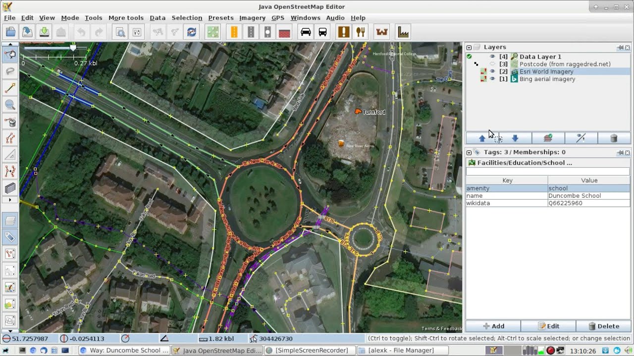
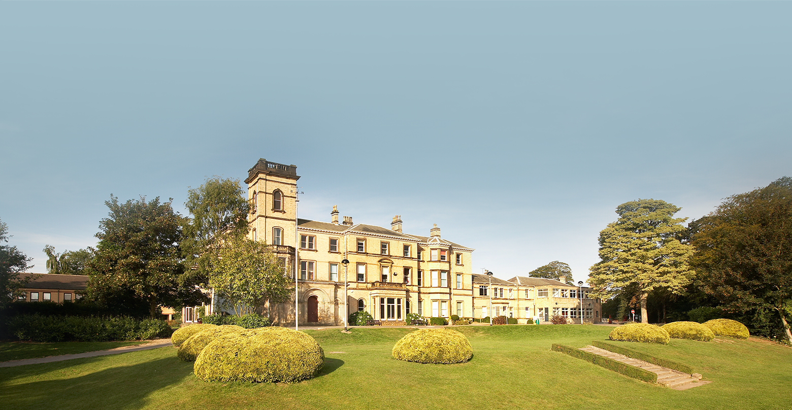
We are still in Covid-19 Lockdown, I’m still diligently mapping schools in the HU (Hull & East Riding of Yorkshire) Postcode, and I’ve reached an interesting school near Anlaby that incorporates my family’s Alma Mater of Hull Grammar School (I wondered where it had gone).

Tranby Croft

HE tags for Tranby Croft (these are specific for the UK):–

  • heritage:operator=Historic England
  • heritage=2
  • listed_status=Grade II
  • HE_ref=1103387

Hull Grammar School

See full entry

Location: Garrison Side, Drypool, Hull, Kingston upon Hull, Hull and East Yorkshire, England, HU9 1TL, United Kingdom
Posted by AmeliaMap on 17 May 2020 in English.

7620 | Tanzania Development Trust

TANZANIA MISSING ROADS RAPID

Tanzania has a very high incidence of Female Genital Mutilation, extreme poverty, early marriage and Gender Based Violence. NGOs on the ground need better maps to facilitate their outreach work and protect girls at risk of FGM.

The Missing Maps project aims to map the most vulnerable places in the world (affected by humanitarian crises: disease epidemics, conflict, natural disasters, poverty, environmental crises). Building on HOT’s disaster preparedness projects, the Missing Maps tasks facilitate pre-emptive mapping of priority countries to better facilitate disaster response, medical activities and resource allocation when crises occur.

Spent 1 hour mapping roads and buildings.

Posted by combloop on 17 May 2020 in English.

After not much time-roughly a month and a half-I have finished editing Fort Lee for now. In the last diary entry, I predicted that Fort Lee would take longer than North Arlington, but it seems like I was incorrect then. As a result of the current situation, I’ve been able to pick up the pace I used to have with areas such as Paramus when it comes to editing.

Fort Lee is on the New Jersey side of the George Washington Bridge. With all buildings in Fort Lee having been added to OpenStreetMap, this means that there is now an expanse of land stretching from New York all the way to around Paramus where all buildings have been mapped.

Next up is Cliffside Park. It’s the most densely populated area in Bergen County, the fifth-most densely populated area in New Jersey, and seventh-most densely populated incorporated place nationwide.

Click below to see Fort Lee!

Location: Linwood, Fort Lee, Bergen County, New Jersey, 07024, United States

JOSM HowTo: map buildings

YT thumbnail

After the glorious success of mapping Schools with JOSM it was obvious to produce a series of shorts showing how-to-map elements of the schools, and let’s start with howto map school buildings.

Less than 8 minutes long, it does what it says on the can; it shows how to map a school building.

Posted by jidanni on 16 May 2020 in English.

Let’s see. For Map Layers, there are
- Standard
- Cycle Map
- Transport Map
- Humanitarian
Well there needs to be an additional yuppie oriented map layer…

No:
- Old folks’ homes
- Boring plumbing supply shops, etc.
- Fussy political boundaries, national or even school district, and associated customs offices
Yup, not rendered a single bit.

Yes:
- Coffee, snack, holiday refreshment shops
Rendered extra big.

So, I had made this umap of field names done in Ireland using overpass-turbo (learning so much, it’s amazing!), and I noticed someone had done tremendous work in Bannow Bay, which is where the Normans first landed and there are some very interesting field names there. There is a Chapel Field and one was Roche’s Field, a common Norman name in Wexford. It just goes to show how much history is captured in those field names. And also The Blue Bell, how cute is that?

And I have actually been there and like many other mappers, I do go into OSM when I visit a place and might add a few things. So I knew for certain that these were recent additions. I much appreciate Sascha’s contribution. I wish him success in continuing his work there. Maybe I’ll get a chance to add some in Cullenstown, not too far from there.

Location: 52.217, -6.803
Posted by n76 on 15 May 2020 in English.

I created this video last summer to show how I map a neighborhood.

And now I am seeing if I can create an “embedded style” link to it on my OSM diary using kramdown.

Mapping a neighborhood

I’ve slightly revised my mapping and editing techniques since then but I think it is still a reasonable introduction or tutorial on using some Android tools and JOSM for mapping.

Location: Portofino, San Clemente, Orange County, California, 92673, United States

In my professional life I have been on radio a whole bunch of times, and on TV a couple of times. My mother used to say I had a face for radio ;) .. but I am experienced enough at this point to handle most media. For the first time ever I was involved in a podcast, and I was super glad that it was the new osm related podcast, “ways and nodes” which is done by Austin Bell who is known as itsamap! and maps a whole lot around South Carolina, in the USA.

The podcast is right here so listen and enjoy.

I learned a lot observing and listening to Austin. He hangs out beforehand and develops his questions by talking to you, and it was great that we mapped together beforehand looking at the same stuff on the map of Ireland. There was a bit of a theme about migration. By the end of the podcast he was determined to map based on his own family’s historical origins in Scotland.

You can get in touch with Austin by simply mailing him austin@nodesandways.com and look at this mapping account here I think it is important that osm has a regular podcast, and Austin gives up a lot of time he could use mapping to make these episodes.

Posted by b-unicycling on 14 May 2020 in English.

Exciting, first entry: So, I’ve been interested in fieldnames in Ireland for a while. Maybe because it’s so exotic to me, because I’m not from a farming background and I’m not aware they exist in Germany. Maybe because it’s oral history and highly underrated by scholars and taken for granted by farmers, i.e. they don’t see the value in their personal heritage (“Sure, that’s just the name we use, like.”).

I’m also a member of Kilkenny Archaeological Society and always on the lookout for group projects that might bring new members into the society or just a bit more engagement with actual people rather than books or bones.

Anyway, being a newbie on FieldPapers, I thought I’d give it at try. I had got a glimps into FieldPapers during the talk Ciarán gave. I liked the idea that a group of people could work together, maybe even in a school project. Gotta get them mappers young!

The first video is about how to make the atlas, the second about how to use the png files in the iD editor. I thought JOSM was a bit too techical and scary for beginners. It’s also not terribly more useful for field names than the iD Editor is. I had made a tutorial before that of just using the iD editor.

I had sent links to a couple of historical and archaeological societies I found on Facebook, the ones that did reply (lockdown + expected demographic = non responsive) were throughout postitive about it and shared it on their page. I just picked some random ones where county names came to mind. I should send out a few more to the Wesht, before it’s too late.

Location: 52.656, -7.254
Posted by Rovastar on 14 May 2020 in English. Last updated on 25 May 2020.

Edit: new record 7209: Thursday, 14th May 2020

On Tuesday the 12th May 2020 there was a new record for daily users editing OSM when 6999 different users edited the map. (http://osmstats.neis-one.org/?item=members&date=13-5-2020)

There has been a gradual ramp up for a while after a dip from know doubt the Covid lockdown shock.

The previous record was 6897 users from way back on 26th January 2017 when mobile game PokemonGO first started using OSM for its maps in South Korea. (http://osmstats.neis-one.org/?item=members&date=27-1-2017)

The application period for the OSMF microgrants program finished a few days ago and i thought i’d share some interesting results from looking over the applications in terms of the raw numbers:

  • The 49 applications listed are asking for a total of about 182k Euro in funding.
  • 9 are asking for less than 2000 Euro
  • 9 are asking for between 2000 and 4000 Euro
  • 9 are asking for between 4000 and 4800 Euro
  • 22 are asking for between 4800 and 5000 Euro

Regarding what the applicants want to use the money for i made a rough classification. There are often border cases of course so don’t take these as exact numbers. Alltogether the applications are asking for

  • ~60k Euro for paid work (directly paying people for work on the project)
  • ~47k Euro for hardware of some sort (from phones to motorcycles)
  • ~29k Euro for commercial services of some sort that are not separately specified in the following - most of this is internet access.
  • ~14k Euro for various sorts of allowances for people
  • ~11k Euro for all kinds of merchandise, gifts and presents other than hardware
  • ~6900 Euro for social media advertisements
  • ~5000 Euro for renting workplaces and rooms
  • ~5000 Euro for administrative costs
  • ~3800 Euro for hosting
  • ~2700 Euro for licensing non Open Source software and services

Not all applications asking for financing paid work specify exact rates but where this is done the hourly rate varies between 7 Euro and 80 Euro. This range does not appear to be much related to differences in living costs, there is one application from the US asking for just slightly more than 8 Euro per hour for example while another from the US is asking for EUR 80 per hour.

Posted by alexkemp on 12 May 2020 in English. Last updated on 15 May 2020.

JOSM HowTo: map schools

YT thumbnail
(above: using roundabouts to align imagery offsets)

My very first video(s) uploaded to YouTube. The first is very long, very slow. Hopefully, an easy entry-ramp for those considering using JOSM to map for OSM. Otherwise, 35 minutes of boredom.

(later videos are much shorter)

See full entry

Posted by -karlos- on 12 May 2020 in English. Last updated on 14 May 2020.

With Android ARCore and iOS ARKit, you can add virtual objects to your real surroundings. Not only in your room but at any place on Earth because GPS is involved too. Next do native Apps, with the proposed WebXR you may do this in a Browser. Google Chrome (for Android) supports it experimental. And I just discovered the “WebXR Viewer” on iOS doing it too!

So with any Android and iOS device, Smartphone or Tablet you could do it, even with an Oculus Quest and soon other AR classes: Run around outside, viewing into/through your device, rotate or walk along, see the real world and added on top of it OSM-roads, street-signs etc. Even editing may be done this way some day.

I did implement this as a VR-feature in my www.OSMgo.org but lost it later. Now it could be done as AR.

Is anyone experimenting with something like this or would like to team up to start a proof of concept?

Edit May,14

  • Hikar, an native Andorid App. device’s camera feed augmented with OSM roads and sign posts. Its gitlab repository may be valuable. There is a sotm 2019 speech.
  • ARnav Android App. Augments with OSM-POIs. (Still running?)
  • Layar, an native App, Android and iOS (not in my country. Most links don’t work!). Not life but a picture is augmented with OSM.
  • The future of OSM editing? 😉 Sci-Fi Short Film “World Builder”

  • This augmented OSM editor is really funny!

See full entry

(Noticed this for the 1st time)

Ploughing through East Yorkshire schools, using a combo of mathmos.net & the government Schools Information Service to add full Address & Contact details to all HU schools, I’ve reached St George’s Primary School off Anlaby Road in Hull. Whilst checking that this was the correct school (very few EY schools — and how absolutely fantastic is it that the entire County has refused to accept the 1975 “Humberside” as their county & gone in their entirety back to “East Riding of Yorkshire”? yeah! — are properly mapped & registered, so it is necessary to check most carefully the mathmos.net correlation) I came across a photo showing on the front of the building that this was a “Board School”, and thus probably established in Victorian times (start_date=1881).

I spent a little time living not too far from this school and, after completing the main mapping, began to try to find when it was built. That brought me to the Hull Carnegie Heritage Centre, where I discovered that the road was started in the 1870s & the school was built in 1881 by the Newington School Board in the very classic Gothic style of that era. The page also states that it is “now a Grade II Listed building and one of Hull’s oldest surviving school buildings”. And here it is (list entry:1197690):–

See full entry

Location: Dairycoates, Hull, Kingston upon Hull, Hull and East Yorkshire, England, HU3 4NG, United Kingdom

English below

(message envoyé initialement à la liste de discussion de l’OSMF)

Il y a quatre ans, le board de l’OSMF, suite à de longues discussions (voir dans le lien précédent) lançait le recrutement d’un contrat à temps partiel dédié spécifiquement en soutien du board concernant différentes tâches administratives, de communication et d’organisation. Il demeurait néanmoins des réticences au sein des membres actifs de la communauté dans les activités de la Fondation de voir s’instaurer un premier cas de travail non bénévole au sein de l’OSMF.

Maintenant, le board communique sur la volonté de mettre en place un cadre de contractualisation, sans aucunement indiquer les besoins à remplir (seulement ceux que les volontaires n’accompliraient pas) ou les postes qui seraient créés, en indiquant quelques cadres et limites, parfois très vagues (moins de 20 employés en 5 ans). Mais surtout, la question posée à la communauté n’est plus SI cette approche est la bonne, mais COMMENT la mettre en place. Comment un tel changement d’approche a-t-il pu survenir en cinq ans ?

Certes, la seule expérience jusqu’ici de contractualisation de l’OSMF a donné entière satisfaction, mais cela tient sans doute autant aux tâches spécifiques de la fonction qu’à la personne qui a été engagée. Vouloir répliquer cette expérience en changeant cette fois complètement d’échelle aura nécessairement des répercussions, et je rejoins totalement Frederik dans son analyse sur les dangers inhérents à faire appel à de nombreux contractuels. Avec ses fonds actuels, l’OSMF aurait nettement plus intérêt à assurer sur le long terme le fonctionnement mince actuel avant que de s’engager sur une augmentation de ses dépenses qui ne fera que pérenniser un besoin croissant de fonds, d’autant plus au moment où le monde va entrer dans la crise économique la plus profonde et globale de son histoire.

See full entry

Posted by AmeliaMap on 10 May 2020 in English.

5773 | MT ELGON LANDSLIDE RISK

Mt. Elgon, located in Eastern Uganda, is reported to have the highest rates of landslides and floods in Uganda, often with devastating impacts on local communities. High annual rainfall, steep slopes, increasing population pressure, and cultivation on steep slopes following deforestation are the leading causal factors of landslides.

In October 2018 landslides and debris flows occurred in Bududa District , causing 60 fatalities and displacing thousand of families. GFDRR is supporting the Government of Uganda in assessing landslide and other hydrophysical risks in the wider Mt Elgon area. Detailed location of buildings and roads are needed to study the potential impact on population and infrastructure.

Spent 1 hour mapping buildings.

Posted by Sawan Shariar on 9 May 2020 in English.

Humanitarian OpenStreetMap Team (HOT) is the dedicated team to take humanitarian action and develop the community through Open Mapping. It is the active team of OpenStreetMap data for disasters and preparedness mapping. I really appreciate the value of open data and the way that HOT has created for the people around the world to contribute in a meaningful way.

I am S M Sawan Shariar, deputy volunteer coordinators for OpenStreetMap Bangladesh Foundation (OSMBDF), as well as deputy coordinators & validation lead of Bangladesh Humanitarian OpenStreetMap Operational Team; known to all as BHOOT. Recently chosen as Data Quality Intern for HOT. Currently supervising the Map Your City project commenced by team BHOOT to bring the whole Bangladesh into the map. It is noteworthy to mention that, I am listed as the top contributor on MissingMaps Global Leaderboard.

I have been involved with HOT activities over 5 years, which starts with the Data4Action project initiated by American Red Cross in 2015. Since then I have been an active contributor to OpenStreetMap, HOT & MissingMaps mapping activities through remote tracing, field mapping & validation both in Bangladesh & other parts of the world.

I have also been involved with YouthMappers network since 2016 and was the founder president of YouthMappers Dhaka College Chapter, one of the vibrant chapters in the global YouthMappers network. Currently advising and providing support to the beloved Dhaka College chapter and as well as all the local chapters in Bangladesh.

I have joined all HOT initiatives, campaigns, and activations and spread HOT motives and code of conduct by arranging seminars, parties, training, and open discussion in the local community.

See full entry

Location: Monipuri Para, Tejgaon, Dhaka, Dhaka Metropolitan, Dhaka District, Dhaka Division, 1215, Bangladesh